Skykomish, N. Fork
2. Bear Creek (Drum Beater) to South Fork Confluence(Canyon, Upper, and Lower North Fork Skykomish)

| Difficulty | III-IV |
| Length | 12.4 mi |
| Avg Gradient | 72 fpm |
| Gauge | Nf Skykomish R at Galena |
| Flow Rate as of 43 minutes | 2.29 ftbelow recommended |
| Reach Info Last Updated | February 14, 2026 |
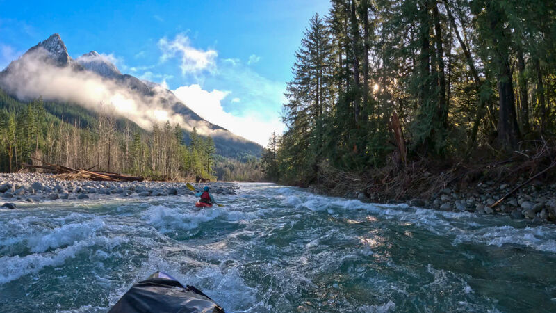
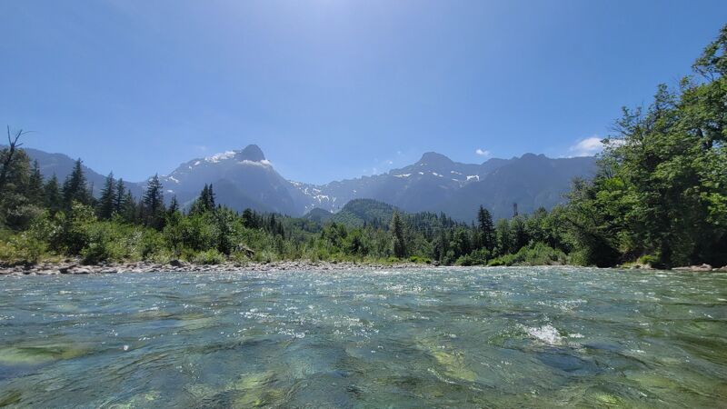
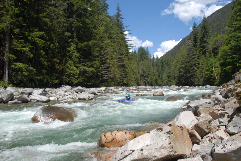
The North Fork Skykomish offers a diverse range of paddling experiences over a 12-mile stretch. While some boaters run the entire section, several intermediate access points allow paddlers to choose a segment that matches the flow and their skill level. The primary segments are The Canyon, Upper, and Lower sections. These options also make it possible for different members of a group to join at different points. The river typically runs during the first fall rains and continues through the spring snowmelt.
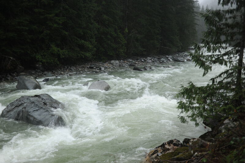
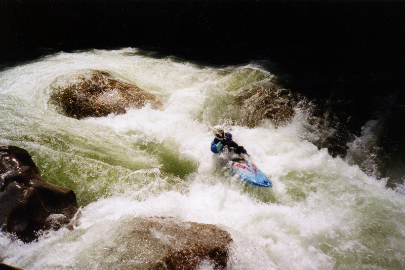
The Canyon: Drum Beater to Rooster Tail, Class IV+, 0.8 mile
The run begins with a technical Class IV+ canyon, with most paddlers putting in at the pool below Drum Beater. The last pitch of Drum Beater is fairly straightforward, but avoid putting in too high—depending on the flow, a terminal hydraulic near the middle of the rapid can make for a rough start to the day. If you plan to run the rapid just above the standard put-in, be sure to have safety set. Most paddlers simply launch at the beautiful pool at the base of the rapid.
The crux rapid, Let's Make a Deal, appears near the end of the canyon. Paddlers can choose from several slots between a series of boulders across the channel. Wood often blocks at least one slot, so scouting or getting a recent wood report is advised. The far left slot is usually the easiest to boat scout. After Let's Make a Deal, the river opens as Troublesome Creek enters from the right, and you pass through a boulder garden with the Troublesome Creek Campground and road on your right.
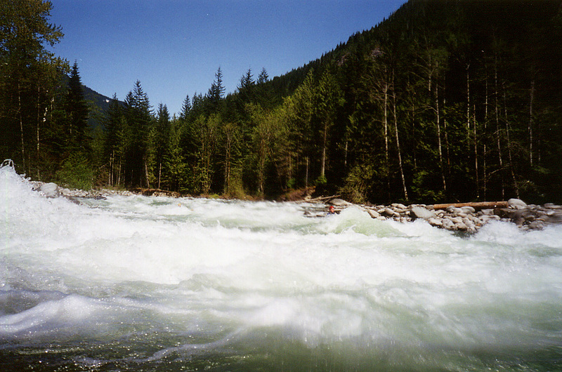
As you parallel the road, the next horizon line marks Rooster Tail. This rapid changed significantly during the 2006 flood. Pull out along the armored bank to scout or portage, and follow the trail through the forest. Right and left lines are possible depending on flow and any wood hazards. Paddlers who make it over the first pitch continue cleanly, but those who struggle at the top often compound their difficul
...
Most put in at the base of Drum Beater but those looking for a little more action can run the final pitch. Beware of the hydraulics upstream of this final pitch.
Inconspicuous access point at Index-Galena Road mile 11.6, located 0.4 miles past the Troublesome Creek Bridge, with a short trail to the river suitable for hand-carry craft that leads to the pool at the base of Drum Beater Rapid (elevation 1335'). Parking is very limited here so on a busy day you may need to park your vehicle downstream.
Like the name implies, Let's Make a Deal provides a choice among a few different slots among the boulders near the exit of the canyon. It is hard to see all the options from upstream. Experienced boaters usually boat scout but some will make the challenging scout from the canyon rim before putting on. Typically at least one of the slots has a piece of wood and it's not always obvious from upstream.
Rooster Tail has a fun boof flake on the classic right line. An alternative is to take the line down the left. It's an easy scout from the right and a standard stop on the shuttle. When flows are low enough you can also stop at the top of the island when you are on the river and walk down the center-channel island to scout either the left or right line. Those who don't want to boat the canyon often put in at the base of Rooster Tail. You can find this access at mile 10.7 on the Index-Galena Road.
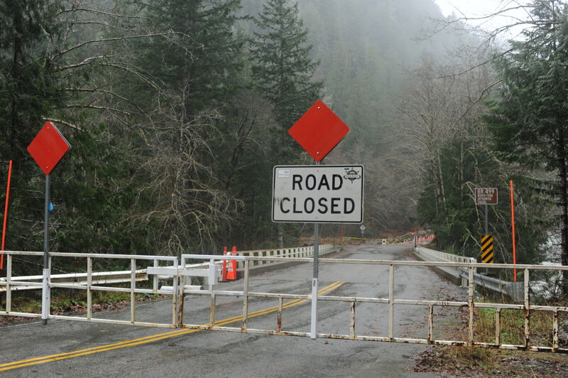
The 499 Bridge at mile 10.1 on the Index-Galena Road is the end of the county-maintained segment of the road and is also an area prone to chronic flood damage. The road is typically gated at this point in the late fall and remains closed through early spring with boaters anxiously awaiting the opening date. When it is closed you can put in here, roadside river access is available on the upstream river right side of the bridge, or hike up the road with your boat.
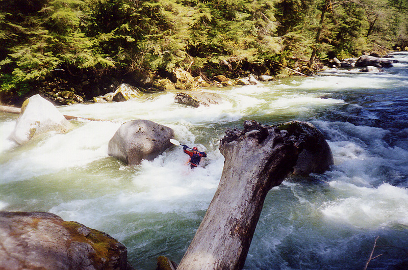
El Nino is the fun rapid just past the cluster of cabins and the confluence of Silver Creek. A successful run usually involves heading down the left side through some holes and between the boulders. It's an easy scout from the road on the shuttle (Index-Galena Road mile 9.2) and many take a look at this rapid to get an idea of the character of the run and a realtime assessment of flows. The Forest Road 6330 Bridge (Index-Galena Road mile 9.1) is immediately downstream of this rapid and serves as a potential access point. You can park on the river right side of the bridge where a short trail leads down to the river on the river right side of the bridge.
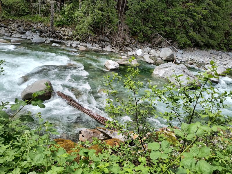
When the flows are up, big holes in a series of rapids known as the Minefield keep paddlers on their toes. Experienced paddlers should be able to boat scout and find their way through.
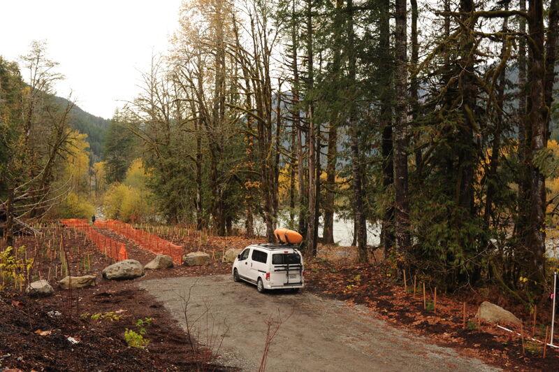
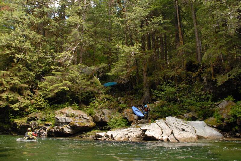
Located at Index-Galena Road mile 6.9, the Seven Mile Bridge access marks the dividing point between the Upper and Lower Sections of the river, which also separates the advanced class IV rapids upstream from the intermediate class III rapids downstream. This designated Forest Service River Access is on the upstream side of the bridge; turn sharply left off the road to reach a small parking area down the hill along the river. During the road reconstruction, American Whitewater worked with the Forest Service and Snohomish County to retain a segment of the old road realignment so paddlers would have a safe place to park off the highway. Local community assistance in stewarding this site is greatly appreciated, as it was provided specifically at the request of the whitewater boating community.

Located at mile 6.1 on the Index-Galena Road at the Trout Creek Bridge (elevation 840'), this river access and private campground has been owned and managed by Outdoor Adventure Center since 2010, at the confluence of Trout Creek and the North Fork Skykomish. Use of this access requires permission, so please contact the Outdoor Adventure Center before planning a visit. It can be a good option for groups organizing a weekend trip to the area.
To reach the town of Index, turn at the Mt. Index Cafe at Highway 2, mile 35.6. Continue to Index via the Index-Galena Road (which becomes Forest Road 63) to mile 1.0. Doolittle Pioneer Park (200 5th St, Index, WA 98256), on river right in town, is a common meeting point for North Fork trips and has public restrooms. You can also stop at the Outdoor Adventure Center or the local grocery store for food and drinks. A convenient take-out for the Lower Section is located on river right, just upstream of the bridge and adjacent to the park. It is suitable for hand-carry craft.
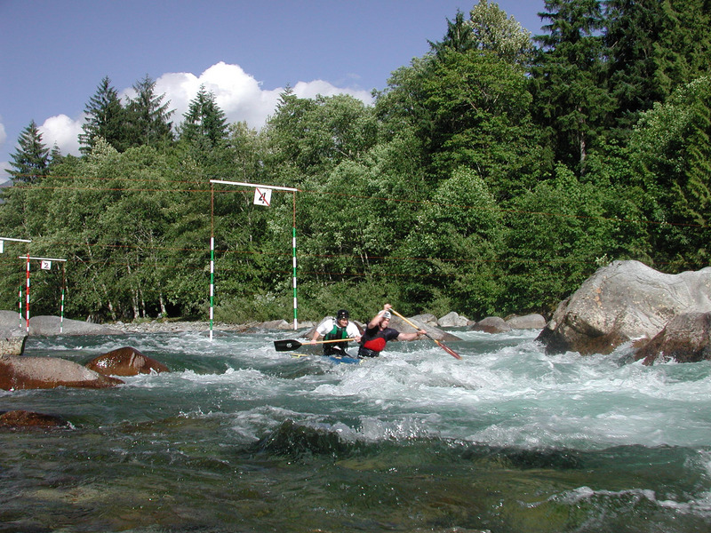
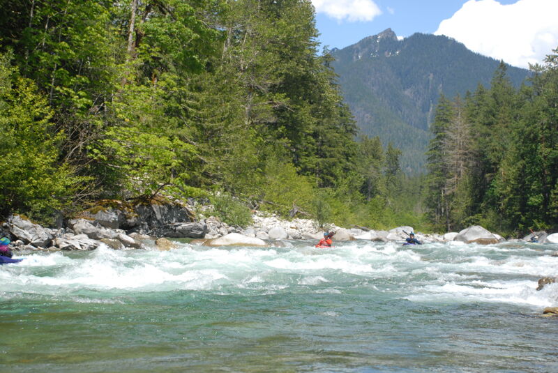
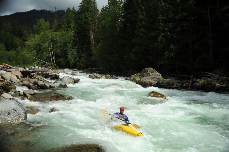
Llama Ledges is just downstream of Index and a fun class III rapid with several different route options. In years past it was the site of a slalom course.
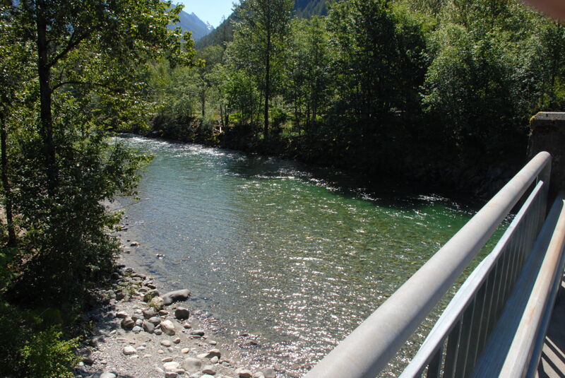
The access at the confluence of the North Fork and South Fork is reached via the pullout at Highway 2, mile 35.1, just west of the Skykomish River bridge. A short informal trail on the downstream, river-left side of the Highway 2 bridge provides a suitable hand-carry access. From here, you can also continue downstream on the main Skykomish River, with Boulder Drop awaiting a short distance below.
Apr 4, 2026
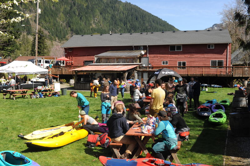
It was a great weekend for the Collegiate Whitewater Festival with beautiful weather and optimal flows on the Skykomish River. The event had 77 racers and 45 volunteers for a great day out on the water. The intermediate race was from Confluence to Boulder Drop and the advanced race was from Boulder Drop to Split Rock followed by awards and prizes at the River House in Index. The races photos are in a separate report on the Main Sky page.
Mar 16, 2026
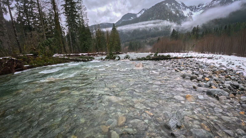
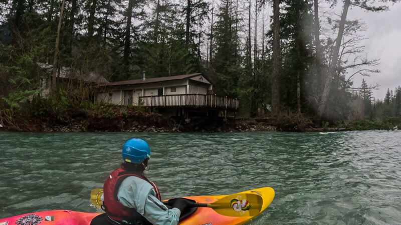
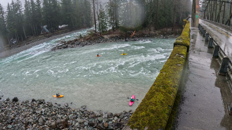
A beautiful day on the river, despite the rain. Snow on the banks. 3.7' on the Galena gage. Some new wood, including a river-wide log just past the house with the cable car. Easy to spot and easy portage around it on river right. There are also a couple of new trees down in the new channel, that are avoidable, but you have to zig-zag through them. The big tree at the bottom of the new channel has been cut back a bit, so it's more easily passable on river left. We got around it, but would've had to walk if the water had been any lower.
Jun 2, 2025
Had a great run yesterday on upper NF Sky from Rooster Tail to Seven Mile Bridge. Level was a nicely padded medium. AW gauge showed the river as very low / below recommended, which was inaccurate.
Paddlers should use the newer NOAA gauge at Galena: https://www.nwrfc.noaa.gov/river/station/flowplot/flowplot.cgi?SNGW1. I've found the correlation to be very accurate, with 3.5 - 4.0 being the sweet spot. Above 4.0 is getting pretty pushy, but still great if that's what you're looking for. I've run it at 3.1 and still had a good day with the right mindset, but it's really bony. Would be great for AW to start using this gauge that's near the put-in and not the main Sky gauge which is only a rough correlation at best.
Jun 19, 2024
The water was on the low side but still plenty for a fun trip on the North Fork Skykomish. Estimated flow was 1150 cfs on the North Fork in Index and 3900 cfs on the Skykomish at Goldbar Gage. This was a good level for a first-time run of the canyon and we had a few folks along who had not done it before. At this flow the rapids in the canyon are pool drop with a few big eddies that accommodated our group of a dozen paddlers. One log on river left about halfway through the canyon was in play and had to be avoided. There was also a tree that extended in to Let's Make a Deal from river right. It was possible to boat the center chute and avoid the log and the left chute was totally clean.
A couple of us ran the far left line at Rooster Tail without any issues but many portaged. From Rooster Tail on down the river had many exposed rocks but plenty of water for clean lines through most of the rapids. We stopped for lunch on the island between Pinball 1 and Pinball 2.
It was a beautiful day and great to be back out on the North Fork Skykomish River. Trip video by Kanako: < https://gopro.com/v/vkLBQV1vragJW >.