Sol Duc
5. Hatchery to Maxfield Road Bridge
| Difficulty | II |
| Length | 7.6 mi |
| Avg Gradient | n/a |
| Gauge | Sol Duc R. Nr Quillayute |
| Flow Rate as of 1 hour | 15.39 ftbelow recommended |
| Reach Info Last Updated | December 3, 2024 |
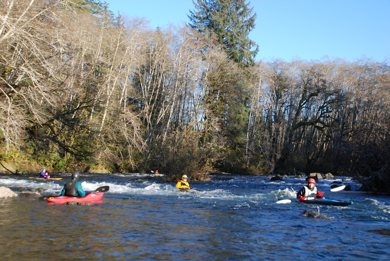
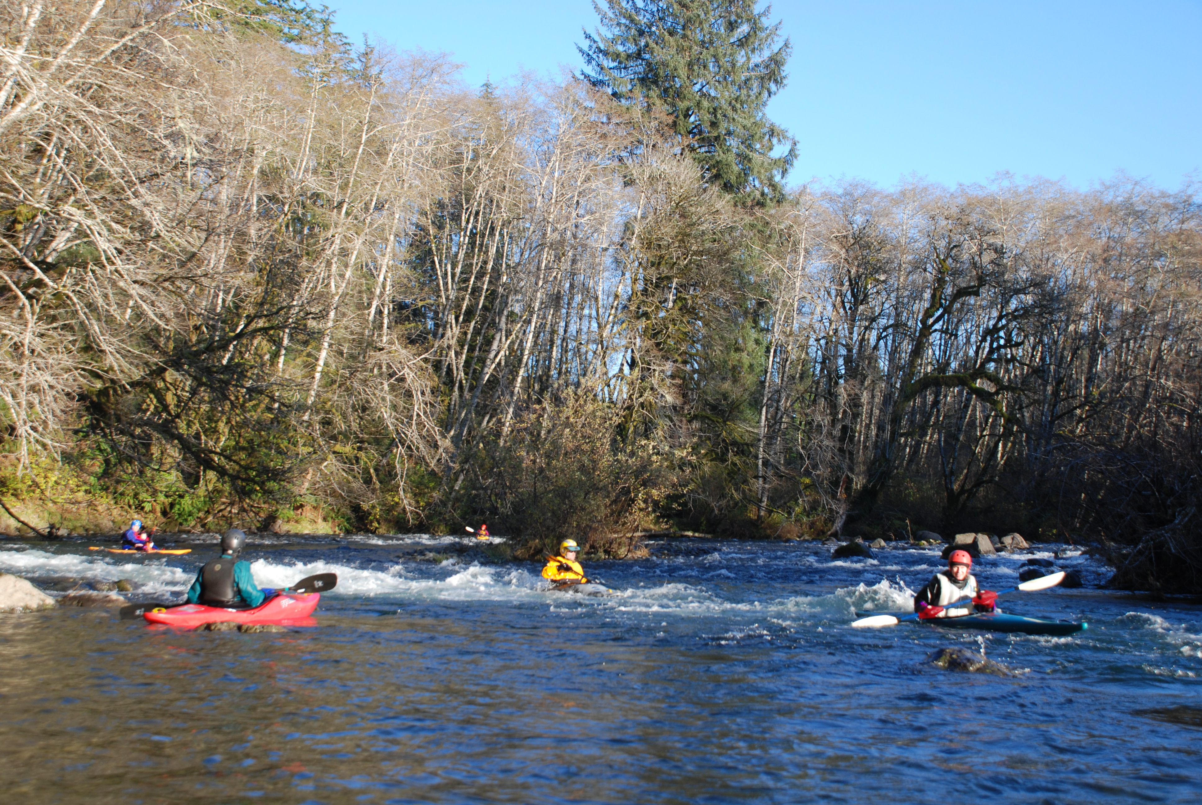
This is a great section for a class II beginner trip that flows after good winter rains. Several good class II rapids are spaced out over the length of the run with good recovery section in between each.
Access Logistics: Put-in at the Sol Duc Salmon Hatchery. At mile 203.5 on Highway 101 turn south on Mary Clark Road and then turn immediately west on Pavel Road towards the State Salmon Hatchery. Follow Pavel Road 1.3 miles to the Sol Duc hatchery and pull into the first parking lot on your right and take the boat ramp down to the river. To reach the take-out go to Highway 101 mile 197.4 and turn east on to Mansfield St. which becomes Maxfield Rd. Follow this a 0.3 mile from Highway 101 to the WDFW boat ramp at the bridge.
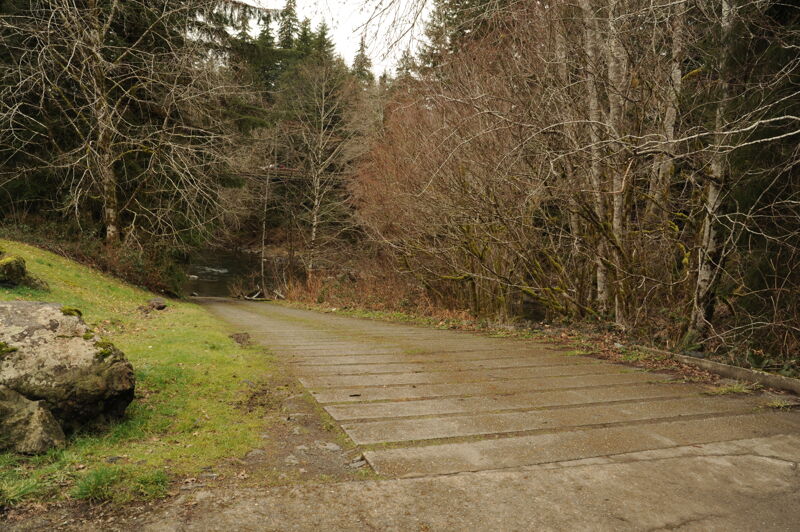
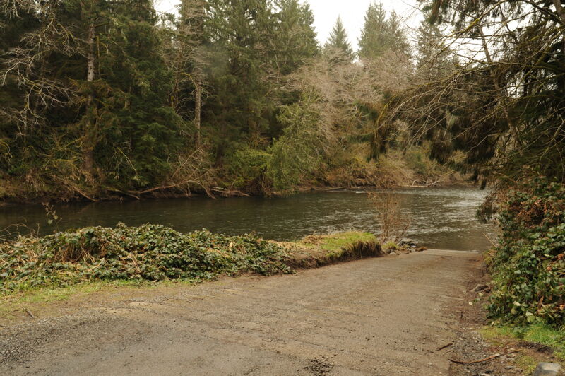
Put in on river left at the Sol Duc Hatchery. The site is administered by WDFW and a Discover Pass is required. This access is at approximately USGS river mile 30.8.
The take-out is managed by WDFW and is on the downstream river right side of the bridge. A Discover Pass is required to use this site. This access is at approximately USGS river mile 23.5.
Mar 7, 2026
Sol Duc R. nr Quillayute- 18 feet
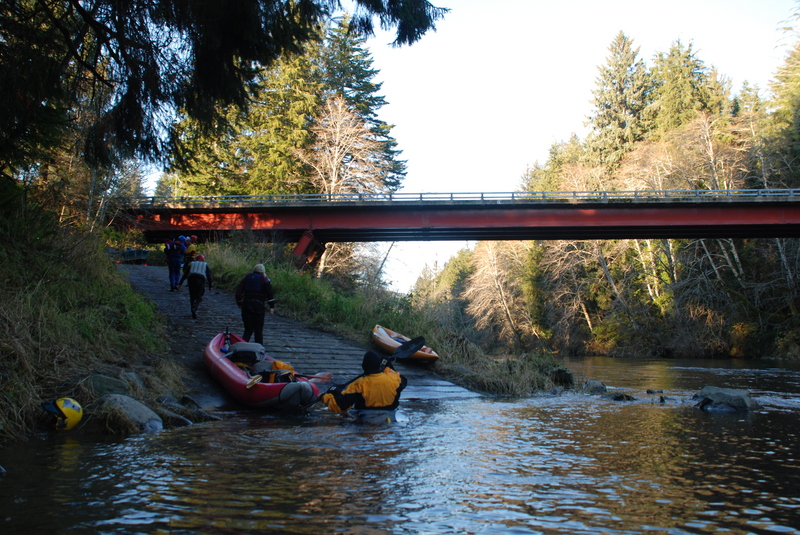
Put in our packrafts at the hatchery (48.0561, -124.30888) boat launch, which has good parking and a bathroom, frequented by people fishing and their boats, discovery pass required. Good class 2 rapids, with wave trains and a few boulder gardens often followed by calm river and pools. No major wood obstructions. I did not mark the rapids, as the rain made working with the phone challenging. There are sections with cabins/homes at rivers edge, but also long sections of wilderness. After passing under the red Maxfield bridge, take out river right, on the boat launch ramp. The boat launch at the Maxfield bridge (48.02257, -124.38370), has a bathroom, discovery pass needed, and parking is sometimes scarce on the weekend. For some reason, this boat launch does not show up on google maps. Trip was 7.5 miles and took around 3 hours with lunch break.