Stillaguamish, S. Fork
3 - Verlot to Granite Falls (Robe Canyon Run)
| Difficulty | V |
| Length | 12 mi |
| Avg Gradient | 56 fpm |
| Gauge | Sf Stillaguamish River Near Granite Falls, Wa |
| Flow Rate as of 30 minutes | 3.62 ftbelow recommended |
| Reach Info Last Updated | February 18, 2026 |
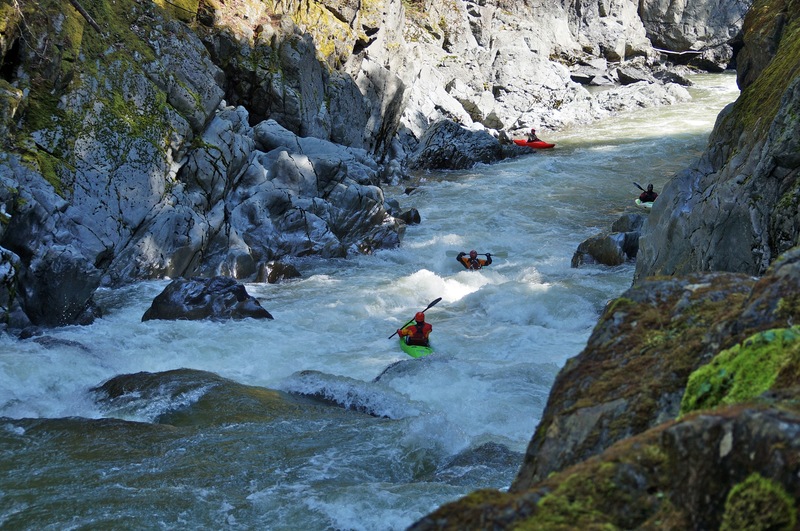
Considered one of North America's classic whitewater runs, and a dependable class V standard for boaters in Western Washington, the run starts with five and a half miles of class I/II before slamming into a three mile canyon of class IV, V, and V+ rapids. Most cut off this warm up and utilize the private access at Paca Pride. You can have a look at the rapids at the start of the canyon along the Old Robe Historical Trail (an old railroad grade through the canyon) and potentially use it as an alternative access (although it's nearly a mile to the river). The trailhead is on Mt. Loop Highway at mile 7.2 and you can view approximately 1/2 a mile of the canyon's whitewater before the trail basically ends.
Check out a video guide to Robe Canyon.
Logistics: Take-out at the Mountain Loop Highway Bridge just outside of Granite Falls (Granite Falls lurks just downstream so make sure you get out here). Turlo Campground is one potential public access point if you're looking for a warm-up. Alternative hike-in access of about a mile, which cuts off some of the flatwater, is available along the Old Robe Historical Trail which is part of Snohomish County Parks. Access across private property east of the trailhead is also possible at Paca Pride if you have permission (check with local paddlers. You can find them on the Robe Facebook Group).
This Forest Service campground sits 4.5 miles upstream of the start of Robe Canyon. It’s a rarely used access point, but a good option if you’re looking for public access with easy shoreline entry and no hike to the river.
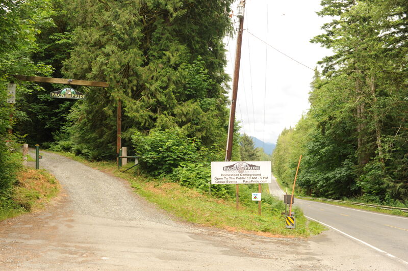
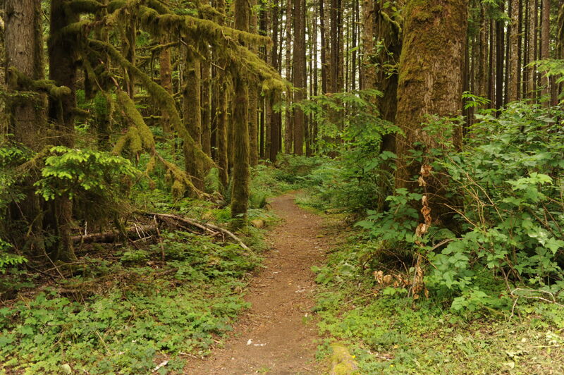
The most common put-in for Robe Canyon is at 28520 Mountain Loop Hwy, where the owner, Dave Albano, has granted paddlers permission to pass through the property. Because a yurt on-site operates as an Airbnb, paddlers should avoid disturbing guests. The property offers no parking, and paddlers should use the trail along the western end of the property. Park instead at Paca Pride Guest Ranch, 28311 Mountain Loop Hwy, Granite Falls, WA 98252 (360) 691-3395, open dawn to dusk. From there, walk east along Mountain Loop Highway and enter a trail on the south side of the road. The trail continues west through forest, turns southwest at a cedar shed, then descends via one switchback and a short log bridge. The Robe Canyon paddling community helped improve the bridge and trail. After the bridge, the trail crosses a levee and descends to the South Fork of the Stillaguamish, one mile upstream from Robe Canyon.
Robe Canyon Historic Park serves as a public trail, managed by Snohomish County allowing you to hike down about 3/4 mile to the river and then continue downstream to view the start of Robe Canyon.
The river transitions from an alluvial reach to the constrained bedrock reach of Robe Canyon.
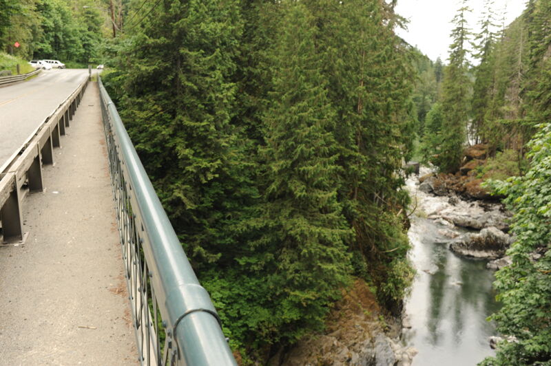
Parking is available along the Mountain Loop Highway on the river left side of the Granite Falls Bridge (#102) across the river. The take-out is just upstream of Granite Falls on the downstream side of the bridge on river left.
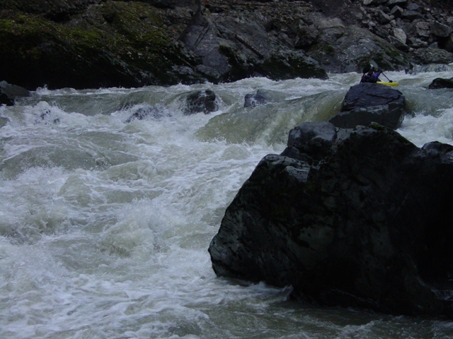
Most paddlers take out above the falls but they have been run. https://www.youtube.com/watch?v=rgHzQQYMmw8
Dec 13, 2015
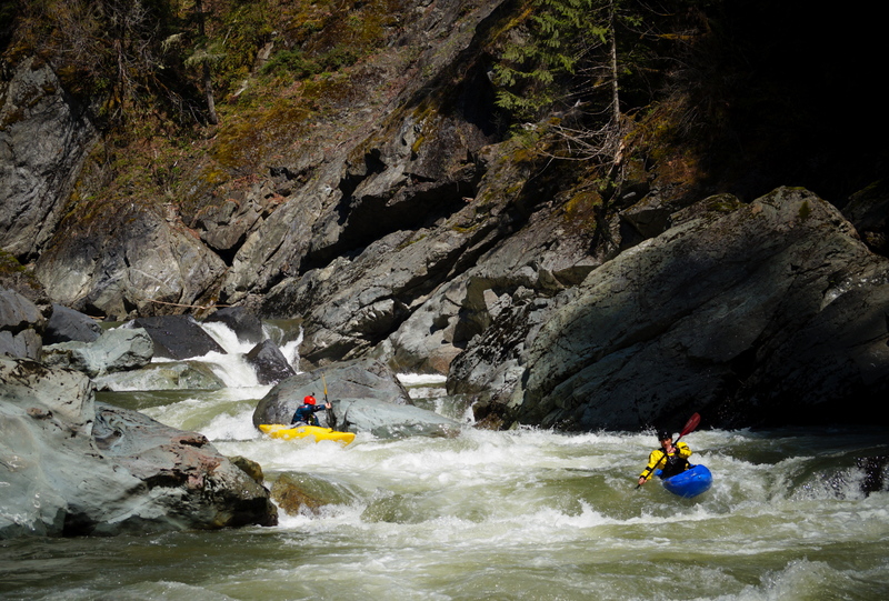
Paddlers in T2 heading into the pool above Last Sunshine
Nov 21, 2006
From: Shane Robinson
Date: November 18, 2006 8:16 PM
Subject: River changes: post flood
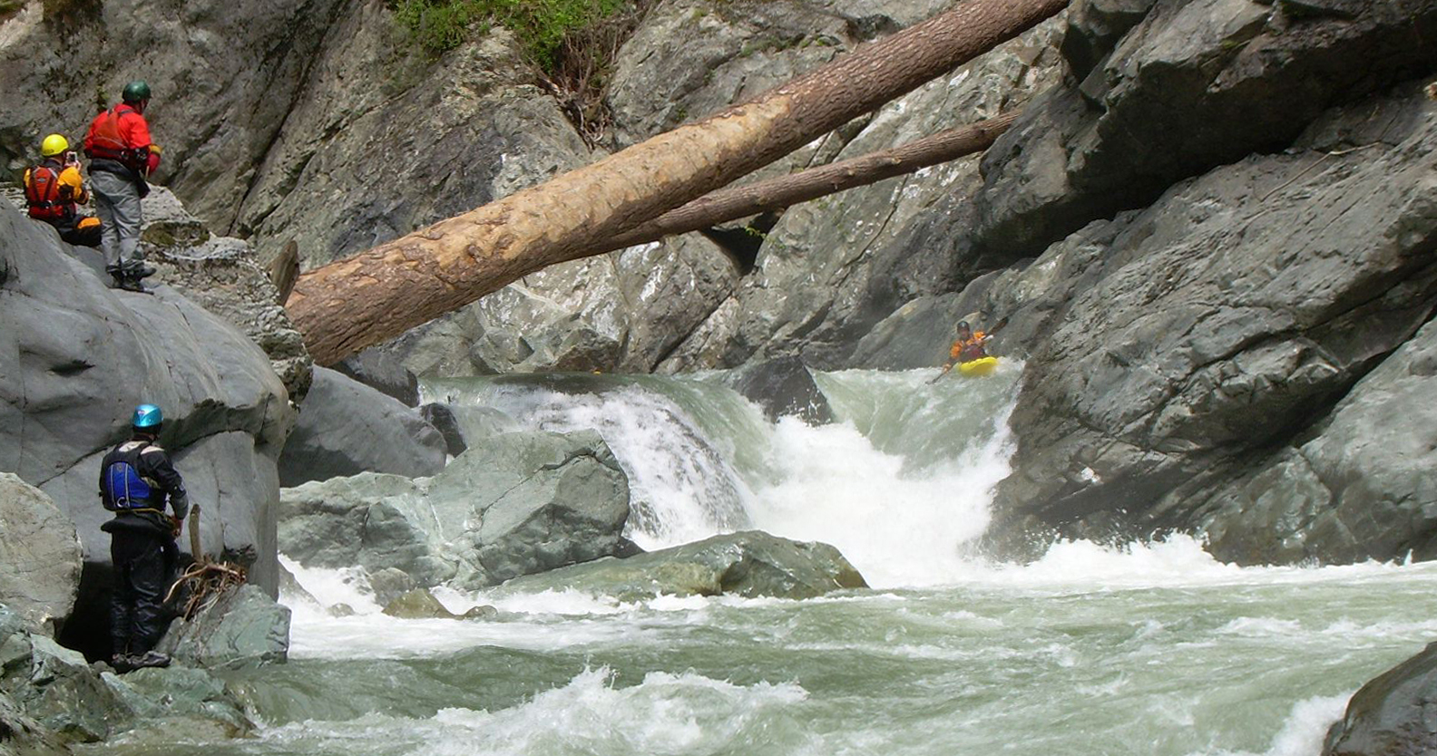
Just went down Robe today. Every rapid on that river has changed. Some dramatically. The biggest change is that T1 and T2 are pretty much gone, and all of that gradient is now lost at once in Last Sunshine. And the only way to portage and/or scout Last Sunshine is to get out on River Right at Tunnel Rapid (basically the first one), and walk through the tunnel and take a look at Last Sunshine from the bottom. It will likely be a portage for most people and I recommend just portaging to the bottom of it. There are some other major changes, however, they are easy enough to figure out with some prudent scouting.
Jan 1, 1900
Frame taken from digital video.
Video footage from the Twitch
series, featuring runs from
Washington and around the world.
Available through the [books & videos link](http://
www.americanwhitewater.org/library/
).
Robe Canyon on the Stilliguamish. Monte Cristo Railroad Tunnel Number 5 with a train in the background waiting between Tunnel 4 and 5. The old railroad grade is now a trail that provides a glimpse of the first
rapids. By permission: University of
Washington Libraries. Manuscripts, Special Collections, University Archives Division, Image LAR305.