Tieton, S. Fork
Grey Creek Campground to Rimrock Lake
| Difficulty | IV(V+) |
| Length | 5.9 mi |
| Avg Gradient | 72 fpm |
| Reach Info Last Updated | November 15, 2004 |
This reach does not have a description. If you know about this reach, please tell us about it!
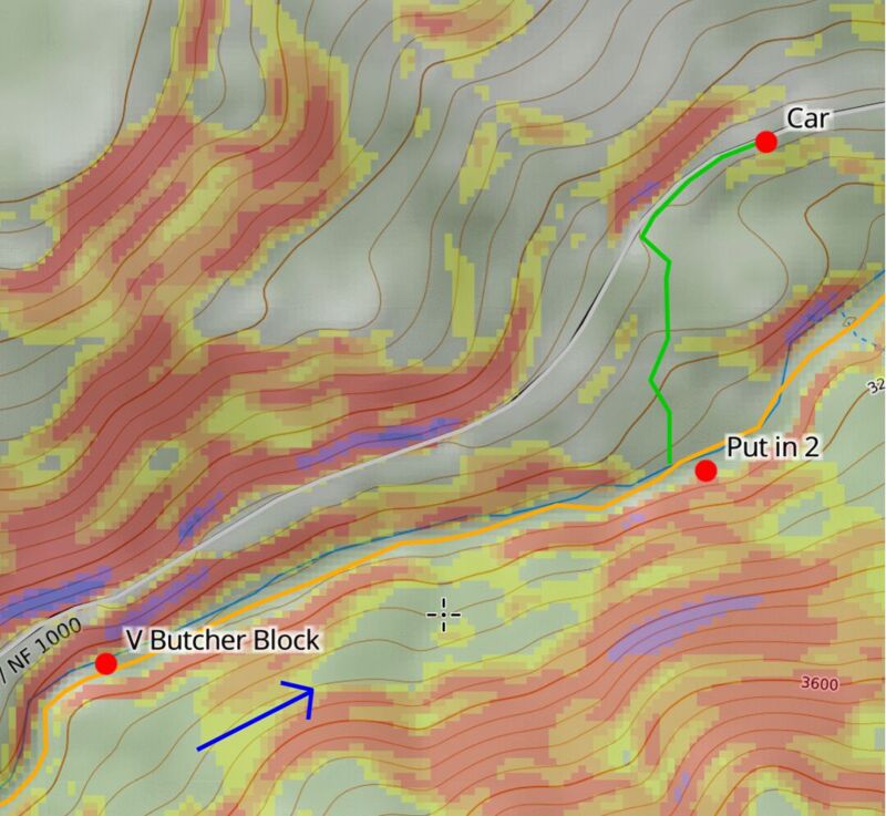
May 3, 2026
We had a nice day checking out the SF Tieton from below Butcher Block to the Rimrock Resevoir. The forest road 1200 bridge across the SF Tieton is out until ~2027, so we had to access forest road 1000 from the west side of the lake. There were a few logs spanning the channel that we found pretty easy to walk over / around.
—
Ariel, Brett, and I paddled the SF of the Tieton 5/3/26 on a nice sunny day. Flows were low but passable at 800cfs on the inflow to Rimrock Reservoir. If I were to go back, I think I'd like to see it at 1200cfs. There were some boulder gardens that would be a bit more exciting with more water. But there was also wood throughout the river, so I'd want to be cautious before going too high.
—
We actually did two laps, the first lap we put in below the easier version of butcher block.
46.61420, -121.16340
—
We parked the car on the shoulder above and followed a fairly well trodden, surprisingly gradual, trail down to the river. The only steep part was dropping the first 15 feet from the car.
46.61546, -121.16489
—
Most of the river below this point felt to me like class II+ or III- boulder garden style rapids. Maybe it would bump up half a level with more water. The road is generally a couple hundred feet above the river, so the river has more of an untouched feel. There is a bridge a mile and change above the take out that can be used as an alternate access point. Most of the better boulder gardens are below this point anyways.
46.61746, -121.15226
—
We used a takeout about a quarter mile upstream of the SF 1200 bridge. The bridge was kinda a construction area and the takeout spot had a nice sandy beach to chill at after the run. It was a few hundred yards walk to the car from there.
46.62293, -121.13324
—
The next lap we put in a bit higher, below the class V butcher block.
46.61045, -121.18296
—
We parked at a shoulder, walked up the road a bit, and dropped down. We never did find much of a trail, just a bunch of cow poop, but the trail down was pretty gradual and not too bushwacky.
46.61304, -121.18182
—
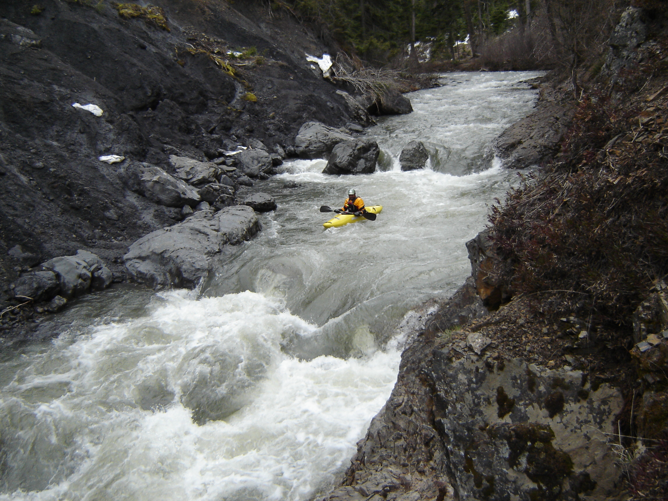
This section of river was more class III-. Little butcher block, which can be scouted from the road high above on the way in, felt class III+ at low flow, I could see it pushing IV- with more water. The entrance right hand turn pushes you left into a picket fence of boulders clogged with wood. After driving right to avoid that, we changed gears and immediately drove left to avoid a couple tight boulders. Then it's just a ho diddle diddle, right down the middle, couple of fun drops / waves. Fun rapid once you get past the wood!
46.61495, -121.16603
—
We continued down the section we had previously run, the second lap clocking in at a quick 3.3 mile run. Ran back to get the car, not a single car passed by late Sunday evening