Washougal
4 - Highway 140 to Washougal (Big Eddy Section)
| Difficulty | III-IV |
| Length | 7.1 mi |
| Avg Gradient | 35 fpm |
| Gauge | Washougal R. @ Hathaway Park |
| Flow Rate as of 1 hour | 115 cfsbelow recommended |
| Reach Info Last Updated | November 23, 2024 |
Washington’s legendary volcanoes – Mount Rainier, Mount St. Helens, and Mount Adams – are the source of wild, free-flowing rivers and streams that cascade over big drops and through deep basalt canyons on their way to the Columbia River. Rivers like the Clear Fork of the Cowlitz, Cispus, Green, [...]Read More
DESCRIPTION:
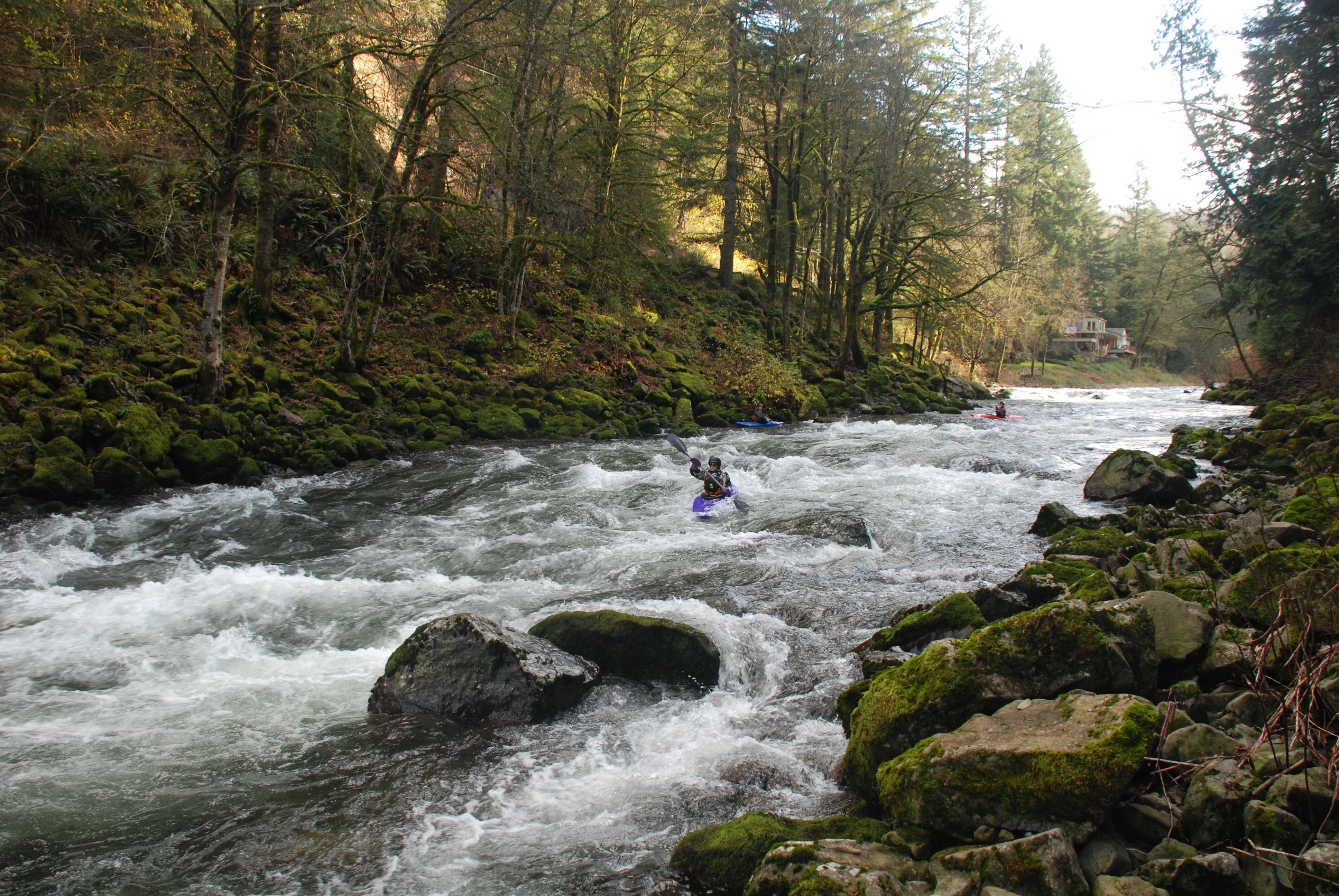
This is a great run close to Portland that's a mix of several class II rapids, a couple of class III drops, and one great class IV. It flows during winter rains. The run starts out with a couple miles of class II rapids and the action picks up as you approach Big Eddy. This class IV boulder garden is the biggest drop on the run. Easily scouted from the road, however remember that when scouting from above the gradient is not visible. Below here the best class III follows in the short section down to the Mt Vernon Road bridge (another possible access). Below there it's class I and II with occasional playspots all the way to the takeout, making the bridge a good launch for more tentative paddlers.
BEGINNER RUN AND STEPPING UP FROM THERE:
The vast majority of local boaters use the Washougal as a rainy season training run for beginners and early intermediates. The boat ramp at Hathaway Park is civilized and has ample parking. When people first start paddling they run they LAUNCH at Milepost 3, making it a short and fairly easy run with lots of small rapids. Once they have mastered this section, they start launching at Milepost 5. This added two miles has considerably more gradient and some great rapids, and it also has a lot of small play that is enjoyed by folks in playboats. Launching at Milepost 7 is the next step up but avoids Big Eddy, which is a serious rapid, not for beginners. When paddlers get good enough to run Big Eddy, they begin taking out at Milepost 3.
LOGISTICS:
At Highway 14 mile marker 16 turn north onto 15th St. into Washougal following the sign for City Center. In 0.4 mile this street becomes Washougal River Road and you cross the river and start heading upstream on river right. There are several homes along the river and public access is limited so you'll need to use the WDFW fishing access sites. The take-out is at Washougal River Road mile marker 3.0. There is a pull out and steep but wide tra
...May 7, 2023
We use this gauge: https://www.nwrfc.noaa.gov/river/station/flowplot/flowplot.cgi?WASW1 and yesterday's level was 6 feet, which is what Dee Brodigan told me was her personal minimum for the section. I agree with Dee. The gauge parameters on here say it is 'runnable' a good bit lower but I wouldn't go there, we have better options.
That said, at 6 feet Big Eddy was starting to look manky and had a tree blocking the main flow right below the biggest drop. We put in immediately below that. We enjoyed the eddy hopping and surfing in the section immediately below, and Cougar rapid was also fun to work at 6 feet. (I've run this section more commonly at 7 and 8 feet. At 8 feet Big Eddy is a BIG rapid and the water is high throughout.)
We ran all the way down to Hathaway just to see that bottom section and it is indeed dull. Still, from milepost 3 to Hathaway (a Washougal City Park) would be a decent first-timer float with adequate support. If the water was up you could still swim and lose a boat here. =-D
Nov 15, 2006
Realtime DOE gauge: https://fortress.wa.gov/ecy/wrx/wrx/flows/station.asp?sta=28B080
Jan 1, 1900
Tried to do this section today. The water was too low and it turned into a trip of dragging the bottom of our rafts and canoes filled with lots of lots of wading in ankle deep water. 2 weeks ago we did it it in about 6 hours with only a few sections of wading/dragging past shallow parts.
