White
2. West Fork to Bridge Camp (Middle)
| Difficulty | III |
| Length | 12.2 mi |
| Avg Gradient | 44 fpm |
| Gauge | White River Below Clearwater River Nr Buckley, Wa |
| Reach Info Last Updated | June 20, 2019 |
Projects
The Puyallup River drainages includes the White, Carbon, and Puyallup Rivers which originate off the slopes of Mt. Rainier, Washington’s tallest mountain. All of these rivers offer whitewater boating opportunities that serve a range of skill levels form beginners to experts. White River The White River flows off the [...]Read More
River Description
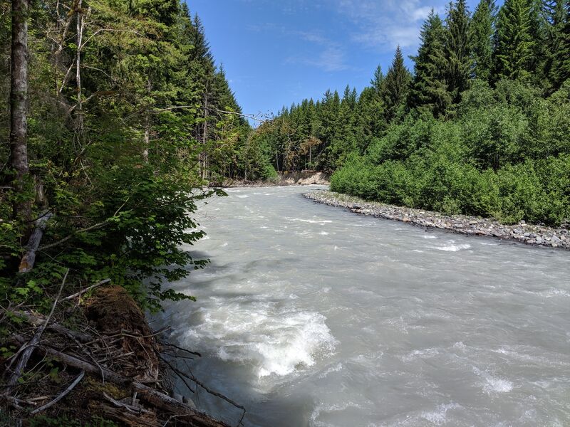
The run is mostly class 2+ with some 3. The character is relatively consistent gradient with gravel bar rapids interspersed with small boulders.
The primary hazard on this run is wood. You need to be prepared to portage, as channel-spanning log jams are not uncommon.
NOTE: According to user comment 6/2019 there are several river-wide logs requiring portages. See user comments for details.
Logistics
The put-in for this section is the FR 74 Bridge which can be reached by Highway 410, turning off onto FR 74 at mile 46.4. Although this run starts on public land, it enters the private White River Tree Farm making access a bit of a challenge. The traditional take-out for this section, upstream of the slackwater of Mud Mountain Reservoir, was at the bridge reached by a private logging road that turns off Highway 410 at mile 35.3. In recent years this road has been closed to public vehicle access. Unless you want to hike up with your boat, the most practical access is near a bridge that can be accessed relatively easily from Highway 410 mile 38.3. For an even shorter run, there is also convenient road-side access at Highway 410 mile 41.5.
River Features
Alternate Bridge Access

Last access point with convenient access to Highway 410.
Put In
Take Out
Trip Reports
Log in to add a reportChris R
Jun 18, 2019
Packrafted down this stretch with a buddy on 6/16/2019. There were perhaps 4 or 5 river-spanning strainers. We were being conservative, and scouting, and portaging as-needed, and it was definitely the right way to play it. Longest portage was perhaps 1/3 of a mile on the shore river-left (early on in the run).
Aaron Carr
May 12, 2016
Floated this stretch 5/11/2016 in inflatable kayaks. Took it slow with lots of stops to scout the river, but the river was mostly open. Did not run into any river wide log jams and all the sketchy stuff was easily avoidable. The river was flowing great. A good float for an advanced beginner that's hit the yo-yo and lower skykomish a couple times. Floated from FR 74 to the alternative pull on 410 in 41/2 hours. Go enjoy this great stretch of water!
James Amandus
Jul 28, 2003
There are several trees and logs down right now on the lower and middle strech of this run. I went down on 7-26-03 and found 3 blocked areas of the river. There are a few strainers that you have to get out for... Don't attempt to run any of them. I lost a Werner Player orange 194' paddle in one of these jams because we could not see if the tree covered the entire river. Take care and contact me if you would like more information on where the jams are.