Wind
4. High Bridge to Columbia River(Lower Wind)
| Difficulty | IV-V(V+) |
| Length | 5.2 mi |
| Avg Gradient | 56 fpm |
| Gauge | Wind R. @ Stabler |
| Flow Rate as of 1 hour | 88 cfsrunnable |
| Reach Info Last Updated | March 13, 2024 |
This run through the spectacular Wind River Canyon features some great rapids and a personality that changes with flows. At low summer flows you can have a fun evening running Shipherd Falls and at higher winter flows be prepared for action-packed excitement and a mandatory portage of the falls.
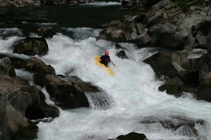
Shortly after the put-in you encounter High Bridge Rapid which is a fun class IV boulder garden and one of the longer drops on the run with lots of good eddies and slalom moves at moderate flows. Below this rapid the run settles in to class II and III pool-drop rapids. The next big drop is The Flume which is a great class IV rapid ending in a pool at the bottom. You can get around the main part of the rapid by portaging on the right. Just a few hundred yards downstream of The Flume you will encounter class V Beyond Limits at an obvious horizon line. This drop can be portaged on the left hand side. The line to run it is down the right but depending on the flow the rocks on the right back up the flow to create a nasty hydraulic at the base of the falls.
After Beyond Limits you are just about to Shipherd Falls and you will need to hop out on the fish ladder on river left. This area is posted no tresspassing however enforcement is minimal. Shipherd Falls is a series of four drops that can be run at low summer flows. The problem with running them at higher flows is the dam at the bottom that was constructed to direct fish into the fish ladder creating a deadly hydraulic characteristic of lowhead dams. The state fisheries department does not look favorably on boaters portaging on the fish ladder, but their dam creates the hazard to navigation that requires a portage. If you are running the river during moderate to high flows and portaging down the fish ladder you will need to scramble up the cliff at the bottom on river left for a 25' huck and jump into the pool below the falls. This is necessary to safely clear the hydraulic at the base of the dam and would be ex
...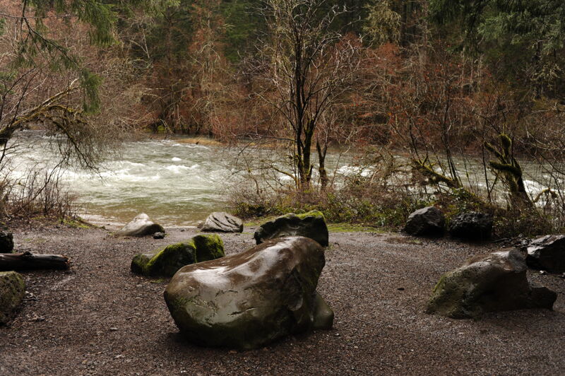
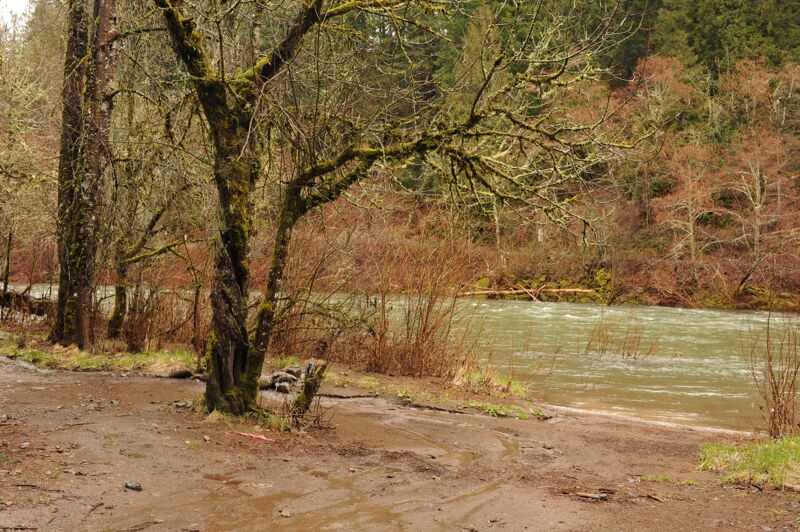
The access is on river right. From Highway 14 at mile 47.4, head north into Carson on Wind River Road. To reach the take-out continue to mile 3.0 on Wind River Road and turn left onto High Bridge Road. Head 0.1 mile and turn right on Detour Road. Detour road winds 0.7 mile down to the river. The parcel at the river is owned by Skamania County.
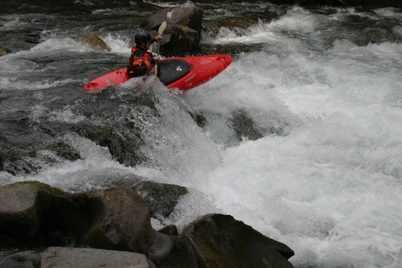
First real rapid after the put in. Long boulder garden with a lot of fun lines. At higher water, it could create some nasty features.
Varies a lot with water level. Not a place to be upside down. A lot of sharp rocks under and above the surface. It is not a fun portage, but no shame in portaging.
Next to an old fish ladder. At highler levels, this is definatley a class IV. At normal flows, it's a fun auto boof on river right. Enjoy.
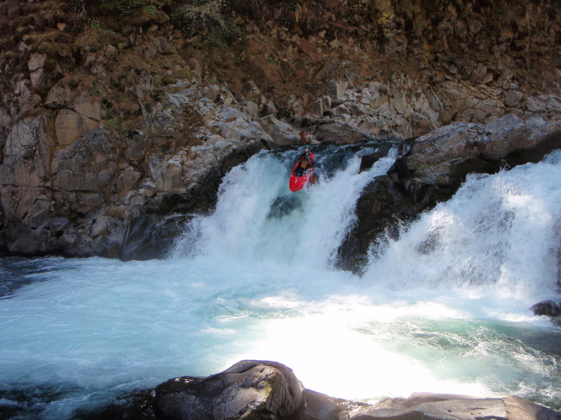
The first falls is next to a fish ladder chute, right after a class III drop. Be careful. Eddy out after the drop, and line up the first falls middle to river left. It's about a 12 ft drop. Pretty forgiving.
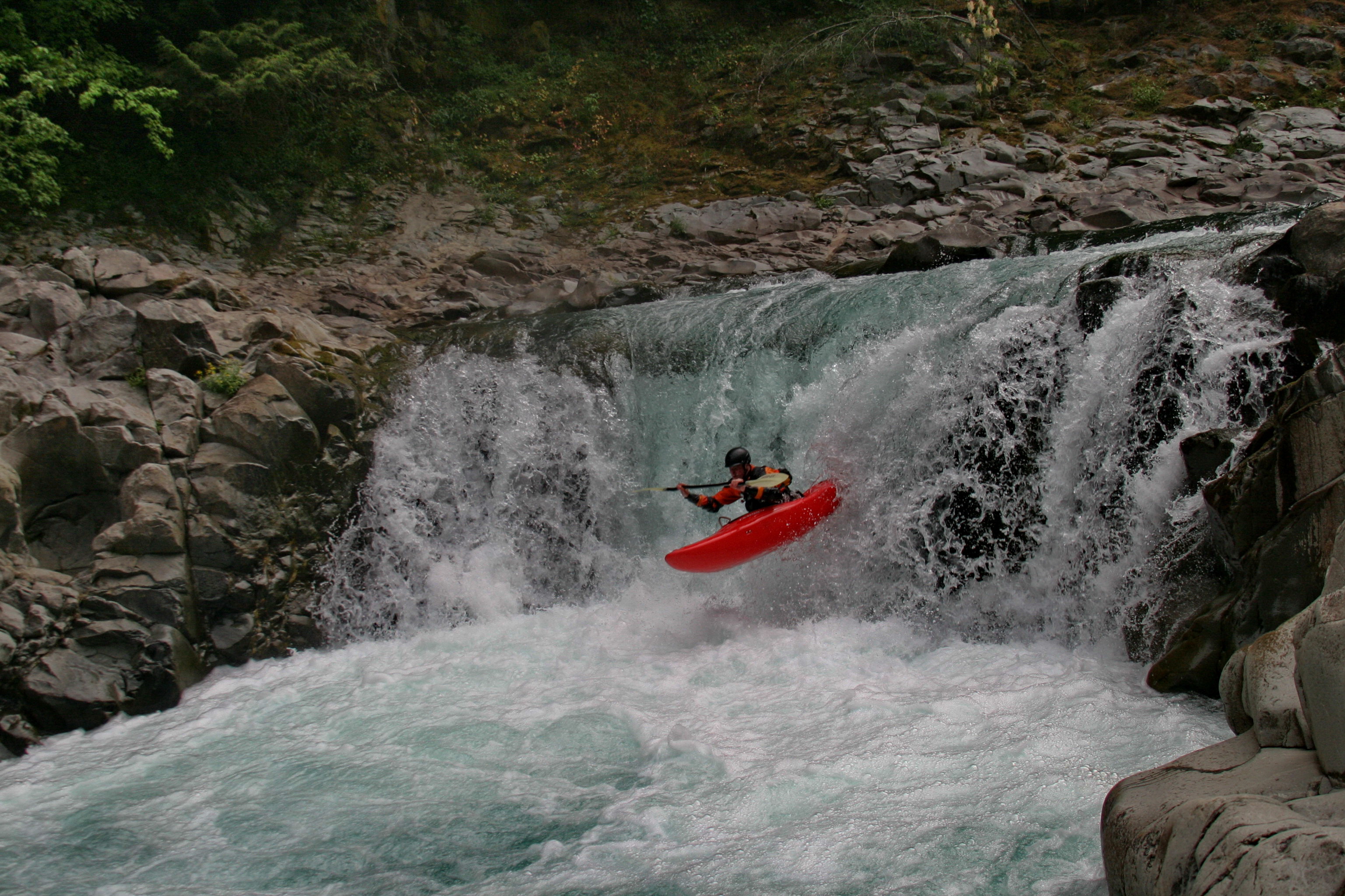
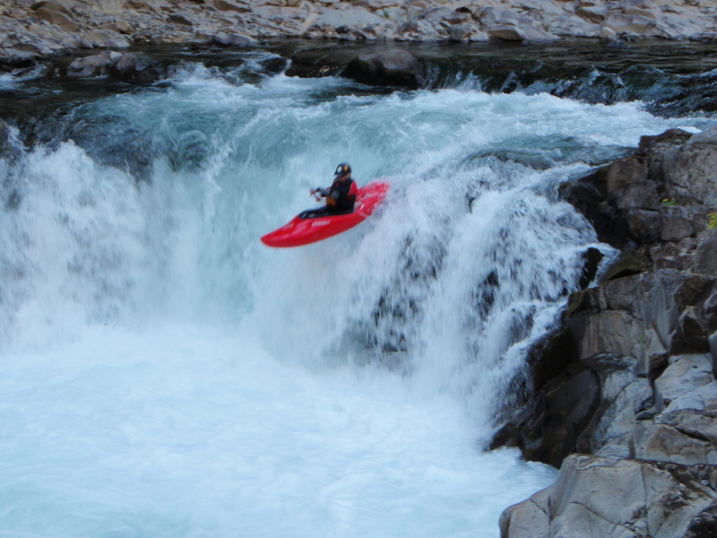
Shortly after the first falls, there is a 17ft waterfall on river right (medium flows). It's a high volume waterfall, so make sure to get a good boof stroke and clear the base. There is a forgiving eddy on river left. River right could push you into the last falls rapid.
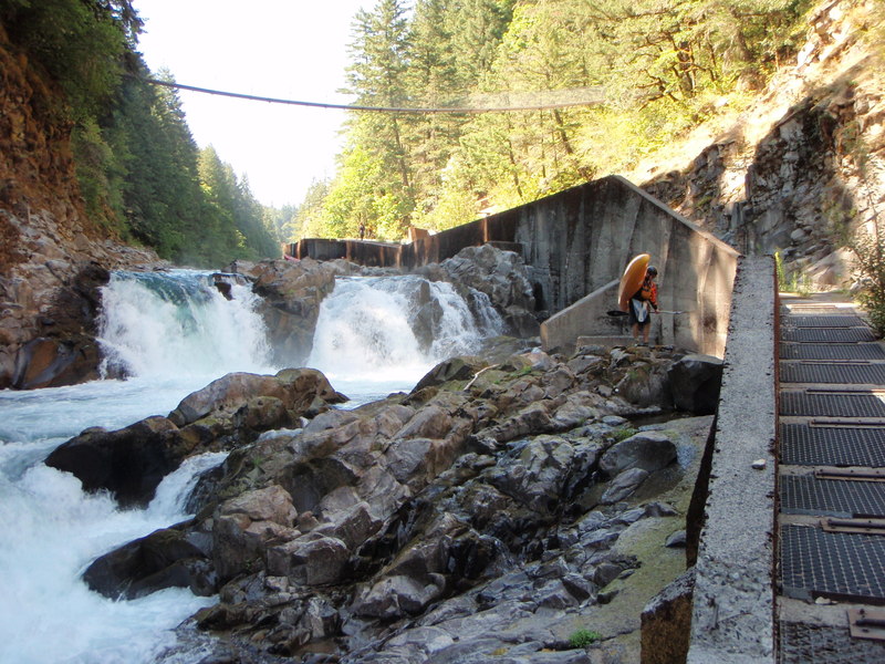
The last of the Shepard falls is a man made dam feature. At high flows, this is unrunnable. At medium to low flows, it's still a dam hydrolic, shallow and risky. The entrance is middle to left, down a shallow slide. Then a moment of calm to line up river left to boof the dam. The entry to the rapid is harder than the end. (Photo is looking at the 2nd falls)
This access point is on private land on river right and may not be open to the public. You can reach it from Highway 14 mile 49.3 by turning north on Hot Springs Ave. and continuing to mile 1.1 and the turn onto St. Martins Hot Springs Road (you will see a sign for Carson Hot Springs). Follow this road 0.1 and turn right onto St. Martins Hill Road. The road switchbacks 0.4 mile to the river and provides good low bank access.
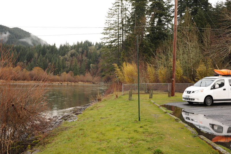
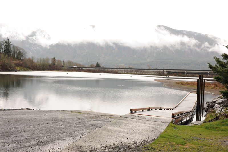
This access located on river left is reached from Highway 14 mile 49.6 where you turn north on Old Hatchery Road. Follow this road 0.3 mile to the access. The Wind River Boat Launch is administered by Skamania County and may be an option for a take-out. Users are required to purchase a Skamania County Boat Launch Permit to launch at Wind River this site. Parking is designated for tow vehicle and boat trailer combinations; single vehicles are not allowed to park in the lot unless a valid handicap permit is displayed.
Mar 12, 2024
Jul 29, 2022
The hot springs resort has purchased the take-out @ the bottom of St. Martin's Hill Road & have closed it to public use.
We need to use the big ramp on the river left side of the Wind @ Columbia confluence:
Jun 25, 2021
The Washington Department of Ecology recently updated their entire site the new url for the gauge is: https://apps.ecology.wa.gov/ContinuousFlowAndWQ/StationDetails?sta=29C100