Wynoochee
Wynoochee Reservoir to Save Creek(Wynoochee Gorge)
| Difficulty | II-III(V) |
| Length | 11 mi |
| Avg Gradient | 22 fpm |
| Gauge | Wynoochee River Near Grisdale, Wa |
| Flow Rate as of 53 minutes | 235 cfslow runnable |
| Reach Info Last Updated | July 12, 2026 |
The Wynoochee Gorge is typically best from November through May, but it is generally runnable year-round due to consistent releases from the reservoir. It has been run as an overnight trip during the summer, and it is also possible to continue downstream below Save Creek onto the Lower Wynoochee.
Wynoochee Dam to Hatchery Dam, Upper Gorge (2.2 miles, Class II+)
The Dam-to-Dam run starts with a couple of Class II rapids before entering an impressive gorge that has been partially flooded by the fish collection dam. This is considered a Class II+ run because of the wood in the water, not because of the rapids themselves. There are numerous places where beginners, and even more advanced paddlers, must portage around strainers. It can be run as low as 210 cfs, although open boats will require a little dragging at that level.
Fish Collection Dam to FR 220 Spur (3.8 miles, Class I/II)
The Fish Collection Dam provides an intermediate access point and serves as either the take-out for those paddling the Upper Gorge or the put-in for those running the Lower Gorge. From the Fish Collection Dam, the river meanders at a mellow pace for about four miles. There are potential campsites on Forest Service land in this section before the river enters private forest land, making it a good option for overnight trips.
FR 220 Spur to Save Creek Gauge, Lower Gorge (5.4 miles, Class III(V))
The five miles of the Lower Gorge is essentially a Class III run, except for one rapid, Landslide, which should be treated as Class V because of its remoteness, its tendency to change with flow, and its propensity to collect wood.
Expect to encounter wood in Landslide. It is one of those drops with committing lines and places you do not want to end up. You cannot see the entire rapid until you are in it, as it rounds a corner.
The character of the rapid changes considerably with flow. In terms of difficu
...On Wynoochee River Road mile 33.3 (2.3 miles north of the Forest Service boundary sign where it becomes FR 22) turn west to stay on FR 22 (the road continuing straight is FR 23). From this turn, follow FR 22 0.3 miles to a right turn onto FR 2294 (follow the signs to Coho Campground). At 0.8 mile down FR 2294 you'll find the access to the uppermost put-in at the base of Wynoochee Dam as it crosses the river just downstream of the dam. Parking is available on river left on the north side of the road. The access to the river is a spur from FR 2294-010 that heads south from opposite the parking lot. Although this road is normally gated, those who have planned ahead have arranged for the dam operator to unlock the gate. It's a relatively short walk if the gate is locked. The dam is located at USGS river mile 51.8.
On Wynoochee River Road mile 33.3 (2.3 miles north of the Forest Service boundary sign where it becomes FR 22) turn west to stay on FR 22 (the road continuing straight is FR 23). From this turn, follow FR 22 1.7 miles to the river. The collection dam is visible on the downstream side of the FR 22 Bridge. Put-in below it. If you are traveling down the river from upstream this dam is a portage. Located at USGS river mile 49.6.
Save Creek Access located on river left is the traditional take-out for the gorge or the put-in for the canoe run down to Bob's Bridge. At Wynoochee River road mile 28.7 (0.2 miles after crossing Save Creek), turn west on FR 2266 (aka Simpson 600). This road may be gated during periods of fire danger and if private lands are absued--problems with timber theft have led to closures. Take this road 0.15 miles across a stream and turn left on the Simpson O-602 Rd. You'll pass a couple spur roads and then reach a Y junction in 1.7 miles. Take the left fork down the hike and continue another 0.3 miles to a trail that leads straight down to the river. The road takes you within sight of the river and it's about a 250 foot climb from the river to the road along the trail which is about 4 feet wide, and although it's steep it's a good trail. This access is located at USGS river mile 40.4.
Oct 24, 2021
High Flow - lots of character.
This run is 'in' at 220-800cfs (at the dam). Most other reports I have seen are 300-650cfs, so this was a high-flow endeavor.
We put-in at ~11:30 and were out at ~3:30
It is approx 1.5hrs from Olympia to the take-out
Weather: light to medium rain, 45F air
Shuttle: We found the 728 spur road gate open. Since it was hunting season and there were many obvious hunters (mostly near the spur roads) If you were bike shuttling or hiking it might be prudent to wear blaze orange or other bright plumage.
The drive down to the take-out on the O-602 spur was straight forward with a generally good road with some potholes. It was not a goopy mess even with the rain. A passenger car could do it with care. There is space for multiple vehicles at the obvious end. The trail to the river was a bit slick but not too challenging, and is ~100 yards. The drive up to the Dam parking lot was quick and easy.
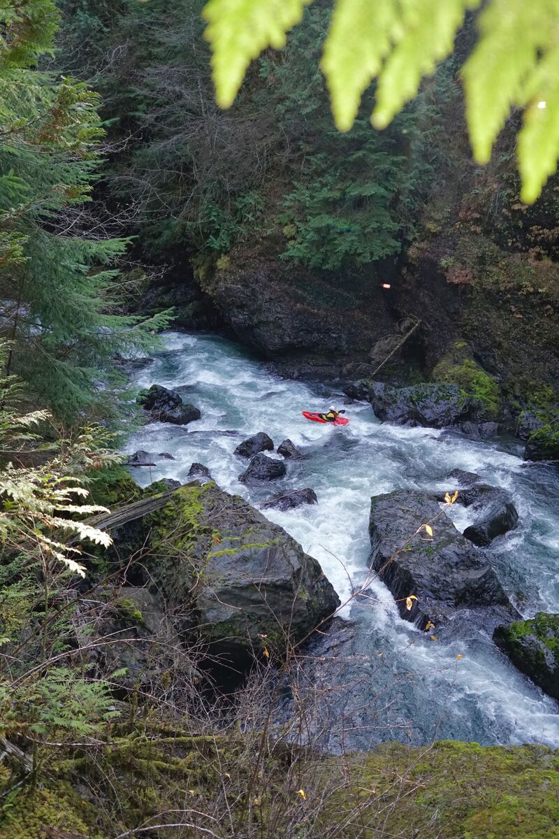
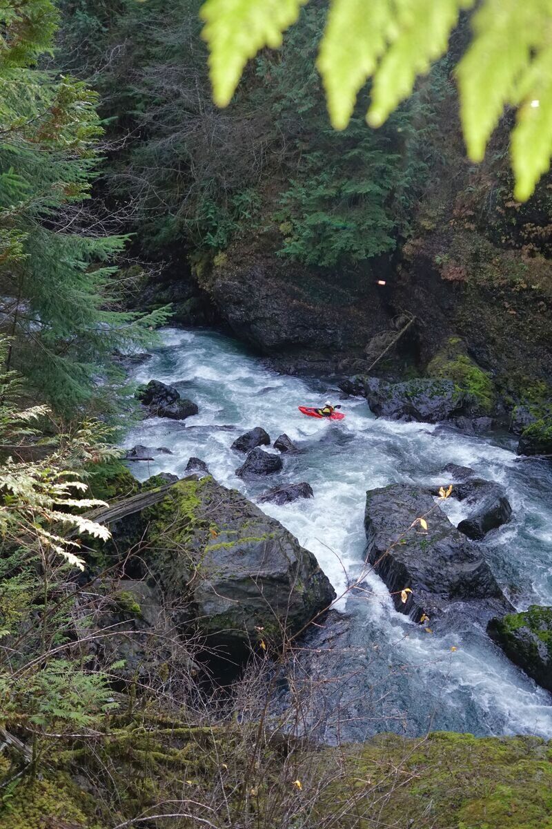
The Paddle: We started at the lower outlet of the lake dam. Easy entry off of basalt slabs, then a bit of effort to clear the eddy created by the outflow. The current was swift. Upper section was enjoyable CL2 with some strong current, submerged wood and low hanging branches. Super scenic. We exited early before the low-head dam on RL and scouted from the bridge, then returned to our boats, traveled until just past the bridge and exited RL. Space here might be a bit tight, so sequence and make room for others quickly. If you miss the RL eddy, you have little chance of avoiding the dam, which despite its description as the 'Hatchery Dam' is a narrow and tall ~15 low head dam. There is also an apparent portage on RR, right at the concrete works of the dam. High consequences for missing it. On our portage on RL we hiked up a short grade, then descended the stairs of the station and followed the chain link fence. We re-entered the river at the first opportunity which was a fast and fun rapid from the dam outflow. Below the dam there was some channel navigation with increasing levels of submerged wood and relatively easily avoidable logjams. The river was not pushy in these wider sections, but lower down the mixing currents certainly got my attention. Gravel bars start to appear and there are good options for breaks. We saw Eagles, Mergansers, Dippers, and Kingfishers. The wood hazards were increasing and there were several narrow channels between partially submerged logs. While messing up would be bad, I think being distracted by the beautiful scenery is the real risk on this run, outside of the Landslide and Ring of Fire rapids.. The combination of fall foliage and numerous cascades entering from side drainages was exceedingly beautiful. I expect the ~4.5' of rain over the previous 96 hours had made the number of waterfalls increase substantially over 'typical' flows.
Landslide: At our flows we heard it before we saw it, and the horizon line was obvious. Approaching the rapid was easier than I expected and it was straight-forward to catch the eddy on RL to scout/portage. There was space for our 4 packrafts. The portage itself is not bad. The first portion is a steep 50' chute of 2+' talus, but there was a decent handline up with hand loops tied in it. The rope was in good shape. Even without a rope established it would be fairly easy to establish a handline with a rescue rope. At the upper portion of the chute is a large tree with exposed roots. You can use the handline and move slightly left and up, then back over the root ball, or climb out right (below the tree) using roots for hands. Were you or your raft to slide back down the chute would probably not be catastrophic. You would not tumble into the river and be swept into the rapid. Once crossing the tree you can descend back to some good entry points. Although there was a line here I barely used it. There is ample room on basalt slabs to comfortably re-enter the river and you can scout down at least 2 eddies with a bit of fairly easy bouldering.
If you run the rapid at these flows: The sieve and constriction hazards seem to be replaced by swift, powerful current and some significant holes. There looked to be 2 viable lines to my inexperienced eye. Both lead through holes, and a swim would result in at least bruises and a 50+yard swim that would require defensive and offensive swimming to gain an eddy. I think boats and people would most likely be recoverable not more than 100yds downstream at a bend in the river, but I don't want to find out.
Re-entry from the portage: After a low-angle launch, paddle with gusto toward the smaller eddy on RR. While not mandatory it gave me some time to regroup, then exit and catch a larger/easier eddy, also on RR, 20 yds downstream. From there you have a longer line of sight and can pick your way through nice obstacles until you reach Ring Of Fire.
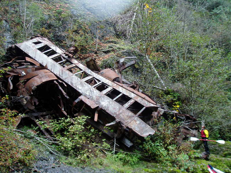
Ring of Fire: ROF is easy to spot as you will see the Train first, and the rapid is after the train (at these flows?). At our high flows, the approach was only inhibited by some tricky wood (nearly full-width, just enough space on RL) but it was an easy eddy at the Train on RL. The rapid is obvious and RR was the cleaner line and had no exposed metal. We also could not see any RL with the high water. The obstacles just downstream were straight-forward. The remainder of the run is just good fun, and I think it would be easy to miss the Exit. Look for a large tree against the bank on RL (at least as of 10/23/21 - it looked well anchored). Just after this on RR will be the gauging station which was hidden from view by foliage. Great trip with great people in a great place.