Kings, N. Fork
Balch Afterbay to confluence with Dinkey Creek
| Difficulty | V |
| Length | 1.6 mi |
| Avg Gradient | 130 fpm |
| Gauge | N Fk Kings R Abv Dinket Ck |
| Flow Rate as of 22 days | 1.33 ftstale data |
| Reach Info Last Updated | February 22, 2024 |
This is a super little section that is easiest to catch with flow in January or February when PG&E does maintanence on a downstream powerhouse. It can also flow at a reasonable level in the spring of a big water year.
Take-out is in Balch Camp at the confluence with Dinkey Creek. Most boaters will continue on down the NF Kings to the confluence with the main Kings.
Put-in: Drive up a paved road on the south side of the river towards Balch Dam. Just before the dam, there is a wide spot and a steep slope and gulley leading down to the river. It is loose and awkward and steepest just above the water. Consider lowering your boats with ropes. Alternatively, go a few feet past the gulley to a clean cliff dropping straight to the water. There are huge bolts in the wall on the left side of the road for anchors. The cliff looks around 200 feet high and the landing at the bottom is large enough to accomodate several boats and people. Rappelling and lowering down this cliff might be quicker and safer than going down the gulley.
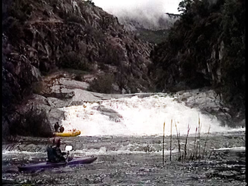
Once on the water, you get a few eddies and a very short ways to warm up before the creek drops down several long steep rapids. Watch for logs! You can scout or portage, but it is very awkward because of thick vegetation.
The initial rapids end at a pool above a 25' (approximately) waterfall. It may be runnable and it does drop into a short pool.
Immediately below is a steep sliding cascade with a congested exit. I portage on the right, then cross the small pool to the left and finish climbing down on the left side. The portage is much easier on the right except that it is very difficult to relaunch into the river on that side. Check it out and decide for yourself.
After the portage, one immediately enters a
...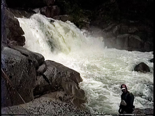
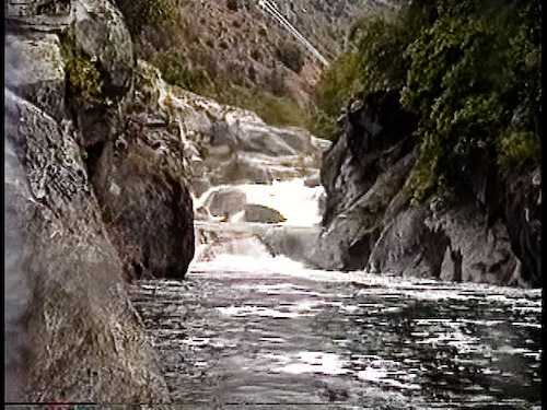
There is nearly continuous class 5 whitewater from the put in to here. Fortunately there is a pretty good pool at the top of this falls. Granite slabs on river right allow an easy take out and portage around the falls. Many modern boaters might run the falls these days, but check the pool and runnout.
This spectacular waterslide is at the end of a short narrow gorge. The slide has a short upper tier and a long lower tier with a very narrow pool in between. The total drop is 30 or 40 feet, I think. The slide is pretty clean, but I pitoned an obstruction on one run and bent the nose of my kayak.
Aug 24, 2011
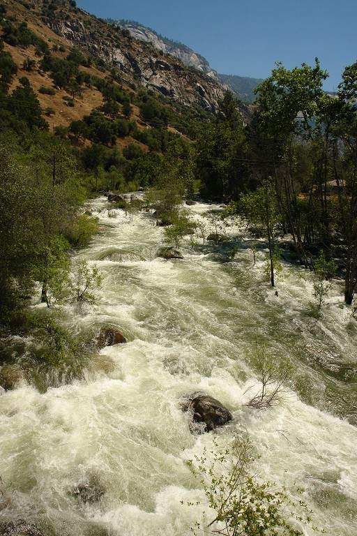
The Balch afterbay dam is releasing about 250 cfs into the river continuously because of some stuck valves. PG&E cannot repair the valves till October, so the flows will continue till then. 250 cfs is a low but okay flow for this section, I think. I walked along the road above and the parts that I could see looked boatable.
PG&E is also doing major road work several hundred yards from the dam. A big section of road slid out. There was no one working on the weekend so we were able to walk through the construction zone without any problems.
Getting down to the put in from the road looks as ugly as ever. Rapping off down a cliff would be the cleanest, but needs a long rope and anchors.
Feb 19, 2010
The poison oak that lines this section is not to be believed. Not mere vines or shrubs, these are absolute forests of poison oak, with trunks like trees.
Richard
Jun 8, 2006
Looking upstream from the bridge in Balch Camp, the NF looks full of trees. Fortunately this is the worst section of the run for trees. Tree hazards will change from year to year.
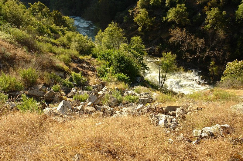
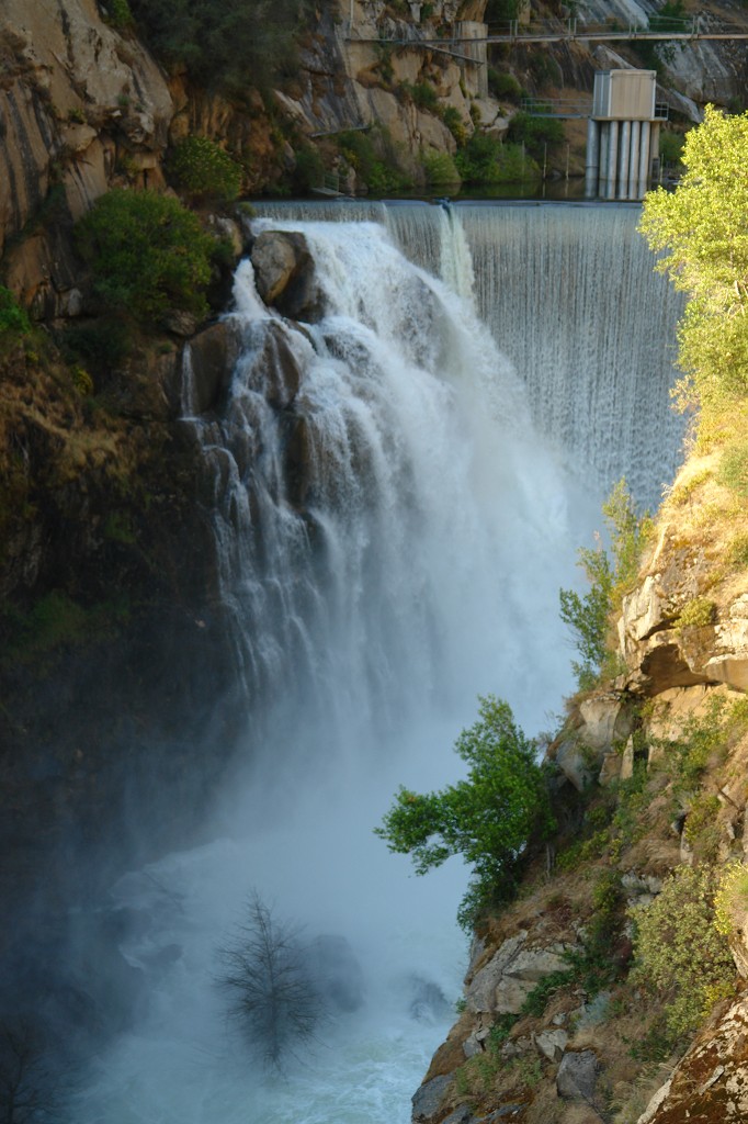
High flows spill over the Balch Afterbay dam into the NF Kings river. This is much too high to boat, but it sure makes a nice picture.
This gulley near the dam has been the standard put-in route. It is steeper than this picture makes it look. Kayakers can carry down it, but many will prefer to use ropes to lower their boats, especially in the last 30 feet to the river.