Brush Creek
Rincon Camp to Kern River
| Difficulty | IV(V) |
| Length | 1.4 mi |
| Avg Gradient | 360 fpm |
| Gauge | Sf Tule R Nr Cholollo Campground Nr Porterville Ca |
| Flow Rate as of 1 hour | 9 cfsbelow recommended |
| Reach Info Last Updated | February 13, 2019 |
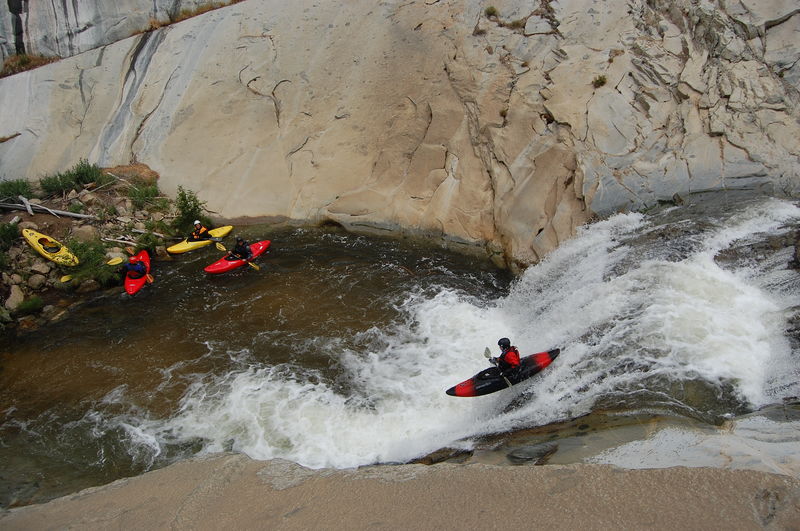
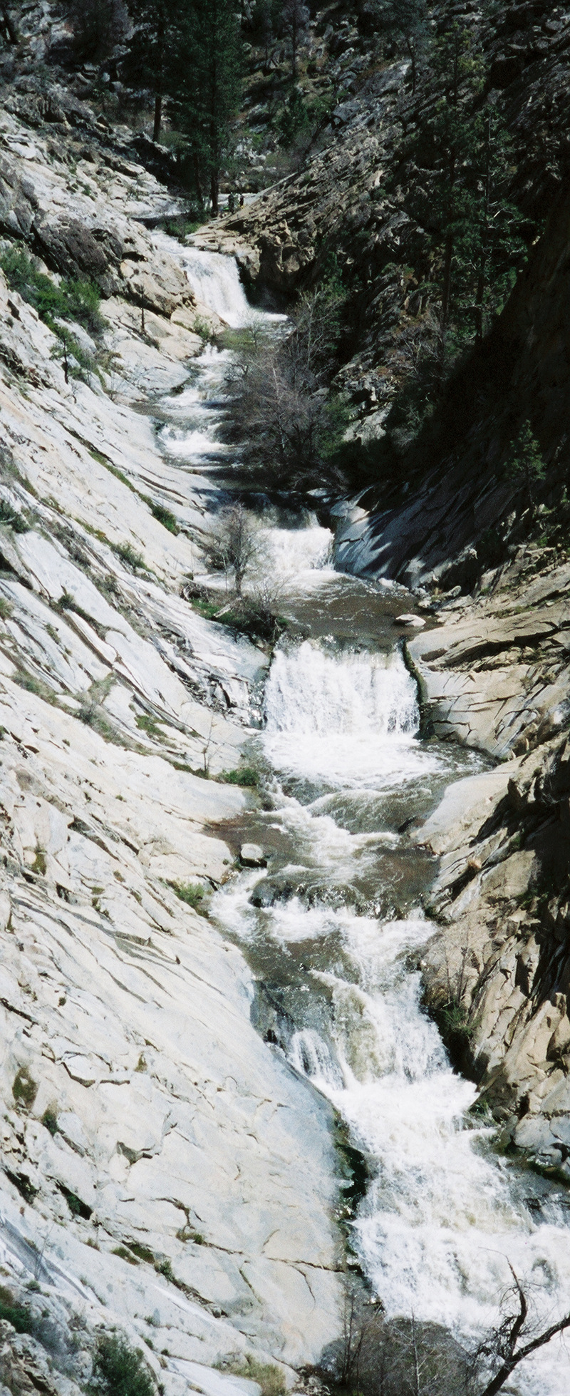
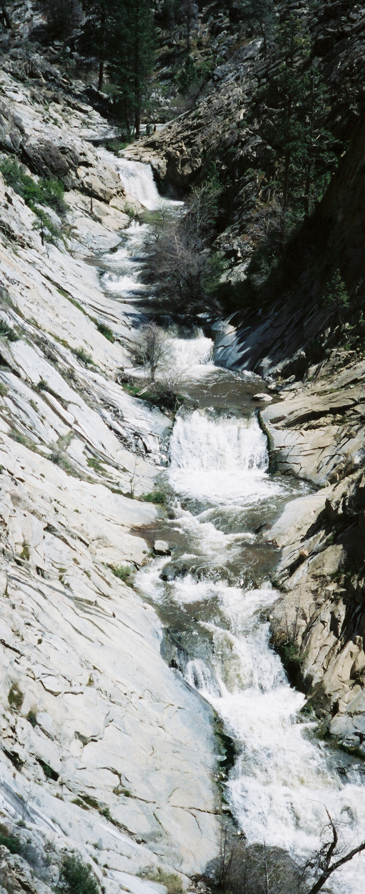
****Brush Creek provides easy access to super fun rapids, slides and waterfalls. Brush can be run down to very low flows and still be fun. Most years it will have low to moderate flows which allows a wide range of boaters to enjoy themselves. In some wet years when flows get high, the run is experts only. The boating season generally starts in late winter, then extends through spring and some years into early summer. Flows can also be good after winter rain storms.
There has been a Brush Creek Down River Race during the Kern River Festival for a number of years. This is always an excellent opportunity to view and participate in trash talking and carnage as well as displays of boating skill. .
Getting There: Brush Creek enters Kern River about 19 miles north of Kernville. It is only about 1/2 mile downstream of the Johnsondale Bridge. It is about 70 miles and a 1.5 hour drive from Bakersfield. From the north it is probably quickest to exit highway 99 at Earlimart to travel through Ducor, California Hot Springs and Johnsondale to reach the Kern River. Because of the windy roads it will take nearly 2 hours from Earlimart. You can also take highway 99 to Delano, then take highway 155 through Glenville, Wofford Heights, and Kernville, but this is considered the slowest route into the Kern Valley.
Take out: There is a big parking lot at the confluence of Brush Creek with the Kern River. It is easiest to take out just after the bridge.
Put in: From the take out, go north on the main road a very short distance then turn right up Sherman Pass road. Drive about a mile and a half, to a large area designated as a helicopter landing pad. There is a plenty of parking off to the sides. Hike upstream along a dirt road till you see a heavily used trail leading down to the creek. The walk is about 1/4 - 1/2 mile to the creek (careful in the winter, there are some ste
...Jul 9, 2010
Check out this rockin' 9-year-old girl running.
http://jacksonkayak.com/blog/2010/05/05/sage-donnelly-9yrs-old-takes-on-cas-brush-creek-video/
She's got some sweet moves. I'm totally jealous. And I'm almost 5 times her age! LOL
May 24, 2008
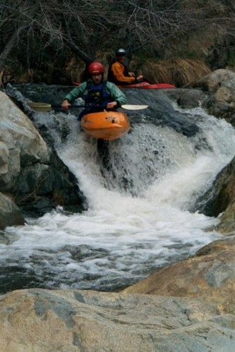
Heath daring the Chiropractor's revenge
Magda getting her boof on.
Mar 27, 2008
On Monday March 24 the flow was just below 1 on the guage.
On Wednesday March 26 the flow was just over 1.
Note: The pools below the bigger drops on Brush creek have silted in over the last week or so. It is less than 4ft deep in the landing zone of the big drop. The pool below the biggest sequence (that you can see from the road) is also silted. A bunch of folks were hitting hard this weekend.
Also...always be careful of down trees. We ran it twice yesterday and on the second run there were two new trees across the river. This was in the span of an hour or two. It was a breezy day but not crazy windy or anything. Anyhow...something to keep in mind.
Apr 20, 2001
Check out many more of Scott's excellent photos here.
Check out many more of Scott's excellent photos here.
Check out many more of Scott's excellent photos here.
Thanks to Scott Ostrem for posting this photo and for securing permission to use it. Check out many more of Scott's excellent photos here.
Check out many more of Scott's excellent photos here.