Klamath
12. Coon Creek to Green Riffle

| Difficulty | II |
| Length | 20 mi |
| Avg Gradient | n/a |
| Gauge | Klamath R Nr Seiad Valley Ca |
| Flow Rate as of 55 minutes | 1090 cfsrunnable |
| Reach Info Last Updated | July 26, 2025 |
Restoring the Klamath River: A Historic River Reborn The Klamath River now flows freely for the first time in more than a century. The removal of the four lower Klamath dams—J.C. Boyle, Copco 1, Copco 2, and Iron Gate—marks the most ambitious river restoration effort in U.S. history. For [...]Read More
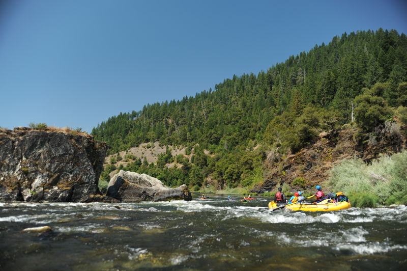
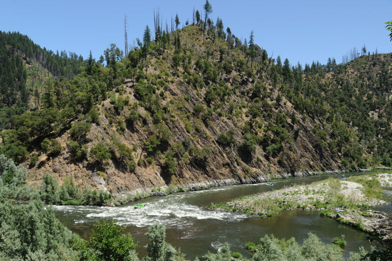
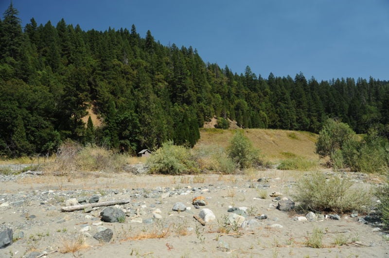
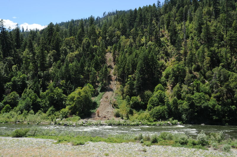
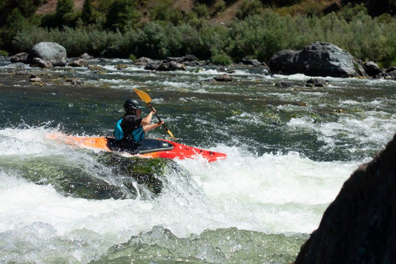
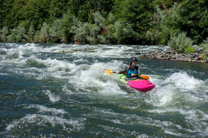
The put-in access for this section is at Coon Creek although this segment can be run as part of a longer trip beginning at an access point farther upstream or a shorter trip beginning downstream (both are common). Multiple access points along the way allow for either day trips or an overnight excursion. All of the rapids are class II-II+ with a couple that have some larger waves and faster currents to make it exciting for beginner and intermediate boaters. Long pools follow every rapid.
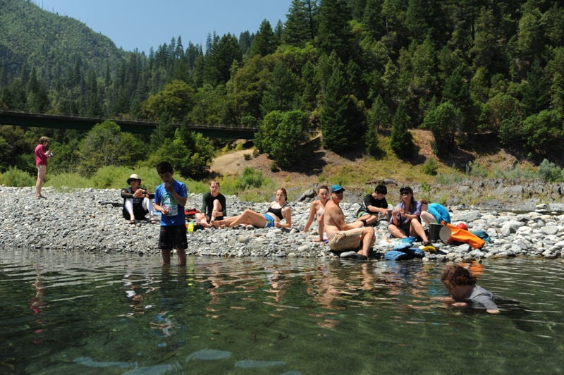
This reach is popular with local boaters, summer camps, and a few commercial outfitters. Even so, it is not uncommon to have the river entirely to yourself even in the summer.
A few parcels of private land are along this stretch but river use tends to be light, the river is largely shielded from the road, and paddlers often experience excellent wildlife viewing.
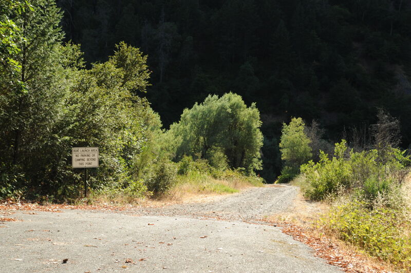
Most boaters take out at either Persido Bar or Stuarts Bar. But be sure not to miss the last take-out at Green Riffle access and to check the Klamath National Forest website for summertime ceremonial closures at this access.
Logistics
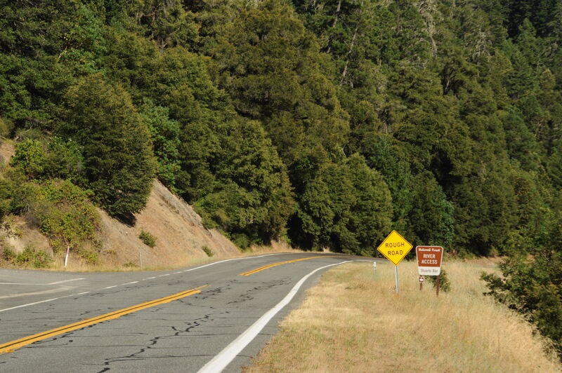
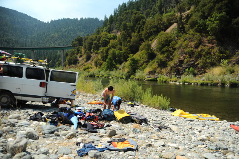
Coon Creek: This access is at Highway 96 mile 23.8 and is a standard put-in for an overnight trip on this section. Parking for Coon Creek River Access is along the highway. A paved access road provides access to the water's edge but no room for turn around or parking. The Forest Service provides a portable toilet here in summer months.
Dillon Creek: This access is at Highway 96 mile 16.0. Parking for day use is along the highway. Access to the confluence of Dillon Creek with the Klamath River, and a prime swimming hole in late summer, is by hiking down an undeveloped trail along Dillon Creek. A campground is available across the highway from the river.
Persido Bar: This access is at Highway 96 mile 13. This site is a high-use, popular take-out for river floaters and i
...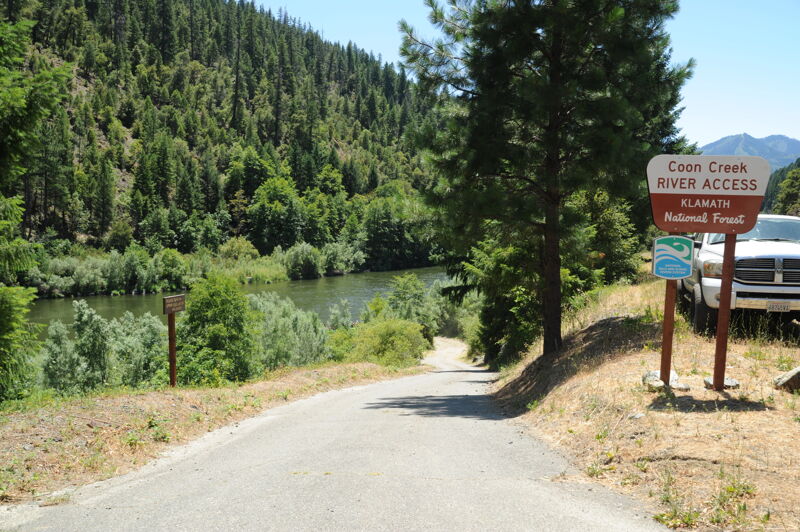
This access is at Highway 96 mile 23.8 and is a standard put-in for an overnight trip on this section. Parking for Coon Creek River Access is along the highway. A paved access road provides access to the water's edge but there is no room for turn around or parking. The Forest Service provides a portable toilet here in summer months. More information at https://www.fs.usda.gov/r05/klamath/recreation/coon-creek-river-access.
Fun rapid formed by the outwash from Dillon Creek that extends into the Klamath River channel. The rapid is along the river left side of the channel and straightforward. Eddy out on the bottom on river right to cross the gravel bar to enjoy the swimming hole on Dillon Creek.
There is walk-in access from Highway 96 to the river here but this is not a common access point for boaters. It's not too hard to walk kayaks or smaller inflatables to and from the river but this location is not suited as a river access for rafts and large boats.
This access is at Highway 96 mile 13.4 and is signed. This site Forest Service-managed site is a high-use area, popular take-out for river floaters, and it is also frequently used as a put-in for the run down to Stuarts Bar. A graded gravel road to the large cobble bar and road across the gravel bar to the water's edge provides convenient access and ample parking. There is a concrete vault toilet a short disatnce from the river along the access road. More information at https://www.fs.usda.gov/r05/klamath/recreation/persido-bar-river-access.
Persido Rapid is immediately below the Persido Bar river access. Go right of the small island above the rapid to gain access to the main channel though the drop.
Named for a rock that formerly resembled a frog but that has since broken apart. Nevertheless, the name persists and there are some unique rocks at the top and bottom of this rapid. Paddle to the left near the bottom to avoid shallow rocks on the outside of the left-hand bend in the river channel.
Many boaters find the long wave train at Ti Bar to be a highlight of this section of river.
This access and camping area is at Highway 96 mile 12.1. The Forest Service-managed site provides a restroom, ample parking, and a shaded dispersed camping area. This river bar was the former site of an airstrip. There is a public phone nearby on the opposite side of Highway 96 about 1/4 mile in the upriver direction. More information at https://www.fs.usda.gov/r05/klamath/recreation/ti-bar-river-access.
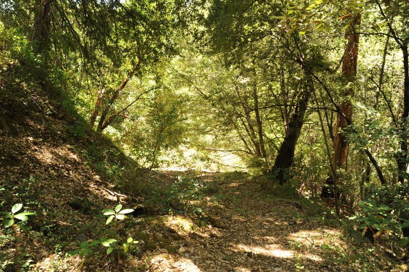
This hike-in access is at Highway 96 mile 11.3. Parking for this access is along the highway and limited. A 1/4 mile steep hiking trail accesses the river. More information at https://www.fs.usda.gov/r05/klamath/recreation/rock-creek-river-access.
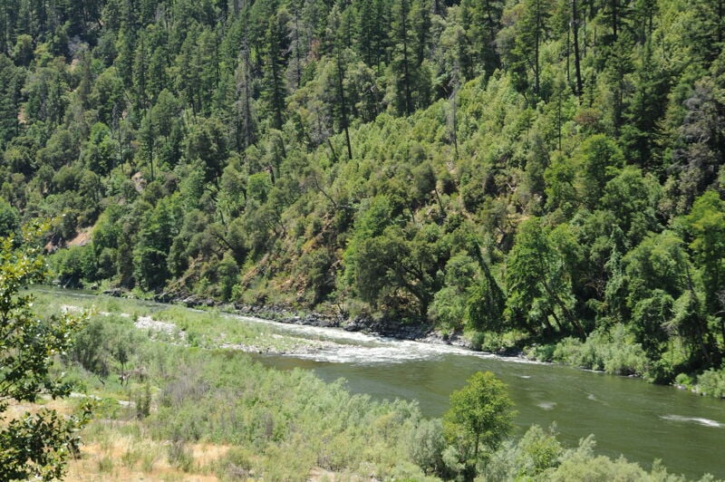
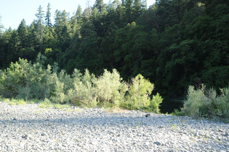
Rock Creek flows out of the Siskiyou Wilderness Area and enters the Klamath on river right here. The multilevel beach formed with perfect skipping stones is a popular lunch stop and overnight camp. Highway 96 is away from the river here and the setting is superb.
The water of Rock Creek is cool, clear, and clean. As refreshing as it is, please avoid the area around the creek mouth from June through September as salmon and other fish use this area to survive the warm waters of the Klamath River. Distrubing the fish forces them to swim into the Klamath where the water is sometimes lethally warm. The good news is that there are amazing swimming holes up the creek a short distance.
Not far below Rock Creek, the river flows straight ahead into a large rock wall. Aim left to avoid a collision.
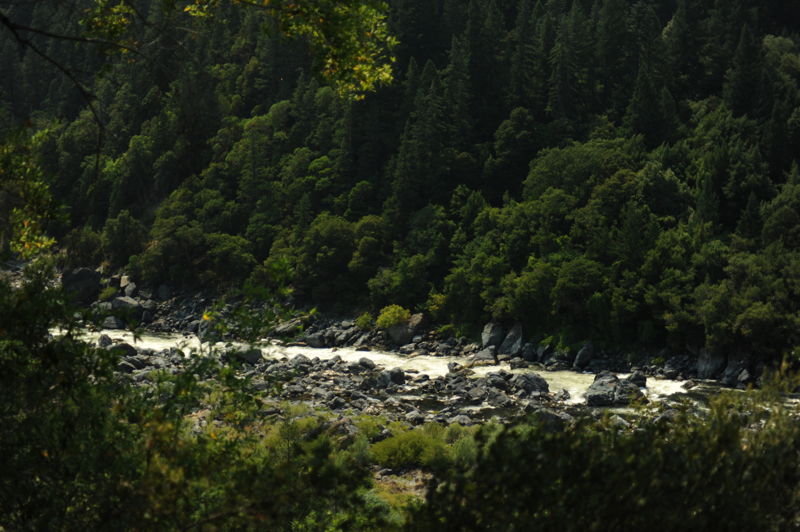
After a very long, flat pool, the river drops again where a large cobble bar on river right constricts the channel. The lead-in to the rapid is a straight shot down the center of a wave train with long sightlines. The crux of this long rapid is avoiding the Kissing Rock at the bottom of the wave train. This is done by aiming to the left of the rock but not so far left that you then run into a smaller rock: go between the two rocks. Another long pool follows before the next rapid at Sandy Bar.
This rapid changes frequently; this describes its form as of July 2022.
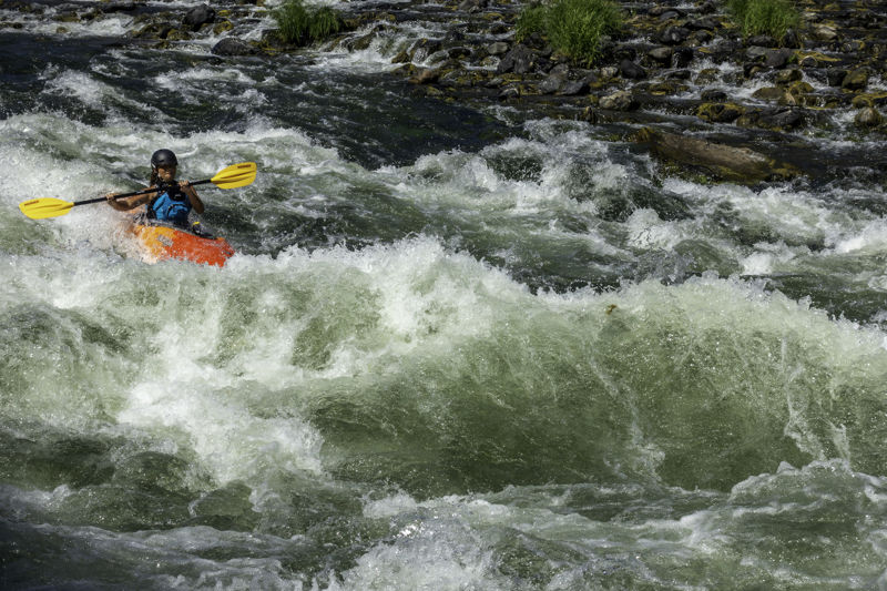
This is a steep, somewhat long rapid that consists of a slow, shallow entry on the river right that then steepens and picks up speed as it forms a set of large offset waves in its lower half. Sandy Bar (river left) is known as sánnipa to the Karuk people.
This access is at Highway 96 mile 4.9 and is a standard take-out for this section. The sign along Highway 96 is faded but the dirt that goes to the river is on the east side of Highway 96 on the downstream of the R. Lyle Davis bridge (very shortly after the bridge on the left if you are driving downriver). Take this dirt road then be sure to bear left onto the steeper road that drops to river level immediately upstream of the brisge. The road is steep with a sharp switchback that could be an issue for longer vehicles and trailers. This Forest Service-managed access has a large gravel bar with ample staging area for loading up after a trip. More information at https://www.fs.usda.gov/r05/klamath/recreation/stuarts-bar-river-access.
The Green Riffle River Access is on river left a short distance downstream from the R. Lyle Davis bridge located at Highway 96 mile 4.6. A half-mile gravel road descends to a large gravel bar at river level. The road starts in good condition but becomes steeper and more rutted toward the bottom. Confident drivers in passenger vehicles can generally make it. Boats can be carried a short distance to the river’s edge. This is the last road accessible take-out before Ishi Pishi Falls, which is off-limits to all boating activity and visitation out of respect for tribal considerations. Boaters wishing to continue downstream must take out here and vehicle shuttle to the Ishi Pishi Bridge river access downriver of the falls in Somes Bar (on Ishi Pishi Road). More information at https://www.fs.usda.gov/r05/klamath/recreation/green-riffle-river-accessmandatory-take-out.
Please check for tribal ceremonial closures of the Ishi Pishi Bridge river access and the downstream Ike's Run in July and August of each year. These are usually (although not always) posted on the Klamath National Forest website at https://www.fs.usda.gov/r05/klamath/alerts.
This access is located at Highway 96 mile 3.5. A roadside pullout leads to a trail descending to the river on river right. It is used by shore-based anglers but is not a practical site for boat access although it is referenced in some older guidebooks. This is a Forest Service-managed site.
Ishi Pishi Falls is a sacred area to the Karuk Tribe, and it is absolutely off-limits to boating and even visitation by non-tribal members. Please respect this and do not paddle, portage, or visit the falls. The falls can be viewed from a distance from a small pullout on Highway 96 that is approximately 300 feet in the upriver direction from the Salmon River Outpost; this is the only place to see the falls. Located at Klamath River mile 66.7.
Jul 20, 2022
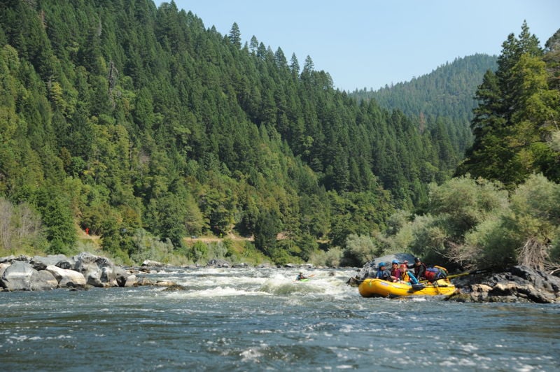
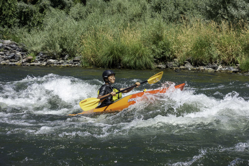
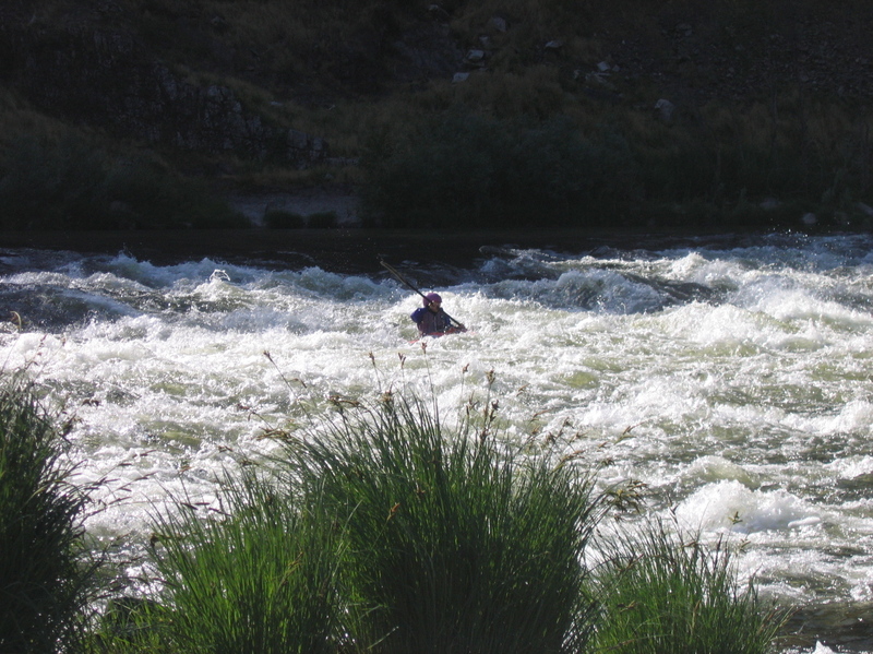
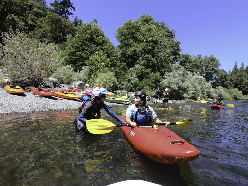
Maqlaqs Paddle and Ríos to Rivers put on the first Paddle Tribal Waters program on the Klamath river in July 2022. The program is teaching Indigenous youth from the region to paddle with the goal of setting them up to be the first to kayak the soon to be undammed Klamath River. Native American tribes have led the long effort to get these four dams removed to help restore the river and its salmon runs which are central to the health, well-being, and cultural identity of the tribes in the Klamath watershed. The 12 students have tribal affiliations with the Hoopa Valley Tribe, Yurok, Quartz Valley Indian Reservation, Klamath, Modoc, Confederated Warm Springs, Navajo, and Hopi.
I joined the crew for a day on the river from Persido Bar to Sandy Bar. It was the student's second week of kayaking and their stoke was high. They had clean lines and a ton of fun while continuing to build their skills.
The program also focuses on river stewardship and advocacy, something that is already part of the lives of many of the the students. It was inspiring to hear of their connections and relationship to the Klamath River and the other rivers in their tribal territories. This is truly the next generation of river stewards!