Klamath
13. Dolans Bar to Weitchpec
| Difficulty | II |
| Length | 18 mi |
| Avg Gradient | n/a |
| Gauge | Klamath R a Orleans |
| Flow Rate as of 1 hour | 1010 cfsrunnable |
| Reach Info Last Updated | July 25, 2025 |
Restoring the Klamath River: A Historic River Reborn The Klamath River now flows freely for the first time in more than a century. The removal of the four lower Klamath dams—J.C. Boyle, Copco 1, Copco 2, and Iron Gate—marks the most ambitious river restoration effort in U.S. history. For [...]Read More
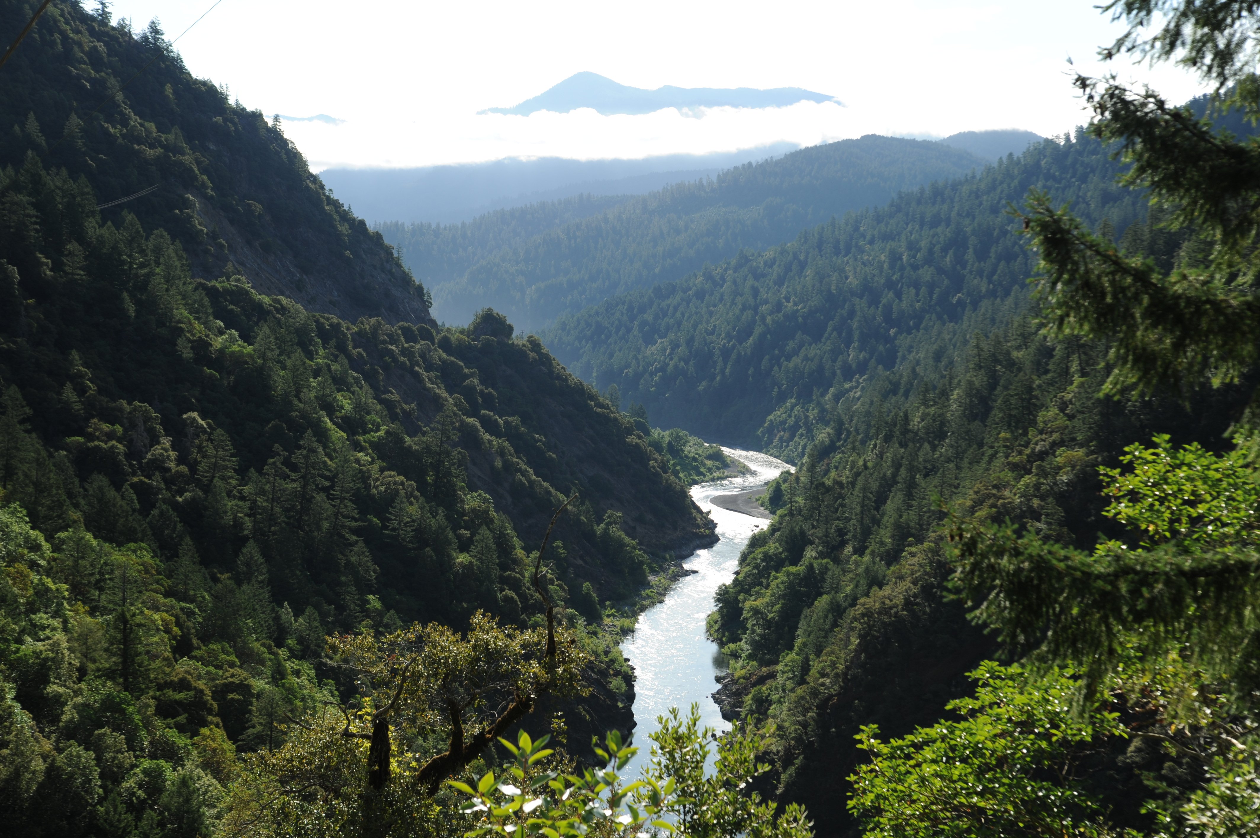
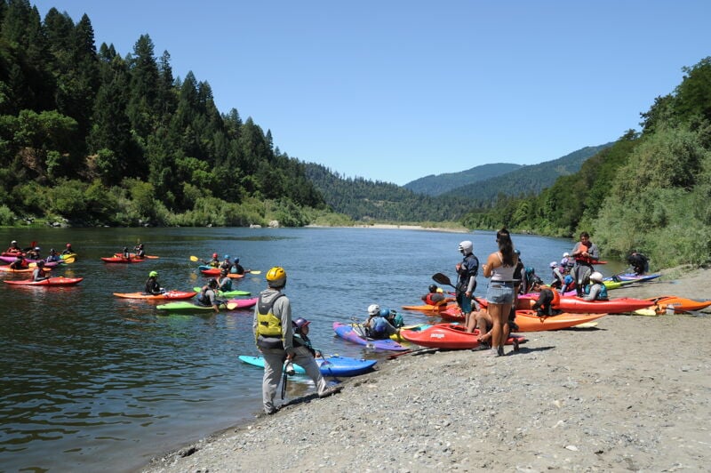
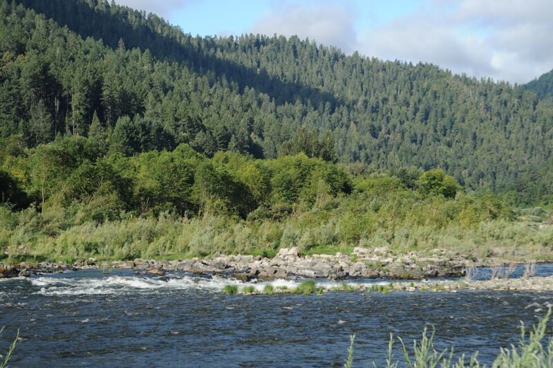
This rarely boated section of the Klamath offers a big scenery and forgiving whitewater suitable for boaters with solid moving-water skills. The entire stretch is rich with cultural and ecological significance, flowing from the ancestral lands of the Karuk Tribe and into those of the Yurok Tribe.
From the put-in at Dolans Bar, the river flows approximately 1.5 miles through flatwater with two small riffles to the town of Orleans (Karuk: Panámnik), most of which is situated on river right downstream of the picturesque suspension bridge of Highway 96, the Bigfoot Scenic Highway. Orleans is the first of two settlements on this stretch and has a clinic, elementary school, small grocery store, gas station, post office, watershed council, and Forest Service station. There's an unsigned river access point on river right directly across Highway 96 from the Orleans Ranger Station, adjacent to the upriver side of gas station. The river here is slow and wide with a few named riffles: Rifle Range, Rock, Camp Creek, and Hillman riffles.
On the downriver end of Orleans just above the confluence with Camp Creek on river right, the river passes by T'ishánnik, one of three locations where the annual Karuk World Renewal Ceremony or Pikyávish, has been celebrated since time immemorial. It is also the site of frequent cultural burns, so don't be surprised to see this in practice. Please enjoy the view of T'ishánnik as you float by, but do not exit the river here.
Not far below is Ullathorne (Karuk: Tûuyvuk) and its signed river access on river right. Below here, the river moves slightly away from the lightly traveled Highway 96, leaving the river corridor feeling quiet and remote.
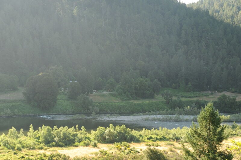
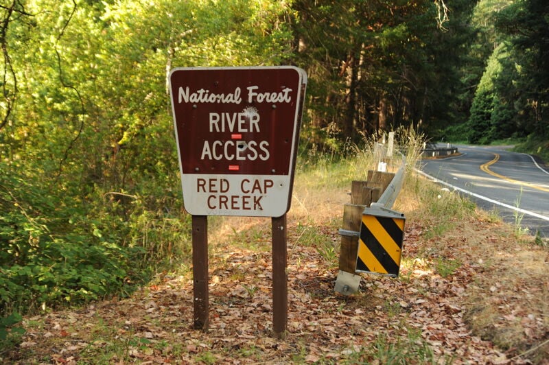
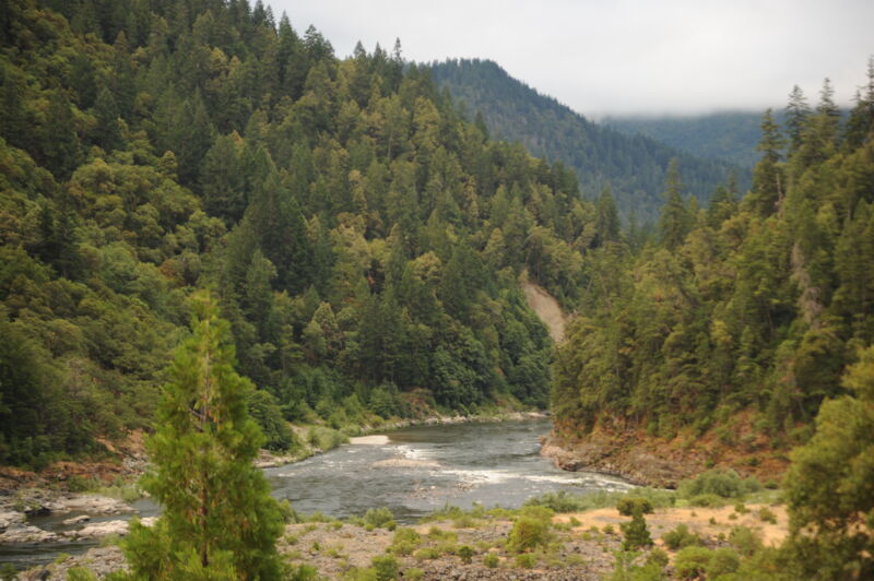
The river meanders past gravel bars with a few splashy rapids before entering a narrow, forested canyon near Red Cap Creek—a location once studied as a potential dam site. Sarvorum Mountain towers 1,000 feet above the river as Red Cap Creek joins from the left.
Rapids on this
...
This access is located at Highway 96 mile 39.9 about a mile upriver from the town of Orleans. There is a sign marking the graded gravel road that goes from the highway to the river bar. The river bar is very large and the best area for accessing the river is the far upriver end of the bar approximately half a mile from the highway. Beware of deep sand and loose cobbles if you attempt to drive close to the water's edge. There is a dispersed camp site on the far downriver end of the bar with a toilet. Break-ins are a problem here: be sure to not store valuables in your vehicle and lock it up.
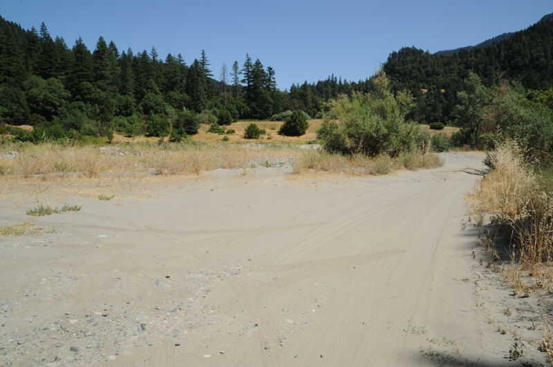
This access is located at Highway 96 mile 38.4 on the downstream river right side of the bridge in Orleans. A dirt road, which can be a little tricky to spot but is on the upstream side of the gas station, begins as hard-packed gravel and transitions to sand as it descends to a spacious river bar suitable for staging. There are no amenities at the site itself, but services are available nearby in Orleans, including a grocery store.
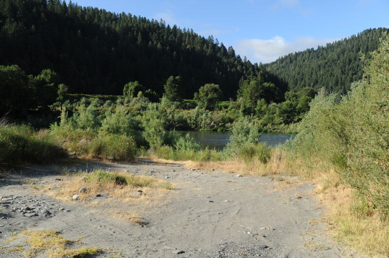
This access is located at Highway 96 mile 36.3. A paved road descends and then transitions to gravel and sand as it approaches a bench just above the river. A narrow gap through vegetation leads to a limited staging area with a short carry to the water. A secondary access a short distance downstream on the same bench offers slightly more space near shoreline and is located just above a notable rapid. There are no amenities at this Forest Service-managed site.
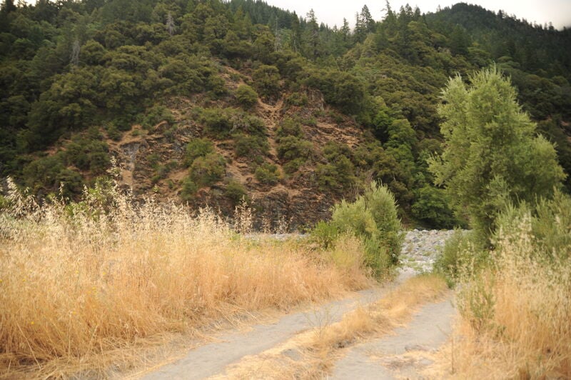
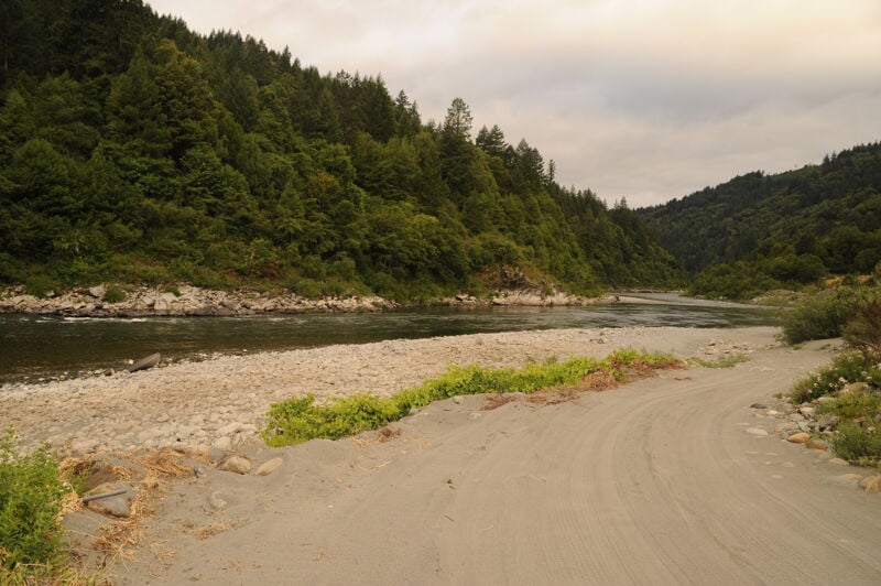
Straightforward river along the river bar below Ullathorne River Access.
A bigger rapid than many on this run at the downstream end of the river bar at Ullathorne.
This access is located at Highway 96 mile 32.4. A roadside pullout leads to a long trail descending to the river. Due to the trail length, it is generally not used as a boating access. There are no amenities at this Forest Service-managed site.
This short rapid is formed at the top end of Big Bar, where the river briefly turns directly away from the road. A bedrock outcrop on the right narrows the channel. There's a fun surf wave here at a wide range of flows, limited somewhat by a lack of eddy access as flows increase. The wave is easily visible from the road.
This access is located at Highway 96 mile 30.3. A short 0.1-mile road leads out to a gravel bar with good river access and space for staging. There are no amenities at this Forest Service-managed site, and overnight camping is prohibited.
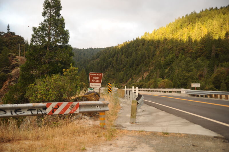
This access is located at Highway 96 mile 28.9. A roadside pullout at the upstream side of the bridge over Bluff Creek leads to a trail down to the river. There are no amenities, and this Forest Service-managed site is not typically used by boaters due to the long steep carry to river level.
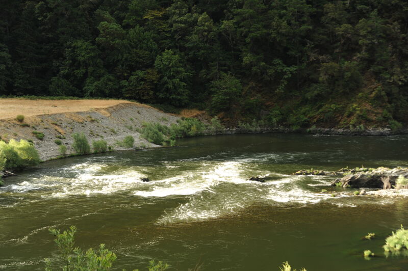
A rapid just downstream of the confluence of Bluff Creek that can change from the outwash coming down Bluff Creek.
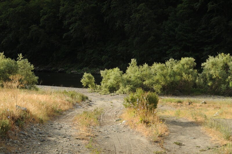
This access is located at Highway 96 mile 28.3. A 0.7-mile road descends from the highway to the river. The road is initially paved and then transitions to gravel. The final 100 yards cross a sandy stretch requiring a high-clearance vehicle. There are a few developed campsites with picnic tables as well as areas for dispersed camping at this Forest Service-managed site. No permanent toilet is present, though a seasonal porta potty may be available. River access requires a short carry across the gravel bar.
Inquire locally at the Yurok Tribe Weitchpec Office on Highway 96 regarding permission to use this river access, which is on tribal land and accessed via a private road thorugh a residential area and old village site. This access is located on river right just downstream of the confluence with the Trinity River. At Highway 96 mile 23.1, on the river right side of the Klamath River bridge, turn onto the HIghway 169, then continue 0.1 mile before turning onto the private Weitchpec Village Road that descends 0.2 mile to a good gravel bar access site. The road surface transitions from gravel to sand, and 2WD is not recommended. Parking is available on the upper bench. The access itself is on river right downstream of the bridge.
Nov 12, 2025
Quick float from Big Bar to Aikens to do some camping and fishing.
Big Bar made a nice put-in. Takeout at Aikens was pretty rough for two people with a raft and gear, but if you have a true 4x4 vehicle you could probably back down pretty close to the eddy above the bar and land there. Nice thing is the access points are so close I just walked up Hwy 96 to get the car.
Water was big and pushy but not too technical at 3k CFS. The Bluff Creek rapid lives up to its II+ designation. Nice clean channel through the middle, but you wouldn't want to drift in sideways and unaware, and there was a decent sized hole on the right.
Jul 4, 2025
Scouting river access sites from Dolans Bar to Weitchpec on Day 22 and 23 of Paddle Tribal Waters Source to Sea Descent of the Klamath River.