Daugherty Run
Co. Rd 3-12 to Cheat River(Daugherty Creek)
| Difficulty | V |
| Length | 6.1 mi |
| Avg Gradient | 203 fpm |
| Gauge | Big Sandy Creek at Rockville, Wv |
| Flow Rate as of 1 hour | 4.00 ftbelow recommended |
| Reach Info Last Updated | April 22, 2026 |
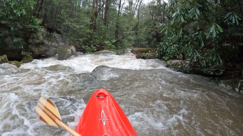
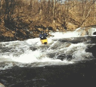
To try to describe this creek in detail would almost be an impossible task. But here is a brief outline just to let you know what you're getting yourself into. Daugherty is a steep low-volume creek run that flows down off the mountain and into the Cheat River just upstream of the Power Plant in Albright, WV. It’s a busy little puppy with an average gradient of 203 feet per mile! The rapids are back to back and range from steep and technical to wide-open slides. Some of the slides go on for 10 to 20 yards, sometimes leading one into another. Throw in a couple of nice 4- to 6-foot ledge drops into the mix and you got the nature of the “Dog”-erty! It reminds me of its nearby neighborFike Run – perhaps on Acid!
Gradient (in Feet), Mile by Mile: 130,250,260,250,230,200.
SHUTTLE DIRECTIONS:
To get to the Take-Out; turn off of RT. 26 in Albright,WV and onto CR7-12). It's just before or after (depending on the direction you're going) where RT. 26 crosses over the Cheat River. Continue on for about 2 miles (you will see the Albright Power Plant on your right) until you come to the first small bridge. This is the Take-Out. There is plenty of room to park on the river left side of the bridge. I suggest you change and load boats here before heading up to the Put-In. Parking at the Put-In is VERY limited.
To get to the Put-In; head back across the bridge and make your first right turn onto CR45-1. Follow this for approximately 4 to 5 miles, always bearing to your right. Then turn right onto CR3-12. According to the Topo map it should be your first right turn. (There is a old School House on the left corner.) This road is rough but passable, to a point, in a two-wheel-drive vehicle. About a mile down there is a clearing for a underground Pipeline that comes down off the hill on your left, goes across the road and cuts down to the creek on your right. This is where I
...To get to the Put-In; head back across the bridge and make your first right turn onto CR45-1. Follow this for approximately 4 to 5 miles, always bearing to your right. Then turn right onto CR3-12. According to the Topo map it should be your first right turn. (There is a old School House on the left corner.) This road is rough but passable, to a point, in a two-wheel-drive vehicle. About a mile down there is a clearing for a underground Pipeline that comes down off the hill on your left, goes across the road and cuts down to the creek on your right. This is where I put in. There are a few places to park at the clearing. Make sure NOT to block the road.
To get to the Take-Out; turn off of RT. 26 in Albright,WV and onto CR7-12). It's just before or after (depending on the direction you're going) where RT. 26 crosses over the Cheat River. Continue on for about 2 miles (you will see the Albright Power Plant on your right) until you come to the first small bridge. This is the Take-Out. There is plenty of room to park on the river left side of the bridge. I suggest you change and load boats here before heading up to the Put-In. Parking at the Put-In is VERY limited.
Mar 2, 2021
Here's a link to the new gauge on Muddy Creek:
https://www.wqdatalive.com/public/1128
Today Daug was 1' while the Muddy Creek gauge read 237cfs. Both Daug and Muddy are dropping.
Several days ago, people reported Daug was 2' while Muddy was reading about 225cfs—but everything was on the rise.
Safe to say, if you see 225cfs-250cfs on the Muddy gauge and it's going up, check Daug. If things are on the way down, probably look for 300-400cfs+ on Muddy for Daug to be running.
Mar 20, 2018
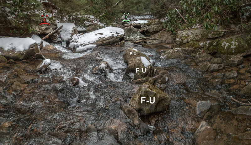
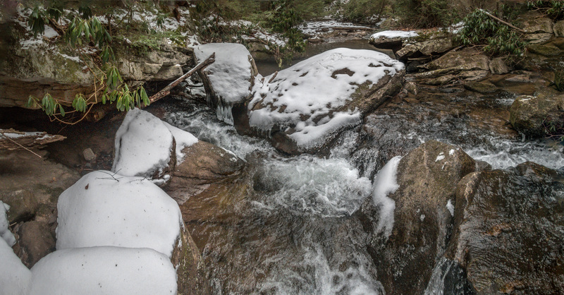
The approach to the Sieve Rapid (with 'F-U' rocks;-)
This rapid is about 100 yds downstream of the bridge (in the background) of this photo: https://www.americanwhitewater.org/content/Photo/detail/photoid/2551/size/big/
Dec 18, 2008
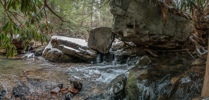
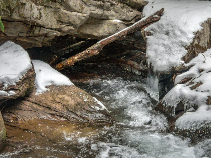
The seive in the seive drop after the wooden bridge is currently full of wood, some water still goes through it, so stay right. There are currently 2 bad logs on the run, if you see orange ribbon on the trees, get out and scout. The rest of the wood you can get by with some finesse. This creek is awesome! Goofy smiles abound;)