North Platte
3- Pathfinder Dam to Alcova Reservoir(Fremont Canyon)
| Difficulty | III-V+ |
| Length | 8.1 mi |
| Avg Gradient | n/a |
| Reach Info Last Updated | June 26, 2020 |
BuRec controlled flow
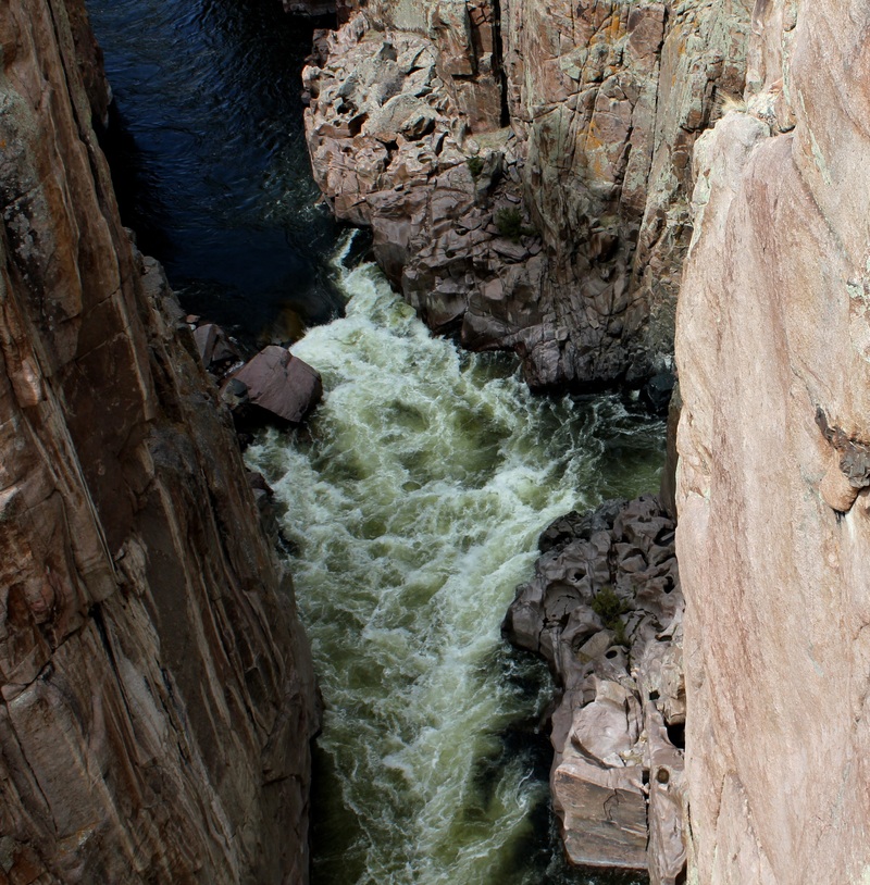
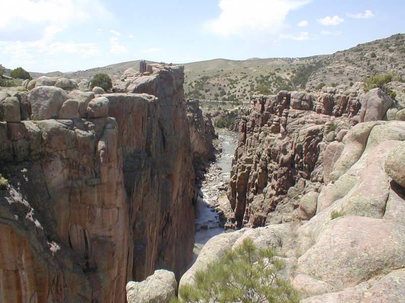
Fremont Canyon is the last great whitewater on the North Platte. The canyon itself is a massive cleft in the earth that resembles the Black Canyon of the Gunnison on a micro scale. Unfortunately for big water boaters the North Platte flows out of Pathfinder Dam as a poor shadow of the great river upstream. Most of the water is diverted downstream to a power plant. The Bureau of Reclamation releases a small continuous flow of water from the dam and occasionally releases more water at irregular intervals. The low flow from the dam is often enough to run the majority of the river.
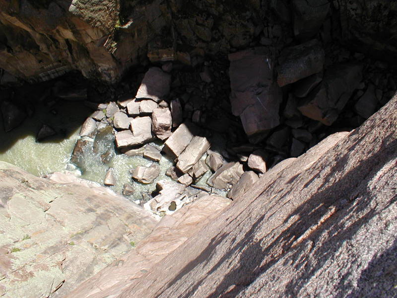
Don’t put in at Pathfinder Dam unless you want a couple of miles of flat water. The river has no real rapids until it enters the canyon downstream. The initial whitewater is fairly open. There are road access points if you decide that you are not up to the inescapable gorge downstream. After about a mile from the first rapids the river enters a slot canyon and the 500 foot slightly overhung canyon walls rise vertically from the river. This marks the start of the most spectacular scenery on the North Platte. Don’t forget where you are. At most flows the river will pool up slightly and you are about to encounter a rock sieve that probably needs to be portaged but might be boatable depending on water level. The incredible slot canyon continues but there is an emergency takeout downstream of the single span bridge downstream on the right. You can climb up a side canyon to the road. The deep canyon has several more drop pool rapids before the powerhouse and then the lake takeout or a carry out on river right.
According to some Bureau of Reclamation data this canyon has minimal boating flows all year. However the lake paddle at the end can freeze.
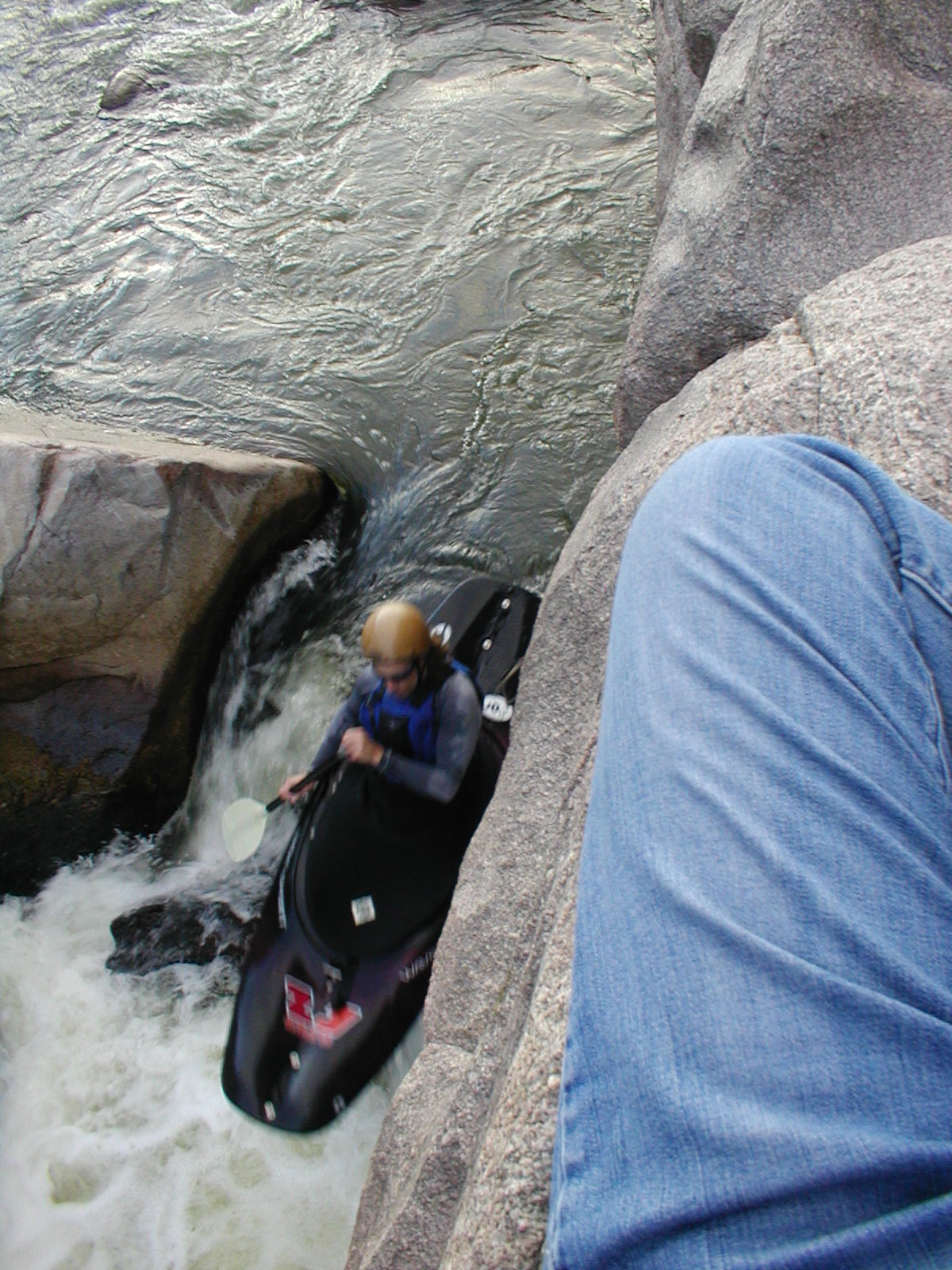
Boating Freemont Canyon is an interesting experience. The river tends to flow at 75 cfs, which is a minimum boatable flow almost every day of the year. The run itself is low and not very challenging at th
...Mar 31, 2020
Packrafted this on 3/29/2020 at 75 cfs, There are a couple of rapids to run early on, but then there are 4 or 5 sieve portages that get increasingly difficult. The last one is epicly difficult and very intimidating and puzzleing to look at, where you spend a quarter mile scrambling, wading, and boating across pools. This could change, but it was best to start this portage by descending the middle boulder jumble 'island' until it ends, ferry across a pool to the left wall, descend the portage no more than a hundred feet, then ferry to the right wall, and continue to portage to the lake. Once paddling on the lake, keep an eye out for a ravine within a mile on the left, which has a small flat camping spot, good for several tents and a camp fire. Keep your food secure from otter that live nearby.