Huron, E.Br.
rail grade off AAA Rd to Skanee Rd (6.2 miles)
| Difficulty | II-IV+ |
| Length | 5.5 mi |
| Avg Gradient | 71 fpm |
| Reach Info Last Updated | April 2, 2019 |
Put-in is reached (from L'Anse, MI) by heading out on Skanee Road, which becomes Erick Road just before Big Erics Bridge. Continuing 4.5 miles East-South-East of that bridge, Erick Road veers more Easterly and becomes Northwestern Road (eventually becoming Triple-A or AAA Road). It will likely be necessary to park on a stub at this bend and carry/drag South, then West down an abandoned railroad grade (a total of nearly a mile) to get to the river. (Note: Looking on aerial views you may see various logging roads which look like they might provide other access. While some of them may work for later spring or random summer rain events which may bring this to runnable conditions, they will not be passable with road vehicles in early or mid spring when most runs are done on this river.)
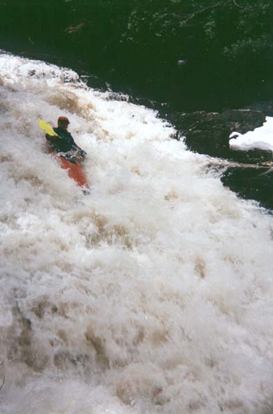
Two big drops (Big Falls and East Branch Falls) and a number of deceptively powerful smaller ones punctuate this scenic gem.

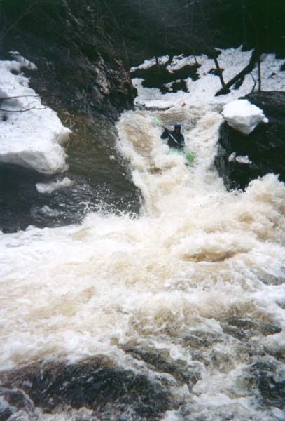
After nearly a mile of moving-water (with maybe a few minor riffles), after an East-South-East straightaway, the river takes a sharp left to head almost due North, and encounters the first good sequence of ledgey drop.
After a short spell of generally straight going, the river takes a sharp hook to the left, and encounters some increased gradient and a fine series of ledges and falls.
As a cluster of buildings come into view on river-left, a series of low ledge/wave/holes will be encountered.
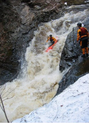
A very nice (and potentially sticky) sequence of ledges and holes leads to a steep sliding drop into a pool. Great photo-op! You may want to carry for a re-run!
(Interestingly, this falls is marked in a variety of locations, depending on which map AND which level of 'zoom' you happen to look at!)
Where the river takes a TIGHT hairpin to the left, be very cautious as you proceed and prepare to exit (river-left) to scout!
The river is squeezed and pours into a slot which diverts flow hard right, then to cascade across much more reasonable bedrock drops.
USGS lists a site below East Branch Falls showing drainage at that point as 26.4 square miles.
The river nears the road at this point. If parking can be found, one could cut off about a mile of flatwater down to Big Ericks Bridge.
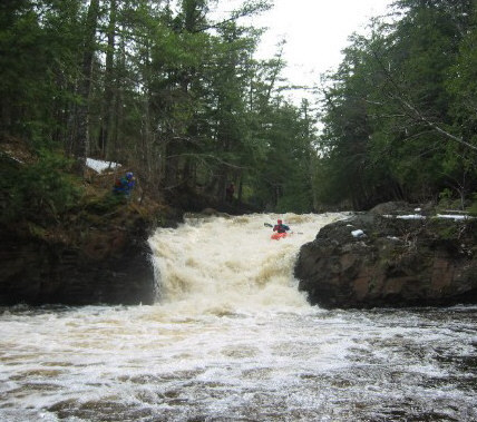
Immediately upstream of Erick Road Bridge lies the confluence of the East and West Branches of the Huron. Just beyond the bridge, the combined flow trips across a series of low ledges, Big Ericks Falls. A campground lies on river-left. Hoardes of fishermen tend to ply the pools between these ledges, often at same time and flows as boaters attempt to ply the rapids. If you happen to find fishermen relatively sparse, you may finish your run by working your way down this series before returning your boat to your vehicle. Downstream of the ledges you'll find an island, and some decent action contines, particularly to the right. However, things very quickly peter out. It is another 7 miles to the mouth of the river, and there are numerous areas of low-grade rapids, but nothing of any significance or merit.
Jan 1, 1900
Arguably the high point of a trip down the E.Br.Huron is a chance to run East Branch Falls.