Roaring Brook
Cold Brook Rd to Rt 17 in S Glastonbury
| Difficulty | III-IV |
| Length | 3.2 mi |
| Avg Gradient | n/a |
| Gauge | Salmon River Near East Hampton, Ct |
| Flow Rate as of 26 minutes | 20 cfsbelow recommended |
| Reach Info Last Updated | May 4, 2018 |
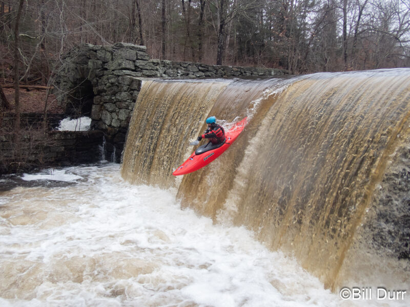
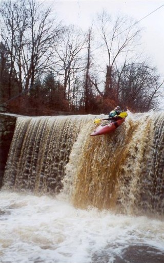
Description - Roaring Brook starts with a meandering class I stream until it arrives at a pond. At the end of the pond is a 13 foot high dam with a very runable section in the middle. Just upstream of the dam is a 2 inch dia. pipe sticking out of the water. By paddling close to the pipe you would be perfectly lined up for the drop. CAUTION: At the higher water levels there develops a very powerful hydraulic at the base of the dam. If you must run the dam at high water run it as far right as you possibly can.
From the 13 foot dam itÂs mostly class III until a second pond with a dam. The dam is only 9 feet high on the right and runable. The landing zone is full of rocks and debris so itÂs best to slowly drop over the edge while trying to pick your route.
The next bridge that you pass under has the hand painted gauge on the right wall. After this bridge it is recommended that you scout the next drop (Poolside) on river right. This is a fast slide that has a narrow start then fans out at the bottom. ItÂs often a crap shoot as to where you will end up at the bottom.
From Poolside to the takeout itÂs mostly class three with several class IV drops. In high water some of these drops get quite intense.
Directions - The takeout is at a parking lot on route 17 just south of the route 160 junction in South Glastonbury. To get to the put-in go north on route 17 and take a right at the light onto Hopewell Street. Angle right onto Cold Brook Rd and park at a dirt parking area just after the road crosses Roaring Brook. Do not take the sharp right onto Woodland Street. Roaring Brook passes under Woodland Street but the landowner here hates boaters and will call the police for parking there.
Many boaters will paddle the entire run first then put in at Poolside Slide for their second run. Poolside is located behind a public swimming pool off of Hopewell Street.
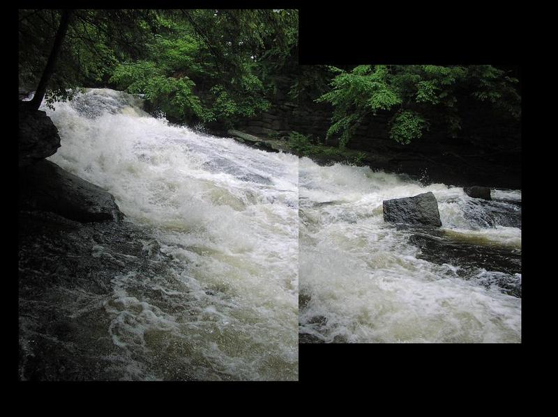
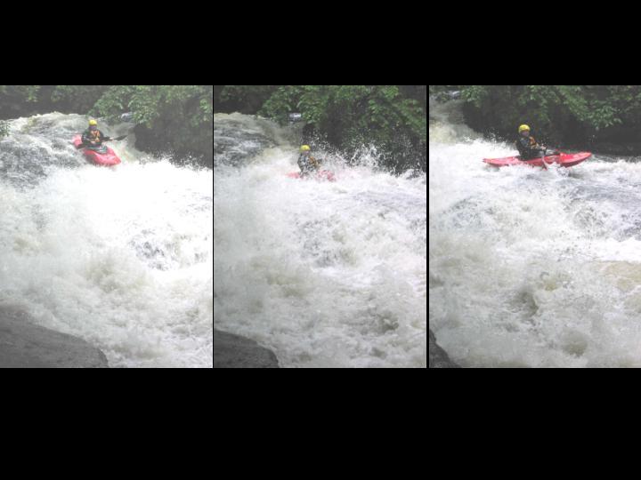
Poolside Slide is formed by a break in an old stone dam. If doing the whole run it will be after you pass under the bridge with the painted gauge on river right. Get out to scout on river right. There's a boulder that forms a good size eddy and you can see some of the remains of the dam below the eddy on the right.
The slide is run down the center, trying to not get thrown to either side. Line up the entrance using small curler coming off the right at the horizion line, you want to be just to the left of it with slight left angle. As you go down the slide, you want to keep to the center and aim torwards a boof flake. From the top of the flake to the landing is about 3ft and is over a sticky hole. Make sure to be pointed straight.
Stay away from the far right as it is badly undercut. Far left is very manky and composed of some of the rocks that made the dam, avoid as well.
One can also put in here to avoid the majority of the flatwater, but you miss out on the waterfall.
Apr 5, 2015
Ran it yesterday, pretty good flow but there were still a handful of strainers. A few downed logs had clearly been cut by paddlers, but overhanging branches and downed debris from the last wind storm still block parts of the brook. I would advise walking up the trail on river right a ways to scout.
May 20, 2006
Here is a correlation of Roaring Brook levels vs Salmon levels I plagiarised from Jim Michaud:
600 cfs = 1.0 ft. Bone Run
800 cfs = 1.5 ft.
1000 cfs = 2.0 ft. Good Level.
1500 cfs = 2.5 ft.
2300 cfs = 3.0 ft.
It's not always accurate, but it does give you an idea. I've run it as low as 1', but I wouldn't recommend anything below 1.5' (a good first timer level).
May 28, 2003
American Whitewater received a report on May 28, 2003 about a landowner on the Roaring Brook who owns a large portion of the land on river left. This landowner has alledgedly hired someone to patrol the streambanks with a sidearm, and has also posted signs reading 'trespassers will be shot'. American Whitewater is researching this report and will share more information as it becomes available. If you have any information to contribute to this report, please call our office at 866-BOAT-4-AW.
-Jason Robertson, Access Director