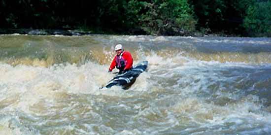
Big Indian Creek
Canter Rd. to County Road 743
| Difficulty | III-IV |
| Length | 6.9 mi |
| Avg Gradient | 35 fpm |
| Reach Info Last Updated | February 20, 2002 |
Gradient:
First mile below Canter Rd: 45 ft.
Next mile: 20 ft.
Next mile: 25 ft.
Next mile: 20 ft.
Next mile: 35 ft.
Next mile: 40 ft.
Next mile: 50 ft.
Last 0.8 mile to County Road 743: 40 ft.

This is an extremely small creek, making it tough to catch with boatable flows.
As calculated by USGS StreamStats 4.0 Beta software, drainages are as follows:
Location* River Mile *Drainage
Canter Road (put-in) 0.0 0.36 square mile
Mount Olive Point Isabelle Road 1.6 2.76 sq.mi.
Goodwin Schoolhouse Point Isabelle Road 3.54 8.48 sq.mi.
State Route 222 4.9 10.8 sq.mi.
State Route 743 (take-out) 7.0 17.7 sq.mi.
If there is not enough flow at the listed put-in, you may be able to put-in at someplace further down for a shorter but still worthwhile trip (if parking and access may be found at other road crossings).
No trip reports yet.