Canton Creek
Confluence with Pass Creek to Steamboat Creek
| Difficulty | III-IV(V) |
| Length | 10.5 mi |
| Avg Gradient | 93 fpm |
| Gauge | Steamboat Creek Near Glide, or |
| Flow Rate as of 1 hour | 42 cfsbelow recommended |
| Reach Info Last Updated | July 15, 2019 |
This is a good run when the Umpqua is too high. This is prime steelhead spawning ground, so stay off the bottom.
Description:
This run splits conveniently into three sections.
Lower Three
This section is enjoyable at a wide range of flows. From the take-out up, the bottom three miles to Scaredman Campground are visible from the road, you can easily scout on the way up. What you can't see won't hurt you. Make sure to boat conservatively if you are unsure about the current wood situation (though most of the run can be seen from the road). Most of the creek consists of boat scoutable class III-IV boulder gardens with the occational bedrock feature.
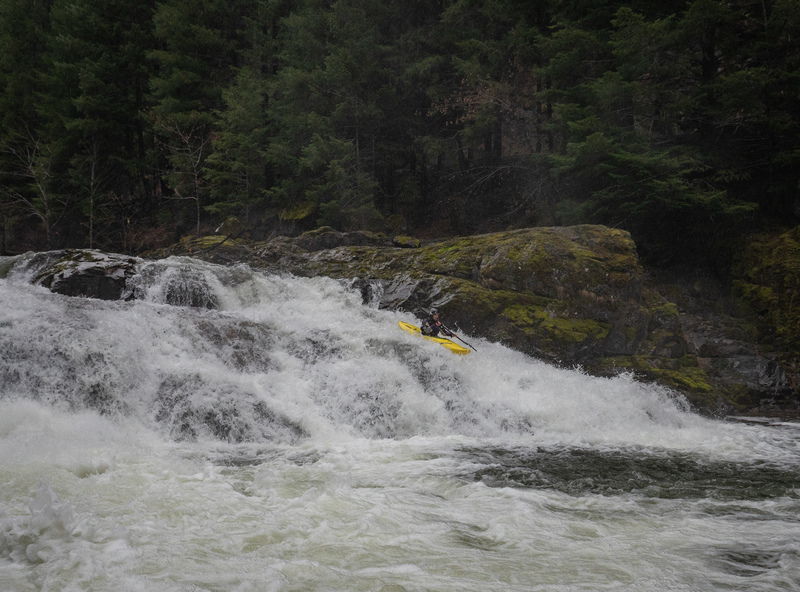
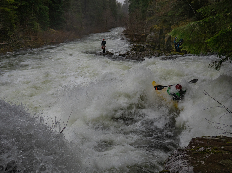
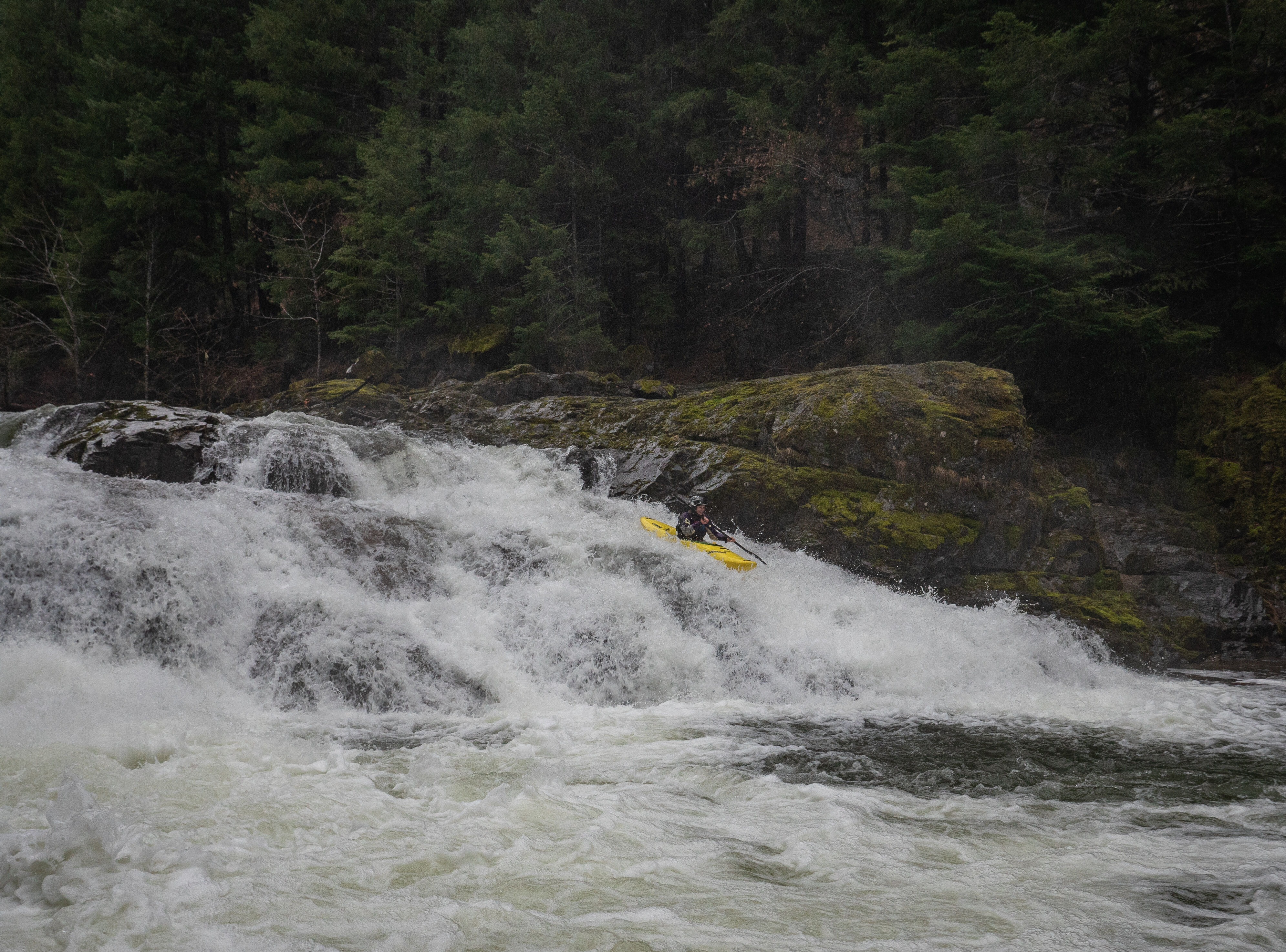
The exception to this rule exists just past the third bridge from the put-in, where a series of fun ledgey rapids lead to a large rapid that is often portaged. At medium to high flows the left side is class IV, the right side class V, and the middle a bit harder. At lower flows this rapid is often portaged. This drop and the ledges above can be easily scouted from the road, and by hiking down a short ways to river level. At higher flows, or with a tentative group, some may wish to get out at the bridge above the ledges to avoid the chance of running the large rapid by mistake.
Middle Three
The middle three miles are away from the road and are class III-IV. Tentative boaters should have a guide who has done it before. This section is busy, remote, scenic, and fun. Put in at the 'six mile bridge' or go upstream a half mile to a wide gravel 'no camping' area if you would like to run the last ledge drop on the Upper Three.
Upper Three
The upper three miles are class IV. There are two good ledge drops and a boulder gard
...Feb 5, 2017
On the Steamboat Creek@Glide gauge at a flow of around 2500 cfs, rising from 1200 to 3500 throughout the day a group paddled the large falls('P/U' noted in other trip reports) on the right side, and thought it was class V ish, with an alternative to run the far left side which felt more class III-IV-the middle of the drop looking heinous. There were no notable wood hazards from the six mile bridge down, and no portages. The creek could have handled more water, but would have still been fun with less-it felt like a medium flow I suppose.
-Priscilla 2/4/17
Jan 10, 2006
We did this run in Jan 2006 at flows of about 1100 cfs on the Steamboat gauge (~3' on the paddlers gauge at the confluence bridge at the take-out). This was near the lower end of the range but still a great level. This run provides 10 miles of wonderful class III/IV rapids and is a good introduction to creeking. Be cautious of the approach to the big falls (just below one of the bridges) as there is a moderately challenging drop that leads to the pool above the big falls.
Jan 1, 1900
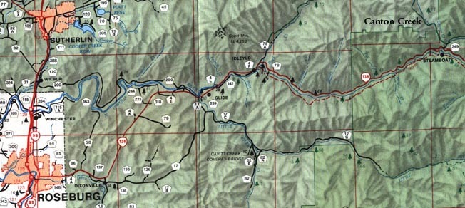
Take I5 to Roseburg exit 124 and follow the signs to state highway 138 east. Go east 39 miles to Steamboat Creek. Turn left and go up the creek one half mile. Cross the bridge, turn left and park. The take-out is at the Steamboat gauge on the upstream end of Canton Creek Campground.
The trail to the river starts just behind the empty vodka bottle in the distance.
View from six mile bridge.
Stay off the bottom. We could be next. Power to the fish.
At lower levels the picket fence funnels you into the 'surprise' which is backed by a guard rock. If you fall into the surprise you will be maytagged left and spit out boatless. Don't ask me how I know.
This was taken somewhere on the upper six. They all look the same.