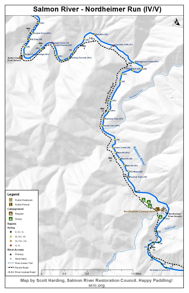
Salmon
Nordheimer to Butler Creek(Nordheimer Run)
| Difficulty | IV-V |
| Length | 6.6 mi |
| Avg Gradient | 31 fpm |
| Gauge | Salmon R a Somes Bar Ca |
| Flow Rate as of 44 minutes | 377 cfsbelow recommended |
| Reach Info Last Updated | March 11, 2026 |
River Description
See alert above about significant changes in 2025 to Freight Train Rapid on this run!
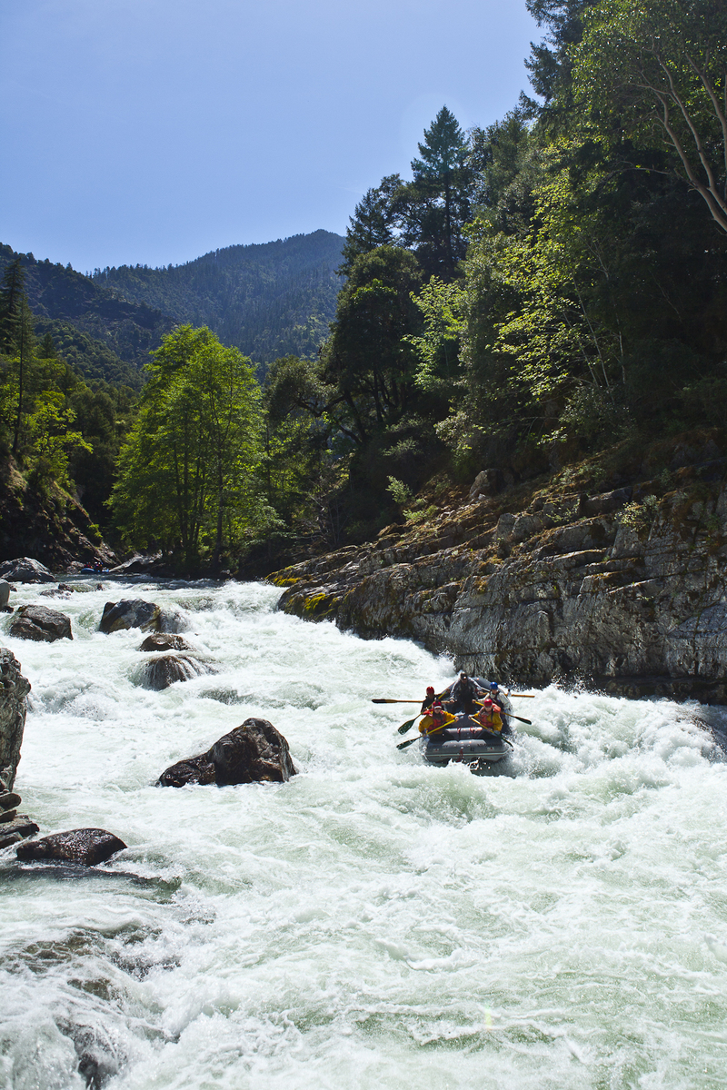
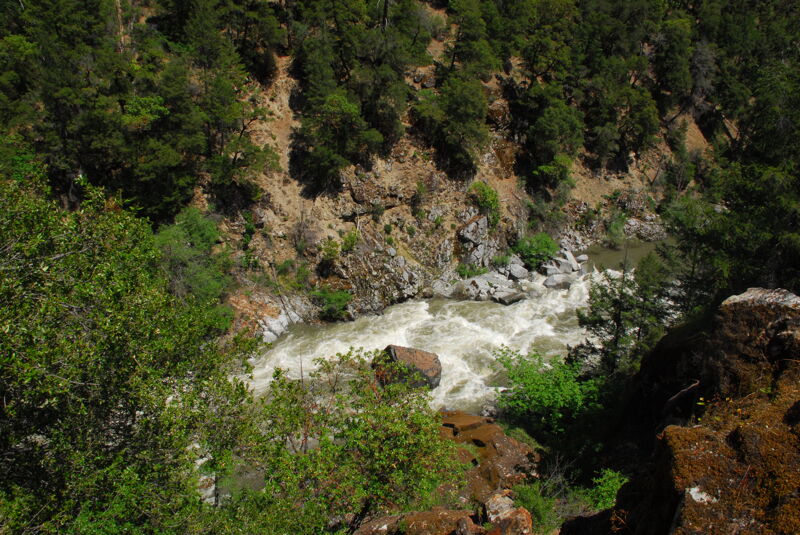
California's Salmon River (Karuk: Masúhsav) is renowned for its whitewater, and the Nordheimer Run is its most famous stretch. This gorgeous river flows through a remote but accessible area in the central Klamath Mountains and has nearly 100 miles of runnable whitewater in its watershed. There are no dams, diversion, agriculture, or industry here, making this one of California's least developed and wildest rivers.
The Nordheimer Run begins at Nordheimer Flat (Karuk: Itróovutihirak) and continues downriver for over six miles to the Butler Creek River Access. It is commonly linked with the Butler Run to make an epic 10-mile day trip containing some of the finest whitewater anywhere.
The largest rapid on the run, Freight Train, changed in late December 2024 and is now more congested and consequential than before: carefully scout from river level! Rafts may not have a clear line through the drop at low and medium flows, making it more difficult to link the Nordheimer Run into the Butler Run. More info is below.
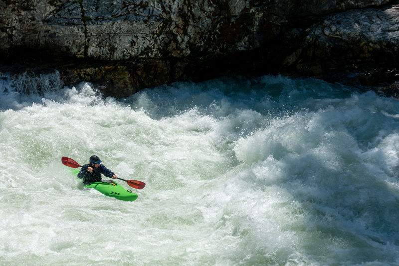
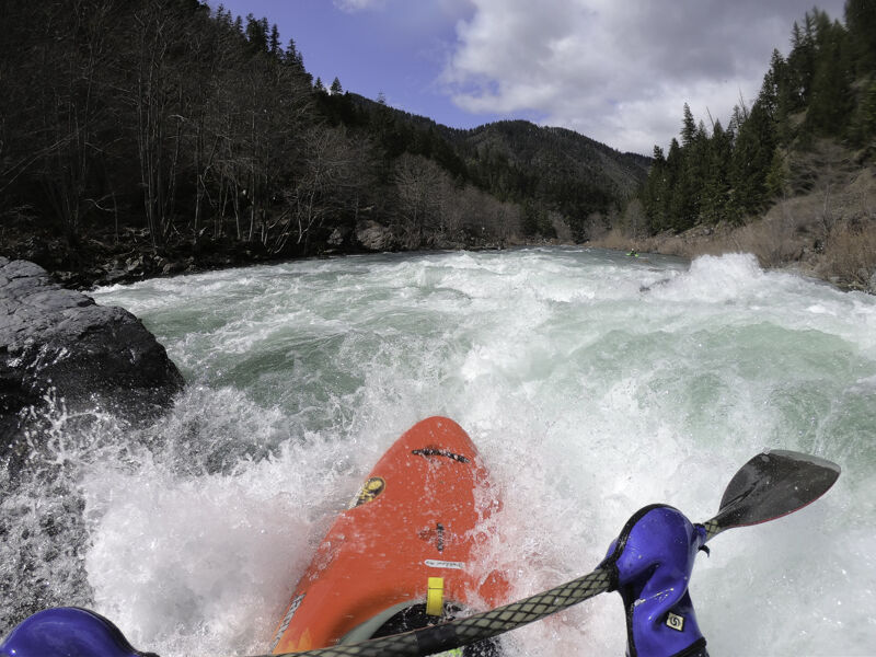
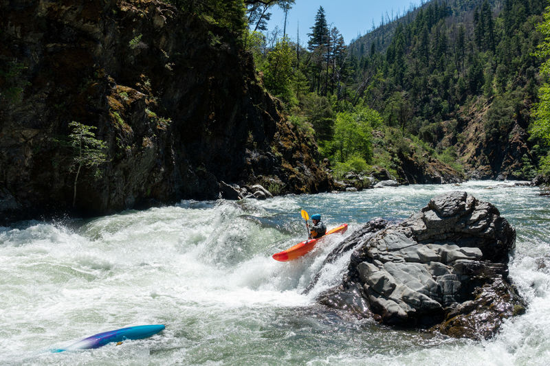
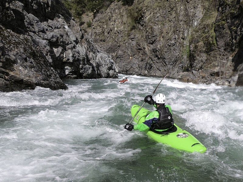
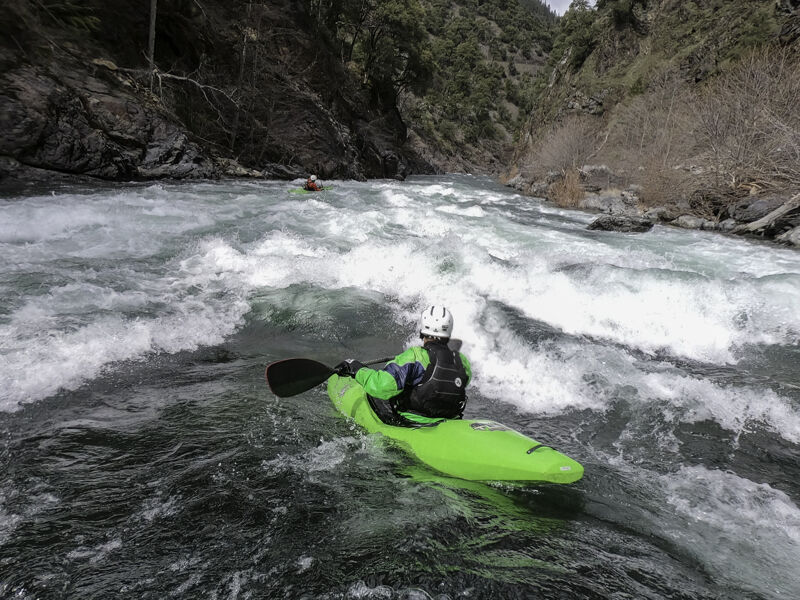
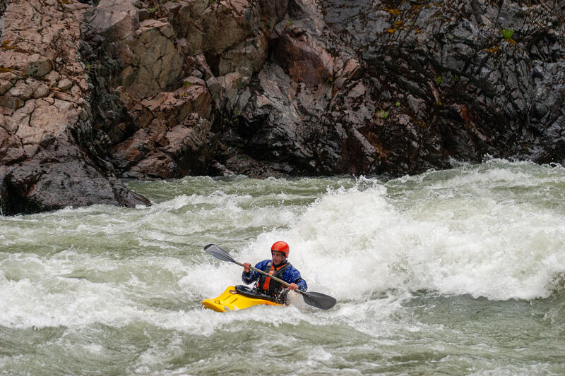
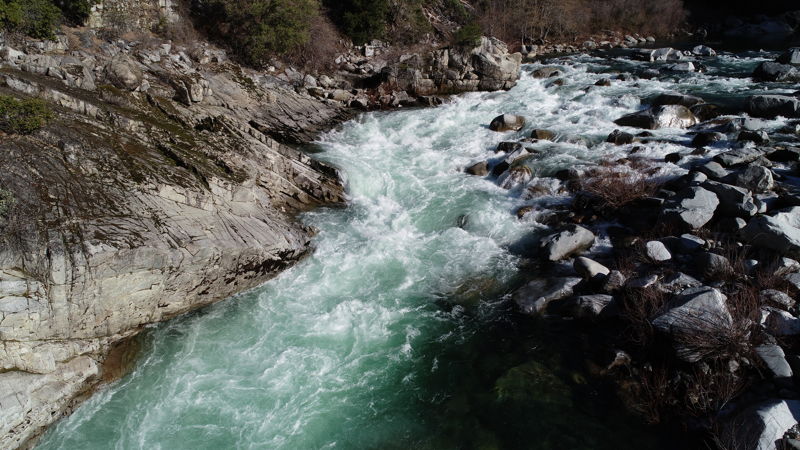
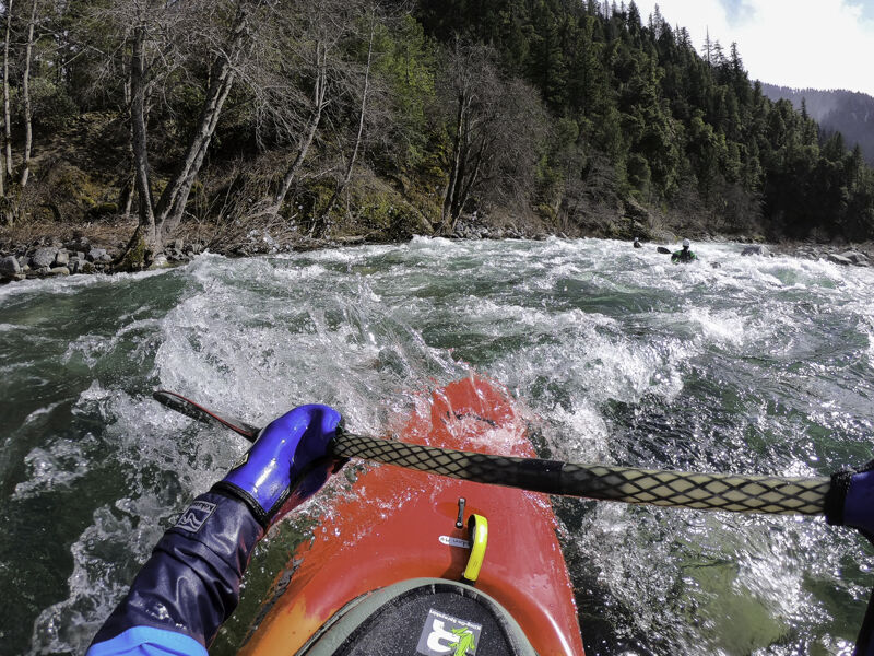
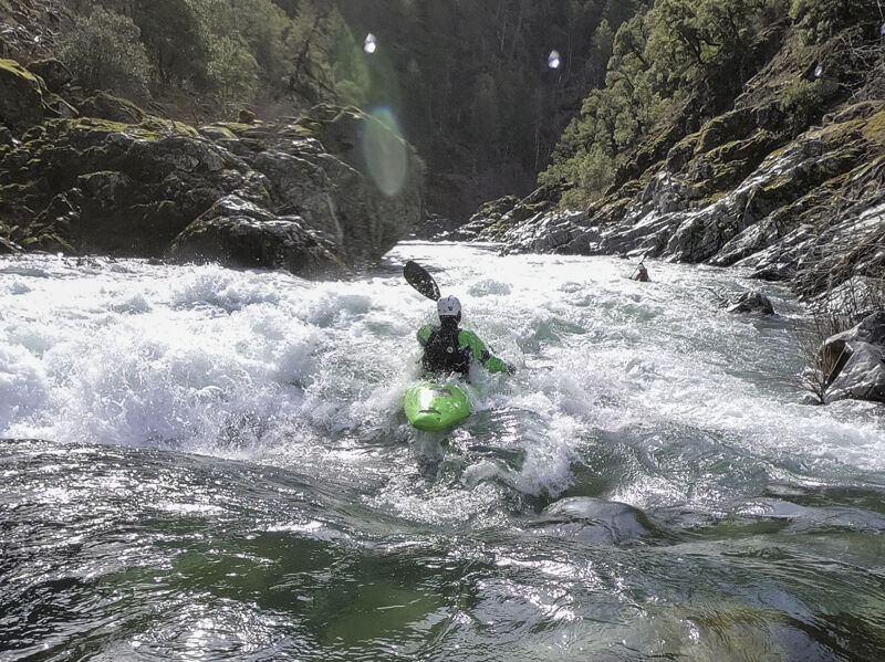
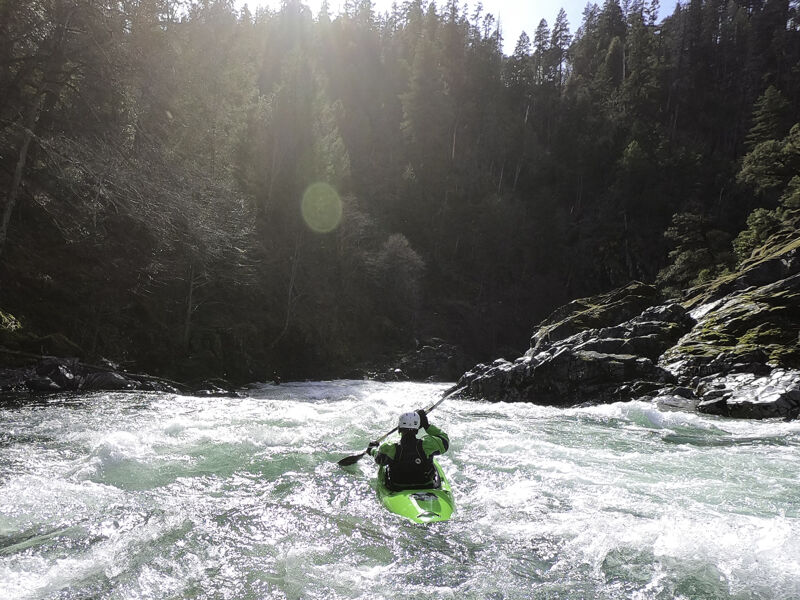
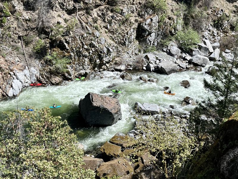
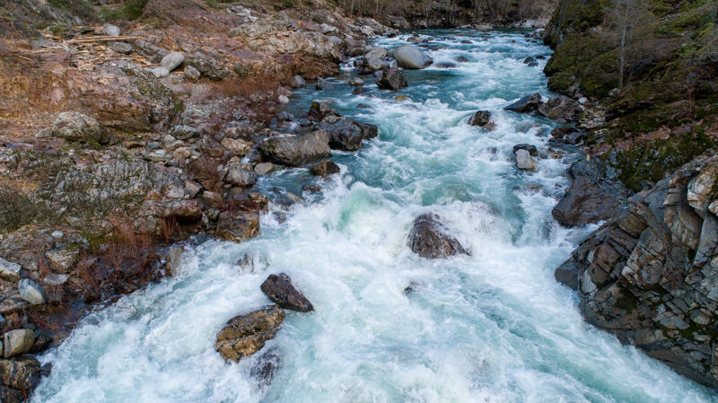
Nordheimer is a pool-drop run with plently of rapids but also some long pools. The rapids more than make up for the slow times in the pools and the run is infamous for its large, powerful rapids that include a number of Class IV drops and two Class V rapids. Rapids are formed both on bedrock and boulders. There's a little bit of granite in the river canyon on this run but most of the run is on classic Klamath Mountain metasedimentary rock, here the Eastern Hayfork unit of the Sawyers Bar terrane.
First Descent & the Era of Gonzo Rafting
Steve Sanders led a small group of kayakers on the first known descent of the Nordheimer and Butler runs on July 6, 1973, portaging six times. By the early 1980s, the river had gained a degree of popularity among boaters as word spread about its powerfu
River Features
Nordheimer River Access
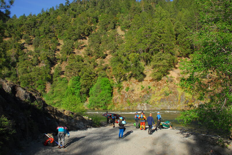
The Nordheimer River Access is behind the campground; just follow the road through the camping area and it continues down to a parking area near the river and the mouth of Nordheimer Creek. This road was repaired in summer 2024 and is currently in good condition.
The information board at the put-in is usually devoid of any information, and it is not regularly maintained by the US Forest Service. There is an excellent whitewater map of the entire watershed in the Nordheimer Campground next to its three information boards at the front of the campground and on the access road to the put-in.
Bloomer Falls
Bloomer Falls is the first drop below the Nordheimer put-in, and it's distinctly different from every other drop on the river. This is because the rapid was formed during the 1964 Christmas Flood when the Bloomer Landslide broke loose from the mountainside on river left and dammed the river here. The river, which was flowing over 100,000 cfs, backed up behind the landslide deposit for several hours, briefly forming Lake Nordheimer which flooded the flat where Nordheimer Campground is now located. When the landslide dam broke loose, the river carved a new canyon and formed Bloomer Falls. In the early 1980s, the California Department of Fish and Game blasted the falls more than once, reducing it from a more vertical falls to a large rapid full of sharp rock. It frequently changes form but retains a double-ledge character.
The rapid still changes very frequently and last did so in the winter of 2020/2021, becoming easier and less steep as the boulders emptied from the large pool above the rapid and were deposited in the pool below the rapid. Additional changes took place in December 2022.
No matter, Bloomer is still a significant drop at most flows and it's a bit of a roll of the dice as to how it goes each time. But, all in all, it isn't the fearsome rapid it once was. That said, its old-time rafter name of '50/50' still applies today.
Scout on the left. The drop can be portaged by kayaks and small inflatable craft, but it's not fun and requires carrying up, along, and back down into the microcanyon below the rapid. There is no reasonable way to portage a raft around the falls.
It's also possible for kayakers to put in just above the drop. Take the brushed in dirt road from Salmon River Road to a small parking area then walk on a rough trail to the pool by the falls to get in. This access is mostly used by local paddlers interested in getting straight into the whitewater without delay or warm-up.
Photo courtesy of All-Outdoors Whitewater Rafting
The Maze
The Maze is a long, multi-stage rapid that begins below Bloomer Falls and continues through the river reach that was scoured out in the epic 1964 flood when the Bloomer landslide dammed the river for several hours before breaking loose. Because of this recent origin of the rapid, The Maze section is different than all other rapids on the river except for Bloomer Falls, which was also transformed by the 1964 flood and landslide.
Lewis Creek Rapid

The river negotiates a slight right bend in its channel as Lewis Creek enters on the left.
Skips
Down the middle kind of rapid with a wave up top and breaking wave/hole at the bottom.
Boulder Gardens
A couple short rapids with smooth granite boulders and fun, squirty eddy lines.
Tercel Turn
Morehouse Creek enters on the right with a waterfall near the top of this rapid. Variously known as Tercel Turn, Oh What a Feeling!, Johnnys, or Morehouse, this rapid is run center or right of center at most flows. A stout hole lurks on the right toward the bottom and can eat kayaks or flip an unlucky raft. There's a good splat rock in the runout of the rapid too at flows below 3,000 cfs. A fairly short pool separates this from Airplane.
Airplane Turn
The river right channel is raftable at 2,000 +/- cfs. At higher flows the far river left channel opens up enough for a raft. Most kayakers choose the river left route at all flows, launching off a boof flake to clear the hole at the bottom.
Leaning Tree
Down the middle kind of rapid with a breaking wave/hole at center top.
Armadillo
Named for the large, smooth rock on river right that could be imagined to resemble the shape of an armadillo's back.
Chrysler
Straightforward with fun waves down the left.
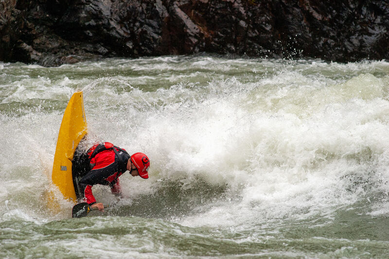
Tripp Point Wave
This fast, eddy-accessible play wave is in the lower set of waves at one of the run's in-between rapids. It comes in around 2,000 cfs and is accessible from both sides of the river at this level. At 4,500 cfs, it offers potential for aerial moves and fast cuts. It takes some effort, but it's possible to hike in to this wave from Tripp Point to make this a destination park-hike-and-play spot; this allows you to paddle a play boat at the wave without committing to a play boat for the full run. The hike back out is a chore. To do this, park in the pullout near mile-marker 10 on Salmon River Road and look for the trail just past its downriver end.
Portuguese Creek Rapid
The top part of this rapid can be run right (straight ahead) or left (more technical) of the rocks that split the flow. The flows merge back together for a fast chute at the bottom. Be sure to take in the scenic Portuguese Creek Falls on the right as you run the rapid.
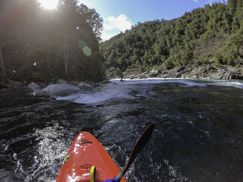
Cascade Falls
Cascade Falls (aka Steelhead Falls), is a long, steep rapid with a multitude of lines depending on flow.
Scout on the river left by getting out at the pool above the lead-in and taking the short, lightly used path downriver to the rock outcrop along the rapid (which can be slippery when wet and frosty in the winter). If you don't want to run it, the portage is on the far river right side and you'll still need to boat through the middle entry way to get there (a Class II move above a Class V drop)..
The classic line is down the left at the entry, through the ramp with a very slight right angle to punch breaking hole at the bottom, and then out to the center to finish the rapid. There's a fair potential to get typewritered left at the ramp hole, and this puts boats along the left wall, which can be tricky to escape from. If you don't manage to get away from the wall, stick to it all the way down and avoid the large hole (or large rock at lower flows) that lurks at the bottom left of this long line. This line is in at nearly all levels.
At medium-low to low-medium levels (1,500 - 3,500 cfs), various lines open up in the middle and middle right sides of the rapid. To get to these, you need to enter the lead-in near the center of the river and quickly move to the middle or right side where you can reset to choose your particular line. Beware that there are some sieves and undercuts in the bouldery middle line; these can be avoided, but be sure you know where you're going and don't beater here.
At higher flows (above 5,000 cfs) there is an obvious high boof in play. If there's enough water to paddle over the boof rock it's good, just make sure to launch from a spot without rocks below. If there's not enough water to go over the boof, there may be enough to run the upstream-angled slide line off the river left side of the boof rock to a 180º turn in the current below.
The farthest right narrow chute is usually run by rafts at medium to high flows. Rafts will need to ship oars to squeeze through. It works for kayaks and other craft too, but most will choose another route that is typically more fun and inviting.
There's a long pool below this rapid and before Achilles. There's also a river access point on the left near the bottom of this pool (Indian Bottom); the dirt road down to this spot is a rough and unmarked 4x4 road that connects to Salmon River Road near a little upstream of the 9-mile marker.
Achilles Heel
Achilles starts with technical entry through chunky granite boulders. There are lines on the right and the middle through the entry and they merge partway through the rapid. Here, with all the current back together, the river charges downstream and to the left. Water is pushed hard right toward the sloping, river right rock wall where a vertical drop is hidden on the outside corner. There's a pushy but non-retentive hole at the bottom right here, and it was once feared by all boaters. It's still enough to cause excitement, and most boaters angle left and paddle hard to avoid the hidden vertical drop along the wall and its hole. But others are now setting up to jump the hole on the right, which is harder to do than it appears: you really have to aim and charge hard for the right wall (but don't actually reach the wall or you're likely to land on a small rock shelf).
If needed, there is a rough dirt road that connects the river bar here to Salmon River Road on river left.
Achilles Heel is named for an incident involving kayaker Peter Sturges, the founder of Otter Bar Lodge Kayak School, in the early 1980s. Paddling a pointy-nosed Perception Mirage, Peter pitoned in the bouldery entrance to the rapid and his heel slid beneath the footbrace in the kayak, tearing his Achilles tendon. Ironically, Peter's paddling partner that day was Don Banducci, the owner of Yakima, which made the footbraces. The rapid had been known as Screaming Left Turn until this incident, but that name now seems to be forgotten. Commercial rafters sometimes call this Cataract Rapid, a name not used by other boaters.
Indian Bottom
The next rapid after Achilles, Indian Bottom starts wide and narrows up at the bottom.
Whirling Dervish
Whirling Dervish is a fun rapid in-between a couple of the larger rapids on the run. There's a series of three somewhat similar rapids in this zone and some debate over which one is named Whirling Dervish and questions over why the others go unnamed.
Grants Creek Rapid
Rapid just upstream of Grants Creek. Flows straight ahead then veers off river left bank at bottom.
Last Chance (aka Big Joe)
This rapid was previously more difficult, but the large hole at the bottom has moderated significantly and is usually no longer a significant issue for boaters.
Most boaters enter left of center, move left around two holes up top, then quickly move back center then right at the bottom. At medium to high flows it can be run straight down the right from top to bottom. No matter what, you don't want to be left at bottom because the river dumps toward a charismatic cabin-sized boulder that is a pin hazard.
Even though the giant hole at the bottom is now compartively tame, this rapid is still high consequence because it is so close to Freight Train. Swimmers and flipped boats can easily wash from Last Chance into Freight Train, especially at medium and high flows where there is little or no slack water between the two rapids.
Scout right from river level and/or scout from the road pullout above.
This rapid was featured prominently in the 1980s cult classic boating bloopers video, Slammin' Salmon.
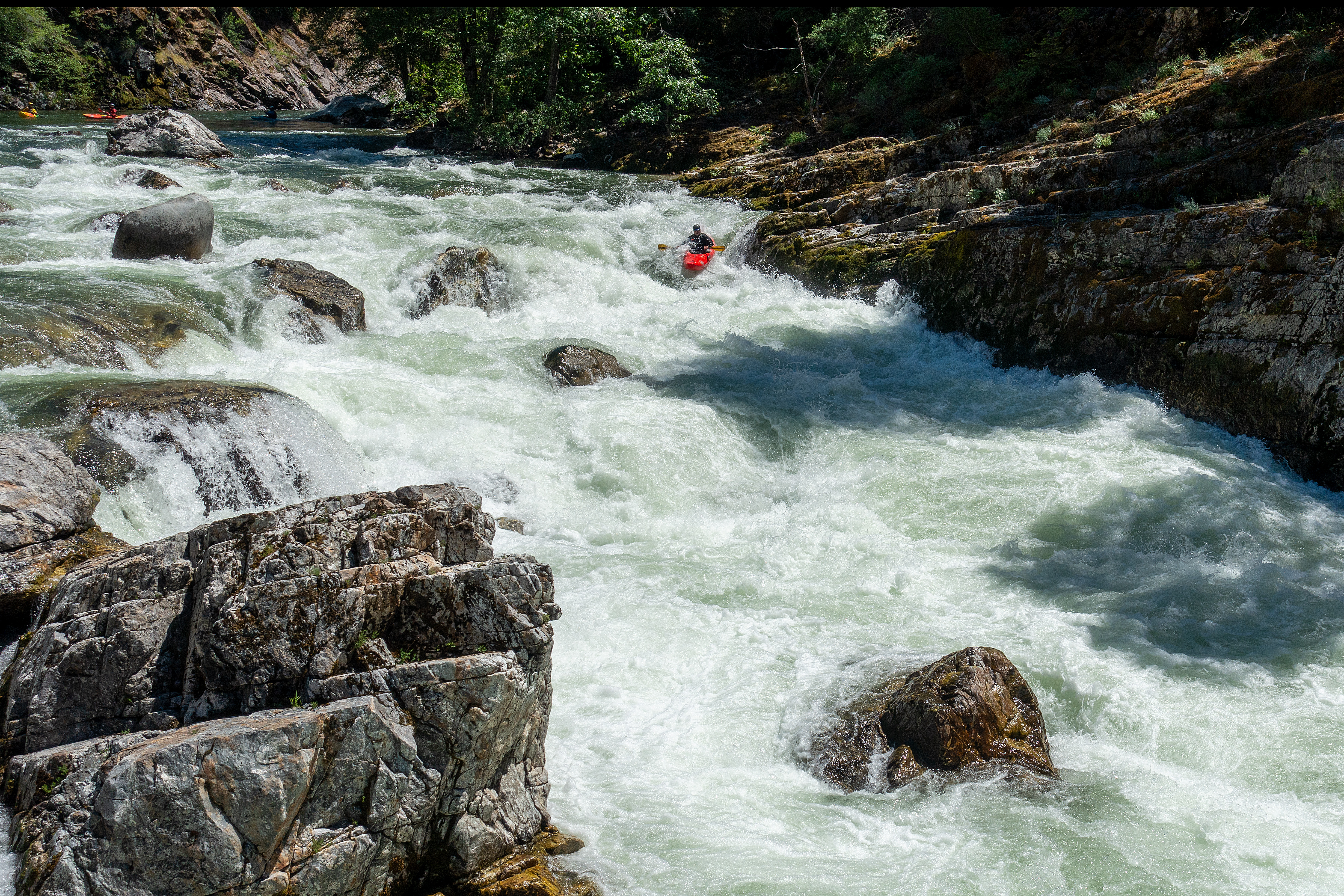
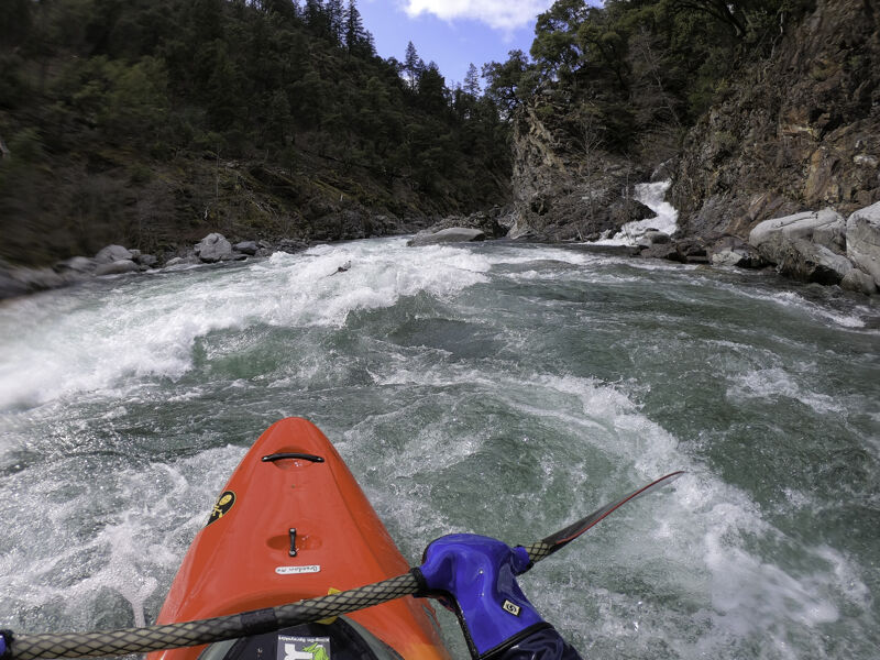
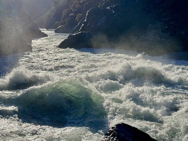
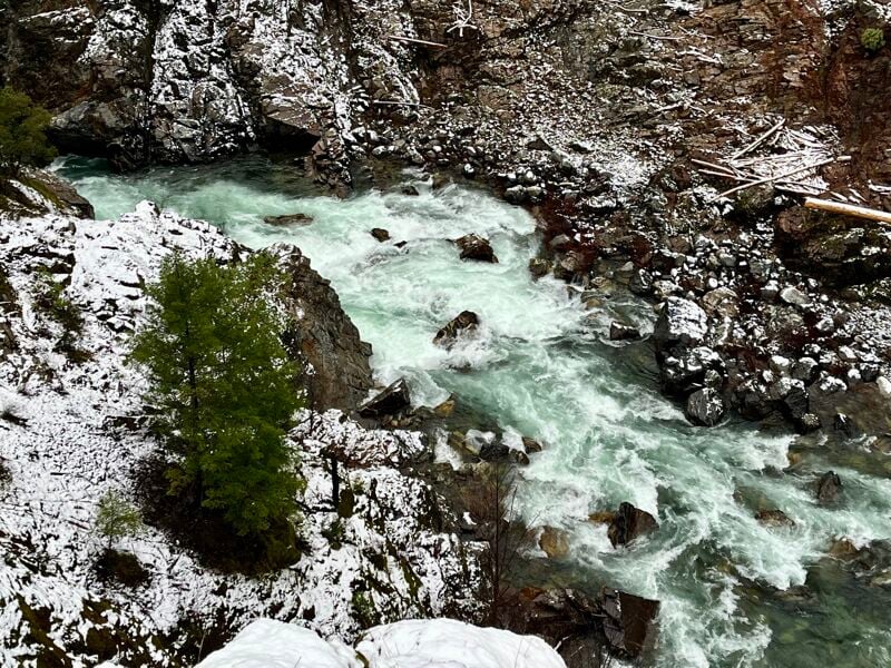
Freight Train
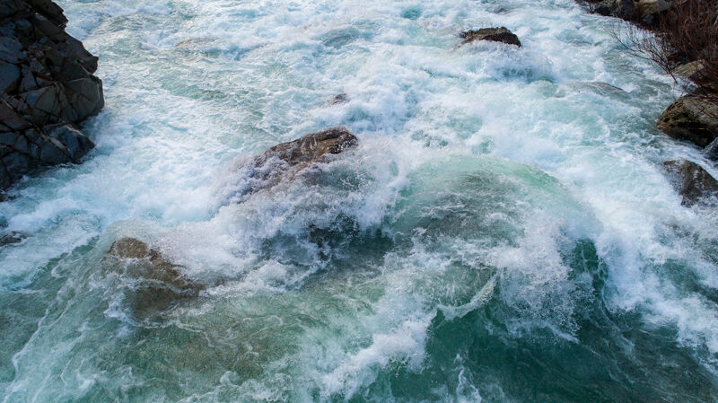
Freight Train changed significantly in late December 2024 and most boaters will probably now choose to portage unless flows are high enough to cover up the rocks through the crux of the rapid. There is no clean line through for rafts or larger boats when the rocks are exposed. Be sure to scout from river level; road scouting does not convey the vertical scale, current speed, and congestion of the rocks, making it look less menacing than it really is. It is now something greater than a standard Class V rapid.
Since the changes are new, boaters are still figuring out the situation. At medium flows (~2,500 cfs and up) there is a sneak route on the far right for kayaks only, but not making the sneak could be disastrous. At flows above about 3,500 cfs, the problematic new rocks are covered enough to consider a line in much in the place where it used to be. Quite likely, at flows of 1,200 cfs or less, the technical slot line along the river left cliff wall will still be viable for kayakers.
The description below is for the Freight Train before late December 2024. Although much of the description is still accurate, the rapid is so fundamentally changed by the problematic new rocks in its crux zone that there's little value to understanding the details of how Freight Train used to be. Scout and make your own decisions now, and know that most boaters will going down the river right banks as they portage. You still get to run the Angel Wings at the bottom.
DESCRIPTION OF FREIGHT TRAIN AS IT EXISTED BEFORE DECEMBER 2024
Freight Train is the largest and most powerful rapid on the Salmon River, dropping a total of approximately 25 feet from top to bottom through a challenging course of rocks and large holes. Locals call it Grants Bluff.
The rapid is easier and safer at flows above 2,500 cfs when lines open up and some of the rocks become covered. At flows below 2,000 cfs, the lines in the middle and bottom of the rapid are tight, the water is fast and powerful, and the river is not deep. Rafting outfitters generally stop running Freight Train at flows below 1,200 cfs. Numerous head hits and head injuries have occurred at low flows, mostly among kayakers. A low water line on far left opens up for the bottom 1/3 of the main rapid for kayakers when flows are about 1,200 cfs or lower. Not all the hazards are amplified at low water: there was a flush drowning here at high water in the 1980s.
At medium and high flows, the rapid is fast and powerful. The topography of the large waves make downstream visibility difficult so know where you want to go, drive by feel, and enjoy the wild ride. Expect to take a hit at the big, breaking curler known as Hawaii 5-0 or the Bomb Shelter. A slight left angle will help you shoot out of this in the direction you want to be going and avoid the rocks and hole that lurk straight below.
Scout and portage on the right. You can also road scout this rapid from the pullout on Salmon River Road near the 8-mile marker, although you can't see the top 1/3 of the rapid and the vertical scale of the drop absolutely cannot be appreciated from above.
Butler Ledge
This rapid is somewhat inconveniently located if you are taking out at the Butler Creek River Access. In order to reach the take-out, you must enter this rapid and move quickly the left to reach the boulder bar that separates the rapid from the pool of Butler Creek where the take-out is located. At higher water levels it is possible to paddle over the boulder bar to the take-out pool but, more often, you will need to get out and carry over the bar then get back in at the pool.
Butler Creek River Access
The Butler Creek River Access is alongside Salmon River Road, about 7.5 miles upriver from Highway 96 at Somes Bar between the 7 and 8-mile markers. There is a long pullout on the river side of the road for parking and loading, a picnic table, a dilapidated information board. A restroom is on the opposite side of the road on the other side of the bridge over Butler Creek. A double track trail goes from the parking area to a pool at the mouth of Butler Creek. Depending upon river flows, you may be able to paddle in/out of this pool to reach the river or you may need to carry your boat over the boulder bar.
Please note that there are multiple private residences across the road from this river access, so be polite and not too loud.
This is also the put-in for the Butler Run (III+/IV). Great whitewater continues for another four miles, so most boaters link together the Nordheimer Run with the Butler Run and in doing so, avoid the challenge of taking out at Butler Creek River Access.
Trip Reports
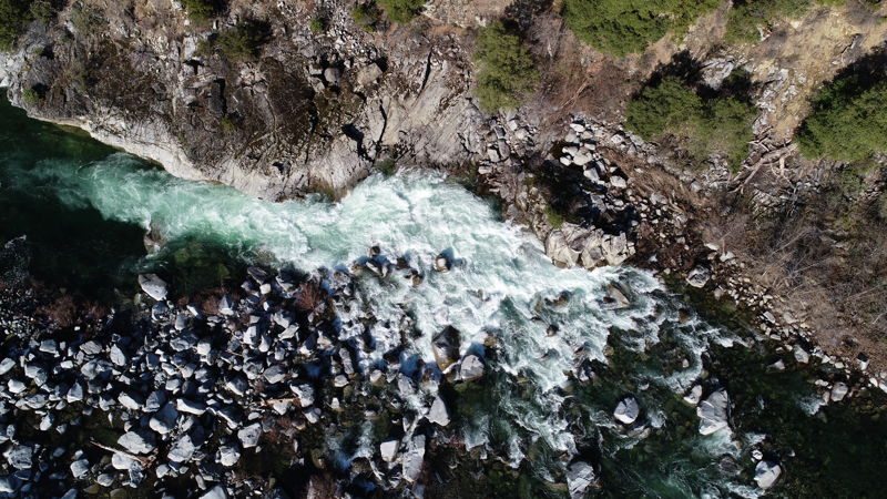
Log in to add a reportFreight Train Drone Photos - Scott Harding
Jan 30, 2025
Overhead views of Freight Train taken at 1,700 cfs with sparkling emerald water.
The changes to the rapid are apparent at its crux: there's a big new fan rock right on the former line into the Bomb Shelter (which is now changed) and a new rock poking up below the Bomb Shelter. It's more congested and more consequential ro run.
It looks like a really tough one for rafts. It's hard even for kayaks to get far left at this flow. The kayak sneak on the right looks better at 1,700 cfs than at 2,700 cfs (see 1/18/25 trip report photos), but still has little margin for error.
Going to take some figuring out...I think many will portage and some may run new routes or possibly a crazy line right into the rocky mank (maybe unintentionally by someone who doesn't read this).
Definitely scout from river level and whatever you do, don't swim into Freight Train from Last Chance.
Freight Train Changed, Now a Portage? - Scott Harding
Jan 18, 2025
On a gorgeous Saturday afternoon, seven of us set out on what might have been the first descent of the Salmon River’s Nordheimer Run since the high-water events of late December 2024 and early January 2025. Flows were a solid medium at 2,700 cfs, and the water had that classic translucent green glow, shimmering under cold, blue skies: the makings of a perfect winter day.
The whole run was great, but this report is only about Freight Train, which is now a completely different rapid than it was before.
As usual, we scouted Freight Train from the road while shuttling up. Right away, we could tell the crux section had changed—it looked tighter and more congested than before. We all agreed to scout from river level and recognized we'd probably portage, which says a lot considering our crew runs Freight Train regularly. From the road, though, it didn’t look nearly as bad as it turned out to be.
The big change is that a huge new rock has shown up right in the crux of the old main line into the Hawaii Five-O/Bomb Shelter curler. It’s impossible to miss, throwing up a big roostertail and closing off what the possibility of running that line without getting smashed at high speed into a pile of rocks with a ton of water. There's a huge hole and then another just downstream. It's just nasty all over, and impressively large and powerful as always.
As soon as we scouted from river level we all knew instantly we weren’t running it.
Faced with the new reality at Freight Train:
• Four of us walked it from the top to the pool on the right above Angel Wings.
• Three took a sneak line on the far right that served only to eliminate the walk, not give the thrill of running the rapid. Missing the sneak would have meant washing into the nasty rock pile: not to be taken lightly and it wouldn't be hard to mess it up.
We regrouped in the pool above Angel Wings, then floated through its swirling currents, taking a moment to process it all. Rivers always change, and we ride them while we can, but this one stings like a real loss.
Here's the alert posted on 1/21/25 about this change:
ALERT: Freight Train changed significantly in December 2024 and most boaters will now consider it to be a portage. There is no clean line through for rafts or larger boats. Be sure to scout from river level; road scouting does not convey the vertical scale, current speed, and congestion of the rocks, making it look less menacing than it really is. It is now something greater than a Class V rapid.
Since the changes are very new, boaters are still figuring out the situation. At medium flows (~3,000 cfs) there is a high-stakes sneak route on the far right for kayaks only, but not making the sneak could be disastrous. Perhaps at high flows above 4,500-5,000 cfs, the problematic new rocks will be covered and a line will emerge much in the place where it used to be. Quite likely, at flows of 1,200 cfs or less, the technical slot line along the river left cliff wall will still be viable for kayakers. It's unclear whether there will be any level suited for rafts: the outlook isn't good.
Access at Nordheimer and Road Scout of Freight Train - Thomas O'Keefe
May 17, 2023
Photos of the Nordheimer access on a trip where the American Whitewater team took an evening to enjoy the Fork Run. We took out here but the photos are included since this is a put-in for the Nordheimer run. We also drove along the road to take a look at Freight Train Rapid from the pull out.
Salmon River Maps - Scott Harding
Apr 4, 2023
Salmon River Whitewater Maps by the Salmon River Restoration Council.
Nordheimer Run at 2800 cfs - Scott Harding
Mar 25, 2023
Great day of paddling on the Salmon from Forks of Salmon to Brannons Bar. It was snowing in the morning which decreased our motivation to do a 29-mile-long run from the South Fork Gorge through Butler. The shorter day starting in Forks worked out and gave us time to take it all in on a day with a good three-person crew, sun, clouds, and translucent emerald water. And we still got 15 miles on the river.
At 2800 cfs, Freight Train was less manky than it at lower flows. After several lower flow seasons in a row, it was nice to paddle through with ample water this time. There should be plenty of days like this in 2023 with all the snowpack and rain.
Last Chance & Freight Train at 1200 cfs - Scott Harding
Feb 27, 2023
View of Last Chance and Freight Train from Salmon River Road at 1200 cfs.
Tripp Point Wave at 5180 cfs - Scott Harding
Feb 8, 2023
Park & play at Tripp Point Wave in May of a good water year.
Last Chance Rapid at 1450 cfs - Scott Harding
Apr 10, 2022
Looking down on Last Chance from the pullout near the 8-mile marker on Salmon River Road, the same pullout used to scout Freight Train. In a very rare occurrence, an open boater happened to be paddling the drop.
Aerial Views of Achilles at 1500 cfs - Scott Harding
Feb 8, 2021
A few overhead views of Achilles at 1,500 cfs on the Somes Bar gauge.
Nordheimer Run at 3,500 cfs - Scott Harding
May 12, 2019
Great day of boating with a greater than usual number of boats on the river (meaning there were more than two!).
Our crew of kayakers put in at the river access at Nordheimer Campground near Forks of Salmon and paddled both the Nordheimer and Butler runs (why would you not do both every time?).
The flow was 3,500 cfs at the Somes Bar gage which is a solid medium flow that packs a good punch in the bigger rapids, particularly Cascade and Freight Train.
Cascade has lots of different lines and our crew ran left, middle, and far right.
As usual, Freight Train had a long lead-in with waves so tall you get lost and the big feature near the bottom (known variously as the Bomb Shelter, Hawaii Five-O, the Tube) disappeared every paddler that dropped into it but all emerged upright. Freight Train is padded out at this flow and is safer than it is at lower flows (below 1,800 cfs or so) because most rocks are well-covered and the odds of a head hit when upside down are therefore lower.
The Butler run was pure fun and even though its easier than Nordheimer, it has a steeper gradient and a faster pace. Lots of fun big waves at this flow.