San Joaquin, S. Fork
Florence Lake to Mono Hot Springs
| Difficulty | IV-V |
| Length | 7.2 mi |
| Avg Gradient | 91 fpm |
| Gauge | So. San Joaquin Below Florence Lake |
| Flow Rate as of 631 days | 25 cfsstale data |
| Reach Info Last Updated | June 7, 2011 |
Elevations:
Put-in at Florence: 7200' google map.
Gauge below Hooper: 6980'
Take-out at Mono; 6560' google map.
Average gradient, Florence to Mono = 91'/mile
Florence to Mono Hot Springs is a great run and not just because the scenery is about as good as it can get. The whitewater is continuous and challenging.
The run starts out meandering through a meadow for over a mile. It is very similar to floating through the meadows of Yosemite Valley. If the whole run were that way, even the most rabid whitewater buff might not mind, as the scenery is stunning. It is almost a pity when the meadow ends and the river drops away.
One's attention is quickly captured by the demands of whitewater churning downhill at a steady angle for as far as one can see. This first mile is only about 90' per mile but it seems incessant. A short slower section is a relief and a time for assessment. The next mile is steeper and seems to have no end with a gradient of about 130' per mile.
The first several miles are extremely continuous, with no pools and mostly tiny eddies. Instead of pools there are a couple of short sections of slower water after the first half mile or so. The gradient steadily steepens towards the confluence with Hooper Creek. Near this confluence there is a gauging station and a weir. The hardest part of the run is probably the last 1/2 mile or so down to this gauging weir. Scouting or portaging is fairly easy on fisherman trails on the river left side. There is also a dirt road an river right leading from Florence to the gauging station. At
...
After a scenic float through a meadow, the river runs next to the granite cliffs of Jackass Dike. Once the river starts dropping, it does not stop.
A steep continuous rapid curves gradually to the right, piles up against a cliff on the right then bounces left and drops over a 6 to 8 foot high dam. At 750 cfs in 2003 all boaters ran the weir, but it looked sticky in spots. Good eddies await below the weir.
Many boaters will want to scout this whole section.
Jun 8, 2003
Doris Lake is one of the attractions in the SF San Joaquin area. Hot springs feed the lake and keep the temperature in a pleasant range. The water is cool, but not cold and one can swim for a long time without becoming uncomfortable. The river and any other lake in the area will be freezing cold. This lake is about 2/3 of a mile north and slightly east of Mono Hot Springs. There is a popular trail leading from the end of the road at Mono Hot Springs. There is probably also a trail leading to the lake from the road to Edison Lake. Doris is only 1/3 mile from spots along this road.
We had fun time jumping off the cliffs into the lake shortly after this picture was taken.
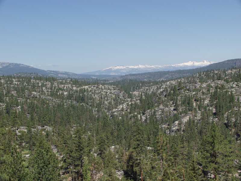
This is looking north from the road near Mono Hot Springs on the way to the SF San Joaquin. The snow capped mountains are the Clark Range in southern Yosemite.
Marmots are a common resident in the Sierra. We saw several on this trip to the SF San Joaquin. This one just made a poor choice of hiding spots in a crack in a small boulder. It could not squish any further down into the crack and was forced to hold still while I took pictures.
In some areas, such as Mineral King in Sequoia Park, marmots are notorious for chewing on the wires and hoses in automobile engine compartments. I have not heard of that problem in this area, but you never know when they might get a hankering!
