Shasta River
Hwy 263 Bridge to Hudson Road(Shasta River Canyon Run)
| Difficulty | III |
| Length | 6.3 mi |
| Avg Gradient | n/a |
| Gauge | Shasta R Nr Yreka Ca |
| Flow Rate as of 55 minutes | 50 cfsbelow recommended |
| Reach Info Last Updated | March 14, 2025 |
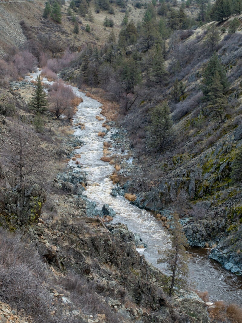
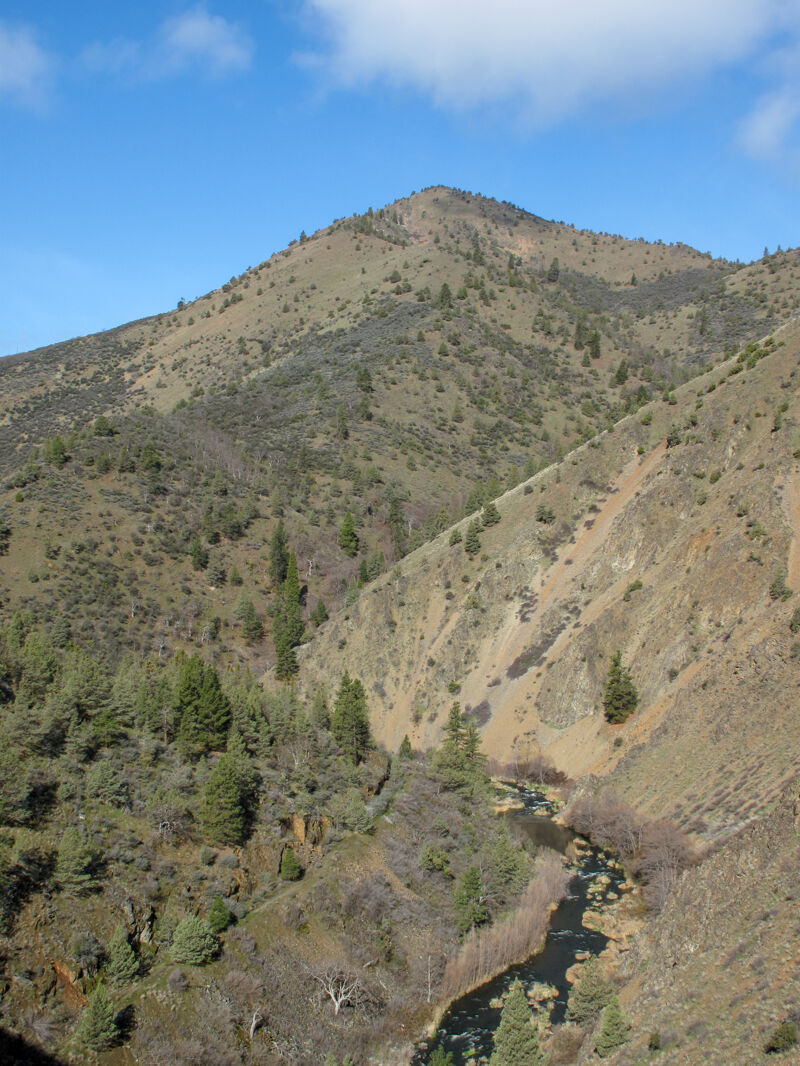
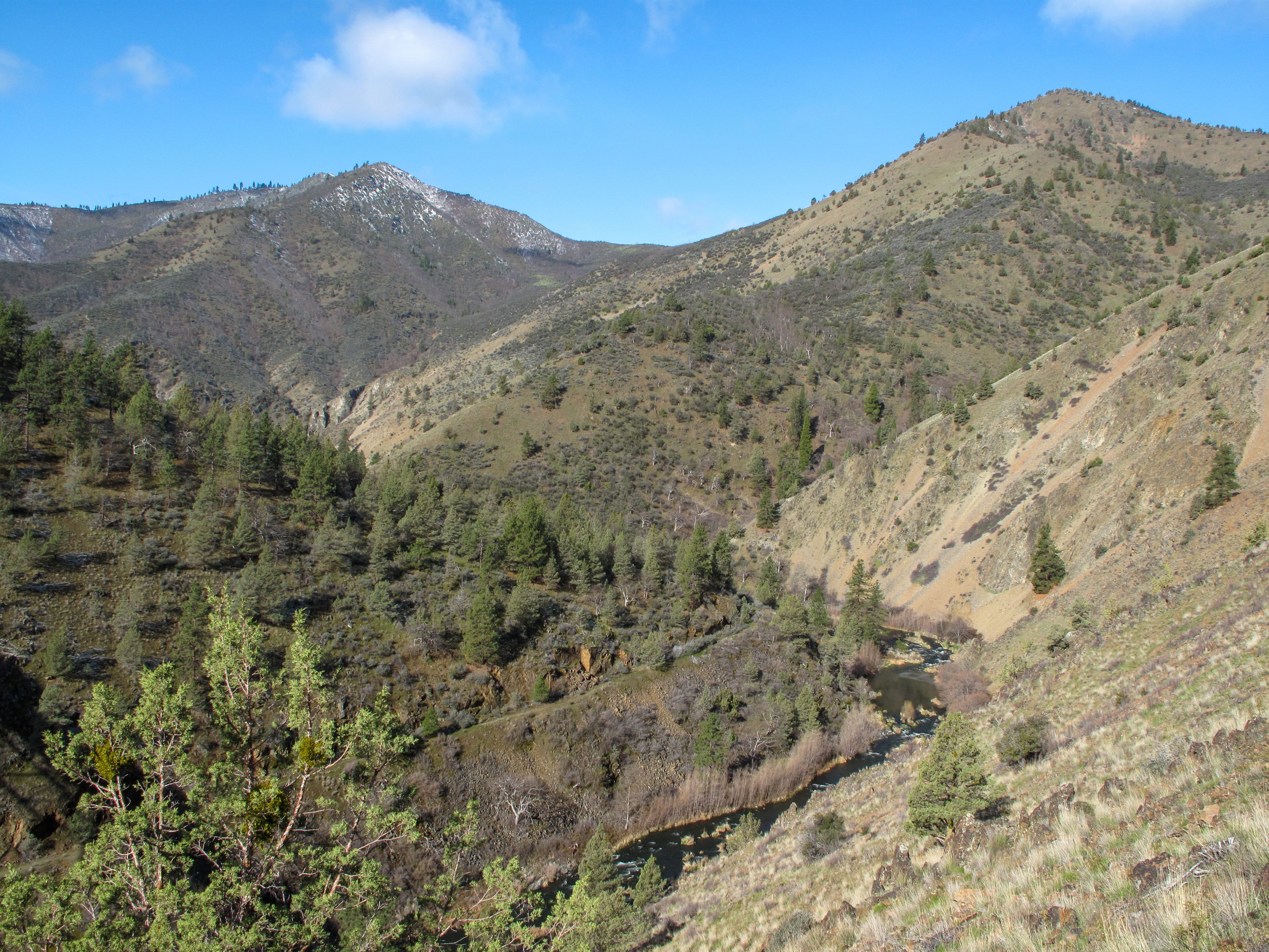
The Shasta River flows from the glaciers of Mt. Shasta and from the eastern peaks Klamath Mountains through the pastoral Shasta Valley before entering the rugged Shasta River Canyon on its final descent to join the Klamath River. This seldom-run stretch features Class II+ to III rapids with tight constrictions, overhanging vegetation, and potential wood hazards. The canyon’s stark, desert-like landscape contrasts sharply with the verdant forests just to the west, offering a unique and challenging whitewater experience when flows allow.
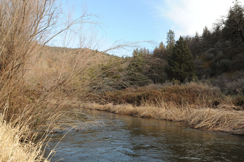
After its origin on the Cascades and Klamath Mountains, the two upper branches of the Shasta meet on the floor of the Shasta Valley, bolstered by abundant spring water. Near the middle of the valley, the river is impounded by Dwinnell Dam, which diverts flow for alfalfa and hay production near Montague. Downstream of the dam, the Shasta meanders across the valley floor and is joined by the Little Shasta River. A few miles north of Yreka, the Shasta flows beneath the Interstate-5 bridges and plunges headlong into the short but rugged Shasta River Canyon, transforming into a whitewater river on its final plunge to join the much larger Klamath River.
The Shasta River would be boatable year-round, flowing with abundant base flows provided by several large springs in the valley above but agricultural diversions have taken nearly all of this springwater from the river for much of the year, affecting the health of the river, its salmon fishery, and leaving little water to flow down the final canyon and into the Klamath. Boaters will need to check flows and count on short windows of opportunity in the late fall through winter to catch a decent flow for this run. Due to agricultural runoff, expect poor water quality.
Unlike Mt. Shasta, the river is small and somewhat diminutive, especially considering the size of its watershed and the abundance of its volcanic springs. Rapids are generally class II+ but tight constrictions
...Renowned salmon habitat where ther river has a side channel that provides habitat diversity. Also a Class II+ rapid.
Take out where Hudson Road is close to the river upstream of the bridge.
Mar 23, 2009
A few photos of the Shasta River canyon from March 2023 when the river was at 170 cfs.