Smith, Middle Fork
Patrick Creek Campground to Forks River Access(Multiple Runs)
| Difficulty | II-V |
| Length | 17 mi |
| Avg Gradient | 47 fpm |
| Gauge | Smith R Nr Crescent City Ca |
| Flow Rate as of 1 hour | 445 cfsbelow recommended |
| Reach Info Last Updated | February 17, 2026 |
River Description
Depending on flows, you can find good whitewater within about 10 miles of the California-Oregon border and continuing all the way down to the confluence with the South Fork about 22 miles downstream near Hiouchi. The river is all roadside with multiple access points. The four runs below represent the standard options but multiple access points allow you to further customize your trip.
1) Patrick Creek to Gasquet, 9.7 miles, class III(IV) (Patrick Creek Run)
The run from Patrick Creek to Panther Flat is a class III/III+ classic. You will encounter somewhere between 15 to 20 class rapids in the stretch from Patrick Creek down to Panther Flat with consistent action from start to finish.
This section also includes one class IV rapid known as Highway Rapid. Shortly after the river passes under the highway from south to north, you will come to Highway Rapid where the river makes a sharp left hand turn. The rapid gets harder as flows rise, but can be scouted or portaged with some effort on river left.
Panther Flat Campground is the usual take out for this run but you can continue on downstream through Gasquet, past the confluence of the North Fork and take-out at Margie’s Access.
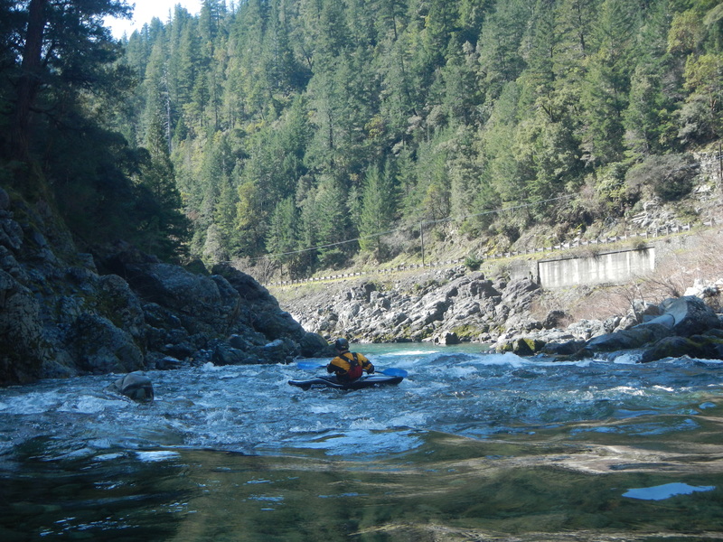
2) Gasquet to Middle Fork Gorge, 4.3 miles, class II/III (Margie's Run)
This is a great run that starts out as class II from Gasquet. If you want to cut out this first section, you can put in at the Mary Adams bridge. Below this point the whitewater action builds with some fun class III rapids including the named drops of Crotch, Cars, and Brent's Hole.
You can use this run as a fun prelude and warm-up to the gorge downstream or take out at Middle Fork Gorge access site if you are an intermediate paddler.
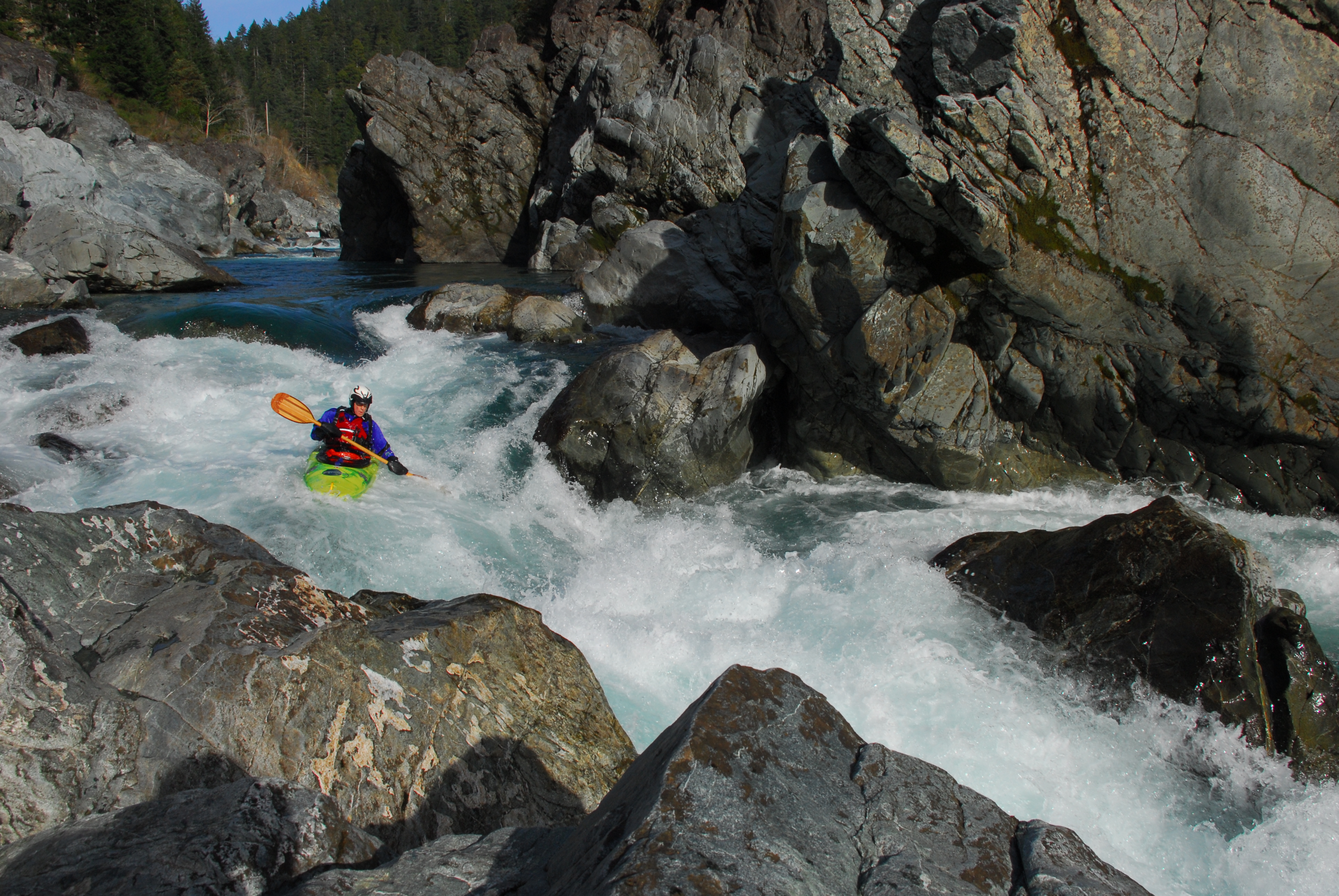
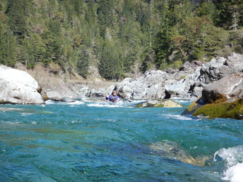
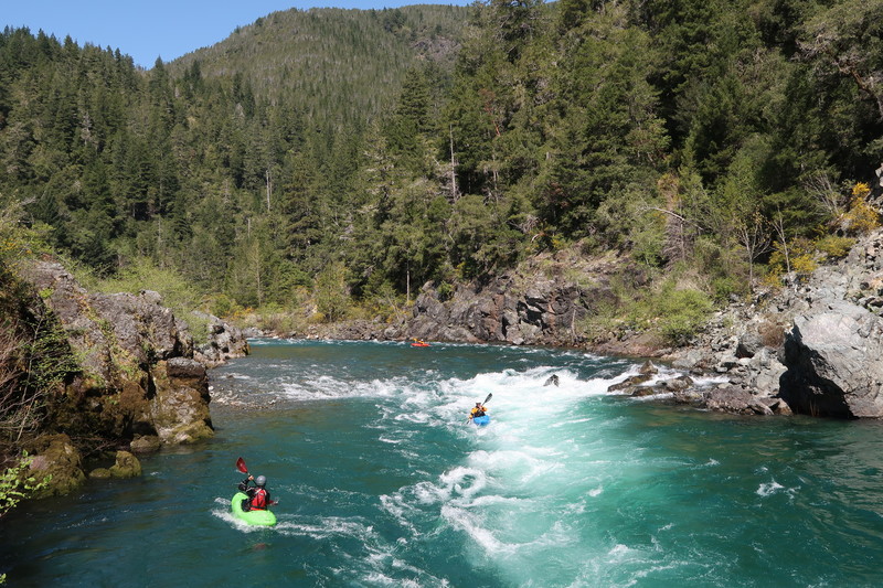
3) Middle Fork Gorge, 2.2 miles, class IV/V (Oregon Hole Gorge Run)
The short Middle Fork Gorge is often run by itself but you can start higher up for some warm-up. The run starts with some fun class III+ drops th
...River Features
Patrick Creek Campground Put-in

The river access point is at the confluence of Patrick Creek and the MF Smith River. To reach this spot, take the trail upriver from the upstream end of the Patrick Creek Campground. There are other access options in the campground area too. Located at USGS River Mile 16.5.
Sandy Beach River Access
The river access is signed along Highway 199. At USGS River Mile 15.2.
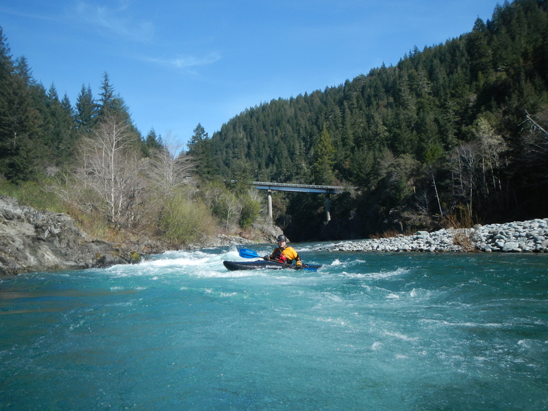
Highway Rapid
This is the largest rapid between Patricks Creek and Gasquet. It is on a sharp left hand turn shortly after the river passes under the Highway 199 bridge. This rapid gets harder at higher flows. It can be scouted or portaged with some effort on river left.
Madrona River Access
The river access is signed along Highway 199. At USGS River Mile 13.5.
Panther Flat Campground
Panther Flat Campground on river left can be a good early take-out for those boating down from Patricks Creek. At USGS River Mile 10.5. This US Forest Service campground is open all year, has a fee, and coin-operated hot showers.
NF Smith Confluence & Water Plant River Access
The town of Gasquet lies between the highway on the south and the river on the north. The North Fork Smith joins the Middle Fork Smith near the upstream end of the town of Gasquet. A bridge crosses the Middle Fork just before the confluence and there are a few homes visible along the river banks here. Located at USGS River Mile 8.1.
The Gasquet Water Plant is on the river right side at the confluence, and a steep climb up the rocks leads to a trail then double-track road past the water plant to the paved Gasquet Flat Road. Kayakers and othe small craft paddlers often use this as a take-out. Rafters typically continue downriver to take out at the more accesible Margie's River Access.
Margie's River Access
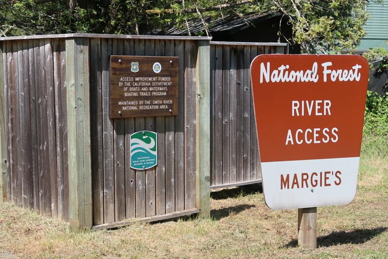
The river access is signed along Highway 199 on the far downriver end of Gasquet. At USGS River Mile 6.8.
Mary Adams Peacock Bridge Access
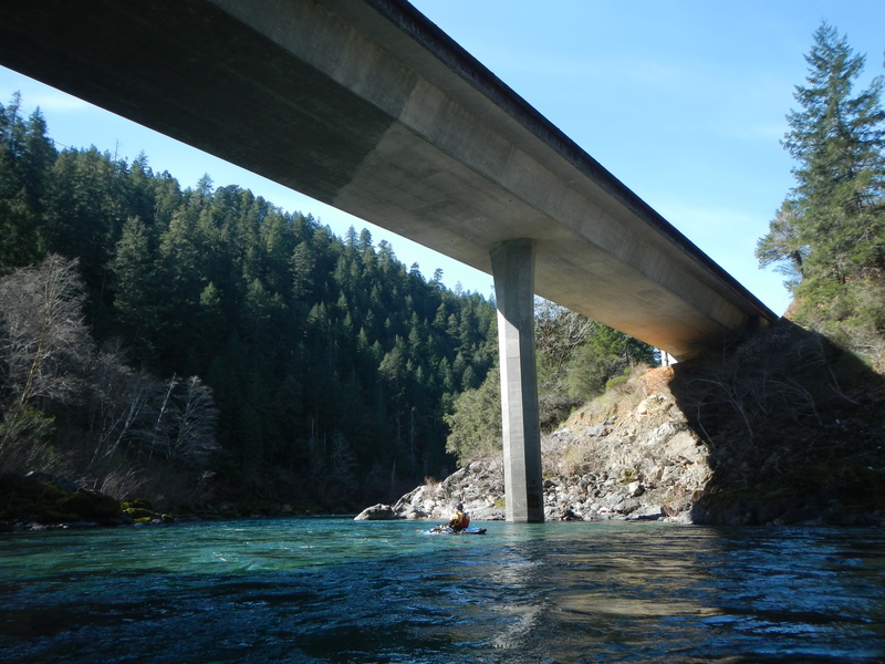
This river access is signed along Highway 199. At USGS River Mile 5.5.
Crotch
Rapid located at USGS River Mile 4.2.
Cars
Rapid located at USGS River Mile 3.9.
Brent's Hole
Rapid at USGS River Mile 3.3.
Middle Fork Gorge Access
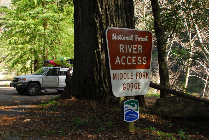
Access located at USGS River Mile 2.5.
Nozzle
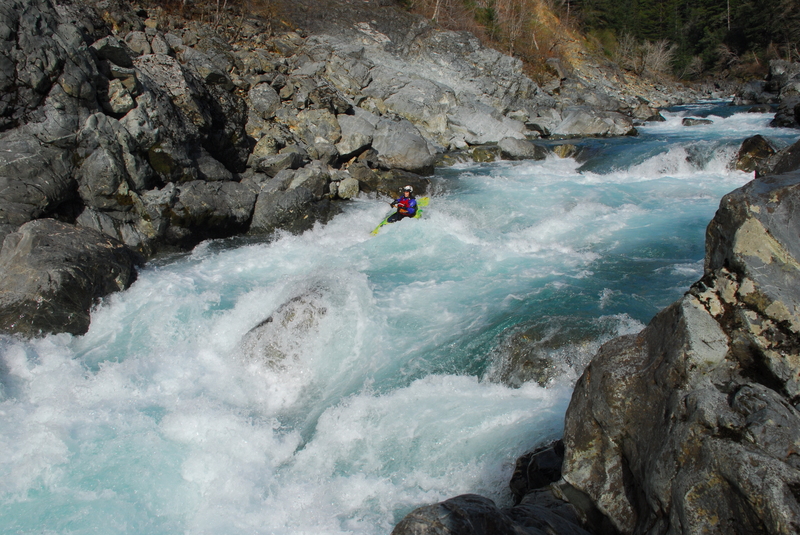
Rapid located at USGS River Mile 1.8.
Hole in the Wall
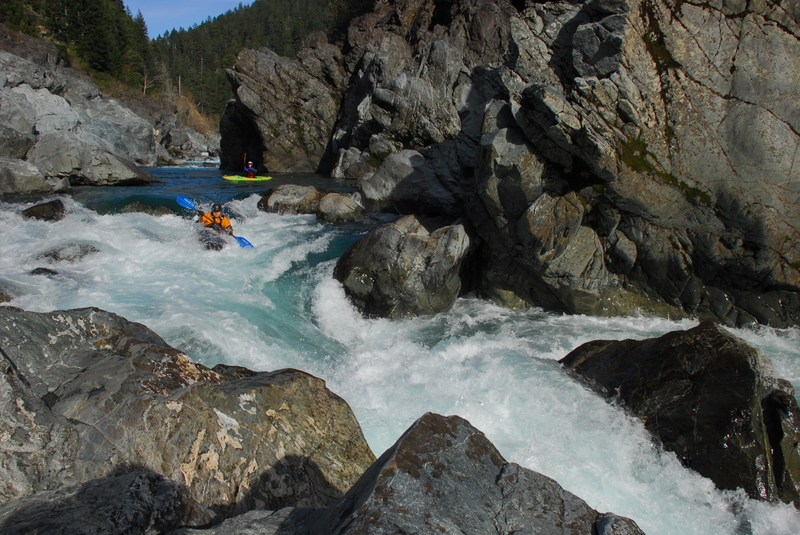
Named for a hole in the rock on river right that is often underwater at typical boating flows. The entrance pushes boaters toward a center rock, forcing a quick decision and active maneuvering to either side—both of which are viable. Rapid located at USGS River Mile 1.7.
Oregon Hole
Myrtle Beach Access
On river right below the South Fork Road bridge. This is not often used by boaters because the Forks River Access on river left is much more easily accessed. Located at USGS River Mile 0.4.
Forks River Access
This is the primary take-out access for both the Middle Fork Smith’s Oregon Hole Gorge Run and the South Fork Gorge Run. The facility consists of a single parking area with separate routes to each river—a trail to the South Fork and a road to the Middle Fork. Located between the two forks off South Fork Road, at USGS River Mile 0.3 on the Middle Fork.
Trip Reports
Log in to add a reportFind me more beautiful water in California - Dup Crosson
May 31, 2020
Did Margie's today. Surprisingly empty for such a scenic Class II/III run. Even after a rain, the water was still clear blue.
Nick Sinderson
Dec 23, 2011
the run from Patricks Ck. to Panther Flat is a class 3 to 3+ classic. With somewhere between 15 to 20 class 3 rapids in the 5+miles of the run. The run stays consistant with rapids from the start to the end. Of course it also has class 4 Bridge rapid too. I have been down this run in excess of 50 times and enjoy it now as much as the first time down. Both playboats and river running boats will find lots of fun waves and eddys to play with.
The stated maximum flow should be increased as we find 12' on the Jed Smith gauge to be good fun, as the river speeds up and wave size increases. Bridge rapid does get harder the higher the flow goes but can be portaged (and scouted) with a little bit of effort on river left. I've always used 20% of Jed Smith gauge flow to estimate the cfs for this run. The run is doable to as low as 500cfs but 800cfs (2,500 & 4,000cfs@ Jed Smith) would decrease the # of rocks you will hit.