Yellow (Wisconsin R. trib)
CTH.N to CTH.A (Little Bull Falls) (up to 7 miles)

| Difficulty | II-III |
| Length | 6.8 mi |
| Avg Gradient | 15 fpm |
| Gauge | Yellow River at Babcock, Wi |
| Flow Rate as of 20 minutes | 18 cfsbelow recommended |
| Reach Info Last Updated | September 7, 2020 |
Dirk Fabian provided (2002-04-01):
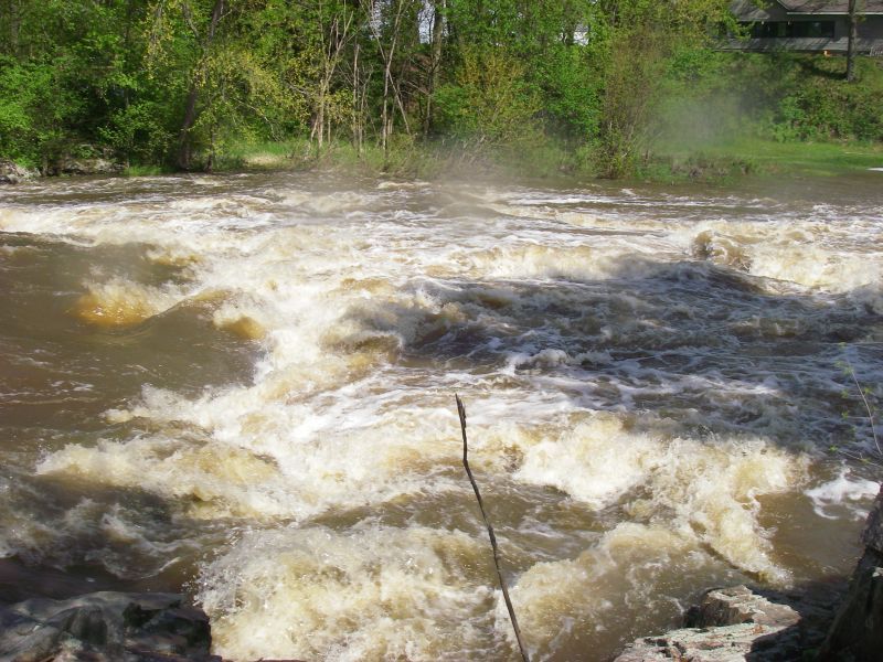
Boated June 2001 at about 1000cfs on the gauge. It was an enjoyable run that starts with a little creeky dells section. There are several holes here that could be sticky/interesting at higher levels. After 200 yards of dells, the river mellows but there are several nice waves and one more good ender hole as the river drops over some bedrock slabs.
This reach has several flatwater sections that are dam backwaters. These dams should be portaged.
Little Bull Falls was a bit scrapey at 1000cfs but still an amusing bounce down about 10 feet of ledges. There is a very 'north woods' bar at the takeout and the locals were amused to see us playing in the waves and holes at the base of the falls. They even lent us a truck to avoid a long rainy bike shuttle.
Note: about 2/3 of the way through, there is a road bridge over the river followed by a section of head-high wire fence for a cow pasture. Watch out.
The water quality when the Yellow is running is mostly agricultural run off. Yellow and brown are the predominant water colors.
Bryan Foster provided an account from May 7th, 2012:
On the down stream, river right side of the center pillar support (SW corner of the support) at CTH.N is a visual gauge for the river. A kayaker who has frequented the river suggested a minimum level would be 0.5ft on this visual gauge. On this occasion, many of the trees had budded out in this early spring and about an inch of rain had hit the watershed about two days earlier. The visual gauge at was 1.5ft and the USGS was 2200 cfs. (The visual will always be a far more accurate method for gauging flows on this river, since the USGS gauge is well down stream.)
There is parking just East of the CTH.N bridge at a non-motorized trail access. From there it is a short walk up the trail to a grassy put-in, above the first class II rapid of the trip. Not long aft
...
From the CTH.N bridge non-motorized trail access, take a short walk up a trail to a grassy put-in, above the first class II rapid of the trip. (We are uncertain precisely how far the trail goes, so the marked location may be beyond the reasonable walk, but appears to be the start of the gradient or rapids above the bridge.)
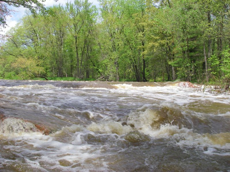
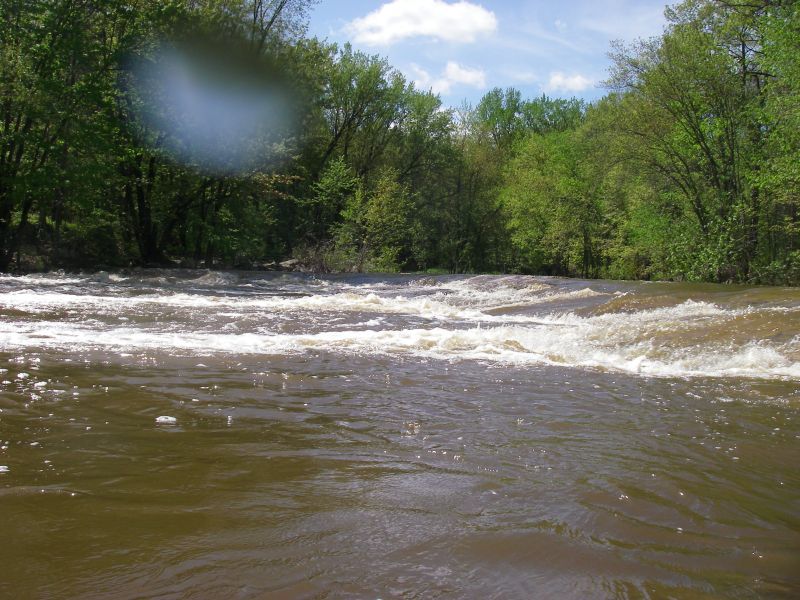
Not long after the bridge, the river picks up pace and the 'dells' section begins with a short ledge followed by some good wave trains. The dells finishes with a constriction on river right by a rock outcropping, followed by some run out rapids.
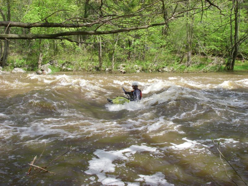
North Wood County Park is signaled by a river-wide ledge/wave. Just downstream on river right is an eddy with access to a nice standing wave, great for surfing. In case of a swim, be sure to get out as soon as you can before the next feature/hazard downstream.
A short ways down (maybe 50 yards) is a road which is underwater at boatable flows which has a culvert/bridge on river right that could potentially pull a swimmer under and into a possible snag. The submerged road also forms a runnable low-head dam-type feature. (It was runnable for our group at our flow, but be sure to scout before running this and each of the dams in the park.)
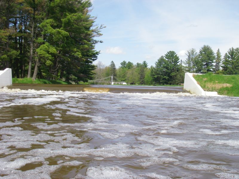
A short section of riffles after the prior feature finishes at a very short impoundment ('Lake Kaunewinne') backed up by the first dam. The dam is mostly sloping faced, with one sheer drop located in the middle of each side on the first one. The first dam can be portaged on the left.
Immediately after the prior dam, you are in the backwaters ('Lake Manakiki') of the next dam. Again, this dam is mostly sloping faced, with a sheer drop located in the middle. This seems equally bad for reentry on either side, so take your exit which ever looks easiest to you to get out on.
Below this dam, the alternating rapids and flat-water resumes.
Jenny Falls is marked by the river taking a sharp bend to the left after which you can see the drop as the water slides down to the right. Jenny Falls was divided into three routes at our level. The right had the most water and some good sized waves as it slid down approximately 5 vertical feet. The middle formed a bouncy play hole, and the left formed a micro play hole. The middle and left were shallow slides, with eddies in between the bottoms of the three routes. Below this were some confused eddy lines and swirling water, then a short trailing rapids and the CTH.C bridge.
Little Bull Falls can be heard as houses appear on the left. There is an upper drop (about 50 yards up from main part of Little Bull Falls) that has a couple of big waves to get your adrenaline pumping and warm you up. Little Bull Falls is best scouted from the take out before you put-in. Otherwise river-right (no houses) would be better than river-left (houses), unless you obtain permission. A hole forms at the center-right bottom that could potentially stop and retain a boater who does not paddle through and out. A bright yellow metal staircase on river left at the bottom of the falls takes you up to the the Little Bull Falls Tavern parking lot, your take out.