Smith, South Fork
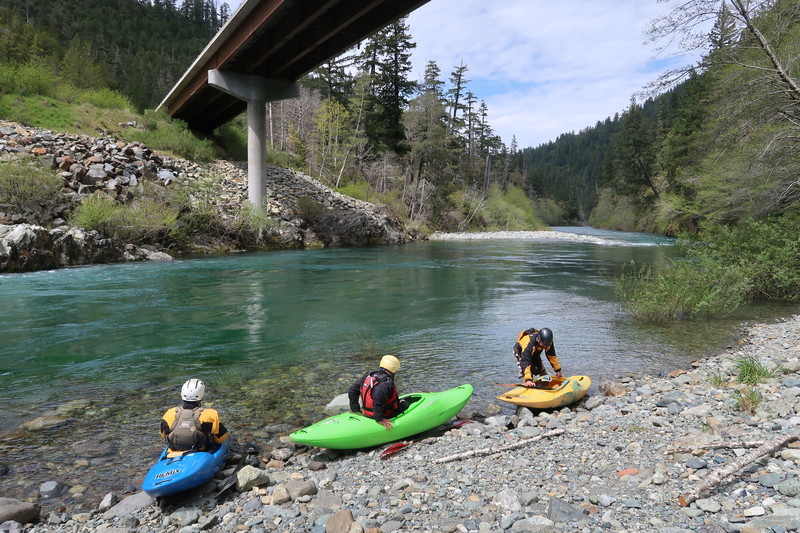
Stevens Bridge to Craigs Beach River Access(Stevens Bridge Run)

| Difficulty | II-IV+ |
| Length | 12 mi |
| Avg Gradient | 31 fpm |
| Gauge | Smith R Nr Crescent City Ca |
| Flow Rate as of 1 hour | 314 cfsbelow recommended |
| Reach Info Last Updated | March 12, 2025 |
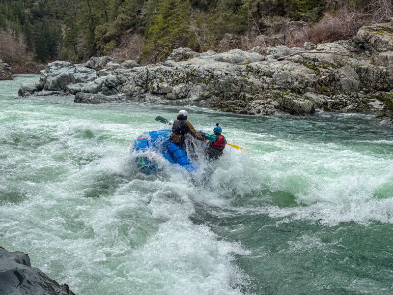
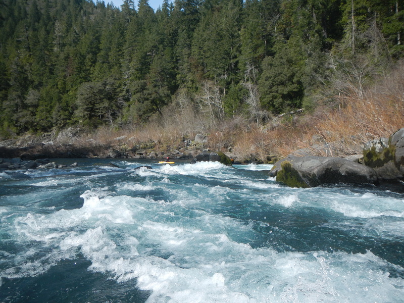
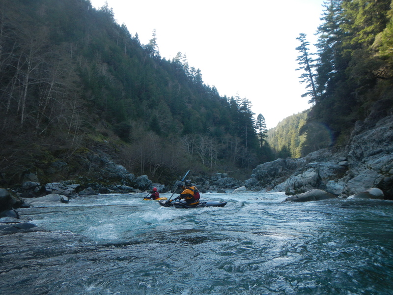
This is the classic Class III run on the Wild and Scenic South Fork Smith River. Multiple access points along the way allow boaters to paddle varied sections.
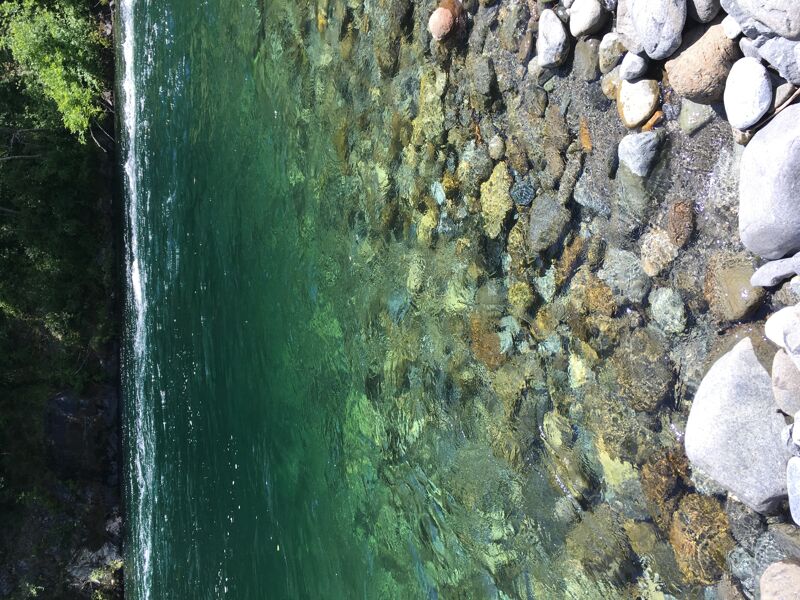
You will be hard pressed to find more beautiful and clearer water than that of the Smith River watershed. It is the only first-order river system in California with no dams or diversions between its sources and the sea (other river systems in California have no dams or diversions but feed into larger ocean-going rivers that do).
The standard Class III roadside run on the South Fork Smith goes from Stevens Bridge to Craigs Beach River Access. For a shorter run, put in at Sand Camp River Access instead of Stevens Bridge.
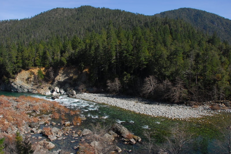
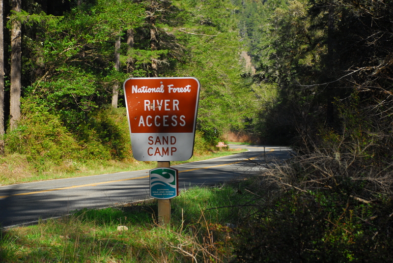
Boulder Creek is one of the notable drops near the top of the run where a large midstream boulder divides the flow. Sand Camp Access is a possible intermediate access point that is a good option particularly when flows are lower or if you are continuing on down through the gorge and just looking for a warm up for that.
Below Sand Camp the road crosses over to river right to avoid the landslide-prone slope on river left. There's a fun Class III rapid in this section between the two bridges.
As you pass Coon Creek, you will come to Coon Creek Rapid, a straightforward Class III with a boulder towards the end of the drop on river right that is easy to navigate around. Broken Paddle is next and, although it is a named rapid, it is characteristic of several of the unnamed Class III rapids along this section.
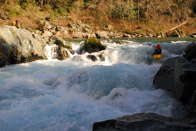
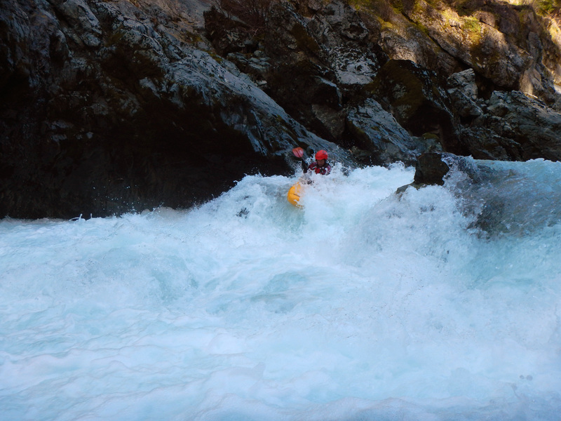
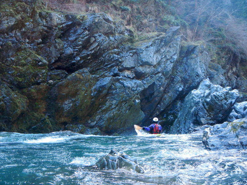
The most challenging rapid on this run comes near the end at Surprise, a fun Class III at an obvious horizon line on a sharp left bend. Scout from river right. A hole forms on the river right so the preferred line is generally down the left where you may need to negotiate a rock outcrop towards the bottom of the drop. At higher flows, the rapid is characterized by two large holes in the center of the flow. It's easy to portage this drop on river right.
...
Access to the river down a 700’ trail. Site includes parking for 15 vehicles and a vault toilet. River mile 13.5.
A named drop in the upper portion of the run where a large midstream boulder splits the flow. River mile 9.4.
This is a nice intermediate access point that makes a good put-in. The site has a 460’ trail to the water, parking for 20 vehicles, and vault toilet. Site characteristics include a sand/cobble beach, large pool, and primitive camp. River mile 8.0.
Very friendly playspot that's a wave at lower flows and a hole at medium flows. This was a popular destination during the era of rodeo boating and can even be a park-and-play session if you start at Sand Camp River Access and walk back up river left on the angler's trail. Ideal flows for a fluffy hole are around 8,000 cfs at the USGS Smith River gage. See https://darinmcquoid.com/gspot.html for photos.
A fairly straightforward rapid just past Coon Creek which enters from river right. A large boulder is near the bottom of the drop on river right. River mile 4.8.

One of several class III drops in this section. River mile 3.1.
The biggest drop on the run until you enter the South Fork Gorge. It can be easily scouted on the right. Standard lines avoid the hole on river right. River mile 2.5.
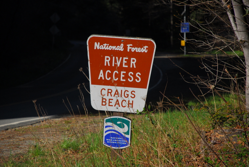
The river is accessed by a 300’ trail to the water. Its narrow width makes it a challenging carry for rafts. The river access includes parking for 20 vehicles, a picnic table, and a vault toilet. It serves as the take-out for the class III run upstream and as the put-in for the class IV/V South Fork Gorge. River mile 1.8.
The Slalom Course is a fun boulder garden section that gives you a little quick warm up before entering the gorge. Yes, actual slalom courses have been set up here and national level races have been held here. River mile 1.7
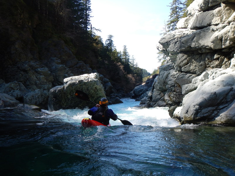
The drop marking the entrance to the gorge is run down the right and consists of a fun double drop sequence. River mile 1.2.
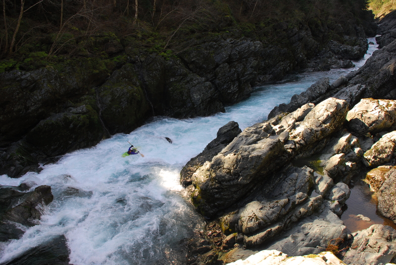
Good Luck! is generally considered the most demanding drop in the gorge. Scouting can be done from up high on river right (best option) or down near river level on river left. A hole develops toward river right midway through the drop. River mile 1.1.
A fun rapid with alternate lines depending on flows. A good scout is available from river left. River mile 1.0.

A fun slot move down the right or follow the main flow down the left being sure to avoid the holes and getting hung up on the wall. River mile 0.85.
The final major rapid in the gorge drops off a horizon line through a fun flume that then slams into the bedrock wall on river left and then back to river right if flows are higher. River mile 0.8.
Take out on the beach on river right at the South Fork Road Bridge, also known as Slant Bridge or First Bridge. A trail connects to the parking area at Forks River Access.
Dec 23, 2025
We had an excellent trip on the South Smith the day before Christmas Eve. The character was slightly pushy big water with a few important large features to avoid and weird boils but overall just big and fun. The larger rapid had one taker for a huge far right line over two curlers and through the shoulder of a large hole while the rest of us snuck down the left shoulder.
Putting a damper on our float was the theft of all my paddling gear during at Craig's Beach during our shuttle run. Bummer!!
Feb 15, 2025
BoatSmith 2025 afternoon run on the SF Smith.