Second Creek
State Rte. 132 to Confluence with Todd's Fork
| Difficulty | II-III |
| Length | 6.3 mi |
| Avg Gradient | 35 fpm |
| Reach Info Last Updated | August 28, 2017 |
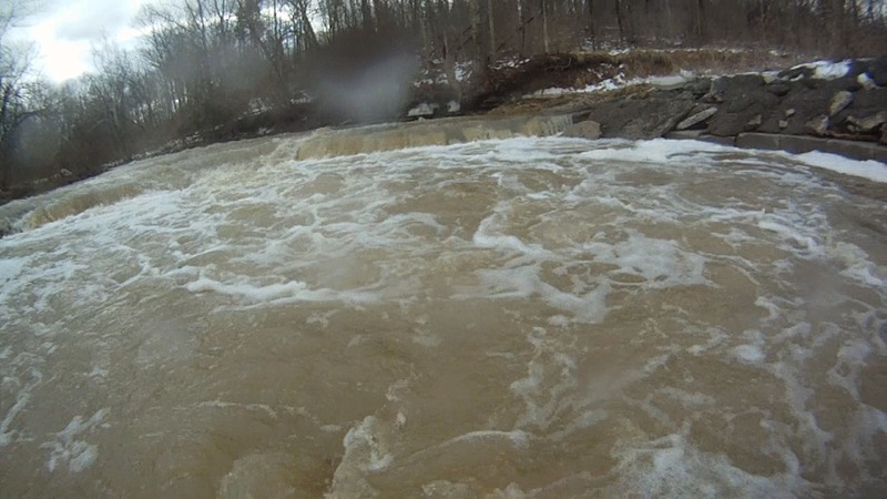
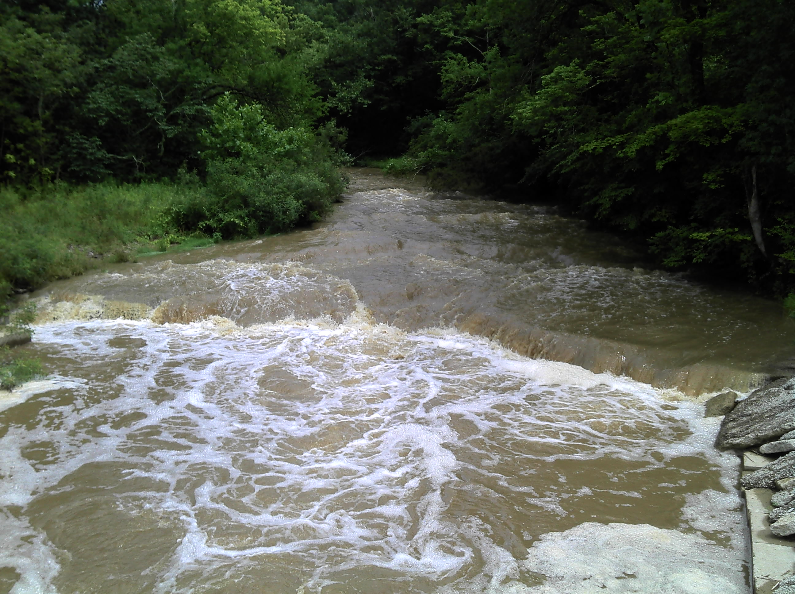
This creek needs a big storm. It starts out as a small stream rolling through the woods, then starts to drop over limestone ledges and even has some serious holes. There is an ever present risk of strainers so be careful.
It should be noted that the cited length of the run is a bit misleading. The listed mileage is just for Second Creek down to the confluence with Todd Fork. Actually, it is nearly another quarter-mile to the true confluence, since Second Creek runs parallel to Todd Fork (at what is likely to be an island at higher flows). However, there is no access/egress from there, so you will proceed down Todd Fork some distance. The take-out listed here is the take-out for the Todd Fork run (in Morrow), which essentially doubles the listed length, although there are takeout options before you get to that point.
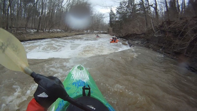
This has a similar character to First Creek. See also Todd Fork, since you will be running at least some stretch of that run. Obviously it would be easy to make a daily-double or -triple by setting up to run a combination of these in a day, since it is entirely likely (though not guaranteed) that if one is running, they all are.
Enjoy the following video of a run on this creek, with video ending at the Todd Fork confluence (courtesy Scott Puthoff via YouTube):

Drainage at our listed put-in (as calculated by USGS StreamStats 4.0 Beta software) is about 17.2 square miles. At the confluence with Todd Fork, it has increased to 20 square miles. After that confluence, Todd Fork has drainage area of 239 square miles. (You may have two rather different experiences, as flow from here down is likely nearly ten-times flow in the creek!) At the listed take-out, Todd Fork has 262 square mile drainage.
The largest ledge is about 100 yards below the road crossing.
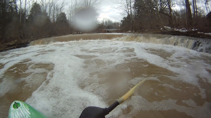
A fine ledge lies just upstream of this bridge, and another decent drop lies just downstream of it ... meaning this would e a great location to scout and verify flows for the creek as you are setting shuttle!
First Creek enters from river-left. It would be possible to exit the river here, or just continue a short distance to the listed take-out for the Todd Fork run.
Just past East Pike Street in Morrow, an old railroad bridge now serves as passage over Todd Fork for the multi-use Little Miami Scenic Trail. Parking is immediately adjacent, as well as a handy diner, making this quite an ideal take-out.
Feb 22, 2014
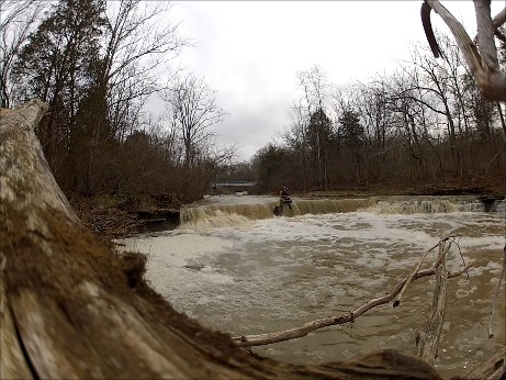
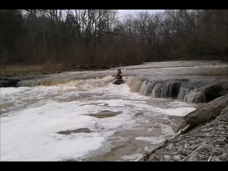
Second biggest ledge drop on the run. At this level (probably low), run it down the middle.
Feb 22, 2014
Some video: http://www.youtube.com/watch?v=1H6QnkwJ8D4
Feb 21, 2014
I'd concur with the above description above. We found the creek clear of strainers today. First Creek looked about as low runnable as you'd want and this was actually okay. Todd's Fork had a ton of water flowing through it as well and surprised us with some nice Class II wave trains. Better access than First - in fact, downright easy.