| Difficulty | IV(V) |
| Length | 9.4 mi |
| Avg Gradient | 85 fpm |
| Permit | Band Required! Stop by the store near the put in to purchase a $5 US Forest Service band. A new band is required for each day. The bands help the Forest Service track paddling use on the river, which ultimately may help justify additional releases. A portion of the proceeds also helps maintain access and pay for agency staffing related to the river. |
| Gauge | Cheoah River Nr Bearpen Gap Nr Tapoco, Nc |
| Flow Rate as of 42 minutes | 178 cfsbelow recommended |
| Next Release | Sat, October 24, 2026 |
| Reach Info Last Updated | July 10, 2026 |
American Whitewater began investigating the whitewater potential of the Cheoah River in 1999, and advocated for a controlled whitewater flow study in 2000, which formed the basis of the next 4 years of negotiating for releases, access areas, land protection, etc. Flows on this river were severely impacted by [...]Read More
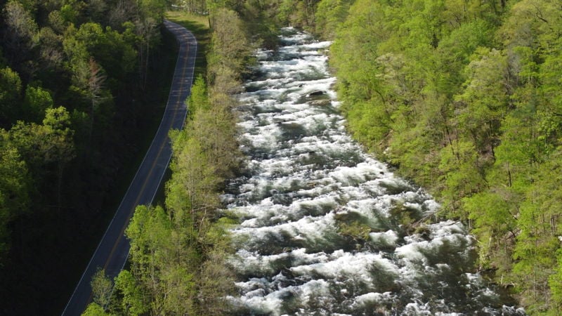
The Cheoah River is located in the extreme southwestern corner of NC, near Robbinsville. For 77 years the nine-mile section between the Santeetlah Dam and Lake Calderwood was dewatered. American Whitewater along with the Western North Carolina Paddlers advocated for releases for over 6 years. Whitewater releases on the Cheoah began in the fall of 2005. Each year there are at least 18 releases for paddlers to enjoy for the next 40 years.
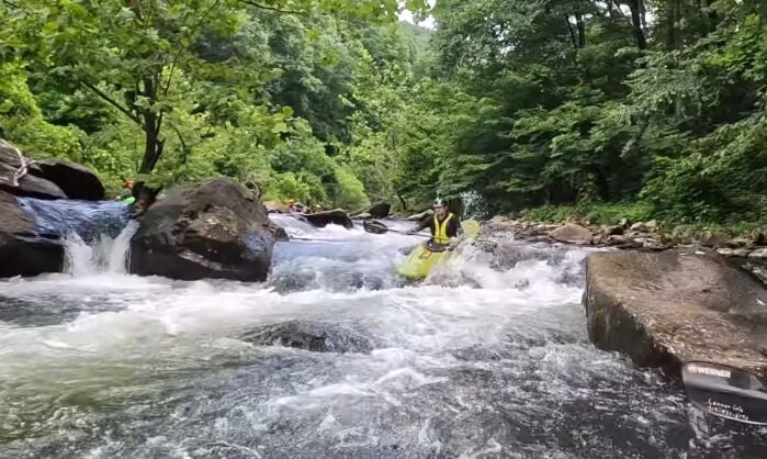
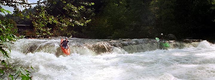
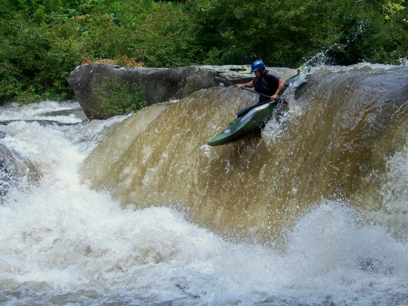
The Cheoah is unusual for rivers of its volume in the Southeast in that its gradient is relatively constant. This means that with the exception of 2 or 3 short lulls, it is unusually continuous, more so than anything else with a similar volume of water in the Southeast. Some call it 'warm western-style paddling;' those paddling it at the higher winter 2002 flows continued the Western analogies, comparing it to Pine Creek on the Arkansas and the Lochsa at high water. No doubt contributing to the analogies was the water quality, which was crystal clear during the winter flows. It has become a classic southeastern run, boasting the best Class IV-IV+ flow state available from any dam release in the east coast.
A Serious River:
At flows of 1000 cfs or less, the upper section is about a half grade, and the middle section, a full grade easier than the lower section. The upper section is harder and more serious than the Upper Ocoee. The middle section is similar in difficulty to the Classic section of the Ocoee, but the risks are greater, as much of the channel is heavily lined with trees and brush, giving the run a nature akin to paddling during a flood. The main technical challenge is presented by the frequent series of offset holes. Scouting is difficult as well, so paddlers need to be proficient at reading pushy water on the fly, or have a knowledgeable guide. As the Cheoah was dewatered for the better part of a century, there are trees growing throughout the streambed. This combined with the flus
...
There is a nice forest service put-in just down from the dam.
Nice pipe about 30 feet above the river with some very mellow fast moving current under it. The next time you see this sucker, things will pick up.
In the first mile and a half after some fast moving flatwater comes a three foot tall ledge. The middle has a rather strong hole with a major backwash at 1500 cfs. At 1000, the ledge can still throw boats vertical and recirculate swimmers. Fortunately there is a big eddy on the right to gather up gear. This rapid was run for the very first time during the Sept 17th release since this section was too over grown to be run during the test releases and the natural flows. Craik Davis helped with that cleanup effort that opened this up and was the first one over the top ledge on the morning of 9/17. He also got munched by the hydrolic & SWAM. The rapid is named in honor of his hard work and unfortunate incident that ended his run very early that day. FYI - Craik did have a successfull run of that ledge & the entire river during the Oct 1 release.
Glorious spin hole, righties and lefties, right next to the old gas station/grocery store.
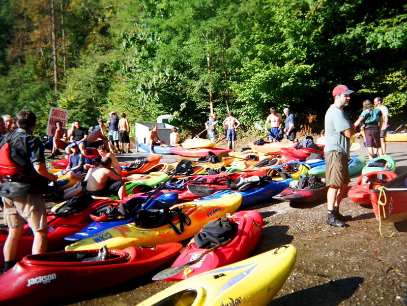
O'Henry's is the most popular put-in, perched right above the goods.
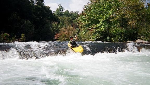
A great surf wave to clear the cobwebs, below the first stretch of good Class III downstream of O'Henry's.
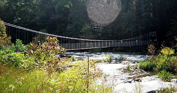
Below the first play wave the river immediately states its intent, and is packed with holes and waves down to and under the overhead pipe and under the swinging bridge. Lots of routes but in the end you're going to be in a big eddy with a blind horizon line just downstream. The holes get bigger and bigger as you approach God's Dam.
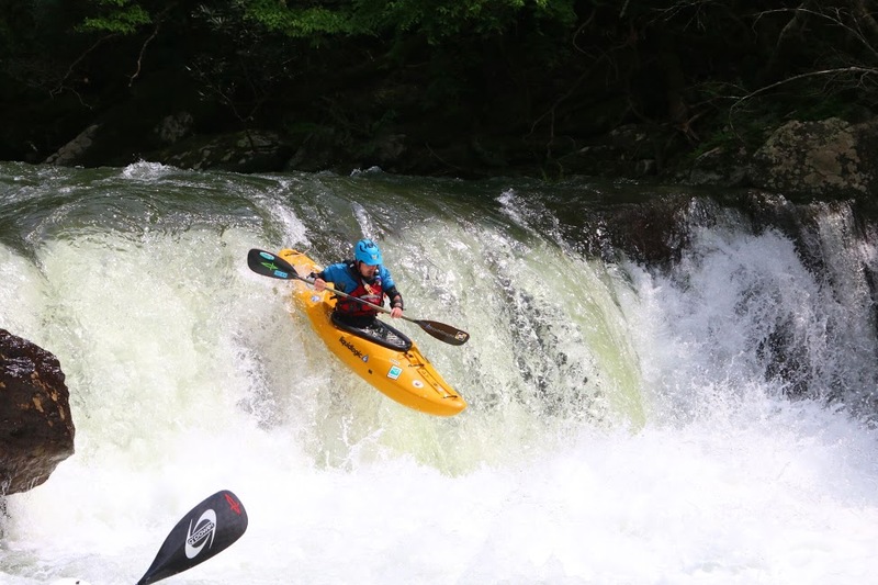
Below the pipe and swinging bridge, the Cheoah drops over a 4 foot ledge that very much resembles a low-head dam. The hole is dangerously retentive and more so as the level climbs. A pin rock left of center in the base of the drop creates more risk for missed boofs and surfs. Rescue and support is difficult but possible from the rock pile just downstream and river left. Send your strongest first and have them catch the eddy there in the event of a situation. The drop can be run left of center to right of center.
Immediately after God's Dam, the road pulls away from the Cheoah at a right-hand bend. Strainers fill the eddies and directly below lies one of the Cheoah's toughest and longest rapids. Takeout, named in honor of many Cheoah pioneers who ended their day early here.
Takeout is difficult to scout due to the brush lined banks that are littered with poison ivy.
Huge holes abound here. One of the large river left holes at the top of the rapid has a bad piton/pin rock to be avoided. Most run a narrow sluice on the right in between two exposed rocks before moving back left at the bottom.
In any case, be sure to scout this one before you launch; otherwise, it may force you to 'takeout' after being thoroughly hammered. At the bottom right of the rapid there is a good spot to exit the river, usually marked by a plethora of on duty rescue folks.
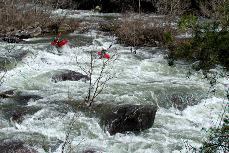
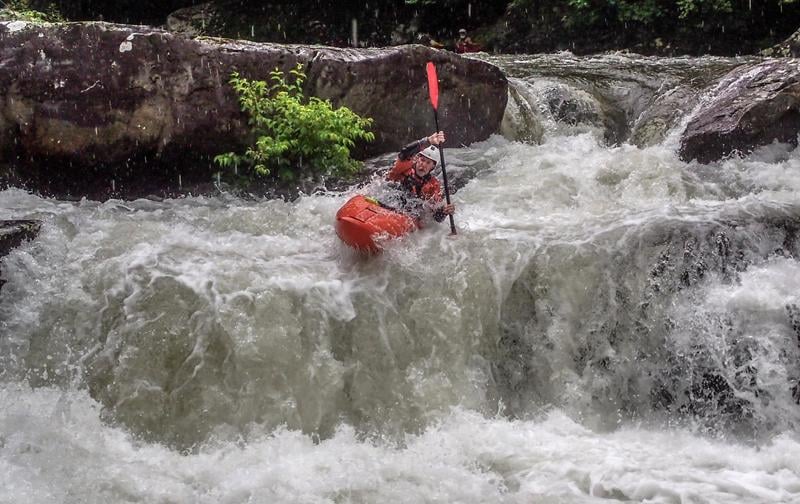
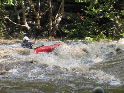
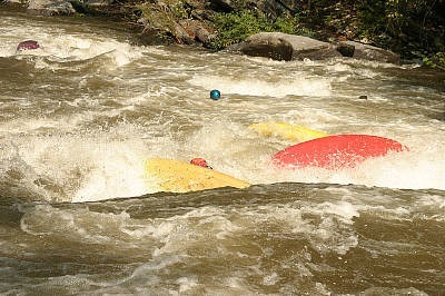
The so-called Land of Holes is a three-quarter mile section of continuous Class III-IV whitewater with few eddies and no respite. I think Land of Holes is one of the very best parts of the Cheoah. Not much beats long, beautiful, and continuous Class IV boogie water. The top harbors several successive, chunky ledge holes, the second of which can be avoided hard left.
Pretty much the only big patch of calm water on the entire run at levels of 1500 and 1000. THE Eddy is in a right hand bend of the river.
Take the left channel, even when it looks like most of the flow goes to the right, unless you like bushwhacking.
Once you see the next bridge, be ready for the Cheoah's final 2 mile mad dash to the lake. This signifies the start of the lower portion of the Cheoah, where the rapids will accelerate back up to IV-V and soon plunge through a large and very long Class V rapid. This is also an alternate put-in for the Lower Cheoah.
One of the best play spots on the entire river is about a quarter mile past the bridge. Big eddy on river left and a riverwide wave. The wave is a bit flushy in the middle but will give up lots of good moves if you have the skills.
The entrance rapid to Bear Creek is nearly as difficult as the drop itself. Its best to grab an eddy at the top of the approach, to scout the approach, the falls, and the hole at the bottom of bear creek. The Entrance is long and pushy, and suprisingly steep abounding with large waves and holes. The horizon line downstream is the big drop. Routes vary dramatically depending on levels, but at most flows you can catch one last eddy above the falls on the right.
The big drop on the run, immediately below Chaos and right above Python. Roadside pullouts provide viewing and scouting opportunities for the entire set. Run the single drop middle or the double drop just to the right. Paddlers generally avoid far right and definitely avoid the left at anything but high water. Contain your group thoughtfully through here, and clean up messes quickly as Python is just downstream.
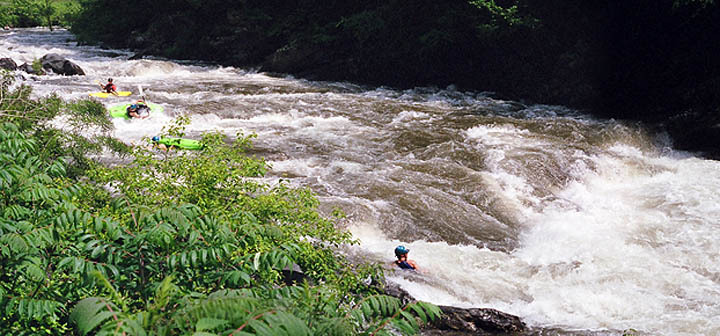
Python consists of the long rapid on the right side of the island downstream of Bear Creek Falls. A classic s-turn from right to middle and through a flushy hole leads through more boogie and into a double ledge, the larger and second of which is perhaps the most hazardous spot on the river. The hole, backed up by a rock, is very retentive and almost impossible to set safety for. Paddlers are on their own in here, but it still helps to keep an eye on each other. Eddies on the left bank below the s-turn allow a more measured descent, with even a back-door exit out of the third eddy to avoid the double ledge all together. Scout from the road and understand that 3 people have lost their lives in this rapid, all very skilled paddlers.
The sneak to Python, and what many consider to be a fun line in its own right. Push hard left of a boulder and island below Bear Creek Falls into a tight channel with at least as much rock as water. Rejoin the main flow downstream of Python into more good boogie water.
The rapid alongside Tapoco Lodge is one of the river's best; it funnels into a great playspot almost parallel to the lodge. Below it, enormous waves continue until under the bridge. At 1000cfs, the left channel offers a couple boofs and holes, and right channel is the less technical option.
After the river crosses under the bridge, it drops into a steep, beautiful mini-gorge. At this point you have 3/10s of a mile before you hit the lake. The first thing you'll notice going under the bridge is that the river goes to one third its previous width. You'll also notice that the bottom is about to drop out, again. Four strong Class IV rapids are hidden in this dark little corner of the run. Just below the bridge are two large (huge?) back to back holes. There is some eddy service below both of them to gather things up. After that are two more big drops then a couple of easy class 3's before you hit the lake.
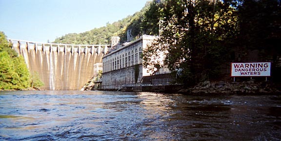
Notice that the water temp in the lake is about 20 degrees colder than the river temp. This is due to the bottom drawn water coming thru the hydro-power station. Also, note Cheoah Dam, where Harrison Ford's character jumped off of in 'The Fugitive.'
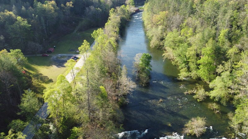
Paddle about a quarter mile down the lake. There is a boat ramp that will be obvious.
Jul 5, 2023
Check out River Kings Video of this run at ELF (extreme low flow)
https://www.youtube.com/watch?v=zhZfETIKc\_M
I've been doing this run since I invented it in 2007. People first thought I was crazy, but over the years I've probably taken close to 500 people down this run at this level. You can go as low as 100 cfs. (and I've done it down to 75, but don't recommend)
I tried to contact that 'powers that be' so to speak the Cheoah Streamkeeper and advocate that this river SEVERELY needs to be broken into sections, but was met with nothing but dismisive rebuttle.
There are some rivers that get very bangy and boat abuse when they're low, THIS ISN'T ONE OF THEM. The bottom section chanels out brilliantly. At this level, it is the single best river I know for introducing people to creeking.
The put in is the second cement ramp, and you paddle down to the normal lake take out.
lat/lon put in: 35.4331769, -83.912124
Google map:
Dec 9, 2018
Here's a video of the last 2 miles of the run: https://www.youtube.com/watch?v=LMbbh7QwIPk&t=1s
Mar 5, 2018
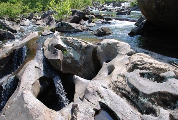
A large pothole exists below the right edge and downstream side of the large rock that divides the river in the first ledge below Bear Creek Falls. Its opening is keyhole shaped and approximately 2' wide at its top, pinches in a bit, then widens at its base to 4'. It varies in depth from 7' at its top to 4' at its lower end. The shadowed area in the upper right corner of the photo is looking upstream at the river-right side of the large rock. Something to be aware of.