Money Creek
Upstream of Money Creek Rd. Bridge
| Difficulty | IV-V |
| Length | 3.2 mi |
| Avg Gradient | 275 fpm |
| Gauge | South Fork Skykomish River at Skykomish, Wa |
| Flow Rate as of 17 minutes | 375 cfsbelow recommended |
| Reach Info Last Updated | February 24, 2002 |
The Skykomish River is one of the nation’s premier whitewater destinations. Rising in the high country of the North Cascades, the river and its tributaries attract paddlers from across the country and around the world. The Washington State legislature recognized the river’s outstanding qualities by designating the Skykomish as [...]Read More
SEASON: Fall rains and spring snowmelt
FUN FACT: One big boulder garden rapid.
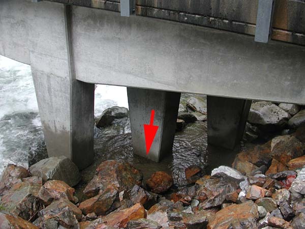
TAKEOUT: Turn onto NE Old Cascade Highway from Hwy. 2 at mile
45.9 (you'll see the sign for Money Creek campground). Follow this road
0.9 miles to Miller River Road (FR 6410). Drive 100 yds. then turn right
onto Money Creek Road (FR 6420). Follow this to mile 0.6 and the takeout
bridge across the creek (elevation 980'). Check road conditions with Mt. Baker - Snoqulamie National
Forest; follow link to the forest road conditions report under the
recreation link.
PUT-IN: From the takeout continue up to any place with good access
near mile FR 6420 mile 3.7 (elevation 1700').
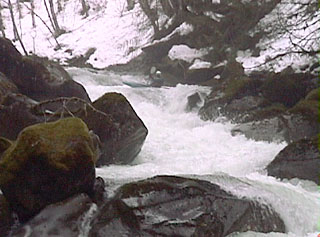
DESCRIPTION:
Most of the run is a big long boulder garden that can be scouted from
the road to the put-in. The middle part of the run requires some precise moves through tight chutes. Beware of log and culvert (that have washed into the river) hazards. Near the end of the run the gradient tapers off a bit as the river settles on to the Skykomish valley floor. This section contains excellent continuous class IV water for nearly a mile that is easy to boat scout.
lat/long approximate by Tiger server
for additional information see: