Klamath
10. Happy Camp to Coon Creek
| Difficulty | III+(IV) |
| Length | 17.9 mi |
| Avg Gradient | n/a |
| Gauge | Klamath R Nr Seiad Valley Ca |
| Flow Rate as of 1 hour | 1090 cfsrunnable |
| Reach Info Last Updated | July 25, 2025 |
Restoring the Klamath River: A Historic River Reborn The Klamath River now flows freely for the first time in more than a century. The removal of the four lower Klamath dams—J.C. Boyle, Copco 1, Copco 2, and Iron Gate—marks the most ambitious river restoration effort in U.S. history. For [...]Read More
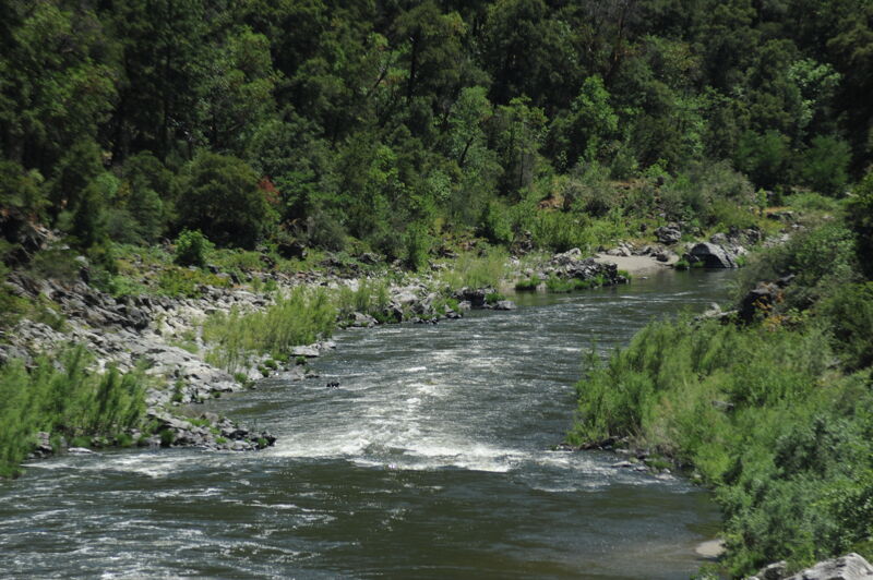
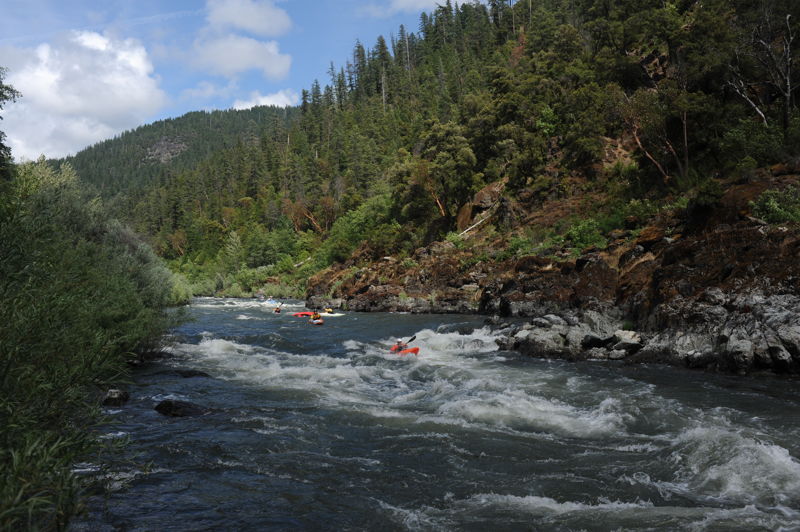
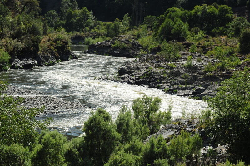
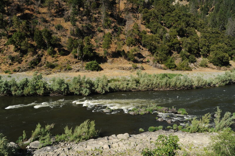
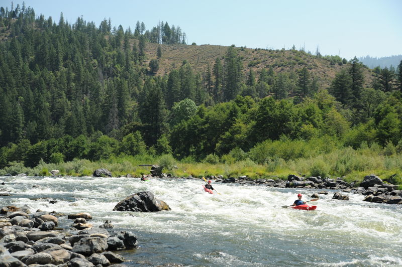
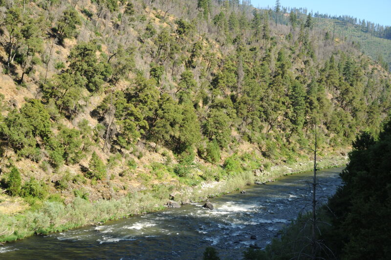
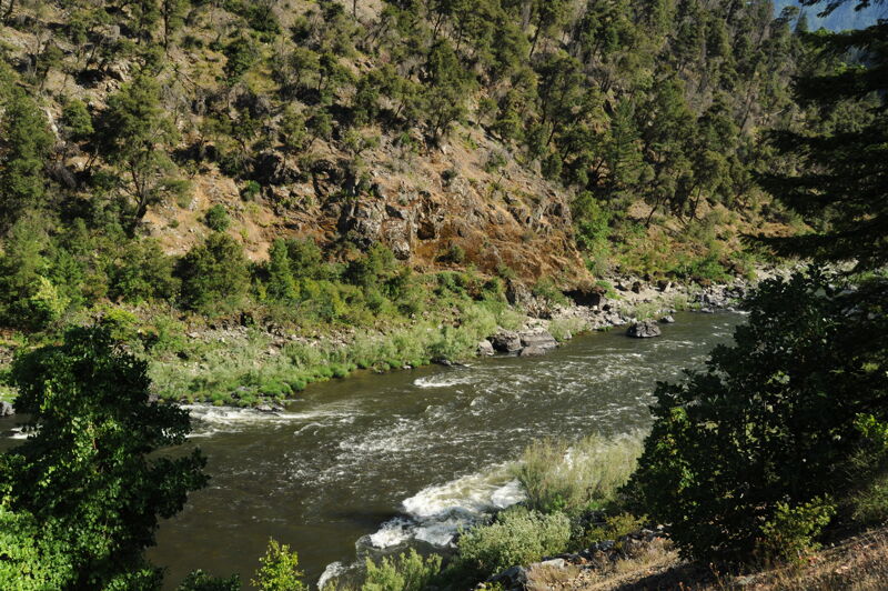
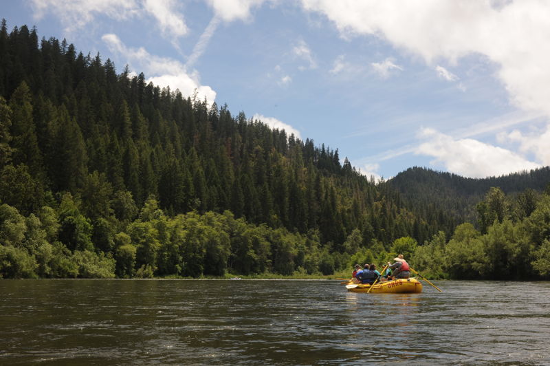
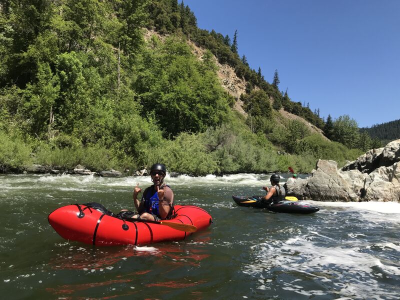
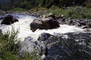
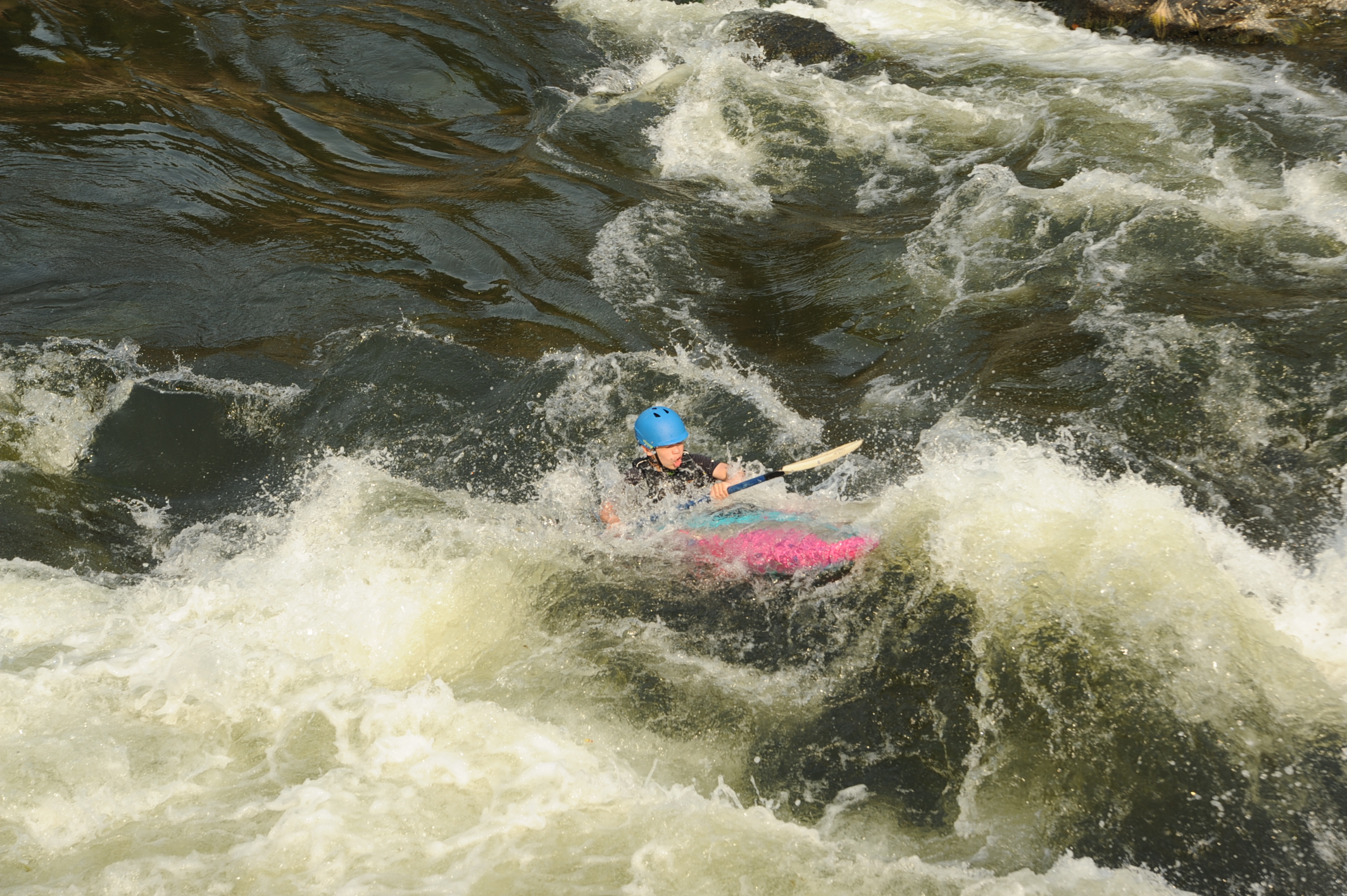
Big water rapids, warm water, and minimal hazards are the trademarks of the Mid Klamath in summertime. Most rapids are class II wave trains with a few larger rapids thrown in to spice things up. The exception is class IV Dragon's Tooth which loves to flip rafts but doesn't pose too much of a hazard.
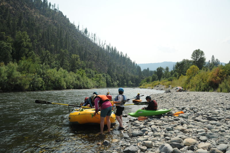
Year-round flows make the Klamath a popular option for summer boating, offering a variety of day trips or multi-day car- or boat-supported trips. Highway 96 parallels the river but is often out of view, and the scenery is very nice. Wildlife are abundant with eagle and osprey sightings being common, as well as otters, black bear, and elk. Seventeen miles below Happy Camp, Ukonom Creek is a popular side hike with lush vegetation and a beautiful waterfall.
Ceremonial Use of the Klamath River and Temporary Closures in Summer
Each summer, the Karuk Tribe conducts important ceremonial practices along the Klamath River. During these times, the Tribe asks for privacy on specific stretches of the river and at certain river access sites. While the U.S. Forest Service issues official closure orders to help support this need, those orders alone do not fully reflect the Tribe’s need for uninterrupted privacy during ceremonies.
To honor and respect these cultural traditions:
Please plan your trip accordingly and honor the Tribe’s request for privacy during these
...
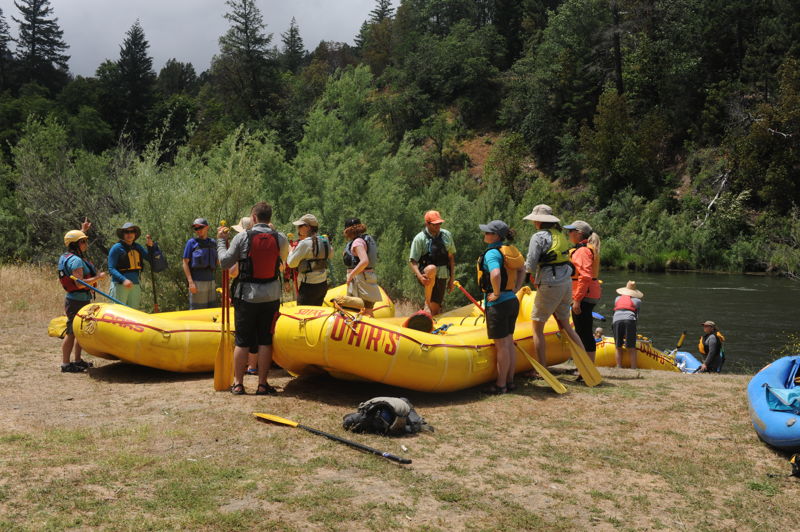
This is a primary access point in the town of Happy Camp on river right immediately downstream of the confluence where the Indian Creek joins the Klamath River at Highway 96 mile 41.0. The large gravel bar provides plenty of area for staging and getting ready for a trip. The site is managed by the Forest Service and includes a vault toilet and offers good parking on a bench slightly above river level. More information at https://www.fs.usda.gov/r05/klamath/recreation/indian-creek-river-access.
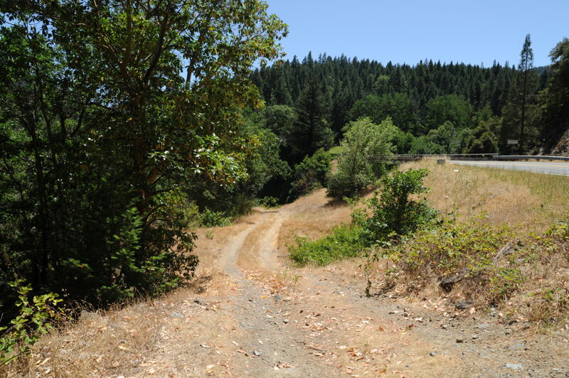
Curly Jack Access is a day use area in the Curly Jack Campground located on river left downstream of Happy Camp. The launch area has a good bench and open area for staging gear. Boats need to be carried approximately 50 yards from the parking area. The access to the river is a steep bank at a break in the willows with space for no more than two rafts to launch at a time.
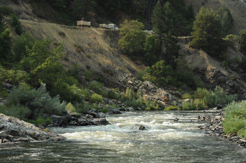
The first of the bigger rapids on this section. Look out for the hole right of center. The move around the right side if a little more technical. The river left line is less technical and more open. You can scout this one from Highway 96 mile 36.9.
This access serving as a popular take-out for day trips launching from Happy Camp is located at Highway 96 mile 33.9. There are no amenities at this Forest Service-managed site, though it offers ample parking both near the highway and down on a lower bench. The lower bench also provides some opportunities for dispersed camping. A short but steep drive leads to river level, though walking gear down is relatively straightforward. More information at https://www.fs.usda.gov/r05/klamath/recreation/wingate-bar-river-access.
Wingate Bar is temporarily closed to boat launching each year during Karuk ceremonies. During these times, boaters should also not float past Wingate Bar, even if launching upriver at a different access site. Dates vary annually but are usually in July or August. See the guidelines in this run's river description above and check the alerts section of the Klamath National Forest website for current closure information: https://www.fs.usda.gov/r05/klamath/alerts.
This access is located at Highway 96 mile 32.7. A small pullout on the upstream side of the Clear Creek confluence on river right provides a short trail down to the creek. This is not a developed site and is generally not used as a primary river access for boats but hand-carry craft can access the water here.
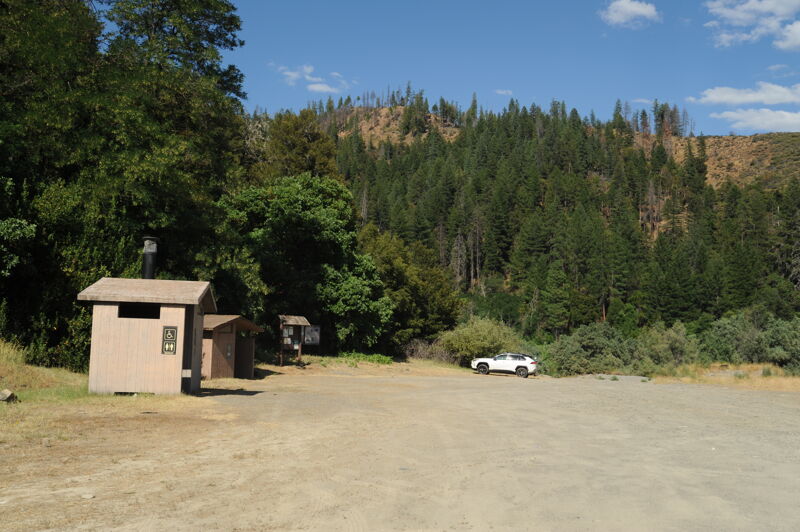
This access is located at Highway 96 mile 30.1. This Forest Service-managed site is reached via a short gravel road that descends to river level. Though the road has potholes, a carefully driven passenger car can navigate it. There is a toilet and dispersed camping is available. The site has ample parking. River access requires a short carry across the gravel and sandbar. More info at https://www.fs.usda.gov/r05/klamath/recreation/ferry-point-river-access.
Ferry Point is temporarily closed each year during Karuk ceremonies. During these times, boaters should also not float past Wingate Bar, even if launching upriver at a different access site. Dates vary annually but are usually in July or August. See the guidelines in this run's river description above and check the alerts section of the Klamath National Forest website for current closure information: https://www.fs.usda.gov/r05/klamath/alerts.
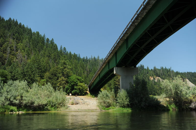
This access is located at Highway 96 mile 28.5. On the downstream river right side of the bridge, a short gravel road switchbacks down to a small parking area. From there, it’s a short carry over the gravel bar to the river. There are no amenities at this Forest Service-managed site, but a small rest area with a toilet is located upstream on the river right side of the bridge at highway level. More information at https://www.fs.usda.gov/r05/klamath/recreation/independence-rest-area-river-access.
Independence River Access and the area around its namesake creek are temporarily closed each year during Karuk ceremonies. During these times, boaters should also not float past Wingate Bar even if launching upriver at a different access site. Dates vary annually but are usually in July or August. See the guidelines in this run's river description above and check the alerts section of the Klamath National Forest website for current closure information: https://www.fs.usda.gov/r05/klamath/alerts.
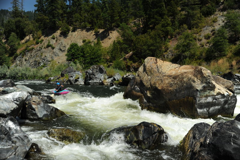
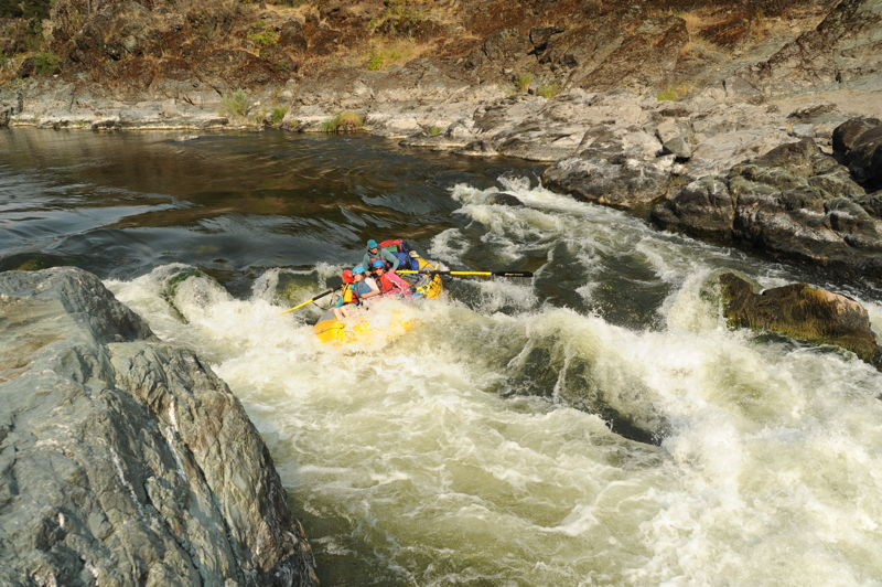
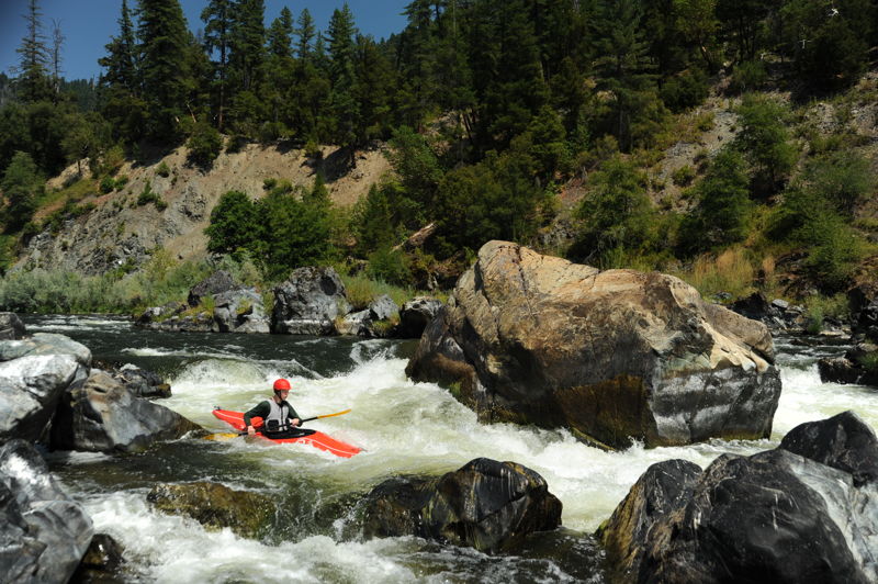
This is the biggest and most problematic rapid in this section of the Klamath. The Dragon's Tooth is a large rock outcrop in the middle of the river. Smaller outcrops clutter the sides and direct river traffic towards the tooth. Kayaks have a choie of lines--either right or left. Rafts generally go left of the main rock, the Dragon's Tooth. It's a tricky move.
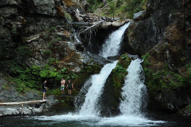
Ukonom Creek comes in on river left. It is a popular side hike up to swimming holes and waterfalls. There is also a good campsite at the mouth of the creek.
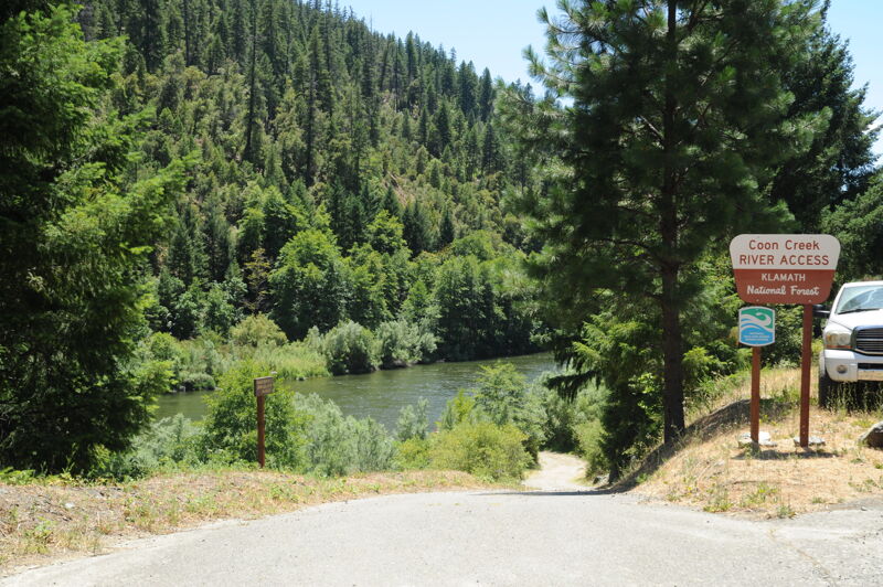
This access is located at Highway 96 mile 23.8. A one-lane paved road descends to river level, where there is a narrow staging area and sand ramp suitable for loading or unloading one vehicle at a time. Parking is located up near the highway. There are no amenities at this Forest Service-managed site. More information at https://www.fs.usda.gov/r05/klamath/recreation/coon-creek-river-access.
Jun 11, 2022
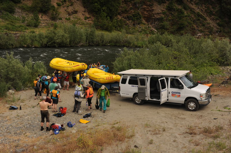
The Pacific Chapter of the River Management Society hosted a trip from Curly Jack to Wingate Bar Access following a day of presentations on Klamath Dam removal and restoration of the Klamath River. The trip included river managers from several of the major river systems on the West Coast and partners who have been involved in dam removal.