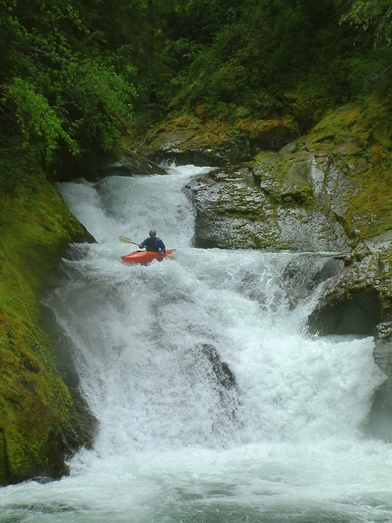
McCoy Creek
milepost 8 to Yellowjacket Creek

| Difficulty | V |
| Length | 7.1 mi |
| Avg Gradient | 200 fpm |
| Gauge | Cispus River Ab Yellowjacket Creek Near Randle, Wa |
| Flow Rate as of 45 minutes | 401 cfsbelow recommended |
| Reach Info Last Updated | June 1, 2019 |
Washington’s legendary volcanoes – Mount Rainier, Mount St. Helens, and Mount Adams – are the source of wild, free-flowing rivers and streams that cascade over big drops and through deep basalt canyons on their way to the Columbia River. Rivers like the Clear Fork of the Cowlitz, Cispus, Green, [...]Read More
check out the McCoy Creek page on Jason Rackley's site.
Also check out the article from the AW Journal: click here.
NOTE: As of 5/24/11 there were approximately 30 wood portages on this creek. Not recommended until a big flood washes some of that wood out.
As of June 2018, the run was reported as having cleaned up significantly.