Clackamas, Oak Grove Fork
Lower Five Miles to Clackamas River
| Difficulty | III-V(V+) |
| Length | 5.2 mi |
| Avg Gradient | 132 fpm |
| Gauge | Oak Grove Fork at Ripplebrook Campground, or |
| Flow Rate as of 54 minutes | 103 cfsbelow recommended |
| Reach Info Last Updated | June 23, 2025 |
The Oak Grove Fork of the Clackamas is one of the main tributaries of Timothy Lake east of Estacada and it is a significant component of the hydroelectric projects on the Clackamas River. After leaving Timothy Lake, the Oak Grove Fork flows almost 10 miles (diverted once for another hydro-electric project) before being impounded a second time by the dam that forms Harriet Lake. From there, a significant portion of the base flow is diverted for the 3 Lynx hydro-electric plant on the main Clackamas River. Other than base fish flows, the section from Harriet Lake to the confluence with the Clackamas River near Ripplebrook only has boatable flows when rain causes the dam to spill water.
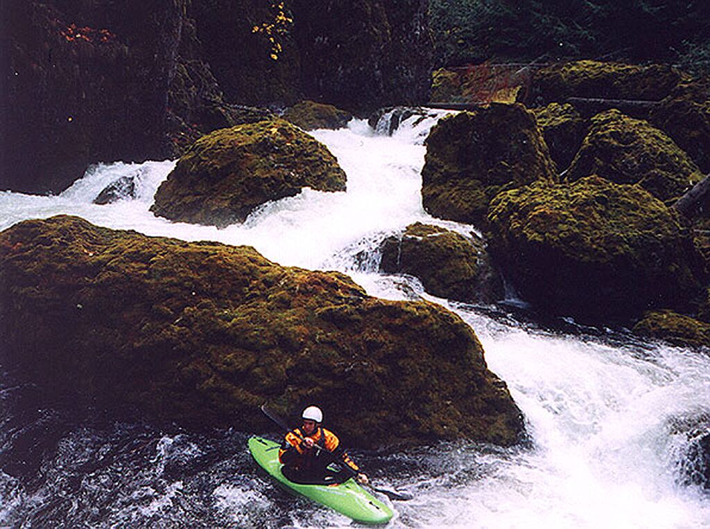
This rarely boated section of river consists of a challenging upper section and a Class 3 lower section. The lower section has had a significant amount of wood hazards on the few known descents. The upper section consists of several Class 4-5 drops before boaters reach Crack in the Ground Falls. Crack in the Ground consists of several big ledges between narrow walls. It is marginal runnable if it doesn't have wood but the vast majority of boaters should look to portage on the left. It should be noted there is a relatively recent hydro-electic station on the right which may complicate a portage or it may provide easier access.
Below Crack in the Ground is a short section of river with a few rapids before boaters reach Barrier Falls which can be scouted and/or portaged easily on the left. Below Barrier are a couple more fun rapids before the gradent decreases and the river takes on more of a Class 3 feel. Depending on flow and the current wood situation, this section could be either pleasant fun or a painful slog of portages. Take out at the Hwy. 46 bridge as the section below the bridge has fish habitat wood that makes it essentially unboatable.
See the description of a flow study, conducted 10/24/01, on Jason Rackley's excellent
...There is no official put in here and there might be limits on how close boaters can get to the dam. On one of the exploratory trips, boaters were able to reach the river down a steep gully next to the dam and put in right at the base.
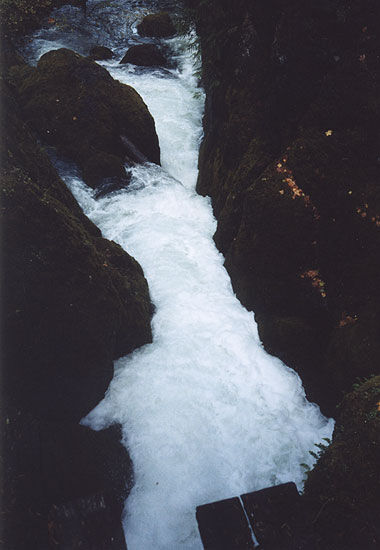
Very dangerous falls with multiple powerful ledges and narrow drops with potential wood hazards. Portage left.
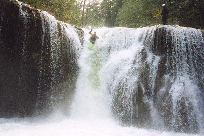
Easy to scout/portage on the left.
Jun 23, 2025
Jun 6, 2017
On 6/5/17, paddled from the confluence with Shellrock Creek 2 miles down to Harriet Lake (above this run). Much of this run is visible from the road or with a short walk into the woods. Very continous Class II, with a couple of Class IIIs at about 600 cfs outflow from Timothy Lake with only one mandatory portage in the first mile, followed by numerous portages in the last mile to the lake including a giant, difficult logjam. I highly recommend getting out after the bridge at the Harriet Lake cutoff. The continous gradient in the first mile makes for few eddies and should be approached with extreme caution.
Rob Cruser