Yuba, North
3. Goodyears Bar Bridge to Hwy 49 Bridge(Maytag Run)
| Difficulty | IV |
| Length | 9.2 mi |
| Avg Gradient | n/a |
| Gauge | N Yuba R Bl Goodyears Bar Ca |
| Flow Rate as of 1 hour | 171 cfsbelow recommended |
| Reach Info Last Updated | March 7, 2023 |
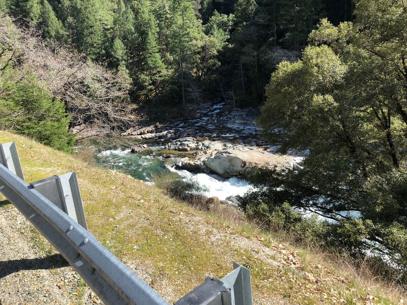
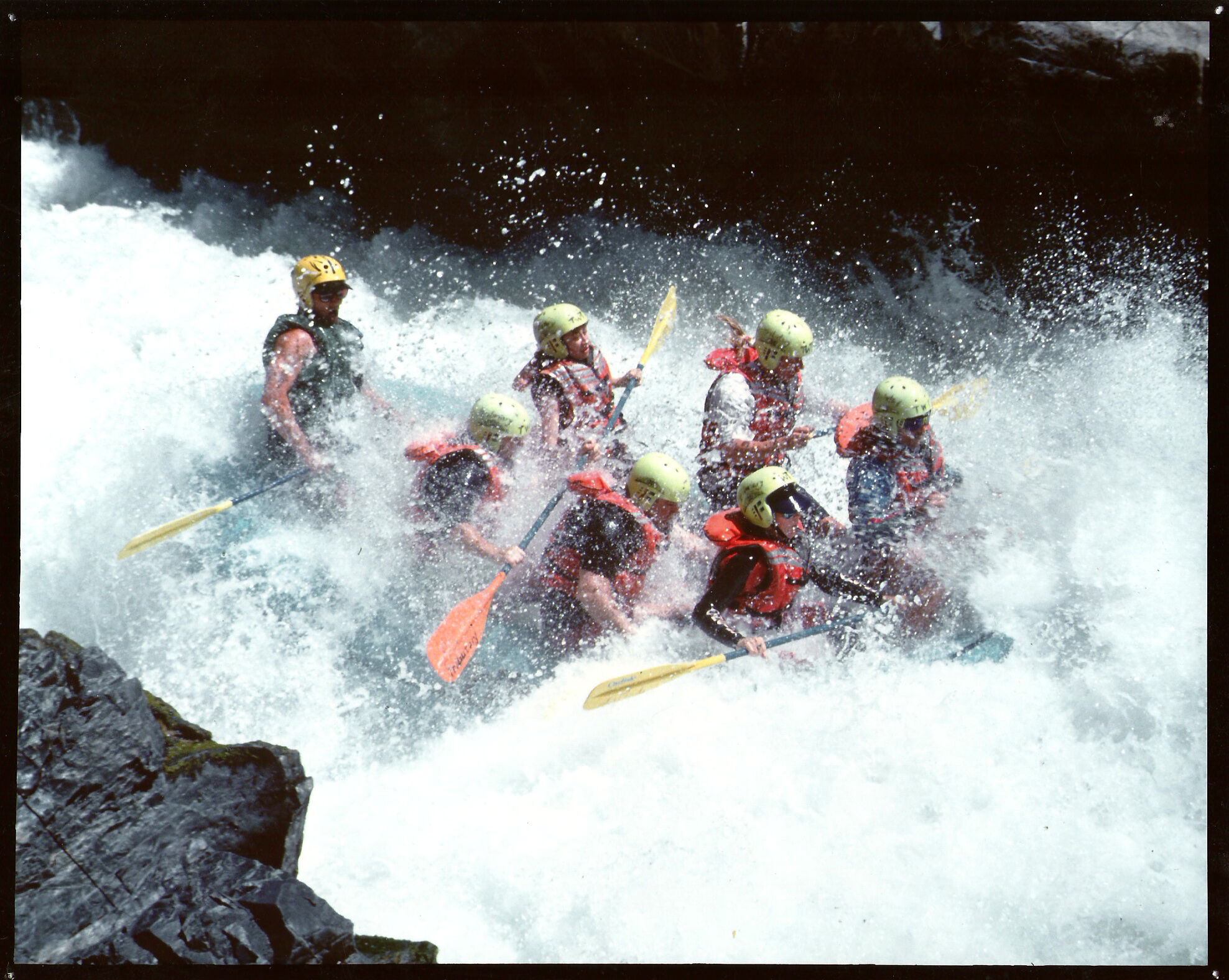
This wonderful section of clear California whitewater is popular with rafters and kayakers. Gorgeous oak trees lining the shores of the North Fork Yuba river combine with melting snow from the high mountain passes to make granite pool drop rapids.
Put in at Goodyears Bar necessitates a slow drive over the bridge and down the road to the put in.
Be courteous and conscientious at the Put in here in Goodyears Bar please.
There are many great rapids in this section.
Maytag gets your attention. Scout from river left, head's up for Son of Maytag.
Wild and Free may the North Yuba River always be!
Other Information Sources:
California Whitewater by Jim Cassady & Fryar Calhoun - ISBN-10: 0961365021
Best Whitewater in California by Lars Holbek - ISBN-10: 0966528905
Yuba North Fork near Goodyear Bar cacreeks.com
May 10, 2001
Posted to Boater Talk, 5/9/2001, by John Lester:
From the Gold Country Paddlers Listserver.
On Monday May 7, a GCP kayaker was trapped and killed on a hidden log strainer in a relatively benign Class III rapid on the Union Flat section of the North Fork of the Yuba. The rapid is located approximately 1.5 miles down river from the Union Flat Campground. For reference, the rapid is located
and can be scouted by hiking down from the Apple Orchard at the 20.9 mile marker on Hwy 49. From the river, the location has been marked on river right with a red plastic construction ribbon tied into a tree approximately 10 to 15 yards above the hazard in a dead tree snag that is about 6 feet above the water level. The strainer may not be visible as the water is rising from our run on Monday. The strainer is approximately 1/4 to 1/3 of the way into the rapid, in the center of the rapid. Out of our group of 5, I was the only one to notice a sharp pointed object (what I thought to be a rock, but upon recovery of the body turned out to be a tree). It is hard to spot, at our flow it was about six inches out of the water in a wave train section down the middle of the run. As of today, the hazard is at water level, with a small rooster tail. The rapid is entered as a right turn with a large rock island on river left with lots of dead trees and is about 50 yards long.
This rapid looks like any number of similar rapids above and below this section on the NF of the Yuba. Please be careful and be aware there is a potential death trap waiting to claim another unsuspecting paddler.
We are preparing a detailed reported of the accident and will post it upon completion. Please pass this along to any and all paddling buddies and groups to prevent any additional tragedies.
John Jerger & Craig Eneboe
Jan 1, 1900
Goodyears Bar run, view of Maytag from Highway 49.