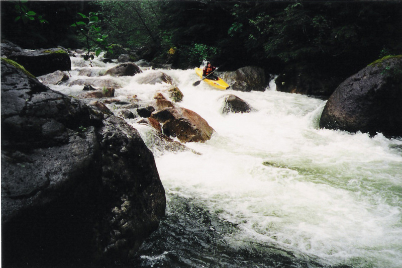
Pratt
Kaleetan Creek to M.F. Snoqualmie

| Difficulty | IV |
| Length | 6.2 mi |
| Avg Gradient | 190 fpm |
| Gauge | Pratt River (estimated) |
| Flow Rate as of 30 minutes | 39 cfsbelow recommended |
| Reach Info Last Updated | June 14, 2007 |
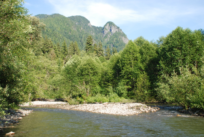
One of the most significant outdoor recreation areas close to metropolitan Seattle is the Middle Fork of the Snoqualmie River. Less than an hour drive from downtown, the valley is accessible to a population of over three million people and attracts visitors from across the country. Few places in [...]Read More
SEASON: November rains and spring snowmelt.
FUN FACT: The most convenient overnight exploratory to Seattle
CURRENT ISSUES: Future management of the Middle Fork Snoqualmie is currently being discussed by several regional user groups and agencies. Check [MidFORC's web page](http://
www.midforc.org) for the latest news. The mid-elevation forest here is known for it's high quality bear habitat.
LOGISTICS: To reach the river take exit 33 off I-90 and head north on 468th Ave. past the truck stop. The Middle Fork Road (FR 56) turns off to the right in 0.5 miles. At mile 5 on the Middle Fork road you will cross the river at Concrete Bridge. Continue on to mile 8.7 and park across from the confluence with the Pratt River (if the weather is clear you should be able to see the Pratt River valley off to the south as you're driving). The parking area is marked by some concrete barriers and you have to ford a small stream and hike a couple hundred yards out to the gravel bar. Finding your way to the trail on this run can be a bit tricky (a topo map is helpful). You will need to bush whack from the road to the Middle Fork and ferry across to the other side. Try to ferry over to just below where the east ridge of the Pratt meets the Snoqualmie and the Pratt valley. Here the trail is squeezed between the river and the ridge, so hopefully it will be easier to find. Once on the trail, it veers to the south and begins going up the valley. Staying on the trail will be difficult at first as the unmaintained trail makes it way through a wet land. Good news is this section makes for some really easy boat dragging. Soon the trail consolidates though as the bottom lands are left behind. Then it's just a long slog up an old skid road, with some steep switch packs about half way, to Kulla Kulla creek. This trip is typically done as an overnight where you hike in one day and then paddle out the next.
DESCRIPTION:
The Pra
...