Sugar Creek
Darlington (1.2 miles)
| Difficulty | I-II |
| Length | 1.1 mi |
| Avg Gradient | 10 fpm |
| Gauge | Sugar Creek at Crawfordsville, in |
| Flow Rate as of 53 minutes | 110 cfsbelow recommended |
| Reach Info Last Updated | December 17, 2019 |
One testament to the popularity of this river is the fact that a number of canoe liveries and campgrounds are scattered along the river. Another testament is the various conflicting assertions we've received regarding where put-in and take-out 'should be', and where whitewater boaters might find the 'best' features or run to focus on. As a result, we have laid out a wide variety of access points, allowing for trips of various lengths, to suit a wide variety of paddler preferences.
Gradient is never really more than 10-15 feet per mile (and generally less than that). By virtually all reports, the rapids are pretty much wide-open wave trains (at least, at good flows ... at lower flows there may be some rock-dodge areas). The biggest hazard is likely to be deadfall and snags (trees and branches) in the river, as well as occasional bridge piers (which may also accumulate wood from time to time). The combination of this data (and input we have received) suggests the river is runnable though a wide range of flows, depending upon boater's experience and awareness of the increased power of higher flows and the attendant increased risk.

According to a 'Report' (see 'User Reports' tab), this is 'rough access and is posted with signs'. (I.E., no trespassing).
According to a user report (See 'User Reports' tab), this may be best put-in. HOWEVER, apparently it has been posted with no trespassing signs. It may be possible to talk with the landowner to receive permission to launch, but (failing to get that permission) it may be best to use other access point(s).
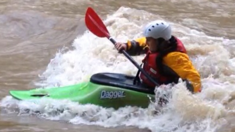
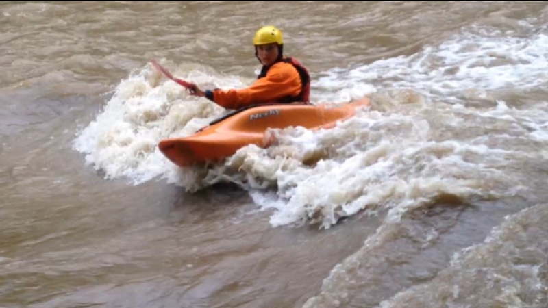
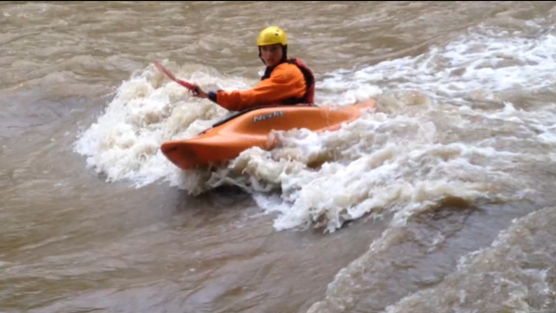
Paddlers often opt for a put in above this old RR trestle (from the river left side). There are several excellent play waves just downstream from the trestle at levels above 3' (or above 1000 cfs) on the USGS gauge.
(Probably don't want to take out here ... a nice bit of gradient lies between here and next access at a scenic covered bridge.)
Drainage area at this location is approximately 320 sq.mi. (as calculated via USGS StreamStats Beta software). This is about 5/8ths the drainage at the listed gauge, thus flow in the upper portion of the river (on average) could be on the order of 0.6 times the gauge reading.
A fine short run (~1 mile) is just putting in here, taking out at CR175E.
At 4 ft (2820 cfs) on the Crawfordsville gage, this is one long (approximately 1/2 mile) wave train with 3 ft standing waves.
At 2.3 ft (616 cfs) on the gage, expect to scrape (there won't really be much to surf).
Look for a minimum of 2.8 ft (1090 cfs) on the gage.
(NOT an access point, just a progress-marker/waypoint.)
Gauge is just above dam upstream of Hwy.231 in Crawfordsville. It lists 509 square miles drainage at that point, and shows elevation of 657.34'.
This is dam (at the coal power plant, just upstream of the Hwy.43/231/Washington Street bridge) is a 'drowning machine'. Portage on river right.
Nov 1, 2021
Update - the put-in at 1200 N is rough access and is posted with signs. The best put-in is at 950 E but as of this summer is posted with no trespassing signs as well. We have received permission to launch here before but were unable to make contact with landowner this fall. There is no put-in at the railroad bridge so do not waste your time.
There is a large pile of wood building up under the railroad bridge as of 10/31/2021, so do be cautious through there.
Crawfordsville USGS gage is down (maybe due to dam removal) so I've been using Thorntown USGS gage. Have run this stretch at 1500 cfs up to 1800 and flow was great.
Jun 5, 2014
Really nice wave. It changed slight as the water rose from about 1200 to maybe 1700 while there. (I guess that was 3 ft to 4+ On the usgs gauge). The wave got wider and the foam pile got better as the river came up. Long feeder eddy. Hard to miss the eddy. Nice spot. 6-4-14
Apr 29, 2009
My buddy James & I had a great day on Sugar creek near Darlington on Sat. The level was around 800cfs. This is a good mid to low class 1 level with very nice surfing. We put in at County line Rd. between Darlington and Thorntown and took out at the covered bridge just west of Darlington. The upper part of this reach has some flat parts with riffles and some small rapids. The 'good stuff' kicks in at the RR Bridge, with some other class 1 stuff later. If you just want to surf and play then just put in at the RR Bridge and maybe look for higher levels (above 1000cfs).