Robinson Creek
Kelly Rd to W Pine Hill Rd (4.9 miles)

| Difficulty | I-II(III) |
| Length | 6 mi |
| Avg Gradient | 14 fpm |
| Gauge | Robinson/morrison/halls(stockwell) Approximation |
| Flow Rate as of 30 minutes | 11 cfsbelow recommended |
| Reach Info Last Updated | September 7, 2020 |
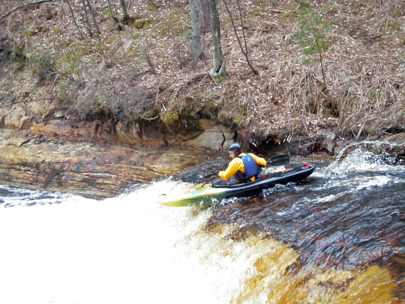
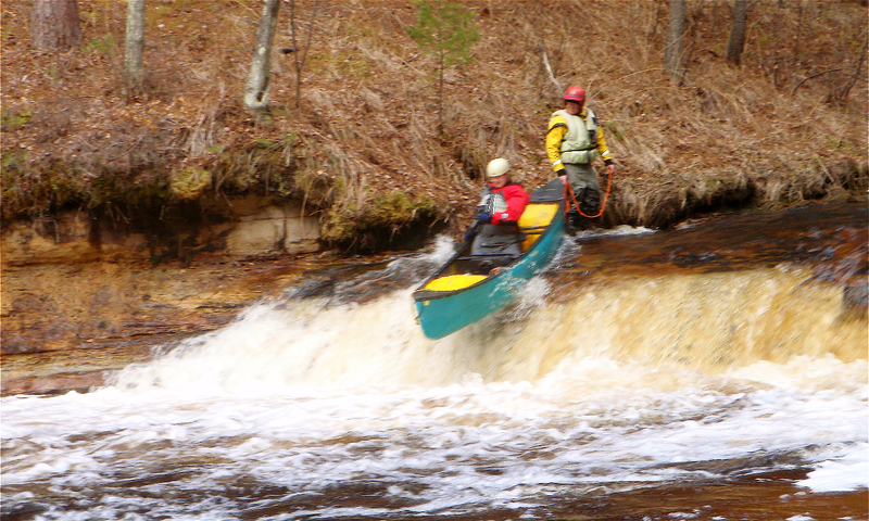
A fine central Wisconsin float, with some small sandstone cliff banks and ledgy sandstone bottom. The main attraction is a 5 or 6 foot ledge called Polly Falls. Some years back, at high water, a drowning occurred here (primarily due to some basic mistakes in judgment, equipment and techniques) so use good judgment as levels increase!
Groups often look at a double or triple (combining it with runs on Morrison Creek and/or Halls (Stockwell) Creek) since these three streams are quite similar in location (Black River Falls area) and drainage areas (80-90 square miles).
The following YouTube video (from 'MnktoDave') offers a great tour of Robinson Creek, nearby Hall's Creek (from about 1:08), and (from 2:46 til the end of the video) surfing the 'Campground Wave' on the Black River at Hatfield: https://youtu.be/LFf1pr8qu4g

Using USGS Streamstats V4.3.11, the drainage area at our listed put-in is 87.7 square miles.
At our listed take-out, it has increased to 125 square miles.
Relative to the USGS gauge at Neillsville, flows on this creek *could* be 1/9th to 1/10th of flow on that gauge.
(Drainage area ratio is actually 0.117.)
We have built and are displaying a 'Virtual Gauge' based
upon a ratio using the average of the three similar-sized Black River
Falls Area creeks (Robinson, Morrison, and Halls/Stockwell Creeks)
versus the drainage area at the Neillsville gauge on the Black River.
Obviously correlation is not assured, as that gauge is likely to lag
both on the rise and fall, as well as not being able to reflect when
different parts of the watersheds get differing rainfall amounts.
Dec 17, 2020
Apr 22, 2011
April 17 2011
Apr 4, 2009
This is a fun drop with the right water level... This run was closer to the right center of the river with not so much speed.. There are some shallow spots around the landing so a little scouting is recommended for picking the right path for the day. I would set up some safety and have at least one throw bag ready if the level is higher.