Klamath
02. Moonshine Falls Access to Spring Island(Big Bend Run)
| Difficulty | IV(V) |
| Length | 4.7 mi |
| Avg Gradient | 92 fpm |
| Gauge | Klamath River Blw John C.boyle Pwrplnt, Nr Keno,or |
| Flow Rate as of 25 minutes | 1190 cfsmedium runnable |
| Reach Info Last Updated | February 22, 2026 |
Projects
The National Conservation Lands—a 26-million-acre collection of national monuments, wilderness areas, wild and scenic rivers, trails, and historic sites—are managed by the Bureau of Land Management (BLM) to conserve some of the most treasured landscapes in the American West. Established administratively by the BLM in 2000 and made permanent [...]Read More
A series of four dams on the Klamath River (originally licensed as FERC P-2082 and then as FERC P-14803) operated by PacifiCorp devastated salmon populations on what was one of the nation’s most productive salmon rivers. These dams produced very little power, relative to their environmental impacts, and were [...]Read More
River Description
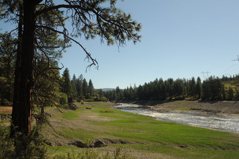
With the removal of J.C. Boyle Dam in 2024, the Big Bend Run has been transformed from a dewatered river that flowed only during large winter storms to a river that flows year-round with seasonal variations. As a result, there are now more whitewater boating opportunities on Big Bend, the most challenging run on the Upper Klamath. The Big Bend Run can be boated on its own, as downriver extention to the Keno Run, or as a great upriver extension to the Hells Corner Run.
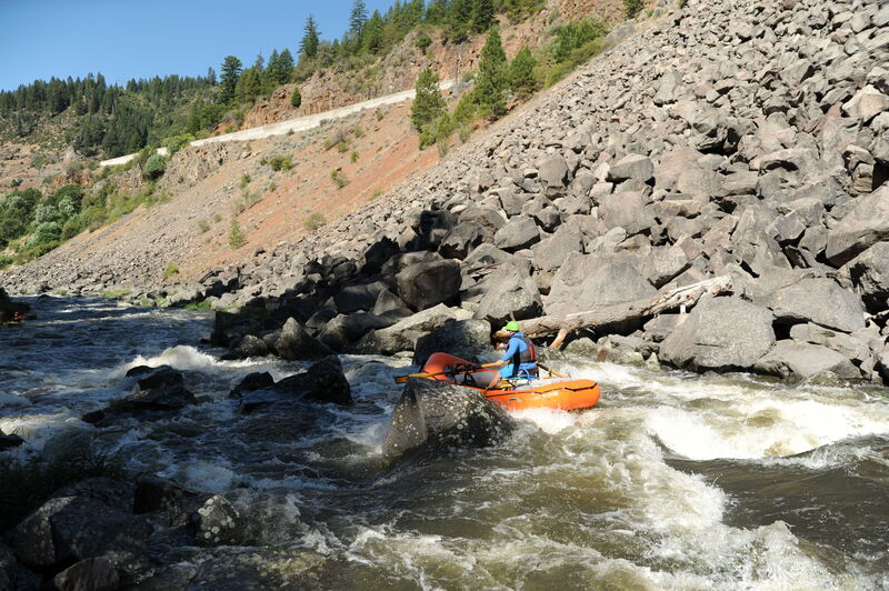
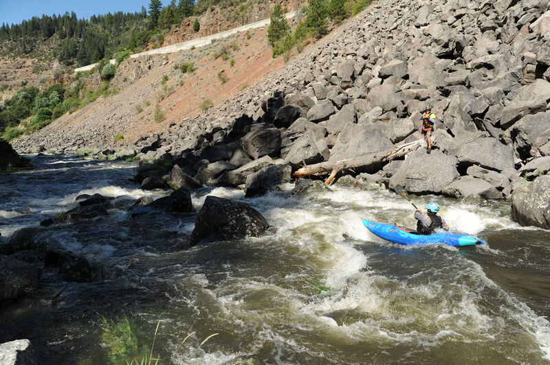
Big Bend is a five-mile run with challenging whitewater and dramatic scenery that is similar to the Hells Corner Run downstream but in a narrower, deeper canyon. Most of the canyon is public land managed by the Bureau of Land Management.
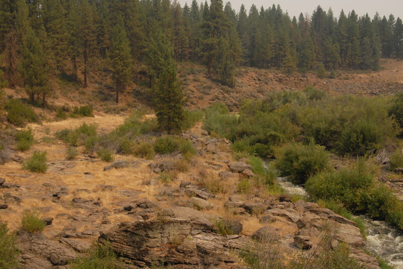
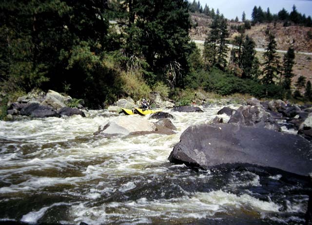
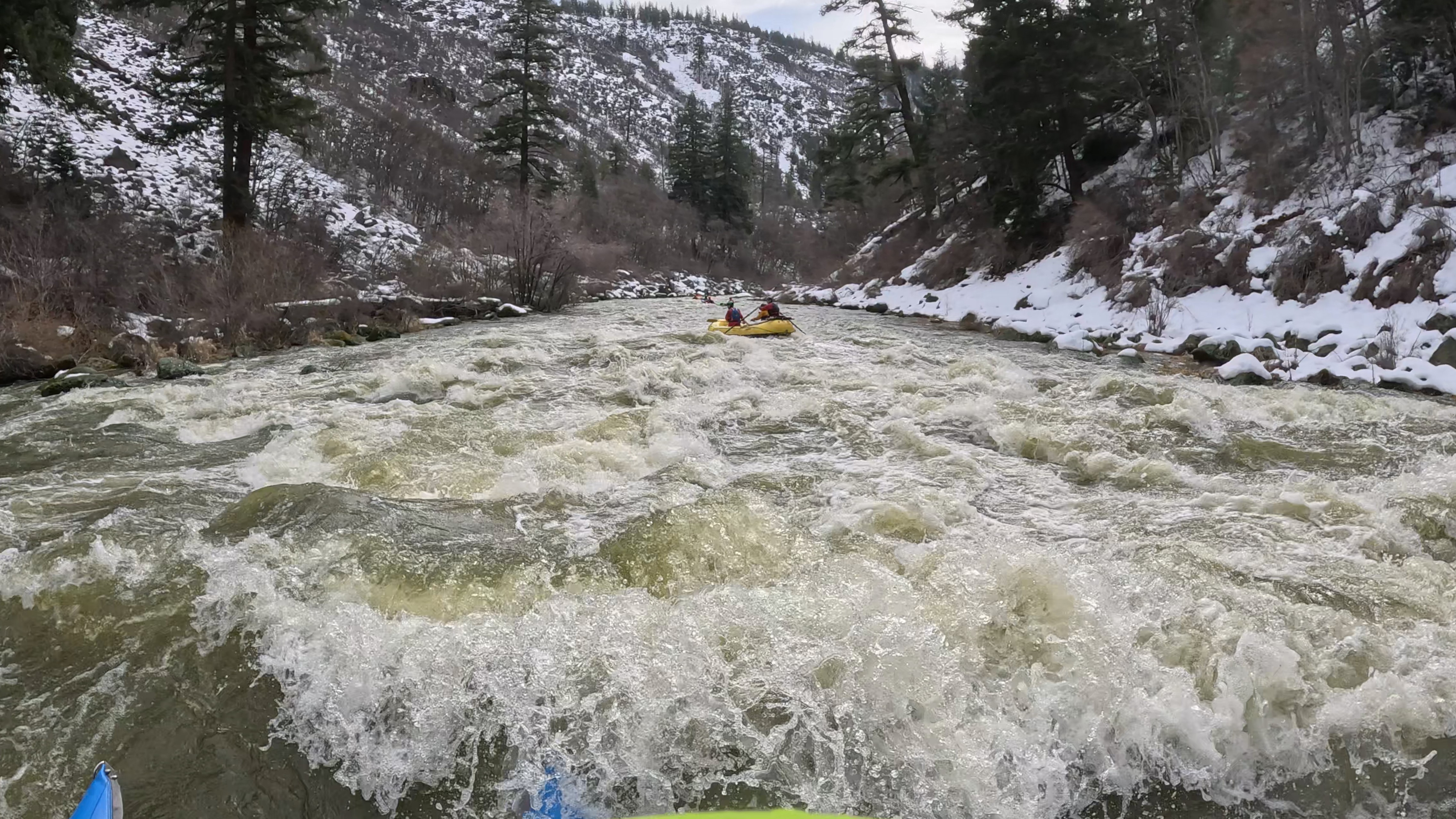
There are at least nine distinct Class IV rapids in this section, some of which are as much as a half mile in length. It is low but boatable by kayaks and small craft such as IKs at flows of 700 cfs but this is too low for rafts. At flows of 1,300 and 1,600 cfs the rapids are well padded, lines are wider, and there are numerous play features to catch on the fly as well as several play spots with eddy service. The run transforms into one of the best big water runs in the region at flows of 2,000 cfs. The long rapids with steep horizon lines provide plenty of entertainment for river runners. Scenically, this reach is characterized by its narrow basalt canyon and ponderosa pines.
While it was still dewatered by the hydropower project, American Whitewater worked with PacifiCorp, local boaters, and outfitters to coordinate a flow release study on this reach during summer 2002 and again in 2020, seeking information on the nature of this reach and its whitewater potential and necessary access points. The newly built river access facility just downstream of the J.C. Boyle Dam site is a product of these studies and American Whitewater's advocacy.
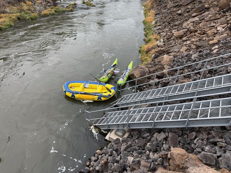
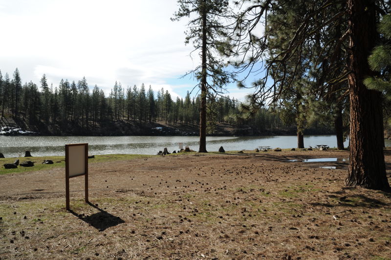
The Moonshine Falls River Access opened to the public on August 1, 2025, provides put-in access to the
...River Features
wGawgos kčal (Moonshine Falls) River Access
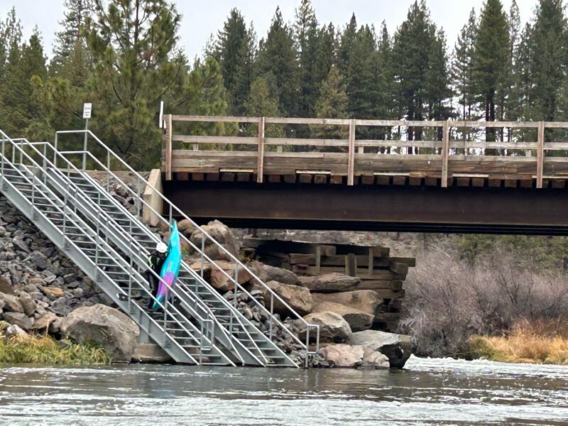
wGawgos kčal (Moonshine Falls) River Access is downstream of the falls on river right. This access opened to the public on August 1, 2025 and include stairs to the river, a raft slide, parking, turnarounds, restrooms, and other amenities. It is accessed via a gravel road off Highway 66, about 1.6 miles west of the Klamath River bridge. It is open as a day-use site, 7 am to 7 pm.
The site is open year-round, but the access road is not maintained in winter and may be impassable or temporarily closed due to weather. Nature ultimately dictates access—please use good judgment and avoid attempting the access road drive in unsafe conditions. When snow makes Moonshine unreachable, the Pioneer Park West River Access on Highway 66 is a reliable alternative and adds a 1.5-mile warm-up to the run.
American Whitewater successfully advocated that this river access facility be constructed as part of the Klamath dam removal project and participated in the design process. It was constructed with support from an Oregon State Marine Board grant.
Landback Gela oLal (Landback Landslide)
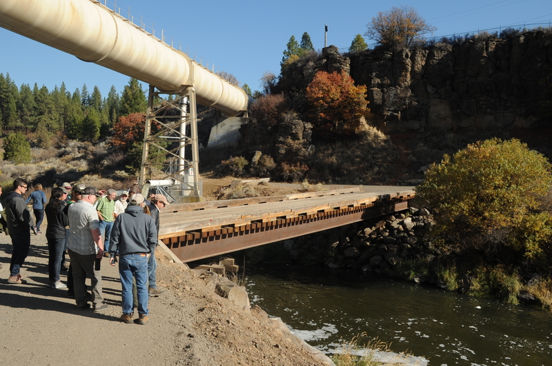
The rapid previously had navigation hazards caused by sharp, blasted rock that entered the channel during canal construction for the J.C. Boyle Powerhouse. American Whitewater successfully advocated that this man-made hazard be dealt with as part of the dam removal project. The most hazardous rocks were broken apart in early 2024, virtually eliminating the hazards. The rapid is now no more rocky or congested than any other of the similar rapids on this run. About this rapid's name: This rapid was renamed by Indigenous youth during Paddle Tribal Waters’ 2025 source-to-sea journey on the undammed Klamath River. Formerly known as Sidecast Slide—a name given by PacifiCorp in reference to the landslide it caused—the youth chose the name Landback Gela oLal. This new name blends English and Modoc; Gela oLal means “landslide” in the Modoc language, making the full name mean Landback Landslide.
Spring Island River Access
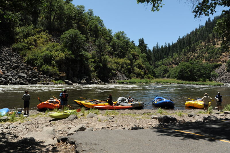
Access just downstream of the J.C. Boyle Powerhouse site on river right and a developed BLM river access site also used as a put-in for the Hells Corner Run downstream.
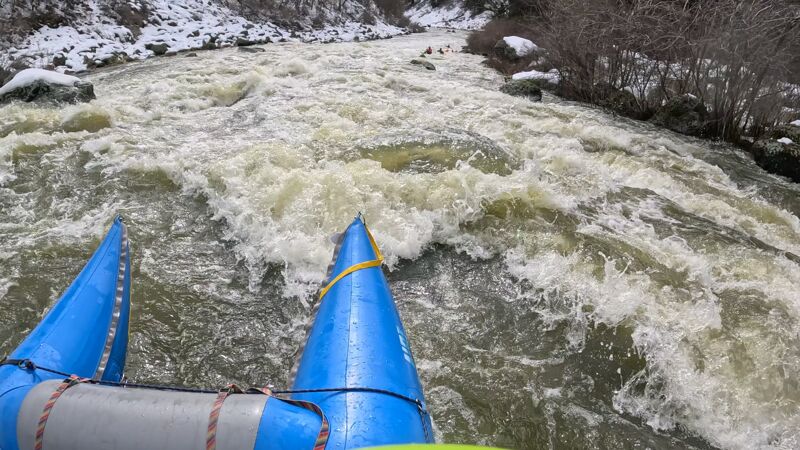
Trip Reports
Log in to add a reportBefore dam removal happened my biggest question was whether or not the flushing flows the bureau of reclamation has been doing for years would continue. For now the answer seems to be yes. With only a few days notice the BOR started releasing from keno dam At 4600 CFS. This is a good sign that these will continue. It has been an absolutely abysmal year for precipitation and if they're doing this during a year like this one, they will probably continue to do it in the future is my guess. This will provide at least a few opportunities in a season. When I woke up this morning, I was hoping that flows would be a little closer to 3500 to 3800, which are closer to flows I've seen before. When Adler Thomas and I took off today, the river was still at 4200 which is now the highest that we've done it so far. I think this flow is class V and requires knowing the lines ahead of time. The lines are tight and hard to stay on. the holes are numerous and big. In most of the big rapids the line is similar to 3/3500ish but there are a few exceptions. Razorback rapid being the most notable. Instead of entering and staying right or entering center and moving left, the line is left the entire way and the two holes in the center of the river are Massive. The InBetween boogie water is fantastic at this flow and even that contains some powerful hydraulics. I would not recommend this flow for most first timers and definitely not for rafts at all.
Moonshine Falls River Access stairs. Photos by Jud Lehman.
The Klamath Dam removal has transformed white water boating in southern Oregon. In my opinion, the Big Bend run is one of the best sections of river in the region. Boaters unfamiliar with this run will be blown away by how much fun it is. It's close to Rogue valley and even closer to klamath falls. The logistics are simple adding to the overall appeal. The run itself is similar to the hells corner Canyon run, but a notch up as far as difficulty and quality. Imagine an easier version of the North Fork Payette. The rapids are long and continuous in Nature. Scouting is difficult given the nature of the riverbank and it's best to have a guide the first few times to learn the lines. I've run this several times in the past few days and weeks at 1600, 2200, 2400, 2,700 and 3500 at the JC Boyle gauge. Most boaters are going to want to familiarize themselves with the run starting at the 1600 levels. Things are slow and there is a lot more time in between moves, although one or two of the rapids become more difficult at this lower level. 2200 to 2400 seems like the high side of good for most rafters and a great level for kayakers. 2700 is starting to feel pushy and it becomes very important to know what the lines are. Very few rafters are going to want to run it at this level I think but the kayakers will be loving it. 3500 is pretty full on. The lines are all very pushy and it becomes hard to stay online. The holes are strong and there isn't much time in between moves. The pools between rapids start to disappear and the run becomes like one big Rapid. I would call this 3500 level closer to class V. Kayakers who are comfortable in difficult whitewater will absolutely love this section at these high levels as it is truly world class. I could not be more excited to have an almost a brand new, high quality run so close to home. Get out there and be stoked responsibly.
General Description For small rafts at medium flows:
This run is generally more technical and up to half a class more difficult than the Hell’s Corner Run downstream at the same flow, we did them both at 1600 cfs in one day in February 2025. There are about 10 major rapids and a bunch of fun boogie water. The feel is continuous but there are eddies and short breaks between most rapids. There are many hidden shallow sharp rocks to dodge even in the main current so pay attention. Lightweight rafts will have more success at rock dodging than heavy or large ones. I would imagine it cleans up a bit with more water. I had also seen this run before the dam removal at 900 cfs and consider it to be more difficult for a raft at that lower flow. We scouted #3 which used to be called “sidecast” by mountaineering up to the old road since we had not seen it post dam renewal. This was one of the two most difficult and longest rapids. For people with a class V skillset, this run could be navigated by boat scouting. However, as of the snow storm Feb 2025 there are several new trees that have come down along the banks throughout this run as well as the Hell's Corner run; it is a good idea to check for wood in key places and plan your exit from the crux by shore scouting at #3. Rapid # 5 is equally as challenging and almost as long and may deserve a scout as well.
#1 Cofferdam site c lass III
An S turn with a shallow exit & erosional banks, this rapid may change significantly in the near future.
#2 Moonshine Falls class III
Both the right and left sides 'go' at 1600, current pushes into the right bank below the channels’ confluence. Generally tight, shallow and brushy.
Bridge and class III boogie water until...
#3 class IV+
Previously called Side Cast or Hog, new name pending....
Entrance: green tongue, wave train, hole.
Upper mid: pillow rock center left, two pour overs left and center.
Mid: pinch point. Dry boulders right bank, large fan off pillow rock left. Decide …head right or left after the pinch to avoid mid stream mank below.
Crux: willow tree protrudes on left bank / manky double hole junk show in the middle / boils, slackwater and shallow rock dodging on the right.
Bottom: final move through the horns on the right or kayakers can cheat all the way left.
#4 class IV-
Slalom between pour overs center right with a rocky exit or hug the right side of the dry boulder that blocks the left side of the river for a ceaner exit.
#5 class IV+
Previously also called Boss Hog, new name pending....
One of the two most difficult and long rapids for a raft at medium flow. Generally enter left and work center right. A long complex rapid with large hydraulics and current pushing into hazardous large angular boulders on the left bank. Pour overs midstream and on the right bank. Lower flows are more difficult for a raft here.
Entrance: In- water downed wood hazard right bank as of Feb 2025...so enter left.
Mid: Double stacked slightly offset holes with exposed rock center right, cut right after.
Bottom: Picket fence extending from right bank, use the slackwater behind it to move center or further right. Stay off the left bank with the big sharp boulders.
Runnout: Midstream crashing fun hole.
#6 class III
Stay center, steep horizon line identified by a rooster tail on the right.
#7 class IV
Big righthand bend, wave train with midstream pour overs to avoid, big hits down the center or technical line down the right. The right side will close off with less water. This is the ore difficult of the two big bends.
#8 class III+
Secret hole fun times boogie. Look out for small chunky holes.
#9 class III+
Another Big Bend Identified by a two midstream horns, start moving right to hug the inside of the bend.
#10 class IV
Best. Rapid. Ever:Enter left, stay center and enjoy large fluffy waves while dodging pour overs.
Guage: Klamath River Below JC Boyle Power Plant BOY03
Flow: 1600cfs on Feb 22, 2025
Put in Hwy 66 Bridge (in the snow).
Take out Access 6 (Spring Island was still closed…not to mention too much snow on the ground for the van) So we ran all the way through the Hells Corner Run as well.
A quick look at the restored river from Pioneer Park at the Highway 66 Bridge down to the J.C. Boyle Dam being removed. Flow from Keno Dam was approxiamtely 735 cfs.
In advance of dam removal, and in anticipation of restored flow to the Big Bend run, Klamath River Renewal Corporation will be fracturing blast rocks that are in the river channel as a result of the canal construction when the hydropower project was built in the 1950s.
Site visit with KRRC and their contractors, Tribes, state and federal resource agencies, whitewater boaters, and whitewater outfitters to discuss options for river access at Pioneer Park and Moonshine Fall following dam removal.
A flow study on the Big Bend reach of the Klamath River in July 2020 evaluated anticipated summer flows of 1000 cfs following dam removal. The river was technical but boatable at this level. Rafting was more challenging than kayaking.
Field tour of the Klamath River below JC Boyle Dam.
The 700 cfs release was determined
to be to low.