Puyallup
1 - Niesson Creek to Electron(Puyallup Gorge)
| Difficulty | V |
| Length | 9.7 mi |
| Avg Gradient | 120 fpm |
| Gauge | Puyallup River Near Electron, Wa |
| Flow Rate as of 24 minutes | 459 cfsrunnable |
| Reach Info Last Updated | March 20, 2020 |
The Puyallup River drainages includes the White, Carbon, and Puyallup Rivers which originate off the slopes of Mt. Rainier, Washington’s tallest mountain. All of these rivers offer whitewater boating opportunities that serve a range of skill levels form beginners to experts. White River The White River flows off the [...]Read More
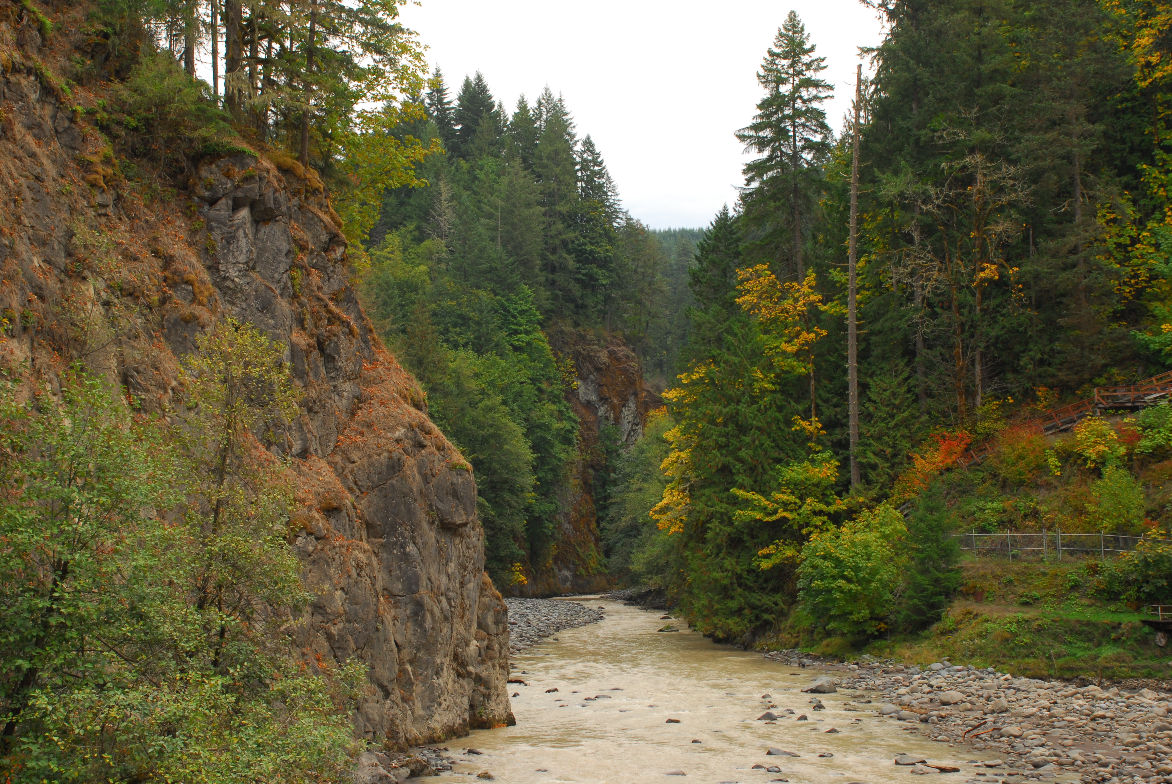
Descending the west flank of Mount Rainier, after meandering for miles, the Puyallup River flows through a narrow and dramatic canyon. After reading comparisons to the incomparable Carbon Gorge, I had to go see it. You shouldn’t have to decide on such things, but I think the Carbon is more awesome. But not by much. Both have a unique combination of rapids and geology that make them truly special. The whitewater on the Puyallup is good, with ten or more challenging rapids in an extremely committing setting. What prevents this run from being a Seattle-area ultra-classic is one issue: access. The timber company that owns the area has completely restricted a large swath of the upper Puyallup watershed. If you want to drive in via the road right along the river, you must purchase a $360/year pass. If you are caught on the property hiking or sitting in the car of someone with a pass, you could be given a $500 fine. Word has it the area is regularly patrolled.
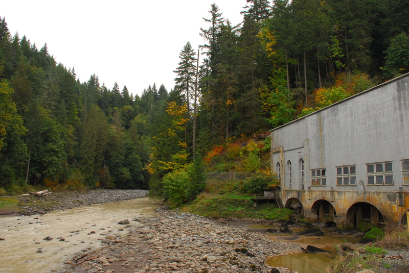
Fortunately, there are ways to paddle this stretch. With an early start it can reasonably be done in a day via the Mowich River, accessed near the west entrance to Mount Rainier National Park. Beginning the hike at 9 got us to the takeout at 3. In 2006 another group put onto the larger South Fork Puyallup using West Side Road; that involves a long hike and paddle-in. Getting down to the Mowich is not bad, but the first part of the river is awful. The wide glacial valley accumulates logs and disperses the river. With the gauge reading 850 at Electron, it took a couple hours to get to the lower section of the Mowich, which thankfully is relatively unobstructed class III. Hiking into the lower portion of the Mowich from 165 would be extremely difficult due to the towering cliffs on river right. Almost immediately after the Mowich meets the Puyallup you come to the diversion dam, final destination of the “World’s Crookedest Railway”. You can visually check that the diversion is occurring, although try to find th
...Oct 6, 2015
Site visit to Electron Hydropower Project including the dam and hydropower facilities.
Jan 25, 2011
Posted by Jon Almquist at Seattle Kayaker Yahoo Group (1/25/2006)
Yep, we took the 'free' route by accessing via West Side Road in the park. The road was closed to motorized vehicles due to a wash-out, but we fabricated a 'kayak' trailer from a bicycle baby carrage and had one guy peddle the bike while two pushed from behind. You go up over one easy pass - historical in that it's famous for the crash of a large military plane - and then you get a fun down hill screamer to the SF Puyallup bridge. You can probably expect 2-3 hours hiking / biking from the start of WS road to the bridge. If the road is open to vehicles, you're golden.
Boating from this point down to the main canyon is unique, lonely (you're in the park for the first bit), but not what I would consider outstanding. The glacier till raised river beds are fun, as you're floating along at the crest of these huge gravel deposits. It's a strange feeling to be floating HIGHER than the surrounding land. There is also an upper vertical walled gorge probably less than a mile long - that would be stellar. But alas, wood kept us on the rim. Once you get past this gorge, you'll have miles of wilderness class 2 before the main canyon. Unless you get to the river at daybreak, expect to spend the night. Also expect wildlife - we saw bear, deer, elk, etc.
The canyon is fantastic - deeper than the Carbon, vertical in spots, and quite dramatic. Most of the drops were straight-forward. We did encounter a fresh and rather large land slide that created a class 6 mess (think Sultan), with an easy carry on RL. Just below, we eddied at the brink of a class 5ish drop, walled in on both sides, with fresh rock and wood from the slide impeading the line. There was one small eddy RR that allowed us step out and teather our boats in a gully. Portaging on shore was not an option. Neither was going up the walls or paddling back upstream to a potential exit from the canyon. This was likely the biggest 'now what' moment in my paddling career. Of course, cool heads prevailed, and we were able to rig a tag line to a mid-river rock that luckily had a hidden but nice seal launch shelf on the downstream side. This dropped us into the latter part of the rapid, below the crux move that was jammed with wood and sharp rock. All is well that ends well. My guess is that both these drops will have cleaned up with years of flow.
Jon