Dinkey Creek
1. Dinkey Dome to Dinkey Campgrounds(SuperDink!)

| Difficulty | V |
| Length | 3 mi |
| Avg Gradient | 360 fpm |
| Gauge | Dinkey Creek at Dinkey Meadow |
| Reach Info Last Updated | January 25, 2019 |
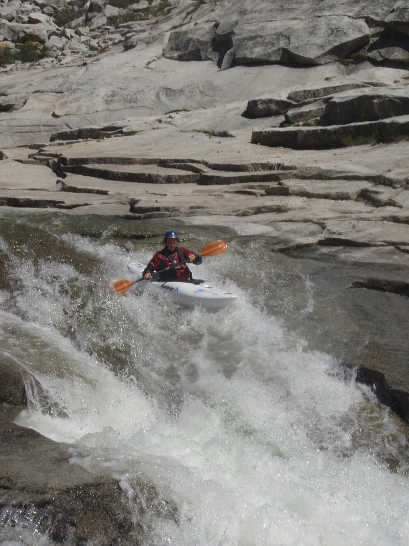
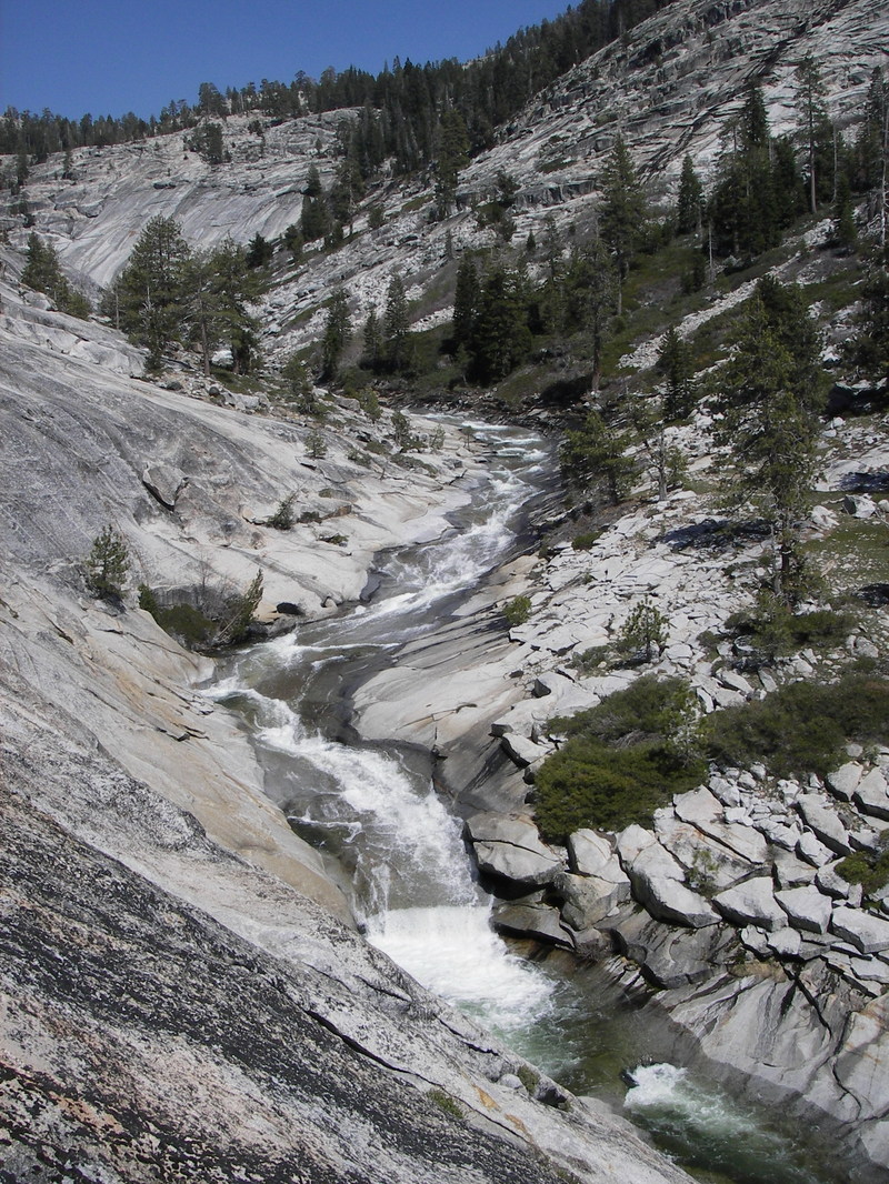
SuperDink is an amazing section of paddling on Dinkey Creek. The first half of the run starts out near Dinkey Dome on granite slabs. The feature destined for greatest renown is the InfiniSlide or SuperSlide, a continuous section of nonstop slides and falls of perhaps 1/2 mile length. The whole section is scoutable on river left and most of it on river right. It is also easy to get awesome photographs of your buddies running these drops. The river right side is cliff near the end.
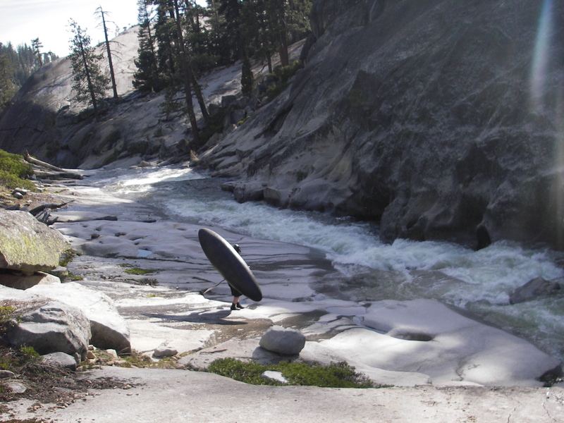
Between Dinkey Dome and the Infinislide, there is one long but easy portage around a beautiful gorge. The gorge itself appears to have moderate drops within it, but unfortunately both the entrance and exit drops are narrow crevases that appear unrunnable and impossible to portage. If you boat the falls down to the entrance of this gorge, you will probably want help from shore to get out and haul your boat up out of the gorge. Otherwise start walking on the river left slabs above these falls.
In the second half of the run, the creek is less steep but more congested. The creek drops into a forested area and runs through many small gorges of tight twisting drops. It is all easily scouted or portaged, but is frequently boat scouted. It remains solid class 5 for the entire distance. Near the end the creek flows between two domes and there is an unrunnable drop or two. This section can be easily portaged on slabs on left or the individual drops can be portaged with difficulty at river level.
When you see fishermen, campers and cars, you know the end is near. Try to look sharp in the final serious gorge ending at Honeymoon Pool. I have always portaged at least one drop in this final gorge, but the young guys just bomb it. Worth looking at when you leave your car at the take out.
-------
Take out: From Fresno, take highway 168 to Shaver Lake. Turn right on Dinkey Creek Road to Dinkey Creek. At Dinkey Creek, bear left through the campgrounds to Honey
...
The entrance to a pretty gorge is a slot that is probably not runnable. Boaters who paddle to this spot will likely benefit from help getting themselves and their boats out of the water and up the rock to where the slabs are lower angle. Other boaters will start the portage further upstream or simply avoid this section by launching below the portage. The portage is easy walking on slabs high above the creek on river left. The total portage distance is around 700 to 800 feet.
The creek exits from a narrow slot into a small pool. There is a small level ledge on river left sufficient to launch a kayak. The exit to the pool is a small pour that consistently provides tail stands just as you are trying to negotiate a quick turn onto the top of a very steep slide which blasts into a diagonal wall on the right. It looks horid, but there is enough cushion to keep boaters off the rock if they are in control. A good catch pool is at the bottom of this short section.
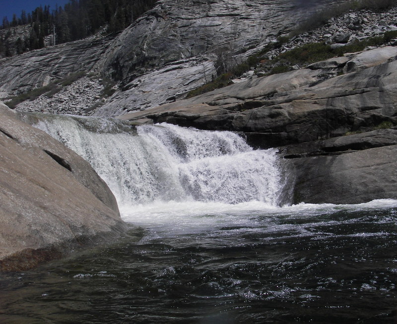
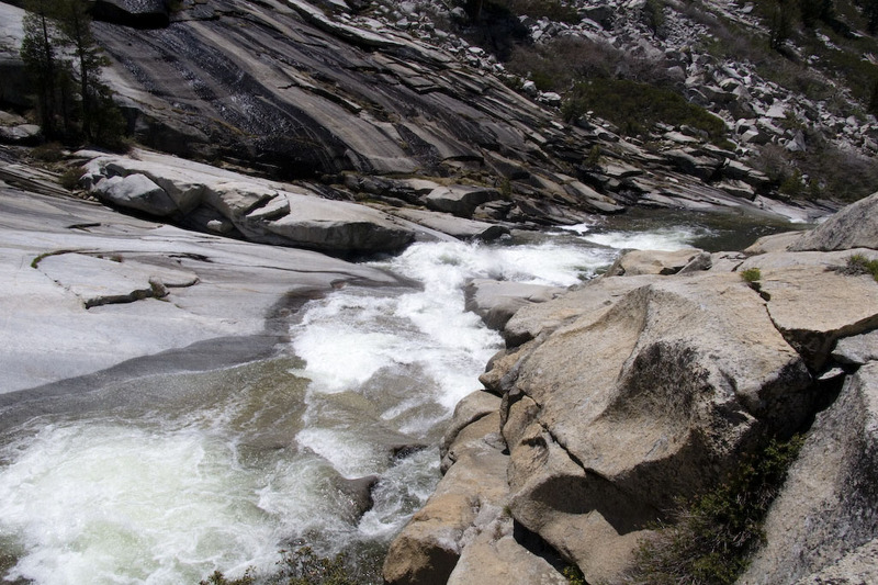
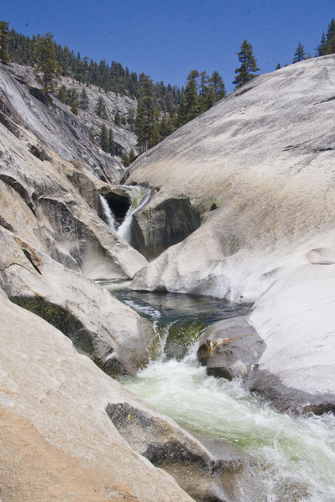
This photogenic falls signals the end of the infinislide. Below this are a few more slides but Dinkey quickly becomes more congested and bouldery.
May 15, 2007
Dinkey Dome and Dinkey Creek, SuperDink! section, with a view of the lower section of the Infinislide.
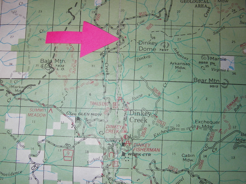
The red arrow points to where the rock quarry (the red dot) is for parking. Cow Creek enters from the north into Dinkey Creek. To get to the Super Dinkey section, cross Cow Creek, then hike along the north side of Dinkey Creek, cutting across the granite is easiliest. the run starts about where the 'E' is in Dinkey Dome. Southwest of the dome on the map.
May 11, 2007
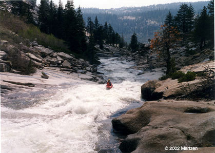
Second to last drop before the unrunnable gorge at the base of Dinkey Dome, prior to the Super Dink section.
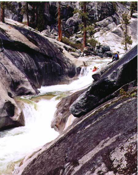
Evan hiking toward our portage over the river right. You can see where the unrunnable gorge starts, at the background of the picture, the steep granite on the right indicates the start of the gorge. The first drop into the gorge section looked Class VI, very nasty. We portaged up and over on river right to the beginning of Super Dink.
overview near the beginning
overview of Super Dink
the starting point of Super Dink
Paul checking out the beginning of Super Dink.
May 8, 2007
The levels listed above are NOT good to go. Seeing that we would have a 'perfect' level of 500-550, we hiked in last week and got skunked by HIGH water. We left our boats and walked back in 2 days later when the level was in the low 400s, and it was probably on the high side of good for a really strong group with lots of safety set. Since then I have talked to close to 10 different people who have hiked in and been skunked by high water, and the consensus seems to be that 250-350 is the range you are looking for on the North Fork Gauge.
Leland
May 2, 2007
The pool in the foreground is the highest put in that I have seen used to start the Infinislide. People have paddled higher up but portage around a gorge to this point.
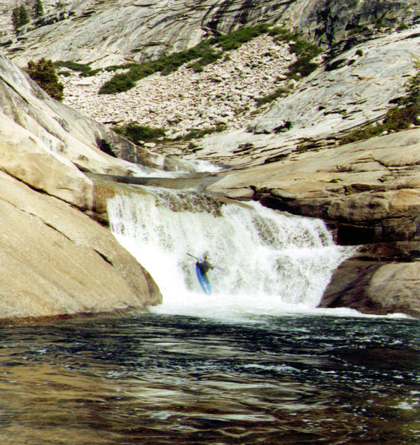
The small exit drop always seems to give big wheelies!
This could be considered the uppermost part of the Infinislide, though there is a short calm pool at the base of this slide,