Savannah
Savannah Rapids Park to North Augusta Boat Ramp
| Difficulty | II(III) |
| Length | 5.3 mi |
| Avg Gradient | n/a |
| Gauge | Savannah River at Augusta, Ga |
| Flow Rate as of 34 minutes | 4120 cfsbelow recommended |
| Reach Info Last Updated | October 7, 2015 |
River Description
This section of the Savannah offers easy access and lots of areas to explore. It is easy enough that it gets heavy use by recreational kayakers in flat water and touring boats. However, the numerous wide shoals offer plenty of potential for whitewater practice and play spots. The Augusta Canal parrallels most of this section and offers additional flat water boating.
Put in:
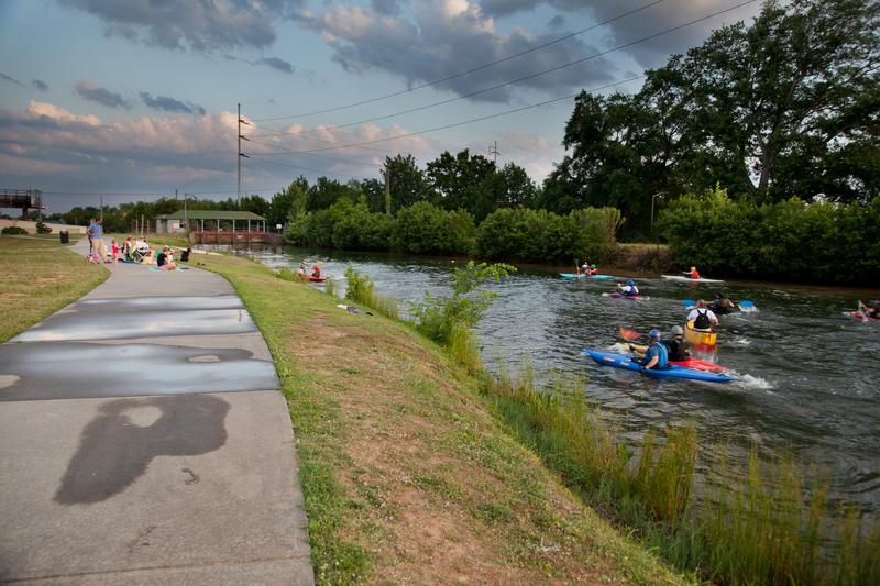
The easiest and most popular put in is just below the Augusta Canal Headgate / Savannah Rapids Pavilion. This county park has a visitor center, picnic areas and plenty of free parking. As you enter the park, turn right to the lowest parking lot. A pedestrian bridge leads across the canal. Fairly wide stairs climb over a low wall then descend to the river.
Previous descriptions suggested putting in at Steven's Creek dam, but as of 2011 there is no public road access to that dam. There is a public launching area 6 miles upstream of Steven's Creek dam on Betty's Branch at German Island. There is also public access 12 miles upstream at the base of Strom Thurmond Dam. The river is flat water above the Augusta Canal Diversion Dam and above Steven's Creek dam. The only whitewater is below the canal diversion dam to Hammond Rapids.
Take Out:
There is a developed public boat launching area on river left at the North Augusta Boat Landing. The landing is on Hammonds Ferry Rd. at Riverview Park, North Augusta, SC. There are limited, primitive campsites nearby which require reservations. Call 803.441.4300 begin_of_the_skype_highlighting803.441.4300end_of_the_skype_highlighting begin_of_the_skype_highlighting803.441.4300end_of_the_skype_highlighting
Boaters can also take out by paddling up the Rea's Creek channel towards Lake Olmstead. Take out under the railroad bridge. It looks like you may be able to drive a car to this location. However, it is probably faster to just carry boats to the canal tra
River Features
Steven's Creek Dam

There appears to be an easy portage around the river right side of the dam. There is a boat ramp on the upstream side of the dam and a grassy slope a short ways downstream of the dam. The dam itself is for hydro-electric power. Boaters must stay a long ways away from the inlets to the generators
The road to the dam is gated, so there is no public access to the dam via road.
Augusta Canal Diversion Dam

This long dam diverts water into the Augusta Canal. There are a few spots along the dam where some boaters carry over the dam or paddle over without portage. Most boaters will take out on river right about 30 yards upstream of the headgates. They then carry across the headgate to the canal trail and downstream to stairs leading to the river.
Savannah Rapids Park; put in
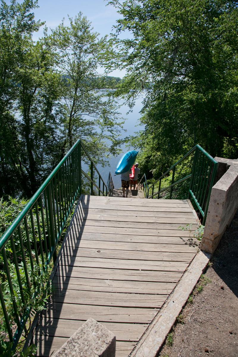
This may be the most used put in as it is convenient and avoids dealing with the dams. From the lowest parking lot at the Augusta Locks Park, walk across a bridge over the canal. Once on the canal trail, look for a wide stairway leading down to the river.
Reed Creek
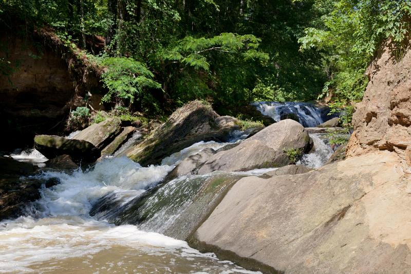
Reed Creek is a small side creek that is next to the put in parking area at Savannah Rapids Park. The creek enters the Augusta Canal immediately downstream of the pedestrian bridge.
When rains bring the flows up enough, boaters can launch near the top of the parking area and crash down to the canal. There are several large drops in this very short section.
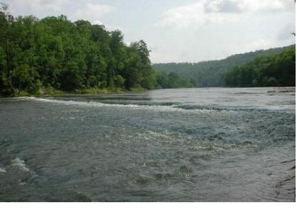
Hammond Rapid
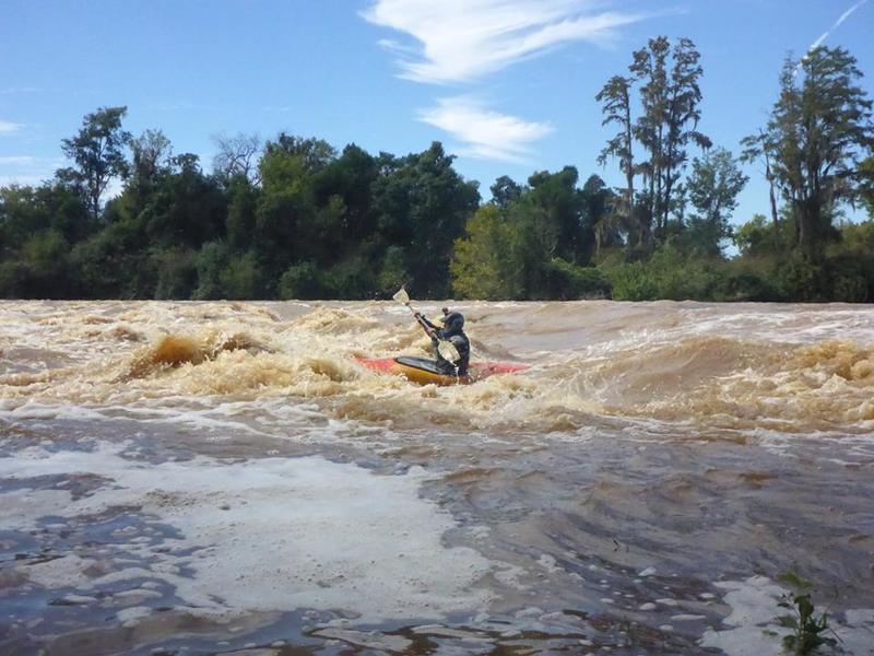
These shoals form the main rapid of significance on this section. They are in the far left channel by the South Carolina shore and are the furthest downstream of any rapids.
Rae's Creek
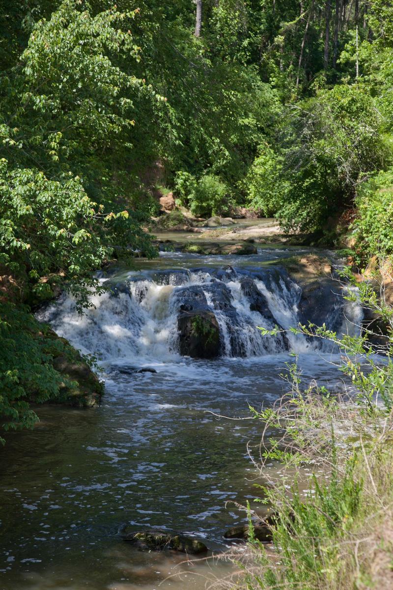
The mouth of Rae's Creek is on river right (Georgia side) about 1/4 mile upstream of the North Georgia Boat Landing. It is the first creek outlet on river right below Hammond Rapid. Paddle up the channel almost one half mile to a railroad bridge and an easy take out. There is also a pretty waterfall with water released from the canal.
There is a parking area at the canal overflow, which can be reached by taking Broad St. to Goodrich St. toward the pumping station. The takeout trailhead is immediately before Goodrich St. crosses the RR tracks. The parking area is immediately after the RR tracks.
You could also carry boats along the railroad to the canal trail, then across a pedestrian bridge to a parking area at the end of Milledge Road. The walking distance is about 340 yards This take out reduces the shuttle distance considerably.
Kayak Football in Augusta Canal
On Wednesday evenings, boaters gather to play 'kayak football' in the Augusta Canal just upstream of the 13th street gates.
There is plenty of parking. The Augusta Canal Trail starts here. Sidewalks and a grass slope provide seating for spectators and easy access to the canal for boaters.
Trip Reports
Log in to add a reportDavid Bazemore
May 29, 2014
Brandon you should go on Facebook and look up The Georgia Canoe Association. Most of the members are whitewater kayakers as am I. I simply haven't been on the section you are asking about. From looking at the pictures I'm not sure I'd play on that. It looks like there are simply too many spots to get seriously injured or pinned and drown. But pics are very deceptive. So take the time to search out some of the GCA members on Facebook. Or go to GaPaddle.com for more contact info. Have fun & be safe.
Nolan Thomas Brandon
May 29, 2014
How dangerous is it to boof the savannah diversion dam? My friend and I really enjoy whitewater and have messed around in the rapids below(even though they're pretty timid) the dam quite a bit. We've always been drawn to the dam drop and think it might be fun. I've seen a video on youtube of some random guy going over using a gopro and without a skirt and he seemed fine. I am just looking for a credible opinion. Thanks.
Paul Martzen
Apr 27, 2011
The Augusta Canal parallels the river down into town. It is heavily used for flat water kayaking and canoeing. A walking trail also runs along the length of the canal. On the downstream end, the trail starts at 13th street. Every Wednesday evening paddlers get together at 13th Street for a game of kayak football. Anyone is welcome to play and extra boats and gear are often available.
Stu Thompson
Dec 18, 2009
The dam at Savannah Rapids Pavilion can also be run just to the right of the closest dam support to the GA side. Plenty of downstream current. Sorry for the long-distance video!
Stu Thompson
Dec 18, 2009
Andy Colbert running Reed Creek, which runs into the Augusta Canal just below the Savannah Rapids Pavilion. Needs a big rain to run. There are only 3 drops/rapids in this short park and huck.

Stu Thompson
Dec 18, 2009
Stu Thompson running Reed Creek, which runs into the Augusta Canal just below the Savannah Rapids Pavilion. Needs a big rain to run; definitely needed more than this for my big boat! There are only 3 drops/rapids in this short park and huck.

Stu Thompson
Dec 18, 2009
Stevens Creek Dam at Savannah Rapids Pavilion can also be run just to the right of the closest dam support to the GA side. Plenty of downstream current. Sorry for the long-distance video!

Stu Thompson
Dec 18, 2009
As mentioned in the previous post, taking out at the Augusta Canal overflow (Rae's Creek) is very easy and cuts off a couple miles of flatwater. Rae's Creek is the first creek entering from river right after Hammond Rapid, and it has little to no current. Just paddle up the creek ~100 yards and take out under Riverwatch Pkwy. It's an easy carry up the trail to the parking area at the canal overflow, which can be reached by taking Broad St. to Goodrich St. toward the pumping station. The takeout trailhead is immediately before Goodrich St. crosses the RR tracks. The parking area is immediately after the RR tracks.
Untitled
Nov 25, 2009
Ran the river today at 28000 cfs. I'm a beginner paddler, yet had little trouble even at this level. Put in at Savannah Rapids Pavilion, took out at the canal overflow (which was not running) I was with experienced boaters...they found a few play holes and waves, even threw some cartwheels and loops at Hammonds Ferry. Great day!