Truckee
4. Mayberry Park to Cottonwood Park (Downtown Reno)
| Difficulty | I-III |
| Length | 10 mi |
| Avg Gradient | n/a |
| Gauge | Truckee Rv at Reno, Nv |
| Flow Rate as of 26 minutes | 367 cfsbelow recommended |
| Reach Info Last Updated | February 14, 2022 |
This is the run that flows through downtown Reno and although the most well known section is the Reno Whitewater Park at Wingfield, there's more river to enjoy both upstream and downstream of the park. The river is in the midst of a major transformation from and there are additional plans for recreational enhancements some of which are described in the Truckee River Recreation Plan. City parks along the length of the run provide several options for access and allow you to customize your run.
Kayakers and canoeists hit the river during the spring runoff when the river is characterized by a long series of class II rapids. The scenery reflects the urban landscape but in the evening it's not uncommon to see birds and wildlife along the river's edge.
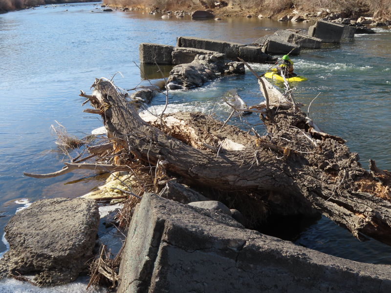
Mayberry Park is out at the west end of town near the warehouse district and as you continue downstream the shoreline alternates between undeveloped banks and trophy homes. Interspersed between the homes and apartment building are a number of community parks that provide river access. Folks fishing and children jumping off rope swings are found around nearly every bend on a Saturday afternoon. Beware of the Chalk Bluff Diversion Dam 2 miles downstream of Mayberry Park. It is marked by a sign across from the Orr Ditch Diversion but the dam itself is not for another half-mile beyond the rapids. Be prepared to portage on the left and if you want to avoid it you can use the access at Crissy Coughlin Park 0.7 miles downstream of the dam.
As you hit the downtown corridor, cottonwood and willow give way to concrete although recent work along the river has created a much more inviting shoreline trading in much of the concrete walls for landscaped rocks. The result is an inviting and accessible shoreline that has become a real community asset. Folks who step out of the casinos watch the s
...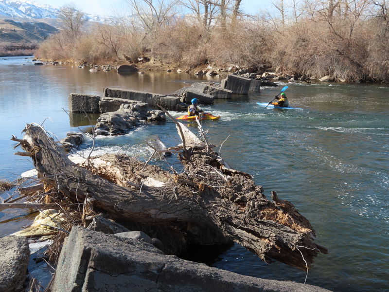
Derelict dam that is a mid-channel hazard. The dam was constructed in 1918 by the local ditch company but has fallen into disrepair. The remants of this abandoned structure sit in the Truckee River and remain as a public safety hazard. Removing this dam and restoring the site is a priority for American Whitewater.
Be prepared to portage on the left.
Alternate access point that avoids Chalk Bluff Dam that can be used for a 2.5 mile paddle down to the whitewater park.
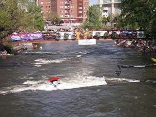
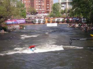
The whitewater park in downtown Reno. Note that we have a separate page for the whitewater park on our website.