Boundary Creek
Near Canadian border to Road 2450
| Difficulty | IV-V |
| Length | 7.2 mi |
| Avg Gradient | 250 fpm |
| Gauge | Boundary Creek Nr Porthill Id |
| Flow Rate as of 1 hour | 40 cfsbelow recommended |
| Reach Info Last Updated | July 13, 2020 |
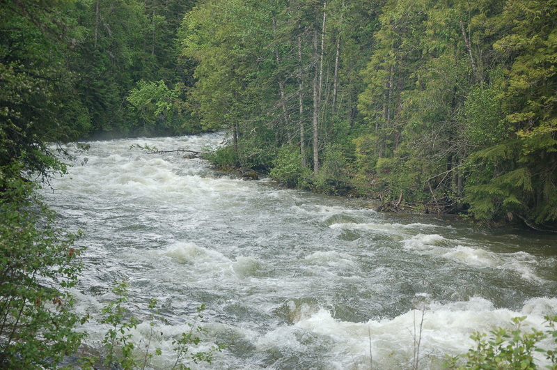
Boundary Creek is a premiere creek run located in the Panhandle of Northern Idaho, and also is critical habitat for bull trout, west slope cutthroat trout, redband rainbow trout, harlequin ducks, grizzly bears, wolves,and mountain caribou. Boundary Creek offers paddlers an exhausting and exhilarating barrage of continuous boulder rapids [...]Read More
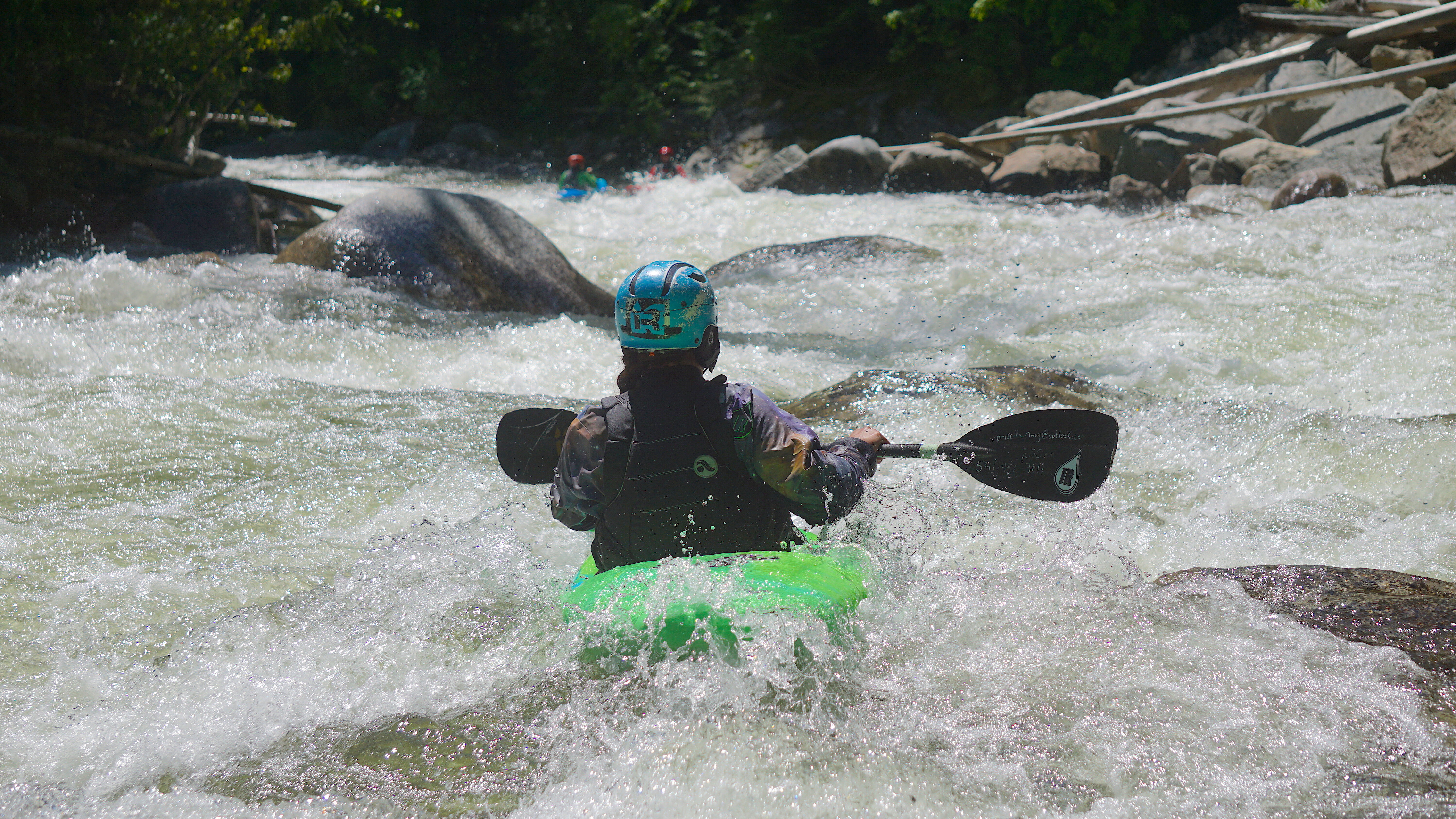
Boundary Creek offers paddlers a seemingly endless barrage of continuous Class IV and V boulder rapids. While the run is 7.5 miles long if you start at the border, most paddlers describe it as 9-11 miles because it feels so long. This run is best attempted only by paddlers comfortable boat scouting and read-and-running steep class IV and V rapids. If you are that kind of paddler, you are in for a remote panhandle treat. A relatively new online USGS gage offers paddlers terrific flow information.
American Whitewater (John Gangemi) played a lead role in defeating a proposed dam on Boundary Creek. A new identical proposal emerged almost 20 years later and American Whitewater helped defeat that proposal as well. Our efforts to have the river found eligible for Wild and Scenic designation failed because of the flawed perspective of the Panhandle National Forest.
Directions to Boundary Creek Takeout
From Bonners Ferry take Hwy 95 N towards Creston, BC
At intersection with Highway 95/3 and Highway 1 veer left toward Porthill border crossing and Creston.
At mile marker 1 on Highway 1 take a left onto West Side Road
Set your odometer to 0 here.
Drive 3.5 miles to West Side Road. You will cross the Kootenai River heading toward West Side Road.
Go right (north) at the intersection; sign should indicate direction of Smith and Boundary Creeks.
You will cross several smaller creeks (Parker and Long) as you travel North
Cross Smith Creek at mile 12 (measured form Highway 1) (no sign for Smith Creek but recognizable when you see Smith Ck Falls to the left)
Continue past Smith Creek. When road begins to turn west in hairpin and climb look for a dirt road on the right in crux of hairpin. This is Road 2450 at mile 13
Follow this road for another 0.2 miles where a road will drop down to the right. Follo