| Difficulty | IV-V(V+) |
| Length | 3.4 mi |
| Avg Gradient | 173 fpm |
| Reach Info Last Updated | September 23, 2025 |
Projects
Pinnacles of the Dan Flow Restoration (VA)
Townes Dam and Talbott Dam on the upper reaches of the Dan (a.k.a. Pinnacles of the Dan) River in Patrick County VA have severely impacted the Dan River for decades. These dams control flow on three stretches of river that range from Class II-V and if the river reaches [...]Read More
River Description
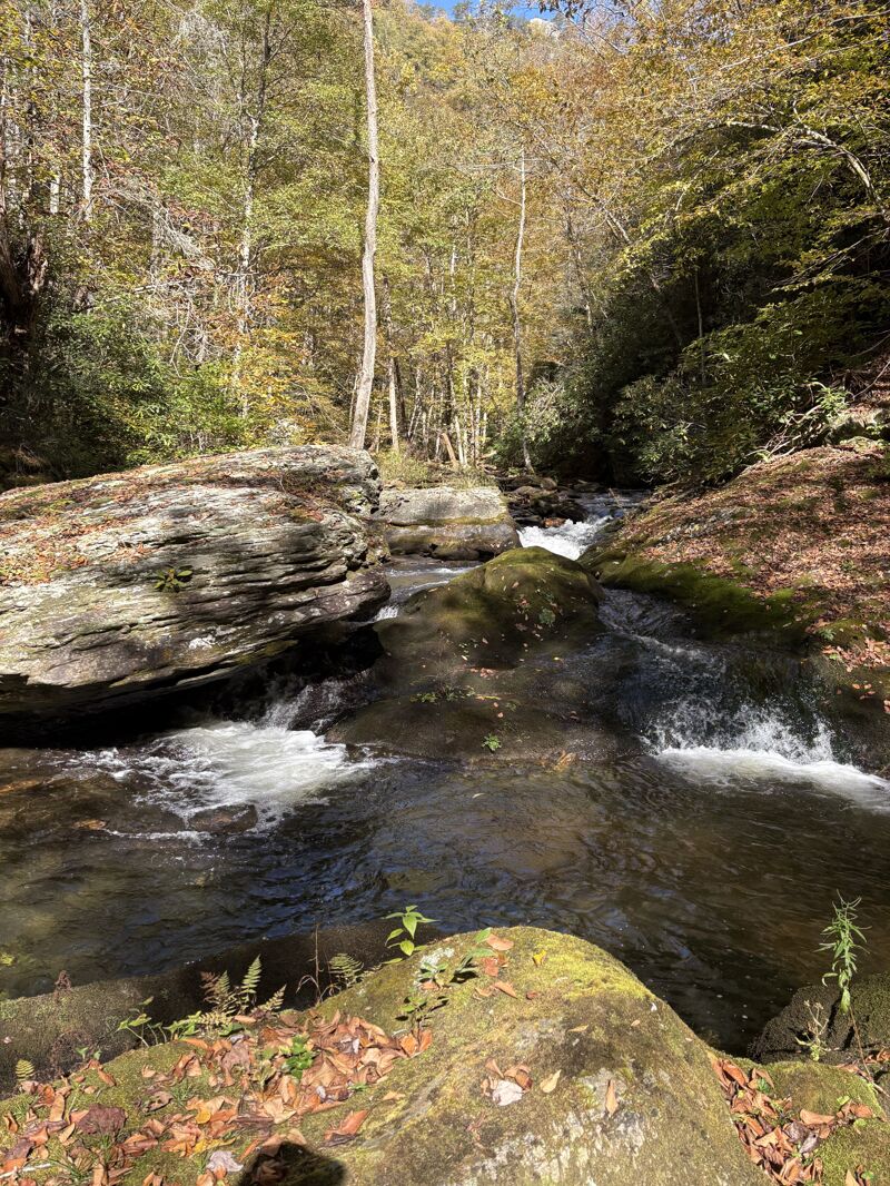
This section of the Dan River is dewatered by a hydroelectric plant, and has therefore seen very little use over the years during rare spills. Reportedly, the whitewater is steep and challenging, however videos of the lowermost portion appear to be Class IV. Here is a video of the last bit: https://www.youtube.com/watch?v=t7jJrto0yeU
Please report your runs here.
River Features
Put In
Access PointDistance: 0 mi
Take Out
Access PointDistance: 3.4 mi
Trip Reports
Log in to add a reportJR
Pinnacles Hike - Jonathan Rugh
Oct 8, 2025
We spent a gorgeous fall day hiking from the powerhouse up the creek all the way to the upper dam.
The powerhouse was releasing 'one tube' to the powerhouse and there was water coming out at the dam. Not enough to paddle, but enough to make it seem like it was a normal summer flow.
Starting from the dam, there looked like a lot of class 3/4 type ledges. There are two big mandatory portages, the great falls of the dan and then a huge sieve pile a little below that.
Below the sieve the river continues to drop down, with cool looking slide type things.
The river flattens out a bit for a half mile or so, then picks back up with a few rapids in the mile above the powerhouse. You could easily run/lap the stuff above the powerhouse, there's an easy hike up along a smooth grassy road.
It's also possible to hike from the powerhouse all the way up to the dam, this could be a good packrafting run, although the 'trail' up and over the ridge is not great, but passable.
Be cautioned that there is a lot of woody debris in the creek right now. However, I'd wager that it would be cleaned up with a couple work weekends to make it passable.
If anyone has any contacts with someone at the powerhouse, please reach out, there is a gauge right below the dam and that would be a great way to know when there is water in there.
KS
Kenneth Swarey
Oct 7, 2012
I hiked this section this past spring after a period of impressive rainfall hoping to observe water topping the dam but no such luck. The damkeeper informed me that this rarely ever happens...maybe once a year. Scour lines in the gorge indicate flows may have reached the 500-700 cfs on a previous overflow. This would make for a very dangerous situation on a very small stream topping out at 250 fpm. I have waded/fished the gorge about 1.5 miles upstream of the powerhouse and noted a couple what I would guess would be IIIs or IVs and runnable levels. The gradient in the lower part of the gorge is only about 80 fpm. As Jon mentioned earlier, the real meat is within 1.5 miles of the dam where it tops out at around 250 fpm.
CG
Chris Gorman
Feb 19, 2008
Anyone have any information on the Sawtooth Gorge Section? Wood?
JJ
jon jolly
Jun 1, 2007
the section below the dam was spilling today.......due to the danville power and light having joined a new electric cooperative......some guy in Ohio calls the shots on production scheduling.....I was told today that we should look for the damm to spill possibly more this month....this would be an excellent chance to get a better look at whats lays below the dam in the dewatered stretch......Keith Vestal from Stokes County NC ran it 2 summers ago ....the dam was spilling for the Kibler valley run....due to penstock repairs.....he hiked at least 2 miles up from the powerhouse and ran some great slides and manky boulder drops.....the real stuff starts just below the base of the dam and includes the big falls of the dan....20+footer?