Henrys Fork
Lower Mesa Falls to Warm River
| Difficulty | II+ |
| Length | 6.7 mi |
| Avg Gradient | 35 fpm |
| Gauge | Henrys Fork Nr Ashton Id |
| Flow Rate as of 31 minutes | 2180 cfsrunnable |
| Reach Info Last Updated | August 16, 2021 |
TO GET THERE: Mesa Falls Senic Drive near Ashton/Island Park. There is a road that comes out of the Upper Mesa Falls parking lot that leads to the clearing next to the Lower Mesa Falls.
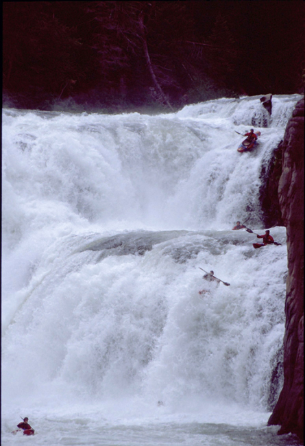
THE RUN: Lower Mesa Falls is great park and huck spot. The usual line is the river left side. It is like a 20 foot fall into a pool that leads into a 45 footer. The sign says 65 foot total drop, the first is definitely around 20 foot, and the second drop is about 30-35'.
It's pretty sic!
The right side has been run, you can see the descents of the right in the opening scene of Valahalla, and No Big Names. MAKE sure that you bring your camera!
Below Mesa Falls the river is mild and easy.
Reference:
Grant Amaral's book, Idaho: the Whitewater State (Watershed, 1992).
Latitude / Longitude data are approximate.
Alternate takeout: US 191-20 near Ashton (9 mi. downstream of Warm R.)
-CODY HOWARD
Oct 20, 2005
The wrong gauge is referenced for this run. The correct gauge would be: Henrys Fork near Island Park.
Apr 15, 2002
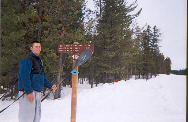
This is Cody Howard after digging the car out of the snow all night, and then at the start of the 3mile trek to the falls in the snow. BRUTAL! -Cody Howard
This is Cody Howard on the way to the trail head. -CODY HOWARD
Jan 1, 1900
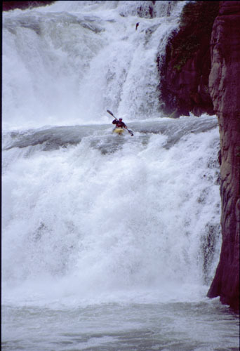
Joe Booth runs the lower left teir of Lower Mesa Falls. Pat Rogers took this picture from the river right platue
Jan 1, 1900
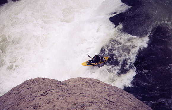
Top half of Lower Mesa. This 20'er leads into the 40' drop.
After the 20' initial ledge you drop this 40-45' falls. I chose the 'maple-leaf' flake to launch from and it was smooth. My buddies chose different lines: one went far left and had a good line, another went somewhere in between and got seriously messed with at the lip.
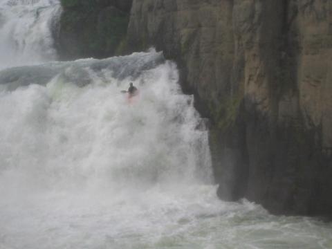
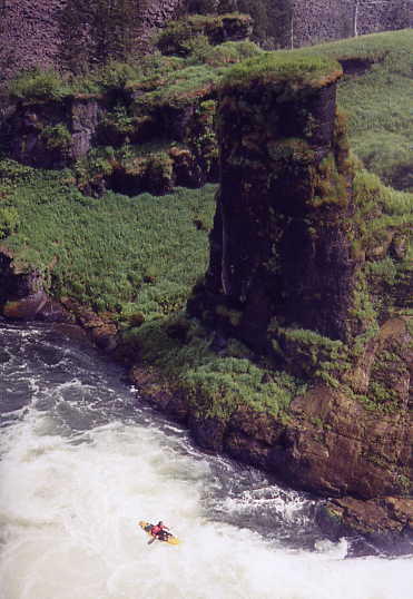
Hawaii? Ireland? Iceland? No - it's the Potato State! This is the happy, misty pool below the falls.
A shot of the hike-out which follows a huck off Lower Mesa. It rocks.