Russell Fork
3. Breaks Park River Access to below Elkhorn City (2.5 - 6 miles)(Lower Russell Fork)

| Difficulty | III |
| Length | 8 mi |
| Avg Gradient | n/a |
| Gauge | Russell Fork Gorge |
| Reach Info Last Updated | February 22, 2026 |
This section contains two Class III rapids Meatgrinder and Pinball and is Class II otherwise. Intermediate paddlers may wish to run this two mile section in combination with other sections of river to gain more river miles. This river is runnable in winter/spring and begins to lose volume in late spring and early summer perhaps not worth making a trip. During the first four weekends of October this river gets a special release to draw down a lake upstream and has guaranteed flows then.
There are multiple take-outs for this section making it 2.5, 3.5 or 6 mile runs. The first is at Carson Island and the Pine Mountain Trail State Park eastern terminus.
There are ample spots to take out in Elkhorn City along the river left bank starting above the second abandoned steel girder bridge that you encounter on the run and extending down behind the businesses on Russell Street. RFG Society is the best spot in town and is owned and operated by paddlers. Coffee and food are always homemade, fresh and delicious.
Another takeout is at the railroad bridge adjacent to the Gas station on the edge of Elkhorn on Highway 80. (3.5 mile takeout)
Takeouts below Elkhorn City:
Downstream side of the concrete bridge crossing at Beaver Bottom. ( 4 mile takeout)
Downstream of both bridges at Pond Creek Road (6 mile takeout)
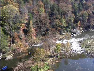
Put-in - Breaks Park River Access

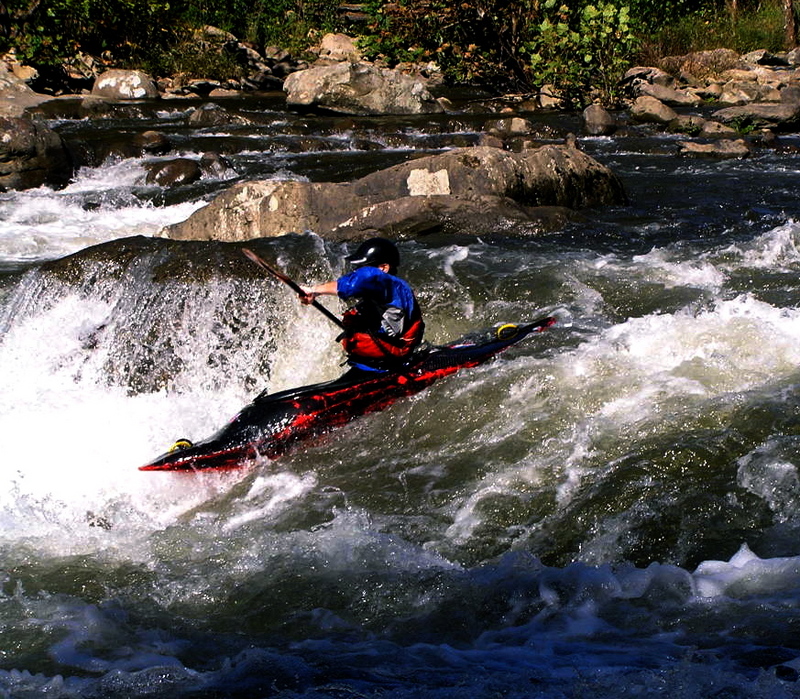
Small rapid split by an island immediately below the Railroad Trestle. The left is the most commonly ran side of this rapid and is a fairly good warm up rapid with Meatgrinder looming below. Right side of the island is only accessible at flows of 900 and above.
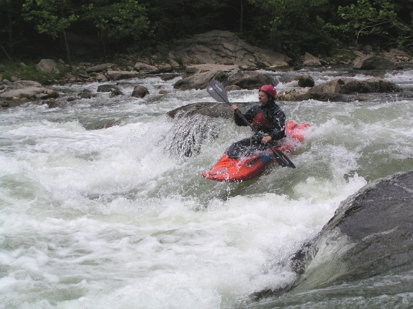
A formidable rapid for any skill level, Meatgrinder changes at varying water levels. Its a 3 tier drop that has the most vertical descent of any rapid on the Lower Russell Fork. Most run it starting in the left center at the top following the flow through the middle with pinning and broaching opportunities on both sides of both drops. Stay in the center of the flow at the bottom to avoid the rocks that give Meatgrinder its name.
At low flows this is an excellent introduction to creeking rapid where you can walk back up on river right and run it as many times as you would like. The fun low line is to boof into the left eddy on the first drop, ferry back and forth a couple times before running the middle drop in the center avoiding a pinning rock on the left making a hard right turn and finishing at the bottom in the center of it.
At high flows you can test your skill by running down the middle and boof the center drop over a strong hydraulic.
Recovery is best done on river right at the beach.
Sneek runs at medium to release (800 CFS+) and high can be had on river right.
At the bottom drop on extreme river left is a serious pinning spot and should be avoided.
100 yard long rapid that is a successive series of class II drops with plenty of pinning, broaching and body pinning spots along its stretch.
Lots of lines out there its a tasters choice, pick your line and make it depending on the level.
The first take-out is at Carson Island and the Pine Mountain Trail State Park eastern terminus.
Series of small rapids starting at the highway bridge to the mouth of Elkhorn Creek.
Nice class II rapid after the horseshoe bend in the river in the town of Elkhorn City.
Take-out is at the railroad bridge adjacent to the Gas station on the edge of Elkhorn on Highway 80. (3.5 mile takeout)
Take-out - Downstream of both bridges at Pond Creek Road (6 mile takeout)