Sandy Stream
Stony Brook to Michael Stream (Lexington Township)
| Difficulty | IV-V |
| Length | 3.1 mi |
| Avg Gradient | n/a |
| Gauge | Carrabassett River Near North Anson, Maine |
| Flow Rate as of 2 hours | 132 cfsbelow recommended |
| Reach Info Last Updated | October 15, 2024 |
Jeff Sharpe shared on 5/25/07:
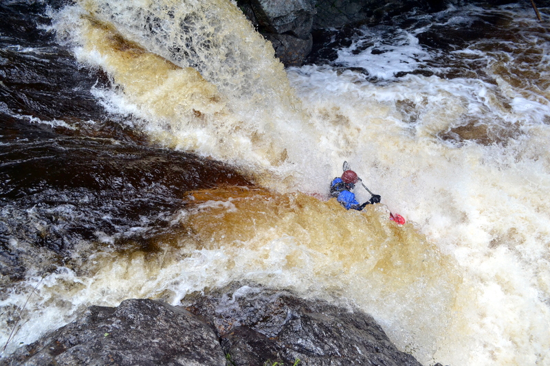
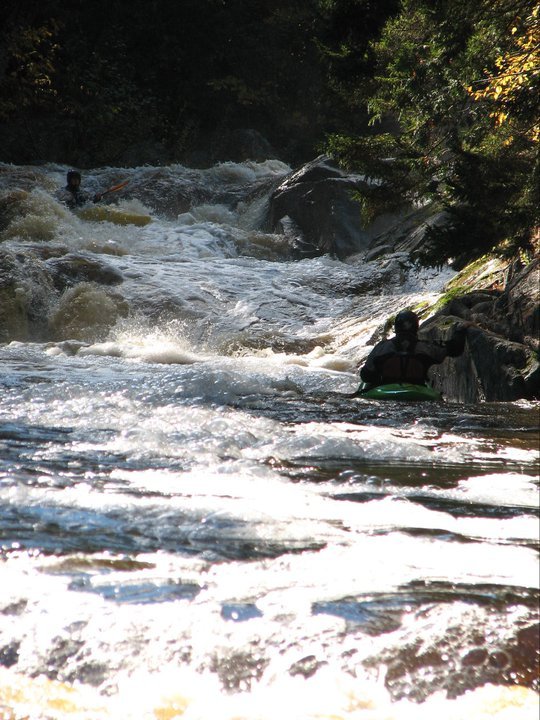
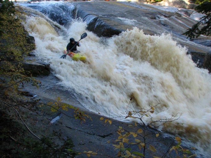
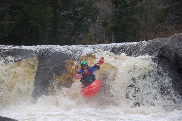
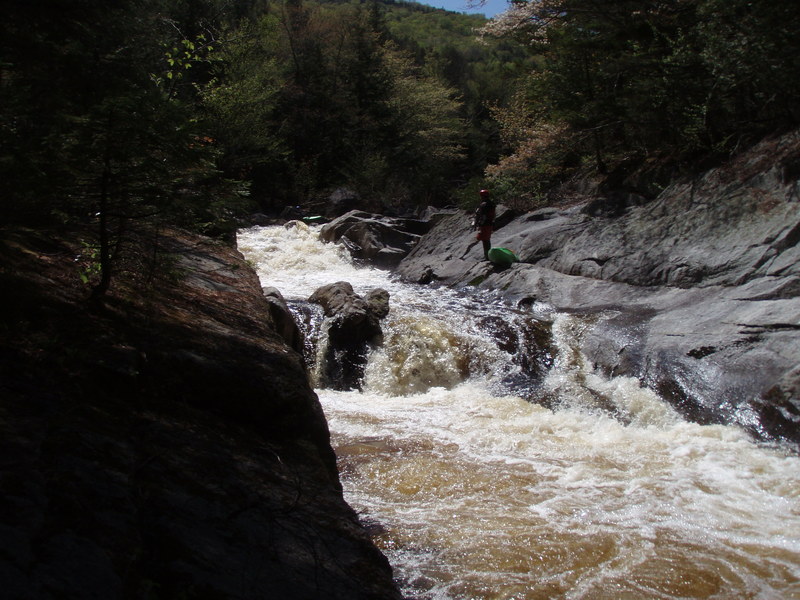
This is a surprisingly high-quality run tucked away in a little valley near the confluence of the Carrabassett and the Kennebec. The nature of the river is smooth granite bedrock slides and falls, of which there are many, separated by pools. There are some big drops on the section including a near-vertical 15-footer with a shallow landing and a few other bigger sliding falls. Everything was run in my one descent of the river. Most drops are Class IV, but there are maybe 10 or so Class-V rapids. Portaging and scouting is very easy and the scenery is quite good with only an occassional glimpse of a seldom traveled dirt road that parallels the river for the entire run. The initial descent was by Dave Gatz with Bill and Joan Hildreth in 1991.
Shuttle: The dirt road to the takeout is obvious on a Maine gazetteer. I believe it is called Sandy Stream Road. Leave a car where the river turns to class 1 and 2. To get to the takeout, it is wise to head back to the paved road and continue a few hundred feet further to a second dirt road that is much better than the takeout road. This road looks steep and rocky initially but quickly becomes more gentle and well maintained than the takeout road, which was in very bad shape at the time of this writing. The two roads in question join together approximately one mile above the takeout.
Follow upstream five miles to a T in the road, go right, over a bridge, and then put in at the next bridge.
Water Levels: We ran it when the Carrabassett was 2000 and dropping. Supposedly ideal levels are in the 2400 range. 2000 was still quite fun, and although low, all the drops were still very fluid.
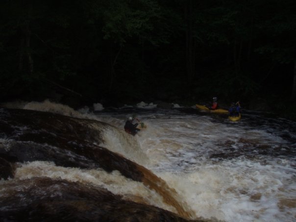
This very fun and big auto boof has a twisty III+-IV entrance rapid just above it. Very fun!
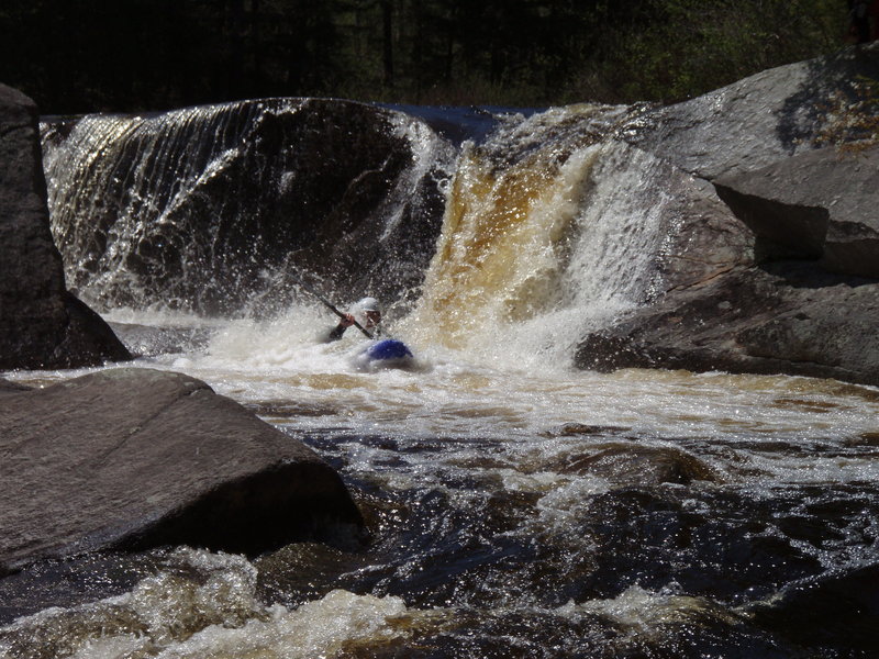
A riverwide near vertical waterfall that runs out onto ledge. It can be floated down the middle or the right, and the transition is very soft.
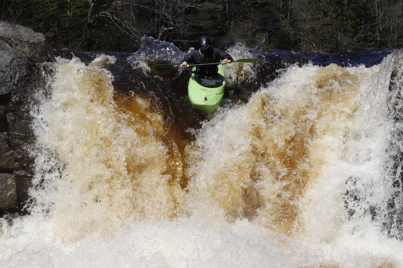
Clean boof into either a slide on the right, or boulder garden on the left. Both gorgeous and classic!
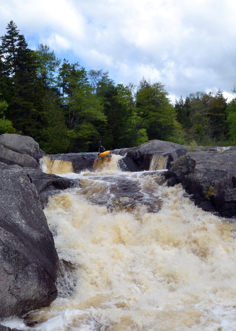
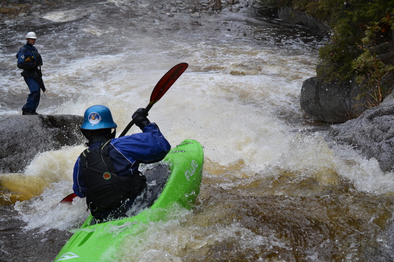
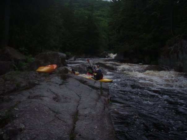
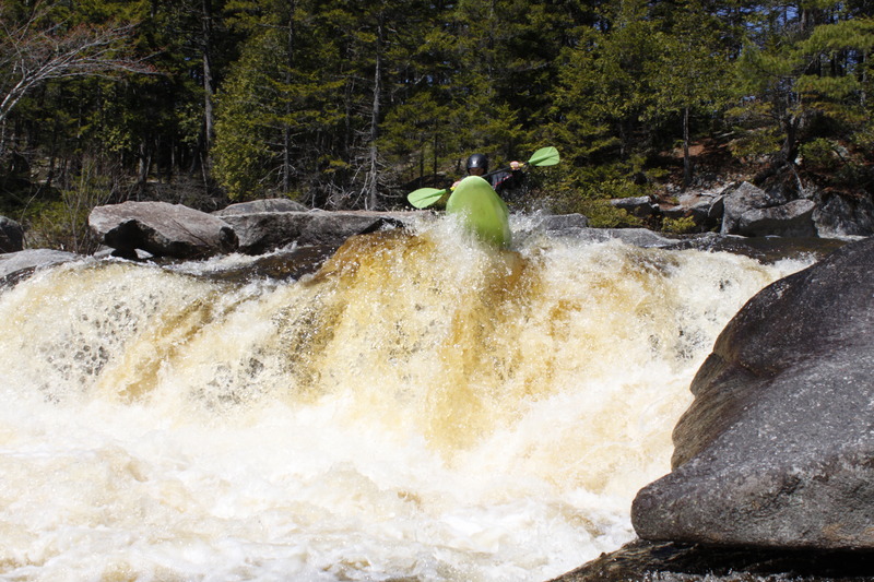
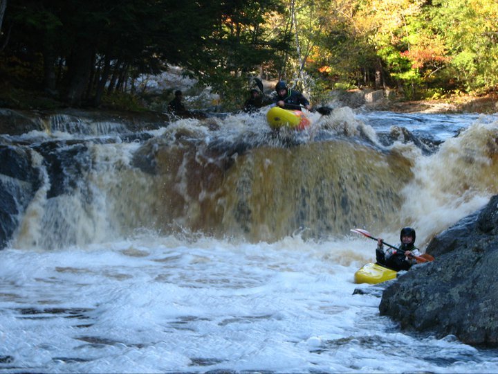
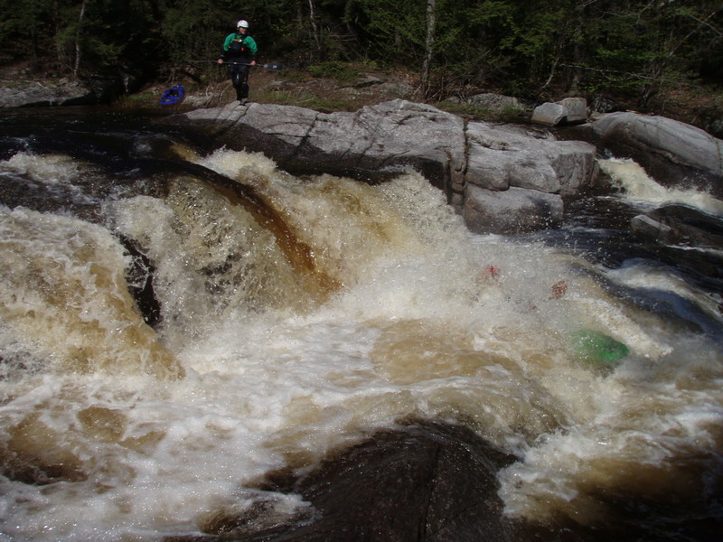
Cat and Mouse is also referred to as the 'Mini-Gorge' Run the cats paw starting left, then working right to avoid a small sieve. Many set safety here (see pictures). Below lies the exit: The mouse gets the cheese, a nice 4-6ft boof into a pool!

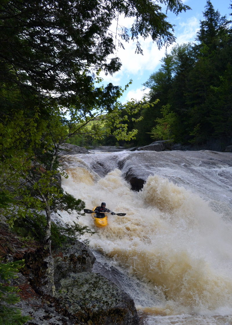
Crusher is not burly slide, but the entire sequence. Scout right. Portage right (or left to have a fun seal launch at the bottom). Man set safety at the pool just above the crusher slide, and the entry rapids are a little rocky. The very top drop is regularly run by some, but sneaked right into a cool room on the right.
Boof center, or take the challenging fade move on the left. Very clean!
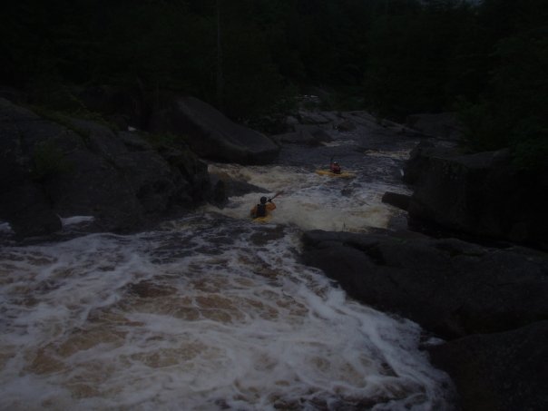
This is the double ledge drop after Rope Swing. Boof into an aerated hole, there is a low angle slide following this rapid.
Oct 24, 2019
Since 2017 access to the put-in requires a 3 mile walk from a gate off the northern logging road. The run is high enough quality (and the road often covered with snow in the spring anyway) that the walk in, while not ideal, is worth the effort.
See below post to the Facebook 'Maine Flows' list: from Taylor Walker (3/8/2017)
'The land is owned by Yale Bayroot and managed by Wagner. Today, I called the Wagner field office in Bangor. They were very nice, and stated that the gate is a direct result of many years of abuse by hunters, locals, and general traffic. There was constant illegal dumping and theft of firewood. The land owner is 'pissed off' and put the gate up. Huge bummer.
I informed them why I was calling and that we, as boaters who often use privately owned and maintained roads, respect the landowners and their decision to protect it. However, I emphasized the quality of the run and suggested that we may even be willing to establish some kind of fund to help pay for maintenance to restore access, if not all the time at least some of the year.
They said they fully understand where I'm coming from but restored access is unlikely. Though, they then suggested I contact the forester with direct connections to the landowner. They kindly gave me his number.
His name is Eric. At first he was quite confident that access is done for good, but, after hearing my case he declared that he would contact the landowner to see if it is possible to open any dialog, however he couldn't make any promises.
I would say things aren't looking too stellar, I will try to open a conversation with them, however, we may be hiking the Sandy for many years to come :(
Foot travel is still permitted on the land.
Jun 2, 2014
Jon Loehke entering Slip & Slide