| Difficulty | II-III |
| Length | 12.3 mi |
| Avg Gradient | n/a |
| Gauge | Swift River Near Roxbury, Maine |
| Flow Rate as of 40 minutes | 1.15 ftrunnable |
| Reach Info Last Updated | March 23, 2001 |
River Description
This reach does not have a description. If you know about this reach, please tell us about it!
River Features
Put In
Access PointDistance: 0 mi
Take Out
Access PointDistance: 13 mi
Trip Reports
Log in to add a reportAK
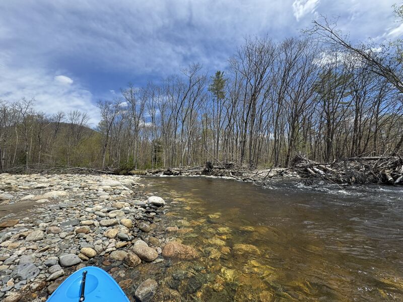
Lots of wood - Alex Kerney
May 16, 2026
While one of the bigger piles of strainers has been cleaned up by more recent high flows, there was a reasonable amount of wood in the flow starting around 1.5 miles down from Coos Canyon. Many are sneakable around 3.2 feet (which is really starting to get too low with the gravel bars). The lower stretch from Rare Woods, till 120 heads away from the river was clean last month, except for a log parallel to the river tucked behind bedrock on the left right where you want to sneak around the ledge.
?
Untitled
Nov 14, 2011
Paddled this on 10/7/11 at around 2.3 ft (about 300 cfs). This is as low as I would paddle this as it gets pretty boney. I put in just outside (south) of Roxbury on Rt. 17 (there's a great spot to park a vehicle right next to an ATV trail.) I would advise you park your take out shuttle at Swift River Falls as there isn't anything more than sporadic class 2's (just enough room to park 1-2 vehicles here.) That being said, there are some nice rapids on this stretch, mostly 2's but there is one 3 (at this level anyway.)
On 11/13/11 I paddled it at around 2.7 ft (400 cfs). Still class 2's and the one class 3 at this level. A little less boney but still rough on a boat. This is a great river for those who live in this region who are tired of Errol, NH.