Baptism
A) Finland to Eckbeck campground (5.2 miles)(Upper)
| Difficulty | I-III(IV) |
| Length | 4.9 mi |
| Avg Gradient | 47 fpm |
| Reach Info Last Updated | April 19, 2025 |
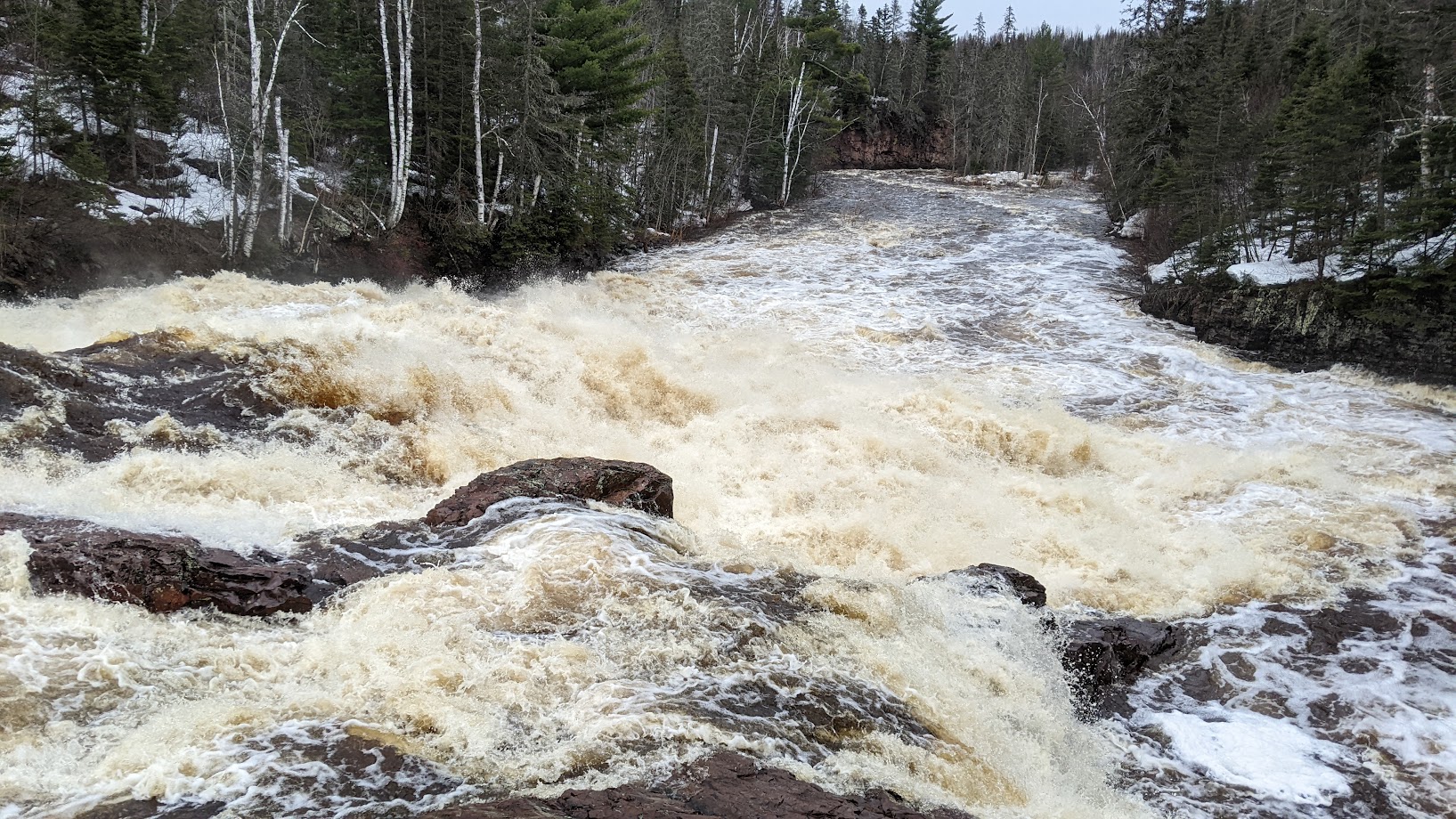
Most of this run is fun 'Land of Sky Blue Waters' (for those who remember the old Hamm's beer commercials) bobbling along. A few larger waves and holes will be encountered, some of which can become rather sticky and/or playful at moderate to high levels.
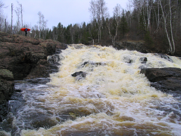
The largest drop is rather midway through the run, where the river drops over a large bedrock intrusion. The main channel has offset huge holes, midway down the large jumbled drop, which do not look very boater-friendly. A tight right-side sneak is possible, though it contains a couple of piton spots.
The remainder of the run is more like the earlier portion, with easy bobbling and occasional ledge/wave/holes.
FROM NORTHWOODS WHITEWATER BY JIM RADA:
'Finland to Eckbeck Campground:
This section, while containing one portage, is suitable for intermediate paddlers. After putting in at the state forest campground at Findland, the river passes through easy, wide open boulderbed rapids for a couple miles. There are also two or three minor ledges which produce small but enjoyable surfing waves. If the river level is about 2.9 feet or higher on the Highway 61 gauge, there won't be many rocks. The river gets quite scrapey by 2.5 feet.
The lone portage is Avalanche Falls, a sloping cascade which drops about twenty five feet. It's evident from above as a horizon line breaks the class I riffles preceding it. As far as I know, Avalanche Falls has never been run. There are a couple good small takeout eddies on river right above the falls and a reasonable portage over rock outcrops on the right side. If the river is high, it might be a little challenging re-entering the river at the base of the falls.
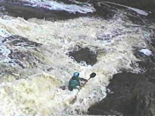
Shortly below Avalanche Falls comes a short class II-III ledge drop. Not much further one enters Paul Bunyan's Steps - a 200 yard long section containing several class III ledges that embrace a number of fine holes for sidesurfing. The play spots here are the best on the Finland to Eckbeck
...
At the put-in drainage area is about 110 square miles (to the best I can do using online planimeter and topomaps).
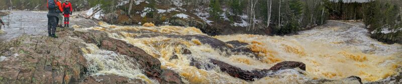
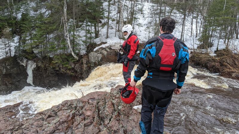
This will be a portage or a 'sneak' for the majority of boaters. Most of the flow goes through a nasty sequence of holes and slides. Tight to the right, a sneak channel can be run, but contains at least a few major piton spots.
Apr 15, 2023
High Spring Flow of the upper Baptism.
Is Fun rolling waves with a couple class 3 random holes, but nothing really bad.
Then you come to the falls a class 5 middle line with a far river right class 4 sneak line.
Here is a video I made from that day https://youtu.be/eBk7rVQtJ1Q?si=22aaHeIfxSBKdldJ