Dirty Devil
01. Hanksville to Hite
March 21, 2025
| Reporter | Jake Pawlak |
| Gauge Reading | 120 cfs at DIRTY DEVIL R AB POISON SP WSH NR HANKSVILLE UT |
| Flow | Low Runnable |
*There is a riverwide barbed wire fence around robbers roost as of 3/14/25, it is visible and easy enough to slip under, but could be an issue to an unsuspecting group with more water*
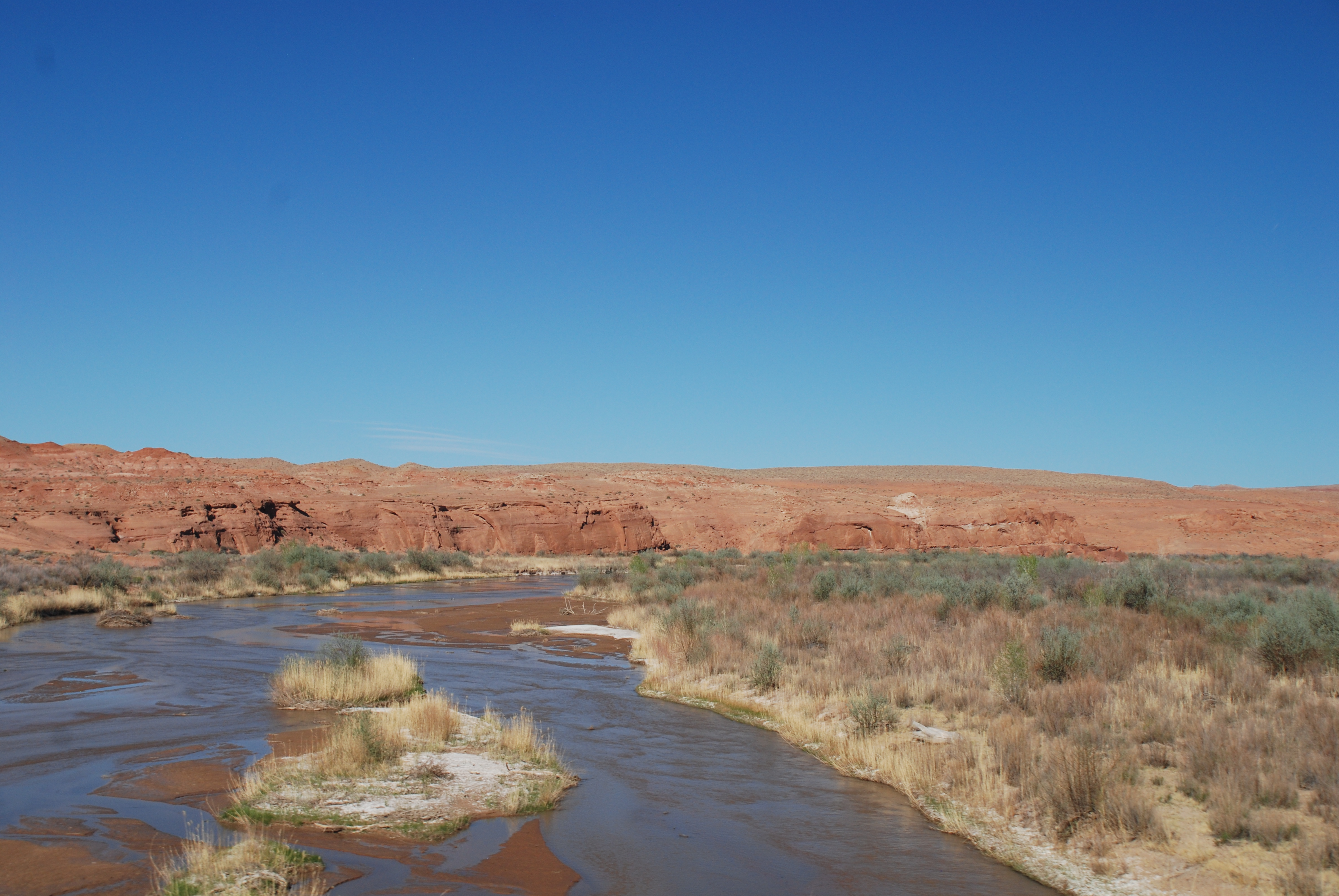
-
We launched from lower sand slide on 3/14/25 and made it to the north wash boat ramp on 3/19/25 with flows averaging around 120cfs.
-
The put in from lower sand slide is 1/2 mile with 500 feet of elevation down a sand dune with short sections of slickrock and cuts off the first 7ish miles of river. If I had a packraft and a willingness to go lightweight I would just hike down at angel cove, but we were in duckies and were willing to carry all our heavy gear down the hill. There is an obvious trailhead here and while the road looks like it could go further, I am not sure it was even open and I was not willing to take my tacoma down it.
-
With heavy duckies we were out of the boats pretty much constantly, pushing/dragging the boats to the banks where you'd often find the deeper channel until it would get braided and you'd need to do it again. If you are not mentally prepared for this then stay away, but if you turn it into a game and realize that slow pace means you get more time to enjoy the scenery then it's not too bad. Just think of it more as a water assisted backpacking trip. The river starts to channelize more below twin corral canyon, but there are still plenty of wide sections that you will need to hop out and drag.
-
6 days is basically the absolute minimum amout of time I would recomend for a full length trip at these flows, most of the trip you are averaging about 2.5 mph and given the shallow nature you can't really push the pace by paddling more often since you'll just beach yourself on a sandbar.
-
The real joy of this river is all the side canyon hikes to explore. Do not miss twin corral, happy, or fiddler cove, all worth camping at and exploring.
-
I'd recommend taking out at the end of an old nondescript road along the west side of the river a few miles upstream of the bridge on SR-95, don't know the status of this road but there are carins visible from the river that mark it. While this portion of the river is fully channelized the receeding reservoir has left behind miles of tall, difficult to scale silt banks that have collected tamerisk and made camping in this stretch much more difficult. I am glad to have ran the river to the confluence, but this is the take out I would use in the future.
-
The muddy chutes at the end are a roller coaster. While not too difficult, (I'd say class II+/III) they are too narrow to effectively paddle so your main goal is to keep everything pointed so you don't wedge the nose of your boat into the bank and get caught sideways.
-
Cyoa on water, we chose to use water wizard to settle, aquamira to shock, and then ran everything through a katadyn filter and the water looked perfectly clear at that point, tasted fine, and we did not get sick, your mileage may vary and a few 5 gallon buckets helps with this process.