Green
2. Big Hungry Creek to Fishtop Access(Green Narrows)
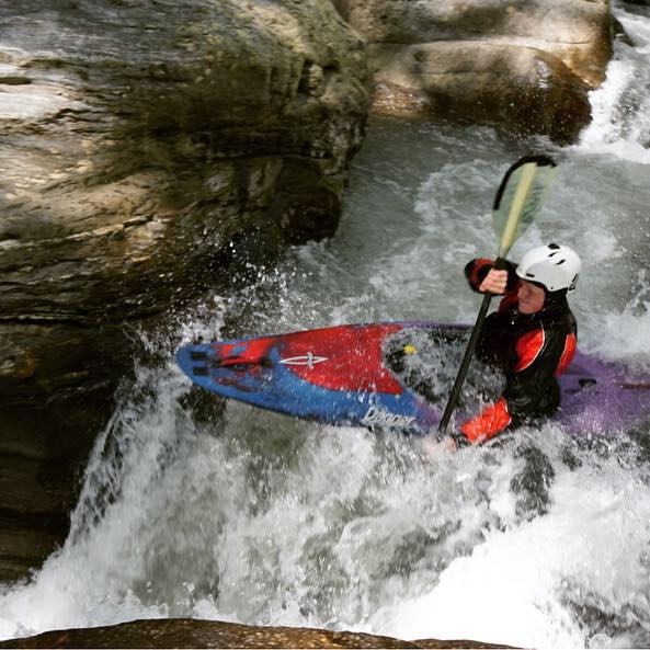

<br>This page is for shuttle directions to the put-in and take-out for the Green Narrows, and to the hike-in trail.<br><br> <font color="green"><blockquote><b> To Fishtop (the take-out) from Asheville:</b></font><br><br> 26 East<br> Exit 59<br> Left off exit, and go 200 yards<br> Left on Green Cove Rd.<br> 3 miles downhill<br> "Fishtop Access" lot on your left <br><br> <font color="green"><b>To Put-in from Fishtop:</font></b><br><br> 26 West<br> Exit 53...."Upward Road"<br> Right off exit and go 1.5 miles<br> Right on Big Hungry Road (after brick church)<br> first Left on Big Hungry Road<br> first Right on Big Hungry Road<br> first Right on Gallimore Road<br> Follow to bottom<br> "Keyholder Lot" on your right, trail on your left, .6 miles gentle downhill (first 2/3 on old roadbed).<br><br> <font color="green"><b>To Pulliam Creek Trail (to hike in to the heart of the Narrows) <u>from Asheville</u>:</font></b><br><br> 26 East<br> Exit 53...."Upward Road"<br> Left off exit and go 1.5 miles<br> Right on Big Hungry Road (after brick church)<br> first Left on Big Hungry Road<br> first Right on Big Hungry Road<br> DON'T TAKE first Right on Gallimore Road....<br> ...But continue 3.1 <u>more</u> miles<br> Park in unmarked pull-off on right<br> Cross little log bridge<br> ~1.5 miles of mellow downhill ...and some uphill after crossing Pulliam Creek<br> Don't take offshoot trails<br> Cross <u>two</u> log bridges after crossing creek<br> Drop off to the right after large bend around to the left, see flagging tape, ropes, trail.<br> This part is <u>wicked steep</u></font>, 200 yards tops, <br> Then jump across the creek, and you're at Groove Tube<br> Good trail leading upstream a couple hundred yards to Gorilla.<br> <br><br> <a href="https://maps.google.com/maps?f=q&q=35.290540,-82.328069+%282362+Big+Hungry+Rd,+Saluda,+NC+28773,+USA%29">Google road map</a> to Pulliam Creek trailhead. <br><br> <b>Tips for those hiking in to watch the race:</b> Allow an hour-plus for the crowded hike, and plan to get there well before 12 noon to look around and get situated. The trail will be stacked and slow-going on the steep part. Don't underestimate the time required. Also, you'll be in there for a few hours, and it's <u>colder</u> down in there so dress accordingly. If you're early, scamper even further upstream of Gorilla as there lots to see up there. Parking for the race is normally very tight, as only a few spots are technically "off the road". Some local residents out there have been upset in the past. Please use caution, don't break any laws, do the best you can, etc. The hike can take only 30 minutes if you're really stepping right along, but on race day it's a whole 'nother story. Finally, in terms of safety, not all dangers exist just for the paddlers. People hiking in to watch the race would be wise to read the cautionary article written by veteran Green Narrows racer Adam Herzog in the AW Journal, linked to in <a href="http://www.americanwhitewater.org/content/Photo_detail_photoid_41956_">this photograph</a>. <br><br><br> <div style= "background-color: #d9e4ee; margin-bottom: 5px; margin-right: 650px;padding: .25em .25em; border: solid 1px black; font-size = small"> <p style="padding: .1em 1em;"> To go to a page of maps for the Green Narrows, <a href="http://www.americanwhitewater.org/content/Photo_detail_photoid_42048_">click here</a>.<br><br> To go to the AW Green Narrows page, <a href="http://www.americanwhitewater.org/content/River_detail_id_1080_">click here</a>.<br><br> To go to The Green Race Information Page, <a href="http://www.americanwhitewater.org/content/Photo/detail/photoid/18557/#brown">click here</a>.<br><br> </p> </div><br><br><br><br>
John Pilson
Shuttle and Hiking
n/a
"I like to watch"