Green
2. Big Hungry Creek to Fishtop Access(Green Narrows)
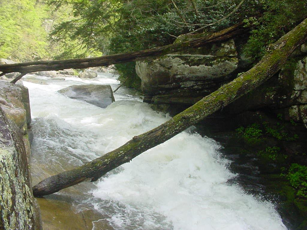
<br>Once long-term fixtures on the Green, this April 2003 picture (at 200% release) shows the two trees that used <br>to cross the river below Gorilla. Both are gone now. In paddling the Green and sorting through a ton of dated and undated <br>videos and photographs to make this page, I became unduly curious about when they came and went. These are the results:<br><br> <font color="green"><b> Top Tree:</font></b> Was there since "forever", ....and washed out during Hurricanes Francis and Ivan in September 2004.<br><br> <font color="green"><b>Bottom Tree:</font></b> Arrived between November 1997 and Summer 1999, ....and washed out just after the Green Race in November 2003. <br><br> As an aside, to envision the impressive creek cleansing all across Appalachia during the record breaking <br>September 2004 <i>Hurricane Trifecta</i> (Francis, Ivan, and Jeanne), check this very cool <a href="http://water.usgs.gov/waterwatch/history/real/real200409.gif">loop-a-loop</a>. <br>Color codes for that loop, and a bunch of other stuff, can be found on <a href="http://waterwatch.usgs.gov/?id=ww_current">this</a> USGS national map page.<br><br> The seal launch landing zone is just downstream of the bottom tree in the photo above.<br><br> You can see all the trees in place during this <a href="http://greenrace.amongstit.com/category/green-race-02/">head-to-head period piece</a> race clip from 2002.<br><br> Below is a photograph from the same date in 2003 which shows the longstanding tree below Nies' Pieces (about 15' out from <br>the bottom of "SuperBoof"). This tree also washed away during the Fall '04 hurricanes...<br><br> <img src="http://www.americanwhitewater.org/photos/archive/medium/3995.jpg?no_cache=1963"><br><br>
Andrew Lazenby
Mr. and Mrs. Wood, and baby wood.
n/a
Gorilla run-out