Green
2. Big Hungry Creek to Fishtop Access(Green Narrows)
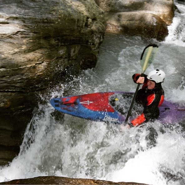
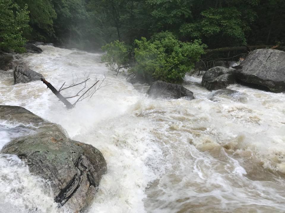
<br> <b>The Green River Flood of 2018</b> <br><br> Rainfall: <u>10.12" in 4 days</u>, including and capped off by <u>5.87" in just 3 hours</u> on May 18th, as measured near Pulliam Creek on Big Hungry Road.<br><br> Above is a photo of a very high water Groove Tube taken by Crom Carey on Saturday morning following the exceptional rains on Friday night, May 18th. This led to serious flooding in Polk and surrounding counties of western North Carolina. A ball-parked guess for the river level by those on site is around 45". Tuxedo was releasing 200% and the lake was at 101' or close to it. How high the Green got overnight is unknown. In comparison, while the high water year of 2013 was <a href="https://www.americanwhitewater.org/content/Photo/detail/photoid/882790/">astounding</a> in its duration/intensity, it did not blow-up like this in a single event. Scroll down for more photos of the Green, and some landslide pics from the Switchbacks.<br><br> <div style="border: 1px solid black; padding: 0.25em; background-color: rgb(217, 228, 238); margin-bottom: 5px; margin-left: 50px; margin-right: 50px;"> <h3 style="text-align: center; color: black;"> A Very Rare Event<br> </h3> For perspective, one inch of rain in one hour's time is very heavy rain, but not uncommon and happens more than once per year. To maintain one inch per hour for three hours is much more rare, and happens on average once every ten years. The pace of two inches of rain per hour is a frog strangler, and to keep it up for one full hour happens by probability once every five years. Maintaining that two inches per hour pace for three hours straight is what created the epic rinse-down which the rivers, creeks, roads, culverts, and homes, couldn't handle, and is so rare as to likely happen only once every two hundred years, if not longer. Including Friday night's massive rain, we received 10.12" of rain as a four-day total, an amount that should happen just once every one hundred years. So in review: we got hit with a two hundred year level mega dump embedded at the end of a one hundred year deluge. And <i>that's</i> why the shit hit the fan. To poke around at the data for this, go to this <a href="https://hdsc.nws.noaa.gov/hdsc/pfds/pfds_map_cont.html?bkmrk=nc">NOAA Precipitation Frequency Estimates</a> page, and use "precip depth" in the top left. It takes a bit to get a handle on it, and is a great resource (thanks Starr Metcalf for finding it). Push other buttons, see colored lines and graphs and things. <p style="padding: 0.1em 1em;"> <br> </div><br> Rivers and creeks all across the area were well outside their banks, mobile homes were moved, roads, culverts and driveways washed out, landslides occurred on the switchbacks down to Fishtop, Interstate 26 was closed for a spell, and untold numbers of trees were down. Trails and footbridges on the Gamelands were wiped out entirely in places, and Saturday's Green River Games had to be canceled. People living in Green River Cove took a major beating, with considerable property damage, including to our friends at the <a href="http://www.nctubing.com/tubing-home.html">Wilderness Cove Campground</a>. One woman in Polk County was killed when part of her house collapsed on her due to a mudslide.<br><br> This graph below of the French Broad River at Asheville is reflective of what other rivers and creeks experienced to varying degrees. <br><br> <img src="https://www.americanwhitewater.org/photos/archive/medium/889309.jpg?no_cache=25570001"><br><br> Pencil Sharpener:<br><br> <img src="https://www.americanwhitewater.org/photos/archive/medium/889310.jpg?no_cache=55870001"><br><br> The Notch: <br><br> <img src="https://www.americanwhitewater.org/photos/archive/medium/889311.jpg?no_cache=81500001"><br><br> Hammer Factor (Rowan Stuart pic): <br><br> <img src="https://www.americanwhitewater.org/photos/archive/medium/889333.jpg?no_cache=15840001"><br><br> <b>Three great Switchback Landslide pics from Bill Clipper:</b><br><br> <img src="https://www.americanwhitewater.org/photos/archive/medium/889312.jpg?no_cache=32150001"><br><br> <img src="https://www.americanwhitewater.org/photos/archive/medium/889314.jpg?no_cache=69000001"><br><br> <img src="https://www.americanwhitewater.org/photos/archive/medium/889313.jpg?no_cache=96720001"><br><br>
Crom Carey/Bill Clipper/Rowan Stuart
Groove Tube Pogo, Landslides
n/a
Groove Tube